- Laurel, New York
Infobox Settlement
official_name = Laurel, New York
settlement_type = CDP
nickname =
motto =
imagesize =
image_caption =
image_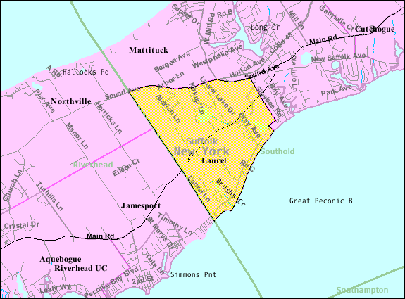
mapsize = 250px
map_caption =
pushpin_
mapsize1 =
map_caption1 =subdivision_type = Country
subdivision_name =United States
subdivision_type1 = State
subdivision_name1 =New York
subdivision_type2 = County
subdivision_name2 = Suffolk
government_footnotes =
government_type =
leader_title =
leader_name =
leader_title1 =
leader_name1 =
established_title =
established_date =area_footnotes =
area_magnitude =
area_total_km2 = 8.9
area_land_km2 = 8.7
area_water_km2 = 0.2
area_total_sq_mi = 3.4
area_land_sq_mi = 3.3
area_water_sq_mi = 0.1population_as_of = 2000
population_footnotes =
population_total = 1188
population_density_km2 = 137.0
population_density_sq_mi = 354.7timezone = Eastern (EST)
utc_offset = -5
timezone_DST = EDT
utc_offset_DST = -4
elevation_footnotes =
elevation_m = 6
elevation_ft = 20
latd = 40 |latm = 58 |lats = 35 |latNS = N
longd = 72 |longm = 32 |longs = 59 |longEW = Wpostal_code_type =
ZIP code
postal_code = 11948
area_code = 631
blank_name = FIPS code
blank_info = 36-41465
blank1_name = GNIS feature ID
blank1_info = 0955082
website =
footnotes =Laurel is a hamlet in Suffolk County,
New York ,United States . It is inside both the Town of Southold and the Town of Riverhead. The population was 1,188 at the 2000 census.History
The area was originally known as the "Middle Ground" between Southold and the Town of Riverhead. Later it was called Franklinville, but relinquished that name for Laurel due to a conflict of names with another Franklinville.
Geography
Laurel is located at coor dms|40|58|35|N|72|32|59|W|city (40.976340, -72.549589)GR|1.
According to the
United States Census Bureau , the community has a total area of 3.4square mile s (8.9km² ), of which, 3.3 square miles (8.7 km²) of it is land and 0.1 square miles (0.2 km²) of it (2.33%) is water.Demographics
As of the
census GR|2 of 2000, there were 1,188 people, 452 households, and 343 families residing in the hamlet. Thepopulation density was 354.7 per square mile (136.9/km²). There were 686 housing units at an average density of 204.8/sq mi (79.1/km²). The racial makeup of the CDP was 97.05% White, 1.26% African American, 0.25% Native American, 0.08% from other races, and 1.35% from two or more races. Hispanic or Latino of any race were 2.36% of the population.There were 452 households out of which 30.5% had children under the age of 18 living with them, 64.4% were married couples living together, 8.4% had a female householder with no husband present, and 24.1% were non-families. 21.2% of all households were made up of individuals and 13.5% had someone living alone who was 65 years of age or older. The average household size was 2.61 and the average family size was 3.03.
In the community the population was spread out with 23.2% under the age of 18, 6.9% from 18 to 24, 25.8% from 25 to 44, 25.0% from 45 to 64, and 19.0% who were 65 years of age or older. The median age was 41 years. For every 100 females there were 102.4 males. For every 100 females age 18 and over, there were 97.4 males.
The median income for a household in the community was $57,639, and the median income for a family was $67,000. Males had a median income of $48,409 versus $33,750 for females. The
per capita income for the CDP was $26,903. About 2.4% of families and 4.0% of the population were below thepoverty line , including 3.3% of those under age 18 and 2.3% of those age 65 or over.References
External links

Wikimedia Foundation. 2010.