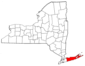
- Suffolk County, New York
Infobox U.S. County
county = Suffolk County
state = New York
map size = 200
founded = 1683
seat = Riverhead
area_total_sq_mi =2373
area_land_sq_mi =912
area_water_sq_mi =1461
area percentage = 61.56%
census yr = 2000
pop = 1419369
density_km2 =617
web = www.co.suffolk.ny.us
footnotes = |Suffolk County is a county located in the
U.S. state ofNew York . As of the 2000 census, the population was 1,419,369. It was named for the county of Suffolk inEngland , from which its earliest settlers came. Thecounty seat is Riverhead, though many county offices are in Hauppauge on the west side of the county where most of the population lives. There are also offices in Smithtown, for the legislature, Yaphank, and Farmingville.Suffolk and Nassau counties together are generally referred to as "
Long Island " by area residents — as distinct from theNew York City boroughs ofQueens (Queens County) andBrooklyn (Kings County), which geographically make up the island's western end.Suffolk County is the easternmost county in New York State and the
New York Metropolitan Area .History
Suffolk County was an original county of New York State, one of twelve created in 1683. Its boundaries were substantially the same as at present, with only minor changes in the boundary with its western neighbor, which was originally Queens County but since 1899 has been Nassau County. However, as eastern Suffolk County has become more suburbanized there have been efforts to split the east end of the county off into a new county, called Peconic County.
Geography
According to the
U.S. Census Bureau , the county has a total area of 2,373square mile s (6,146km² ), of which, 912 square miles (2,363 km²) of it is land and 1,461 square miles (3,784 km²) of it (61.56%) is water. The highest elevation in the county, and on Long Island as a whole, isJayne's Hill in West Hills, at 401 feet (122 m) above sea level, the county's highest point.Suffolk County occupies the easternmost portion of
Long Island , in the southeastern portion ofNew York State. The eastern end of the county splits into twopeninsula s, known as the North Fork and the South Fork. The county is surrounded by water on three sides, including theAtlantic Ocean and theLong Island Sound . The eastern end contains largebay s. Suffolk County is divided into 10 towns: Babylon, Brookhaven, East Hampton, Huntington, Islip, Riverhead, Shelter Island, Smithtown, Southampton, and Southold. Also part of the county, but not considered parts of the above towns, are the Poospatuck and ShinnecockIndian reservation s. Poospatuck isenclave d within Brookhaven in the Mastic CDP, and Shinnecock is enclaved within Southampton, adjacent to Southampton village, Tuckahoe, and Shinnecock Hills.Major facilities include
Brookhaven National Laboratory in Upton andPlum Island Animal Disease Center on Plum Island. Several airports serve commuters and business travelers, most notablyLong Island MacArthur Airport in Islip,Republic Airport in East Farmingdale andFrancis S. Gabreski Airport in Westhampton Beach.Adjacent counties
*Nassau County,
New York - west
*Fairfield County,Connecticut - northwest, water boundary only, acrossLong Island Sound
*New Haven County,Connecticut - north, water boundary only, across Long Island Sound
*Middlesex County,Connecticut - north, water boundary only, across Long Island Sound
*New London County,Connecticut - north, water boundary only, acrossFishers Island Sound
*Washington County,Rhode Island - northeast, water boundary only, acrossBlock Island Sound National
protected area s*
Amagansett National Wildlife Refuge
*Conscience Point National Wildlife Refuge
*Elizabeth A. Morton National Wildlife Refuge
*Fire Island National Seashore
*Sayville National Wildlife Refuge
*Seatuck National Wildlife Refuge
*Target Rock National Wildlife Refuge
*Wertheim National Wildlife Refuge Law and government
Suffolk County has long been a Republican bastion inNew York . U.S. CongressmanRick Lazio , who opposedHillary Clinton in the 2000 Senate race, was from Suffolk County. However, recent elections have turned the county more toward the Democrats. In 2003, Democrat Steve Levy was elected county executive, ending longtime Republican control. In 2001, Democrat Thomas Spota was elected District Attorney, and ran unopposed in 2005. Although Suffolk voters gaveGeorge H. W. Bush a victory here in 1992, the county voted forBill Clinton in 1996 and continued the trend by givingAl Gore a large victory here in 2000 andJohn Kerry a smaller margin of victory in 2004.Suffolk County is represented by three congressional districts, the first, second and part of the third. The former two seats are held by Democrats.
Tim Bishop , a Democrat, represents the once heavily Republican first district, which includes almost half of the county, from Smithtown to Montauk, includingThe Hamptons and Riverhead. The second district, which includes Huntington, Brentwood and Bay Shore, is represented bySteve Israel . A Democrat, Israel won the seat vacated byRick Lazio in 2000 when he made his unsuccessful bid for theU.S. Senate . The third district, which is mainly in Nassau County, but includes some middle-class coastal areas of southwestern Suffolk County, is represented by Peter King, a Republican.Democratic voters in Suffolk, as well as neighboring Nassau County have helped to turn Downstate
New York into a solidly Democratic region.Suffolk County Executives
"* Appointed to compete Cohalan's term"
Suffolk County Legislature
The county is divided into 18
legislative districts, each represented by a legislator. As of 2008, there are 11 Democrats, 6 Republicans, and one legislator from theWorking Families Party :
# Edward P. Romaine (R)
#Jay Schneiderman (R)
# Kate M. Browning (WF)
# Brian Beedenbender (D)
# Vivian Viloria-Fisher (D)
# Daniel P. Losquadro (R)
# Jack Eddington (D)
# William Lindsay (D)
# Ricardo Montano (D)
# Cameron Alden (R)
# Thomas F. Barraga (R)
# John M. Kennedy, Jr. (R)
# Lynne Nowick (R)
# Wayne R. Horsley (D)
# DuWayne Gregory (D)
# Steven H. Stern (D)
# Louis D'Amaro (D)
# Jon Cooper (D)Republicans controlled the county legislature until a landmark election in November 2005 where three Republican seats switched to the Democrats, giving them control. William Lindsay is the current Presiding Officer of the legislature while Jon Cooper is the majority leader.
In November 2007, the Democratic Party once again retained control over the Suffolk County Legislature picking up one seat in the process.
Currently, Democrats hold a 11-7 advantage.
Law enforcement
Police services in the five western towns (Babylon, Huntington, Islip, Smithtown and Brookhaven) are provided primarily by the
Suffolk County Police Department . The five "East End" towns (Riverhead, Southold, Shelter Island, East Hampton, and Southampton), maintain their own police forces. Also, there are a number of villages, such as Amityville, Lloyd Harbor, Northport and Westhampton Beach, that maintain their own police forces.In an unusual move, the Village of Greenport in 1994 voted to abolish its police department and turn responsibility for law and order over to the Southold Town Police Department.
After the
Long Island State Parkway Police was disbanded in 1980, all state parkways in Suffolk County became the responsibility of Troop L of theNew York State Police , headquartered atRepublic Airport . State parks, such as Robert Moses State Park, are the responsibility of theNew York State Park Police , based atBelmont Lake State Park . In 1996, theLong Island Rail Road Police Department was consolidated into theMetropolitan Transportation Authority Police , which has jurisdiction over all rail lines in the county.The Suffolk County Sheriff's Office is a separate agency. With over three hundred years of tradition, the Sheriff's Office has been an integral part of Suffolk County's history. The Sheriff's Office is headed by the Sheriff, an elected position that serves a four year term. The Sheriff is the highest law enforcement official in the county. The Sheriff's Office operates the two Suffolk County correctional facilities (in Yaphank and Riverhead), provides county courthouse security and detention, service and enforcement of civil papers, evictions and warrants. There is also a full-service patrol unit that primarily assists the East End town and village police forces, although can be assigned anywhere in the county and can respond to 911 calls and make arrests anywhere in Suffolk County. In addition, the Sheriff's Office has several specialized units including K-9 Units, Marine Units, a Dive Team, a Traffic Enforcement Unit (including a Motorcycle Section) which covers all roadways in Suffolk County though is primarily concerned with the East End,
Sunrise Highway and theLong Island Expressway , a Mountain Bike Unit, an ATV Unit, a SWAT unit called the Sheriff's Emergency Response Team (SERT) which includes a tactical weapons team and a sniper section. Suffolk County Deputy Sheriff Investigators participate in various task forces (such as the East End Drug Task Force, and the specially created joint task force with the USBureau of Immigration and Customs Enforcement to investigate and arrest illegal immigrant gang members, the DEA, HIDTA and the U.S. Marshals Service), undercover assignments, and also conduct criminal investigations. Suffolk County Deputy Sheriffs are also responsible for patrolling and investigating all crimes committed on county-owned property such as county government office buildings and the campuses of theSuffolk County Community College , as well as providing assistance to theSuffolk County Park Police . As of 2008, the Suffolk County Sheriff's Office employs 275 Deputy Sheriffs, 850 Correction Officers and about 200 civilian staff.Suffolk County has a special court system, somewhat similar to Nassau County, and very different from the rest of the state. Like Nassau, there is a District Court, but only for about half the county. For about half of the county, most traffic tickets are handled by the Traffic Violations Bureau of Suffolk County. TVB is an arm of the Department of Motor Vehicles, and is not part of the state court system. There are TVBs in New York City, Rochester and Buffalo as well. Suffolk County also has village courts and five town courts.
Demographics
USCensusPop
1900 = 77582
1910 = 96138
1920 = 110246
1930 = 161055
1940 = 197355
1950 = 276129
1960 = 666784
1970 = 1124950
1980 = 1284231
1990 = 1321864
2000 = 1419369As of the
census GR|2 of 2000, there were 1,419,369 people, 469,299 households, and 360,421 families residing in the county. Thepopulation density was 1,556 people per square mile (601/km²). There were 522,323 housing units at an average density of 573 per square mile (221/km²). The racial makeup of the county was 84.60% White (78.8% White Non-Hispanic), 6.94% African American, 0.27% Native American, 2.45% Asian, 0.03% Pacific Islander, 3.65% from other races, and 2.06% from two or more races. Hispanic or Latino of any race were 10.53% of the population. Some main European ancestries in Suffolk county as of 2000: 28.33% Italian, 22.02% Irish, 16.95% German and 5.98% English.By 2006 the racial or ethnic makeup of the county was 83.6% White (75.4% White Non-Hispanic). African Americans were 7.4% of the population. Asians stood at 3.4% of the population. 5.4% were of other or mixed race. Latinos were 13.0% of the population. [ [http://quickfacts.census.gov/qfd/states/36/36103.html Suffolk County QuickFacts from the US Census Bureau ] ]
There were 469,299 households out of which 37.00% had children under the age of 18 living with them, 62.00% were married couples living together, 10.80% had a female householder with no husband present, and 23.20% were non-families. 18.30% of all households were made up of individuals and 7.80% had someone living alone who was 65 years of age or older. The average household size was 2.96 and the average family size was 3.36.
In the county the population was spread out with 26.10% under the age of 18, 7.60% from 18 to 24, 31.20% from 25 to 44, 23.30% from 45 to 64, and 11.80% who were 65 years of age or older. The median age was 36 years. For every 100 females there were 95.90 males. For every 100 females age 18 and over, there were 92.80 males.
The median income for a household in the county was $65,288, and the median income for a family was $72,112. Males had a median income of $50,046 versus $33,281 for females. The
per capita income for the county was $26,577. About 3.90% of families and 6.00% of the population were below thepoverty line , including 6.70% of those under age 18 and 6.30% of those age 65 or over.Suffolk County ranks at number twenty-one on the
list of the most populous counties in the United States . [ [http://www.census.gov/popest/counties/CO-EST2006-07.html 100 Largest Counties ] ]Colleges and universities
Suffolk County is home to numerous colleges and universities, including:
*Adelphi University -Hauppauge Campus
*Briarcliffe College -Patchogue Campus
*Dowling College
*Farmingdale State College
*Five Towns College
*Long Island University - Brentwood Campus
*Saint John's University -Oakdale Graduate Center
*Saint Joseph's College -Patchogue Campus
*State University of New York at Stony Brook
*Suffolk County Community College
*Touro College
**Jacob D. Fuchsberg Law Center - inCentral Islip
**Touro College School of Health Sciences - inBay Shore Indian reservations
Two
Indian reservation s are located within the borders of Suffolk County:
* Shinnecock Reservation
* Poospatuck ReservationTowns, villages, and hamlets
In New York State, a town is the major subdivision of each
county . Towns provide or arrange for most municipal services for residents of hamlets and selected services for residents of villages. All residents of New York who do not live in acity or on anIndian reservation live in a town. Avillage is anincorporated area which is usually, but not always, within a single town. A village is a clearly definedmunicipality that provides the services closest to the residents, such as garbage collection, street and highway maintenance, street lighting and building codes. Some villages provide their own police and other optional services. A hamlet is a populated area within a town that is not part of a village. The term "hamlet" is not defined under New York law (unlike cities, towns and villages), but is often used in the state's statutes to refer to well-known populated sections of towns that are not incorporated as villages. For more information, see the article "Political subdivisions of New York State ".In 2006 "Forbes Magazine" ranked six Suffolk County zip codes as among the top 110 most expensive in the United States. Sagaponack,
New York was ranked the most expensive zip code in the nation with a median home sale price in 2005 of $2,787,500. Water Mill,New York was ranked the sixth most expensive zip code in the nation, with a median home sale price in 2005 of $2,150,000. [Forbes Lists [http://images.forbes.com/lists/2006/7/NY_Rank_1.html] ]Sorted by town
* Town of Babylon
** Villages: Amityville, Babylon, Lindenhurst
** Hamlets: Copiague, Deer Park, East Farmingdale, Gilgo, Oak Beach & Captree, North Amityville, North Babylon, North Lindenhurst, West Babylon, Wheatley Heights, Wyandanch
** Other communities: Copiague Harbor
* Town of Brookhaven
** Villages: Belle Terre, Bellport, Lake Grove, Old Field, Patchogue, Poquott, Port Jefferson, Shoreham
** Hamlets: Blue Point, Brookhaven, Canaan Lake, Centereach, Center Moriches, Cherry Grove, Coram, Crystal Brook, Cupsogue Beach, Davis Park, East Moriches, East Patchogue, East Setauket, East Shoreham, Farmingville, Fire Island Pines, Gordon Heights, Hagerman, Manorville, Mastic, Mastic Beach, Medford, Middle Island, Miller Place, Moriches, Mount Sinai, North Bellport, North Patchogue, Ocean Bay Park, Point of Woods, Port Jefferson Station, Ridge, Rocky Point, Selden, Setauket, Shirley, South Haven, Sound Beach, Stony Brook, Strongs Neck, Terryville, Upton, Water Island, West Manor, Yaphank
** Hamlets located partly in the Town of Islip: Holbrook, Holtsville, Lake Ronkonkoma, Ronkonkoma
** Hamlets located partly in the Town of Riverhead: Calverton, Wading River
** Hamlets located partly in the Town of Smithtown: Lake Ronkonkoma
** Hamlet located partly in the Town of Southampton: Eastport
* Town of East Hampton
** Villages: East Hampton
** Village located partly in the Town of Southampton: Sag Harbor
** Hamlets: Amagansett, Montauk, Springs, Wainscott
* Town of Huntington
** Villages: Asharoken, Huntington Bay, Lloyd Harbor, Northport
** Hamlets: Centerport, Cold Spring Harbor, Dix Hills, East Northport, Eatons Neck, Elwood, Greenlawn, Halesite, Huntington, Huntington Station, Melville, South Huntington
** Hamlets located partly in the Town of Smithtown: Commack, Fort Salonga
* Town of Islip
** Villages: Brightwaters, Islandia, Ocean Beach, Saltaire
** Hamlets: Bay Shore, Bayport, Baywood, Bohemia, Brentwood, Central Islip, East Islip, Great River, Hauppauge, Islip, Islip Terrace, North Bay Shore, North Great River, Oakdale, Sayville, West Bay Shore, West Islip, West Sayville
** Hamlets located partly in the Town of Brookhaven: Holbrook, Holtsville, Lake Ronkonkoma, Ronkonkoma
** Hamlets located partly in the Town of Smithtown: Lake Ronkonkoma
* Town of Riverhead
** Villages: none
** Hamlets: Aquebogue, Baiting Hollow, Jamesport, Northville, Riverhead
** Hamlets located partly in the Town of Brookhaven: Calverton, Wading River
* Town of Shelter Island
** Village: Dering Harbor
** Hamlet: Shelter Island Heights
* Town of Smithtown
** Villages: Head of the Harbor, Nissequogue, Village of the Branch
** Hamlets: Kings Park, Nesconset, Smithtown, St. James
** Hamlets located partly in the Town of Brookhaven: Lake Ronkonkoma
** Hamlets located partly in the Town of Huntington: Commack, Fort Salonga
** Hamlets located partly in the Town of Islip: Lake Ronkonkoma
* Town of Southampton
** Villages: North Haven, Quogue, Southampton (village), Westhampton Beach, Westhampton Dunes
** Village located partly in the Town of East Hampton: Sag Harbor
** Hamlets: Bridgehampton, East Quogue, Flanders, Hampton Bays, Northampton, North Sea, Noyack (Noyac), Quioque (Quiogue), Remsenburg, Riverside, Sagaponack, Shinnecock Hills, Southampton (hamlet), Speonk, Tuckahoe, Water Mill (Watermill), Westhampton
** Hamlet located partly in the Town of Brookhaven: Eastport
* Town of Southold
** Village: Greenport
** Hamlets: Cutchogue, East Marion, Fishers Island, Laurel, Mattituck, Orient, New Suffolk, Peconic, Southold
*On Fire Island -
** Villages in the Town of Islip: Ocean Beach,New York , Saltaire
** Hamlets in the Town of Brookhaven: Cherry Grove (a.k.a. Fire Island), Fire Island Pines.
** Other communities: Atlantique, Bayberry Dunes, Corneille Estates, Davis Park, Dunewood, Fair Harbor, Kismet, Lonelyville, Long Cove, Ocean Bay Park, Point o' Woods, Robbins Rest, Seaview, Watch Hill, Water Island, West Fire IslandSorted by name
* Amagansett, Amityville, Aquebogue, Asharoken
* Babylon (town), Babylon (village), Baiting Hollow, Bay Shore, Bayport, Baywood, Belle Terre, Bellport, Blue Point, Bohemia, Brentwood, Bridgehampton, Brightwaters, Brookhaven (town), Brookhaven (hamlet)
* Calverton, Center Moriches, Centereach, Centerport, Central Islip, Cherry Grove (a.k.a. Fire Island), Cold Spring Harbor, Commack, Copiague, Copiague Harbor, Coram, Cutchogue
* Deer Park, Dering Harbor, Dix Hills
* East Farmingdale, East Hampton (town), East Hampton (village), East Islip, East Marion, East Moriches, East Northport, East Patchogue, East Quogue, East Setauket, East Shoreham, Eastport, Eatons Neck, Elwood
* Farmingville, Fire Island (a.k.a. Cherry Grove), Fire Island Pines, Fishers Island, Flanders, Fort Salonga
* Gilgo-Oak Beach-Captree, Gordon Heights, Great River, Greenlawn, Greenport, Greenport West
* Halesite, Hampton Bays, Hauppauge, Head of the Harbor, Holbrook, Holtsville, Huntington (town), Huntington (hamlet), Huntington Bay, Huntington Station
* Islandia, Islip (town), Islip (hamlet), Islip Terrace
* Jamesport
* Kings Park
* Lake Grove, Lake Ronkonkoma, Laurel, Lindenhurst, Lloyd Harbor
* Manorville, Mastic, Mastic Beach, Mattituck, Medford, Melville, Middle Island, Miller Place, Montauk, Moriches, Mount Sinai
* Napeague, Nesconset, New Suffolk, Nissequogue, North Amityville, North Babylon, North Bay Shore, North Bellport, North Great River, North Haven, North Lindenhurst, North Patchogue, North Sea, Northampton, Northport, Northville, Northwest Harbor, Noyack (Noyac)
* Oakdale, Ocean Beach, Old Field, Orient
* Patchogue, Peconic, Poquott, Port Jefferson, Port Jefferson Station
* Quioque (Quiogue), Quogue
* Remsenburg, Ridge, Riverhead (town), Riverhead (hamlet), Riverside, Rocky Point, Ronkonkoma
* Sag Harbor, Sagaponack, Saltaire, Sayville, Selden, Setauket, Shelter Island, Shelter Island Heights, Shinnecock Hills, Shirley, Shoreham, Smithtown (town), Smithtown (hamlet), Southampton (town), Southampton (village), Southampton (hamlet), Southold (town), Southold (hamlet), Sound Beach, South Huntington, Speonk, Springs, St. James, Stony Brook
* Terryville, Tuckahoe
* Village of the Branch
* Wading River, Wainscott, Water Mill (Watermill), West Babylon, West Bay Shore,West Gilgo Beach , West Hampton Dunes (Westhampton Dunes), West Hills, West Islip, West Sayville, Westhampton, Westhampton Beach, Wheatley Heights, Wyandanch, North Wyandanch
* YaphankSee also
* Zip codes of Suffolk County,
New York
*Suffolk County, Farmland Development Rights
* USS "Suffolk County" (LST-1173)References
External links
*
* [http://www.newsday.com/community/guide/lihistory/ny-historytown-suffolk,0,6525532.story Newsday - Long Island History: Suffolk County]
* [http://www.co.suffolk.ny.us/police/index.htm Suffolk County Police]
Wikimedia Foundation. 2010.