- North Lindenhurst, New York
-
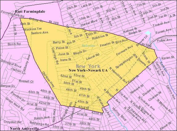
North Lindenhurst, New York — CDP — U.S. Census Map Location within the state of New York

Coordinates: 40°42′25″N 73°23′6″W / 40.70694°N 73.385°WCoordinates: 40°42′25″N 73°23′6″W / 40.70694°N 73.385°W Country United States State New York County Suffolk Area – Total 1.9 sq mi (4.9 km2) – Land 1.9 sq mi (4.9 km2) – Water 0.0 sq mi (0.0 km2) Elevation 43 ft (13 m) Population (2000) – Total 11,767 – Density 6,199.1/sq mi (2,393.5/km2) Time zone Eastern (EST) (UTC-5) – Summer (DST) EDT (UTC-4) ZIP code 11757 Area code(s) 631 FIPS code 36-53198 GNIS feature ID 0958843 North Lindenhurst is a hamlet (and census-designated place) in Suffolk County, New York, United States. The population was 11,767 at the 2000 census. It is a community in the Town of Babylon. Even though it is separate from the Village of Lindenhurst, both share the same school district and zip code, and are considered to be one town.
Geography
North Lindenhurst is located close to Wyandanch and North Amityville bordering the edge of Copiague and Lindenhurst 40°42′25″N 73°23′6″W / 40.70694°N 73.385°W (40.706966, -73.385011)[1].
According to the United States Census Bureau, the CDP has a total area of 1.9 square miles (4.9 km2), all land.
Demographics
As of the census[2] of 2000, there were 11,767 people, 3,808 households, and 2,974 families residing in the CDP. The population density was 6,199.1 per square mile (2,391.2/km²). There were 3,883 housing units at an average density of 2,045.6/sq mi (789.1/km²). The racial makeup of the CDP was 58.27% White, 33.90% African American, 0.20% Native American, 2.13% Asian, 0.05% Pacific Islander, 3.49% from other races, and 1.95% from two or more races. Hispanic or Latino of any race were 11.66% of the population.
There were 3,808 households out of which 37.3% had children under the age of 18 living with them, 60.9% were married couples living together, 12.2% had a female householder with no husband present, and 21.9% were non-families. 17.7% of all households were made up of individuals and 7.6% had someone living alone who was 65 years of age or older. The average household size was 3.06 and the average family size was 3.44.
In the CDP the population was spread out with 25.6% under the age of 18, 7.5% from 18 to 24, 33.8% from 25 to 44, 21.3% from 45 to 64, and 11.8% who were 65 years of age or older. The median age was 36 years. For every 100 females there were 96.3 males. For every 100 females age 18 and over, there were 91.6 males.
The median income for a household in the CDP was $59,022, and the median income for a family was $63,642. Males had a median income of $42,403 versus $31,296 for females. The per capita income for the CDP was $22,631. About 3.3% of families and 5.2% of the population were below the poverty line, including 6.6% of those under age 18 and 3.7% of those age 65 or over.
References
- ^ "US Gazetteer files: 2010, 2000, and 1990". United States Census Bureau. 2011-02-12. http://www.census.gov/geo/www/gazetteer/gazette.html. Retrieved 2011-04-23.
- ^ "American FactFinder". United States Census Bureau. http://factfinder.census.gov. Retrieved 2008-01-31.
Town of Babylon, New York County Villages Hamlets Copiague · Deer Park · East Farmingdale · Gilgo, Oak Beach Captree · North Amityville · North Babylon · North Lindenhurst · West Babylon · Wheatley Heights · Wyandanch
Website: townofbabylon.comCategories:- Census-designated places in New York
- Babylon (town), New York
- Hamlets in New York
- Populated places in Suffolk County, New York

Wikimedia Foundation. 2010.