- North Patchogue, New York
-
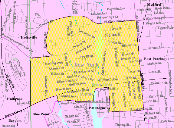
North Patchogue, New York — CDP — U.S. Census Map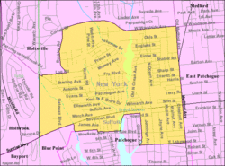
Coordinates: 40°47′3″N 73°1′23″W / 40.78417°N 73.02306°WCoordinates: 40°47′3″N 73°1′23″W / 40.78417°N 73.02306°W Country United States State New York County Suffolk Area – Total 2.2 sq mi (5.7 km2) – Land 2.1 sq mi (5.5 km2) – Water 0.0 sq mi (0.1 km2) Elevation 49 ft (15 m) Population (2000) – Total 7,825 – Density 3,669.7/sq mi (1,416.9/km2) Time zone Eastern (EST) (UTC-5) – Summer (DST) EDT (UTC-4) ZIP code 11772 Area code(s) 631 FIPS code 36-53319 GNIS feature ID 0958869 North Patchogue is a census-designated place (CDP) in Suffolk County, New York, United States. The population was 7,825 at the 2000 census. The community is located on Long Island.
Geography
North Patchogue is located at 40°47′3″N 73°1′23″W / 40.78417°N 73.02306°W (40.784178, -73.023079)[1].
According to the United States Census Bureau, the CDP has a total area of 2.2 square miles (5.7 km2), of which, 2.1 square miles (5.4 km2) of it is land and 0.1 square miles (0.26 km2) of it (2.29%) is water.
North Patchogue is near the intersection of NY-27(Sunrise Highway), and NY-112(Medford Avenue).
Demographics
As of the census[2] of 2000, there were 7,825 people, 2,694 households, and 1,988 families residing in the CDP. The population density was 3,669.7 per square mile (1,418.4/km²). There were 2,781 housing units at an average density of 1,304.2/sq mi (504.1/km²). The racial makeup of the CDP was 93.30% White, 1.44% African American, 0.09% Native American, 1.11% Asian, 0.01% Pacific Islander, 2.38% from other races, and 1.66% from two or more races.
There were 2,694 households out of which 35.8% had children under the age of 18 living with them, 58.1% were married couples living together, 11.2% had a female householder with no husband present, and 26.2% were non-families. 20.3% of all households were made up of individuals and 5.9% had someone living alone who was 65 years of age or older. The average household size was 2.87 and the average family size was 3.32.
In the CDP the population was spread out with 26.5% under the age of 18, 7.4% from 18 to 24, 34.1% from 25 to 44, 23.4% from 45 to 64, and 8.7% who were 65 years of age or older. The median age was 35 years. For every 100 females there were 98.2 males. For every 100 females age 18 and over, there were 95.0 males.
The median income for a household in the CDP was $91,145, and the median income for a family was $95,117. Males had a median income of $74,302 versus $61,724 for females. The per capita income for the CDP was $63,719. About 2.4% of families and 3.7% of the population were below the poverty line, including 4.9% of those under age 18 and 2.8% of those age 65 or over.
References
- ^ "US Gazetteer files: 2010, 2000, and 1990". United States Census Bureau. 2011-02-12. http://www.census.gov/geo/www/gazetteer/gazette.html. Retrieved 2011-04-23.
- ^ "American FactFinder". United States Census Bureau. http://factfinder.census.gov. Retrieved 2008-01-31.
Town of Brookhaven, New York County Villages Belle Terre · Bellport · Lake Grove · Mastic Beach · Old Field · Patchogue · Poquott · Port Jefferson · ShorehamHamlets Blue Point · Brookhaven · Calverton · Canaan Lake · Center Moriches · Centereach · Cherry Grove · Coram · Crystal Brook · Cupsogue Beach · Davis Park · East Moriches · East Patchogue · East Setauket · East Shoreham · Eastport · Farmingville · Fire Island Pines · Gordon Heights · Hagerman · Holbrook · Holtsville · Lake Ronkonkoma · Manorville · Mastic · Medford · Middle Island · Miller Place · Moriches · Mount Sinai · North Bellport · North Patchogue · Ocean Bay Park · Point O' Woods · Port Jefferson Station · Ridge · Rocky Point · Ronkonkoma · Selden · Setauket · Shirley · Sound Beach · South Haven · Stony Brook · Strongs Neck · Terryville · Upton · Wading River · Water Island · West Manor · YaphankIndian
reservationPoospatuckWebsite: brookhaven.orgCategories:- Brookhaven, New York
- Hamlets in New York
- Census-designated places in New York
- Populated places in Suffolk County, New York
Wikimedia Foundation. 2010.