- Shoreham, New York
Infobox Settlement
official_name = Shoreham, New York
settlement_type = Village
nickname =
motto =
imagesize =
image_caption =
image_|pushpin_
pushpin_label_position =
pushpin_map_caption =Location within the state of New York
pushpin_mapsize =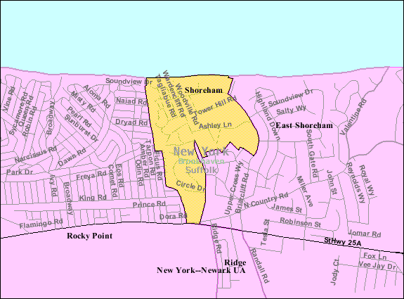
mapsize = 250px
map_caption = U.S. Census Map
mapsize1 =
map_caption1 =subdivision_type = Country
subdivision_name =United States
subdivision_type1 = State
subdivision_name1 =New York
subdivision_type2 = County
subdivision_name2 = Suffolk
government_footnotes =
government_type =
leader_title =
leader_name =
leader_title1 =
leader_name1 =
established_title =
established_date =unit_pref = Imperial
area_footnotes =area_magnitude =
area_total_km2 = 1.2
area_land_km2 = 1.2
area_water_km2 = 0.0
area_total_sq_mi = 0.4
area_land_sq_mi = 0.4
area_water_sq_mi = 0.0population_as_of = 2000
population_footnotes =
population_total = 417
population_density_km2 = 362.3
population_density_sq_mi = 938.3timezone = Eastern (EST)
utc_offset = -5
timezone_DST = EDT
utc_offset_DST = -4
elevation_footnotes =
elevation_m = 20
elevation_ft = 66
latd = 40 |latm = 57 |lats = 25 |latNS = N
longd = 72 |longm = 54 |longs = 31 |longEW = Wpostal_code_type =
ZIP code
postal_code = 11786
area_code = 631
blank_name = FIPS code
blank_info = 36-67191
blank1_name = GNIS feature ID
blank1_info = 0965160
website =
footnotes =Shoreham is a
village in Suffolk County,New York ,United States . The population was 417 at the 2000 census.The Village of Shoreham is inside the Town of Brookhaven.
Geography
Shoreham is located at coor dms|40|57|25|N|72|54|31|W|city (40.956866, -72.908727)GR|1.
The Village of Shoreham, described above, is located within the Town of Shoreham, which is located within Brookhaven Township. According to the
United States Census Bureau , the village has a total area of 0.4square mile s (1.1km² ), all of it land. Both East Shoreham and Shoreham share a Post Office, which has 11786 as the zip code. Most people refer to East Shoreham as Shoreham.Demographics
As of the
census GR|2 of 2000, there were 417 people, 145 households, and 126 families residing in the village. Thepopulation density was 938.3 people per square mile (365.9/km²). There were 163 housing units at an average density of 366.8/sq mi (143.0/km²). The racial makeup of the village was 95.20% White, 2.40% Asian, 2.16% from other races, and 0.24% from two or more races. Hispanic or Latino of any race were 2.88% of the population.There were 145 households out of which 38.6% had children under the age of 18 living with them, 74.5% were married couples living together, 8.3% had a female householder with no husband present, and 13.1% were non-families. 11.0% of all households were made up of individuals and 6.9% had someone living alone who was 65 years of age or older. The average household size was 2.88 and the average family size was 3.11.
In the village the population was spread out with 27.6% under the age of 18, 6.2% from 18 to 24, 17.7% from 25 to 44, 36.0% from 45 to 64, and 12.5% who were 65 years of age or older. The median age was 44 years. For every 100 females there were 99.5 males. For every 100 females age 18 and over, there were 88.8 males.
The median income for a household in the village was $109,719, and the median income for a family was $116,985. Males had a median income of $81,873 versus $31,250 for females. The
per capita income for the village was $37,620. None of the families and 1.4% of the population were living below thepoverty line , including no under eighteens and none of those over 64.Facilities
At Shoreham, Nikola Tesla built the
Wardenclyffe Tower , which was dismantled in 1917. Nowadays there is thestatic inverter plant of theHVDC Cross Sound Cable .It was at Shoreham where an approved
Shoreham Nuclear Power Plant was later disapproved as the result of public protest. The builder,Long Island Lighting Company (LILCO), was partially reimbursed for money spent on construction. The municipal bonds that were floated to reimburse the builder are being paid off by a special levy on the electric bills of residents ofLong Island . This was the last attempt to construct a Nuclear Power plant in the US. The region is currently served by acoal-fired plant.References
External links
* [http://www.villageofshoreham.org/index.html Official Site]

Wikimedia Foundation. 2010.