U.S. Post Office (Patchogue, New York)
- U.S. Post Office (Patchogue, New York)
Infobox_nrhp | name = US Post Office-Patchogue
nrhp_type =
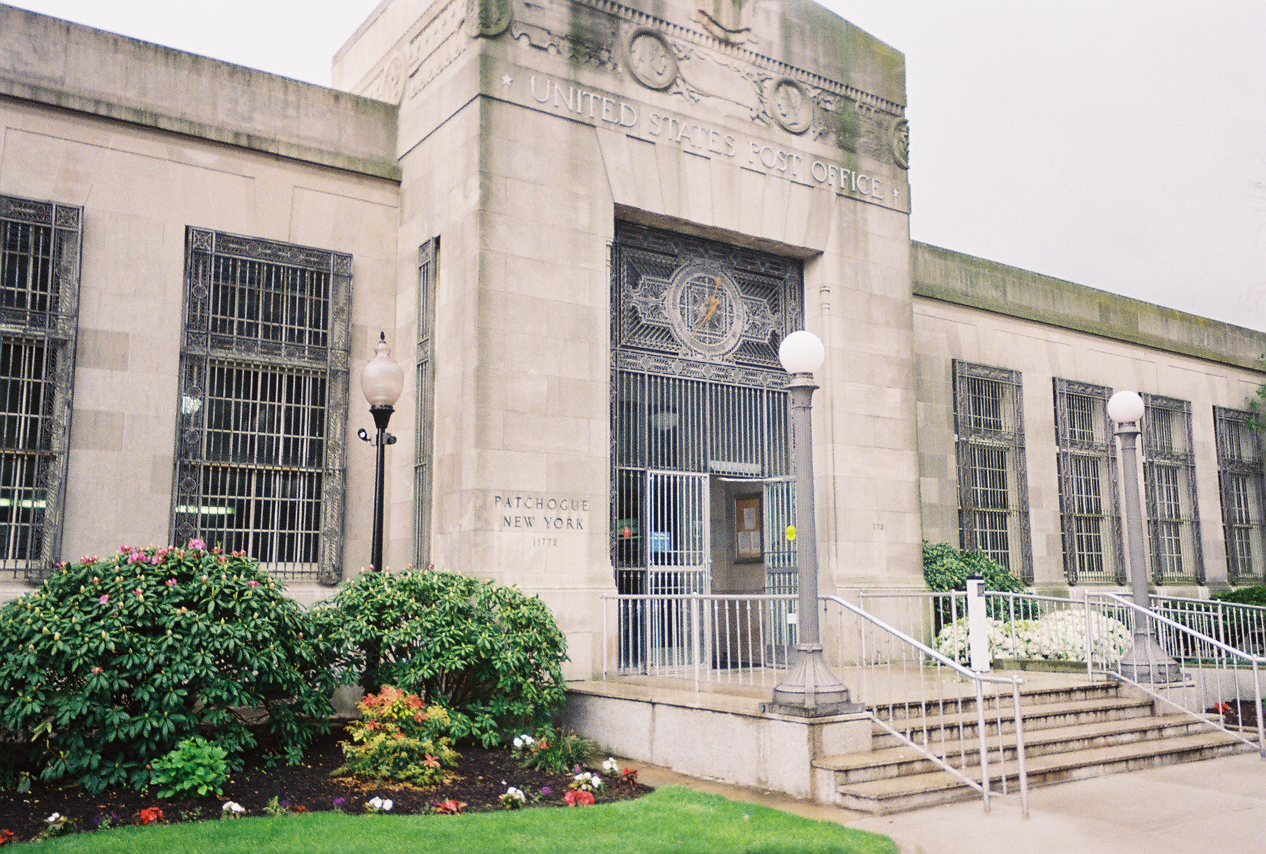
caption = The front of the Patchogue Post Office
location = Patchogue, NY
nearest_city =
lat_degrees = 40
lat_minutes = 45
lat_seconds = 55
lat_direction = N
long_degrees = 73
long_minutes = 0
long_seconds = 42
long_direction = W
locmapin = New York
area =
built = 1930
architect = John V. Van Pelt
architecture = Art Deco, Classical Revival
added = 1989
refnum = #88002397
visitation_num =
visitation_year =
governing_body = U.S. Postal ServiceThe U.S. Post Office in Patchogue, New York is located at 170 East Main Street in the Suffolk County village. It serves the ZIP Code 11772, covering the entire Village of Patchogue, as well as the hamlets of North Patchogue and East Patchogue.Patchogue Post Office was built in 1930 by architect John V. Van Pelt, and combines Art Deco & Classical Revival architecture. The building contains wrought-iron window guards in the front and on the sides, and a matching analogue clock over the front doors. The rest of the building is made primiarily of brick. Long Island-based stamp collectors have often considered the Patchogue Post Office to be one of several sources for stamps with obscure denominations. The building was added to the National Register of Historic Places in 1989. [ [http://www.nationalregisterofhistoricplaces.com/NY/Suffolk/state5.html Suffolk County Listings at the National Register of Historic Places] ]
References
External links
* [http://www.nationalregisterofhistoricplaces.com/NY/Suffolk/state5.html Suffolk County Listings at the National Register of Historic Places]
Wikimedia Foundation.
2010.
Look at other dictionaries:
Patchogue, New York — Infobox Settlement official name = Patchogue, New York settlement type = Village nickname = motto = imagesize = image caption = image pushpin pushpin label position = none pushpin map caption =Location within the state of New York pushpin mapsize … Wikipedia
U.S. Post Office — may refer to the United States Post Office Department (1792–1971) or to the United States Postal Service (since 1971). The term may also refer to individual buildings, many of which have historical or architectural significance. Some noted… … Wikipedia
U.S. Post Office — Als U.S. Post Office bezeichnet man die Filialen des United States Postal Service. Eine Reihe von ihnen ist in das National Register of Historic Places eingetragen, oder es handelt sich um eine National Historic Landmark: Alabama U.S. Post Office … Deutsch Wikipedia
New York City — This article is about the city. For other uses, see New York City (disambiguation). New York, New York and NYC redirect here. For other uses, see New York, New York (disambiguation) and NYC (disambiguation). New York City … Wikipedia
National Register of Historic Places listings in Brookhaven (town), New York — Map of all coordinates from Google Map of all coordinates from Bing … Wikipedia
Medford, New York — Hamlet and CDP U.S. Census Bureau map Coordinates … Wikipedia
National Register of Historic Places listings in Suffolk County, New York — Location of Suffolk County in New York … Wikipedia
Mount Sinai, New York — For other uses, see Mount Sinai (disambiguation). Mount Sinai, New York CDP Mount Sinai Harbor … Wikipedia
Davis Park, New York — Davis Park Hamlet Davis Park Dockmaster Tower, Ferry Port and Marina … Wikipedia
List of county routes in Suffolk County, New York (101-117) — The following is a list of county routes in Suffolk County, New York from Routes 101 to 117. Contents 1 County Route 101 1.1 History 1.2 Proposed extension 1.3 Major intersections … Wikipedia