- List of county routes in Suffolk County, New York (101-117)
-
The following is a list of county routes in Suffolk County, New York from Routes 101 to 117.
County Route 101
County Route 101
Location: East Patchogue-Yaphank Length: 8.4 mi[1] (13.52 km) Existed: 1961[1]–present Suffolk County Road 101 is a county road in Suffolk County, New York. It runs northeast and southwest from Suffolk County Route 80(Montauk Highway) to Long Island Avenue, north of exit 66 on the Long Island Expressway. The road is known as Patchogue-Yaphank Road in some sections, and Sills Road in others.
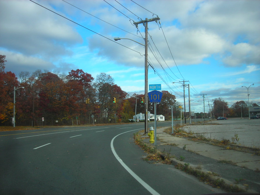
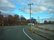 Route 101 heading northbound with old Suffolk County signage on the right
Like many of the roads built by Suffolk County between the 1940s and 1970s, it had the potential to be upgraded into a limited-access highway, but those proposals were thwarted by development and public opposition.
History
At one point much of the road was intended to be part of the formerly proposed Atlantic Expressway. When the New York State Department of Transportation caved into public opposition and cancelled the expressway in 1966, Suffolk County took up the task of improving Suffolk CR 101 for itself. Upon doing so in the 1970s, two segments were realigned; One between Hospital Road and Martha Avenue in East Patchogue, and the other between Old Dock Road and the eastbound service road of Interstate 495(Long Island Expressway) in Yaphank. Suffolk County Department of Public Works built a bridge over New York State Route 27 parallel to the one built by the New York State Department of Transportation as part of the improvement project.
The former segment between Hospital Road and Gazzola Drive(formerly part of Sipp Avenue) was left to local residents. One portion of the segment between Gazzola Drive and Martha Avenue became an extension of Martha Avenue with a connecting road to Suffolk CR 101, while the rest of it was closed to traffic in the late-1980's.
The former segment between Old Dock and the Long Island Expressway was abandoned south of the main line of the Long Island Rail Road, while the rest of it as well as a connecting road in between was made into an extension of Long Island Avenue. The south side of the bridge over the railroad tracks that replaced the old one also contains a right-of-way for the formerly proposed Suffolk County Road 90(Central Suffolk Highway).
Proposed extension
Suffolk County Road 101 terminates at the northern intersection of another Long Island Avenue, although Patchogue-Yaphank Road continues in a northwesterly direction as it curves towards the heart of Yaphank. However the Suffolk County Department of Public Works originally planned to extend SCR 101 from the northeast corner of that intersection over Gerard Road, Lower Yaphank Lake, Suffolk CR 21(East Main Street) and eventually to a future interchange with Suffolk CR 46 and Longwood Road at the entrance to the Brookhaven National Laboratory in Upton, New York.[2]
In addition, at the vicinity of the interchange with the Long Island Expressway, there was to be a southern terminus of Suffolk County Road 8 a.k.a., the proposed Yaphank Bypass. This was planned either in conjunction with the Sills Road extension, or in the event of its cancellation.
Major intersections
Location Mile Destinations Notes East Patchogue 0.0  CR 80
CR 80Formerly NY 27A  NY 27
NY 27Exit 55 (NY 27) Medford  CR 99
CR 99North Bellport  CR 16
CR 16Formerly CR 56 Yaphank  I-495
I-495Exit 66 (I-495) Long Island Avenue Patchogue-Yaphank Road continues
as a Town of Brookhaven road.1.000 mi = 1.609 km; 1.000 km = 0.621 mi
County Route 102

Suffolk County Route 102 was a formerly proposed four-lane county road in Yaphank, that began along East Main Street east of Yaphank Avenue. Unlike the existing East Main Street, it was not intended to become Moriches-Middle Island Road and cross over the Long Island Expressway. The road intended to terminate at the westbound service road of the interchange between the Long Island Expressway and William Floyd Parkway.
County Route 103

Suffolk County Route 103 was intended to be Cedar Swamp Road a proposed road northwest of County Route 51 within Cranberry Bog County Park leading toward the Long Island Expressway.
County Route 104
Main article: County Route 104 (Suffolk County, New York)
County Route 104
Location: Quogue-Riverhead Length: 7.47 mi[1] (12.02 km) Existed: March 29, 1972[1]–present Suffolk County Route 104 is former New York State Route 113 from Riverhead to Quogue. It runs north from County Route 80 in Quogue to NY 24, County Route 63 and County Route 94 just outside Riverhead. Much of Suffolk County Route 104 runs through the David Allen Sarnoff Pine Barrens Preserve, a major New York State Conservation Area, that was once owned by Radio Corporation of America. There is an access point into the Preserve along County Route 104, south of Riverhead.
From 1930 to 1972, the road was signed as New York State Route 113.
History
In the 1930 renumbering of state highways in New York, the NY 113 designation was assigned to a previously unnumbered north–south connector between Montauk Highway (then-NY 27) in the village of Quogue and NY 25 in the hamlet of Riverhead.[3] This also included Peconic Avenue in Riverhead, which was multiplexed with NY 24, until it was redirected onto Suffolk County Road 94. The route remained relatively unchanged until March 29, 1972, when ownership and maintenance of NY 113 was transferred from New York State to Suffolk County. NY 113 was then redesignated as County Route 104.[1]
Major intersections
The entire route is in Suffolk County.
Location Mile[1][4][5] Destinations Notes Quogue 0.00 CR 80Town of Southampton 3.25 NY 27 (Sunrise Highway)Exit 64 (NY 27) 4.62  CR 31
CR 316.18  CR 105
7.47 

 NY 24 / CR 94 / CR 63
Traffic circle 1.000 mi = 1.609 km; 1.000 km = 0.621 mi County Route 104A
County Route 104A
Location: Oakville-East Quogue Existed: 1972–1986 Suffolk County Route 104A was Lewis Road, a suffixed route of County Road 104 running southeast from Oakville to County Route 80 (Suffolk County, New York)(Montauk Highway) in East Quogue, New York.
County Route 105
Main article: County Route 105 (Suffolk County, New York)
Suffolk County Route 105 is a major county road connecting County Route 104 (Suffolk County, New York) in the David Allen Sarnoff State Pine Barrens Preserve, which bypasses downtown Riverhead and leads to Sound Avenue in Northville, New York.
County Route 106
County Route 106
Location: West Brentwood-Brentwood Existed: 1975[1]–present Suffolk County Route 106 is a road spanning from Pilgrim State Psychiatric Center to CR 7, which was originally part of the hospital when it had more territory. Pilgrim State called it "G Road," a name it still contains within the hospital. The entire road runs along a Long Island Power Authority power line right-of-way, which was inherited from the Long Island Lighting Company.
Route description
Suffolk County Road 106 begins as G Road in Pilgrim State Psychiatric Center in West Brentwood, where the former Pilgrim State Hospital Railroad Station can be found on the southwest corner of the Sagtikos State Parkway underpass. G Road becomes becomes Campus Road(or Community College Drive), and the road serves as northbound Exit S2 in Brentwood. That interchange is actually for either the hospital or for the next intersection, which is Suffolk CR 13 (Crooked Hill Road) in Brentwood From there the road serves as the southern border of Suffolk County Community College's Grant(formerly Western)Campus, and the northern border of a local athletic park, and the Brentwood North Middle School, where the road finally ends at Suffolk CR 7 (Wick's Road) in Brentwood.
County Route 107
County Route 107
Location: West Babylon-North Babylon Existed: 1961(1973)[1]–present Suffolk County Route 107 is unmarked along Belmont Avenue within Babylon Township. It runs northeast and southwest.
Route description
Suffolk CR 107 begins at Suffolk CR 95 (Little East Neck Road). Four blocks later both roads go over New York State Route 27, and share Exit 38. North of NY 27, various residential perpendicular streets cross CR 107, the exception being Hebbards Path, which terminates at CR 107 and runs southeast towards the Village of Babylon.
The last major intersection is the interchange with Southern State Parkway (Exits 37 N-S) in North Babylon, which is just south of the terminus of the road at the entrance to the New York State Office of Parks, Recreation and Historic Preservation Long Island Headquarters in Belmont Lake State Park, across from Essex Street. Belmont Avenue continues northbound to Wyandanch Avenue and August Road as a Town of Babylon maintained road.
History
When Suffolk County Department of Public Works originally established CR 107 on June 22, 1961, the road included Suffolk CR 95, along Little East Neck Road from NY 109 to Belmont Avenue. This would change when CR 95 was installed on all of Little East Neck Road on June 12, 1973 and CR 107 was truncated.
As part of its potential transformation into the West Babylon-Centerport Highway, the route was proposed to be relocated onto Hebbard's Path and Cadman Avenue, then use the remainder of Belmont Avenue which was to be extended north of Belmont Lake State Park towards the vicinity of Exit 50 on the Long Island Expressway. At Half Hollow Hills Road (Suffolk CR 67) it would've replaced Cadman Road and much of Pigeon Hill Road, then curve to the northeast and intersect with NY 25 (Jericho Turnpike) onto Suffolk County Road 86, most if not all of which it was also intended to replace.
County Route 108
County Route 108
Location: Central Islip-Smithtown Existed: 1962[1]–present Suffolk County Route 108 is known as Caleb's Path from NY 111 to Motor Parkway and Old Willets Path from Motor Parkway to NY 25 near Caleb Smith State Park. Due to the fact that the road is bisected by the Long Island Expressway, northbound CR 108 is forced into a short concurrency with westbound Long Island Motor Parkway at Exit 55.
Route description
Suffolk County Road 108 begins at New York State Route 111, which heads northeast as CR 108 heads northwest. At the intersection with the Long Island Motor Parkway, CR 108 joins westbound CR 67, while Caleb's Path continues north as a Town of Islip road that ends at the eastbound service road of the Long Island Expressway, on the corner of a Greyhound Bus Terminal, which was originally a Texaco gas station. After crossing the LIE and it's two service roads, CR 108 branches off to the east and crosses the Islip-Smithtown Town Line, where it rejoins it's original segment, which is also at the western terminus of Suffolk County Road 6. From here it runs straight north where descends along the Ronkonkoma Moraine, passing by the site of the former Brentwood Mackay Radio Station[6] until it curves northwest again and approaches the next major intersection at New York State Route 454. The northeast corner of NY 454 and CR 108 is the 4th Precinct of the Suffolk County Police Department, which was once the Smithtown Aviation Country Club until 1957.[7] Across from this police precinct is the eastern terminus of New Highway.
Turning straight north again, the road runs through some residential areas until it curves northeast as it approaches Caleb Smith State Park, where the formerly proposed Northern State Parkway extension was supposed to be built a former section of the road that currently enters the park. Here CR 108 curves back north again and finally terminates at Jericho Turnpike, as does Old Willet's Path, which turns into Plymouth Avenue, a Town of Smithtown residential street.
History
When Suffolk CR 108 was originally designated, the southern terminus was on the northwest corner of the intersection with NY 111 and Suffolk CR 100 until the late-1980's. A formerly proposed extension was intended to run along Plymouth Avenue and Old Northport Road, and then would have terminated at Suffolk County Road 11. In 1973, the road and the northern terminus were realigned toward Plymouth Avenue, while the original northern terminus became part of Caleb Smith State Park.[8]
Major intersections
Location Mile Destinations Notes Central Islip 0.0  NY 111
North of  CR 100
Brentwood  CR 67
CR 67Beginning of CR 67-108 multiplex Hauppauge I-495Exit 55 (I-495) CR 67End of CR 67-108 multiplex  CR 6
CR 6 NY 454
Smithtown  NY 25
NY 25Becomes Plymouth Avenue, a Town of Smithtown road. 1.000 mi = 1.609 km; 1.000 km = 0.621 mi County Route 110

Suffolk County Route 110 was inteded for the unbuilt four-lane highway knowns as the A.O. Smith Turnpike. The road was to begin at County Road 97 in Centereach, replacing Wireless Road, then continue north of NY 347 running through South Setauket and East Setauket where it would have utilized a portion of Sheep Pasture Road and all of Hulse Road, continuing north of Old Post Road into Poquott, New York, where it would've either made a U-Turn along the west shore of Port Jefferson Harbor,[9] or connected to a possible bridge to Bridgeport, Connecticut.
County Route 111
Main article: County Route 111 (Suffolk County, New York)
Suffolk County Route 111 is the Captain Daniel Roe Highway, however it was originally proposed as the Port Jefferson-Westhampton Beach Highway.
County Route 112
County Route 112
Location: Sayville-Islip Airport Length: 1.38 mi[1] (2.22 km) Existed: 1964[1]–present Suffolk County Route 112 is Johnson Avenue between NY 27 and NY 454 at the entrance to the Long Island MacArthur Airport. Because of the close proximity to New York State Route 112, the road is unsigned.
Route description
Johnson Avenue actually begins at Lakeland Avenue and Tariff Street, north of where Lakeland Avenue becomes Railroad Street. This segment is striclty a Town of Islip road. Only when Johnson Avenue encounters the interchange with New York State Route 27 at exit 50A does the road acquire it's designation as Suffolk County Road 112, where it widens from two to four lanes.
North of Sunrise Highway, Johnson Avenue is a four-lane undivided highway. It intersects Church Street before turning northwest. The road eventually intersects New York State Route 454 then turns into the entrance to MacArthur Airport.
History
Johnson Avenue was originally known as Moscow Avenue, and reached as far north as the vicinity of Ronkonkoma Station until the Long Island MacArthur Airport was built.[10]
The road was officially designated Suffolk County Road 112 on April 30, 1964.
County Route 113
County Route 113
Location: Georgica-Hardscrabble Length: 2.5 mi[1] (4.02 km) Existed: 1966[1]–present Suffolk County Route 113 is an unmarked street named Stephen Hands Path near the Village of East Hampton. The route was established in 1966, and the intended northern terminus was to be at the formerly proposed Suffolk County Road 59.
Route description
The south end of the road begins at New York State Route 27 in Georgica across from a nature preserve designed to protect the wetlands around Georgica Pond. The road curves from northeast to straight north before reaching a low(10'1") and narrow bridge beneath the Montauk Branch of the Long Island Rail Road. Later it curves northeast again, before reaching a LIPA power line right of way, and then the intersection of Buckskill Road. The fist major intersection north of the Montauk Branch is New York State Route 114 in East Hampton. From there the road enters Hardscrabble, where it passes by some farmland and intersects both Long Lane and Two Holes of Water Road, which were intended to be part of Suffolk County Road 59, a proposed bypass of NY 114 around the village of East Hampton.[11]
In the vicinity of a fork in the road with Old Northwest Road, CR 113 was intended to terminate at the proposed extension of Sunrise Highway, which was also intended to be the proposed extension of Suffolk County Road 39. Instead, Stephen Hands Path becomes a Town of East Hampton road and continues northeast towards Hands Creek Road, while CR 113 moves north onto Old Northwest Road only for the north end to terminate at Cedar Street, while Old Northwest Road continues towards Northwest Harbor.
County Route 115
County Route 115
Location: Shelter Island Heights Length: 0.56 mi[1] (0.90 km) Existed: 1982[1]–present Suffolk County Route 115 is unsigned West Neck Road on Shelter Island. The road runs entirely in the hamlet of Shelter Island Heights, and was previously designated as Suffolk County Road 28.
Route description
The west end of CR 115 begins at Shore Road(Nostrand and Brander Parkways) and Bootlegger's Alley. At Worth Way, the road turns northeast and after the inersection with Westmoreland Road runs along the North shore of West Neck Bay. The shoreline of the bay ends just before the intersection of Hilo Drive.
CR 115 briefly turns north and intersects Suffolk CR 42 in Shelter Island where the road turns east again along the southern border of the Shelter Island Country Club. The country club ends at the intersection with New York Avenue and Suffolk CR 116. After intersecting an unnoteworthy dead end street, the road becomes the northern terminus of Midway Road before finally terminating itself at a wye intersection with New York State Route 114.
County Route 116
County Route 116
Location: Shelter Island Heights-Shelter Island Length: 1.18 mi[1] (1.90 km) Existed: 1982[1]–present Suffolk County Route 116 is a pair of unsigned two-lane roads on Shelter Island. Previously, the route was known as Suffolk County Road 29.
Route description
The north end of Suffolk CR 116 begins at Suffolk County Road 115 in Shelter Island Heights on Menantic Road. Halfway between CR 115 and the south shore of Shelter Island, CR 116 runs along the east side of West Neck Bay and West Neck Creeek, then turns east onto Smith Street, From here it runs close to the north shore of Menatic Creek, then intersects Midway Road. The road intersects four more streets in "downtown" Shelter Island before finally termiating at New York State Route 114.
County Route 117
County Route 117
Location: Shelter Island Length: 0.45 mi[1] (0.72 km) Existed: 1982[1]–present Suffolk County Route 117 is unsigned along Burns Road on Shelter Island. Previously, the road was designated as Suffolk CR 30. Though not the shortest county road in Suffolk County (this status belongs to Suffolk CR 81), the road spans a mere 0.45 miles from part of former Suffolk CR 37 (Saint Mary's Road) to Suffolk CR 69 (Cartwright Road). Burns Road continues east of the terminus of CR 69 to the west shore of Coecles Inlet.
See also
- List of county routes in Suffolk County, New York
- List of Suffolk County (New York) Road proposals
- List of county routes in Suffolk County, New York (1–25)
- List of county routes in Suffolk County, New York (26–50C)
- List of county routes in Suffolk County, New York (51-75)
- List of county routes in Suffolk County, New York (76–100)
References
- ^ a b c d e f g h i j k l m n o p q r s Suffolk County Department of Public Works. "County Road System - County of Suffolk, New York" (PDF). http://www.greaternyroads.info/pdfs/suffcr.pdf. Retrieved February 24, 2008.
- ^ Hagstrom Map (1973). Hagstrom's Atlas of Suffolk County, New York (Map).
- ^ Dickinson, Leon A. (January 12, 1930). "New Signs for State Highways". The New York Times: p. 136.
- ^ Yahoo! Inc. Yahoo! Maps – Southampton, New York (Map). Cartography by NAVTEQ. http://maps.yahoo.com/#mvt=m&lat=40.862705&lon=-72.6209&mag=5&q1=40.827328%2C-72.592168&q2=40.868849%2C-72.615979&q3=40.878382%2C-72.637802. Retrieved February 24, 2008.
- ^ "National Highway Planning Network GIS data". Federal Highway Administration. version 2005.08. http://www.fhwa.dot.gov/planning/nhpn/. Retrieved February 24, 2008.
- ^ Hagstrom's Western Suffolk County Atlas (1941)
- ^ Smithtown Aviation Country Club (Abandoned & Little Known Airfeilds)
- ^ "Old" Old Willets Path in Caleb Smith State Park (Flickr)
- ^ Patchogue Chamber of Commerce Map(Date unknown)
- ^ Western Suffolk County Road Map; 1941 (Cities Service)
- ^ Eastern Suffolk County Road Map; 1941 (Cities Service)
External links
Categories:- County routes in Suffolk County, New York


Wikimedia Foundation. 2010.