- Montauk Branch
-
Montauk Branch
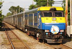
The Cannonball runs express through Bay Shore to the Hamptons along the Montauk Branch.Overview Type Commuter rail, freight rail System Long Island Rail Road Status Operational Locale Long Island, New York, USA Termini Long Island City
MontaukStations 33 Services Montauk BranchOperation Owner Long Island Rail Road Operator(s) Metropolitan Transportation Authority (passenger)
New York and Atlantic Railway (freight)Technical No. of tracks 2 (from Long Island City to Sayville)
1 (east of Sayville)Track gauge 4 ft 8 1⁄2 in (1,435 mm) Montauk Branch Legend

NY Waterway 
1.9 Long Island City 

Main Line (east) 
Lower Montauk 
Penny Bridge closed 1998 Haberman closed 1998 

Bushwick Branch freight only Fresh Pond closed 1998 

Bay Ridge Branch/New York Connecting Railroad 

Glendale closed 1998 Richmond Hill closed 1998 Atlantic Branch (west) 

Morris Park Facility Main Line (west) 


AirTrain JFK Zone 1/Zone 3 


11.3 Jamaica 
Atlantic Branch (east) 
Main Line (east) 
14.0 St. Albans Queens/Nassau County border Zone 3/Zone 4 West Hempstead Branch 

Long Beach Branch (west) 
19.5 Lynbrook 
Zone 4/Zone 7 
Long Beach Branch (east) 20.9 Rockville Centre 22.9 Baldwin 24.1 Freeport 25.9 Merrick 27.2 Bellmore 28.2 Wantagh 29.4 Seaford 30.3 Massapequa 31.0 Massapequa Park Nassau/Suffolk County border Zone 7/Zone 9 32.9 Amityville 34.0 Copiague 35.5 Lindenhurst Central Branch 
38.2 Babylon Zone 9/Zone 10 42.3 Bay Shore Fire Island Ferries 44.8 Islip 46.9 Great River 49.0 Oakdale 51.5 Sayville Sayville Ferry Service 55.6 Patchogue Davis Park Ferry Zone 10/Zone 12 59.4 Bellport 64.0 Mastic–Shirley 

Manorville Branch abandoned 1949 Eastport closed 1958 73.1 Speonk Zone 12/Zone 14 75.9 Westhampton 83.7 Hampton Bays 90.9 Southampton 96.1 Bridgehampton 
Sag Harbor Branch abandoned 1940 103 East Hampton 106 Amagansett 
117 Montauk The Babylon Branch is highlighted.
Distances shown in miles from New York Pennsylvania Station.The Montauk Branch is a rail line owned and operated by the Long Island Rail Road in the U.S. state of New York. The branch runs the length of Long Island, 115 miles (185 km) from Long Island City on the west to Montauk on the east. However, in LIRR maps and schedules for public use the term Montauk Branch refers to the line east of Babylon; the line west of there is covered by Babylon Branch schedules to Jamaica and as part of the City Terminal Zone to Long Island City.[1][2]
Contents
Route description
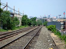
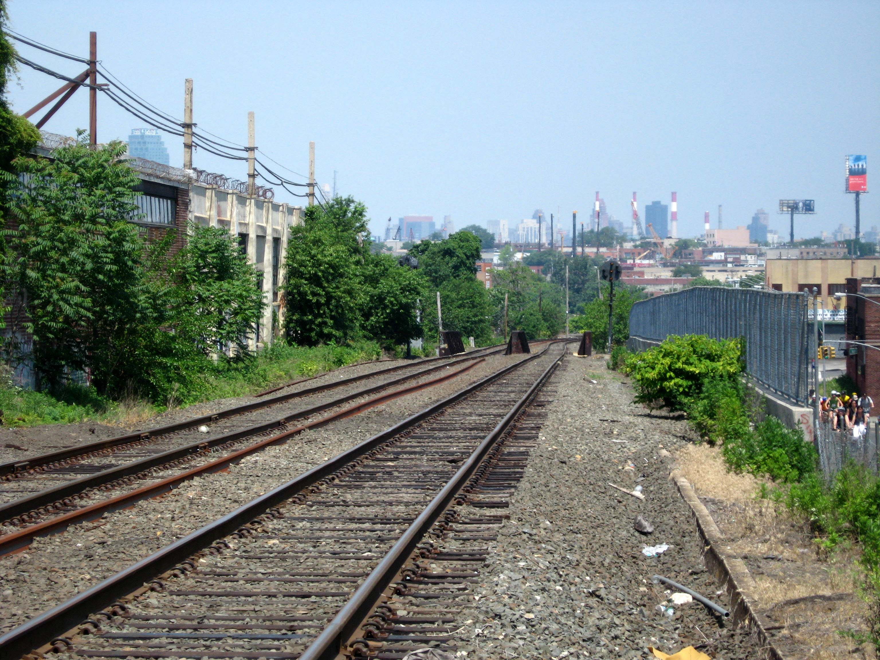
The westernmost portion of the Montauk Branch in Queens, known as the "Old Montauk" or "Lower Montauk", runs from Long Island City to Jamaica, mostly at street level with grade crossings. On weekdays this part of the line sees one regular passenger train that makes no stops on the Old Montauk itself. The five stations along the Old Montauk (Richmond Hill, Glendale, Fresh Pond, Haberman, and Penny Bridge) were closed on March 13, 1998[3] due to low ridership and incompatibility with then-new bi-level coach cars that can only use high platforms.
After Penn Station opened in 1910 the Lower Montauk became the freight route, and when the present Jamaica station opened in 1913 the two Lower Montauk tracks continued past the south side of the station, south of Hall tower and the south Union Hall Street platform and on to Holban Yard. Those two tracks now carry trains to/from the Hillside Facility that has replaced Holban Yard; they can also carry nonstop Main Line trains past Jamaica station. East from Jamaica the Montauk Branch runs between the Main Line tracks (with two usually-westward Main Line tracks north of it and two eastward tracks south of it) until it rises to cross above the other tracks at 40°42′21″N 73°47′04″W / 40.70585°N 73.7845°W and turns southeast to swing parallel to the Atlantic Branch at 40°40′01″N 73°44′49″W / 40.667°N 73.747°W. The Montauk Branch east of Jamaica is 0.7 mile longer than the Atlantic.
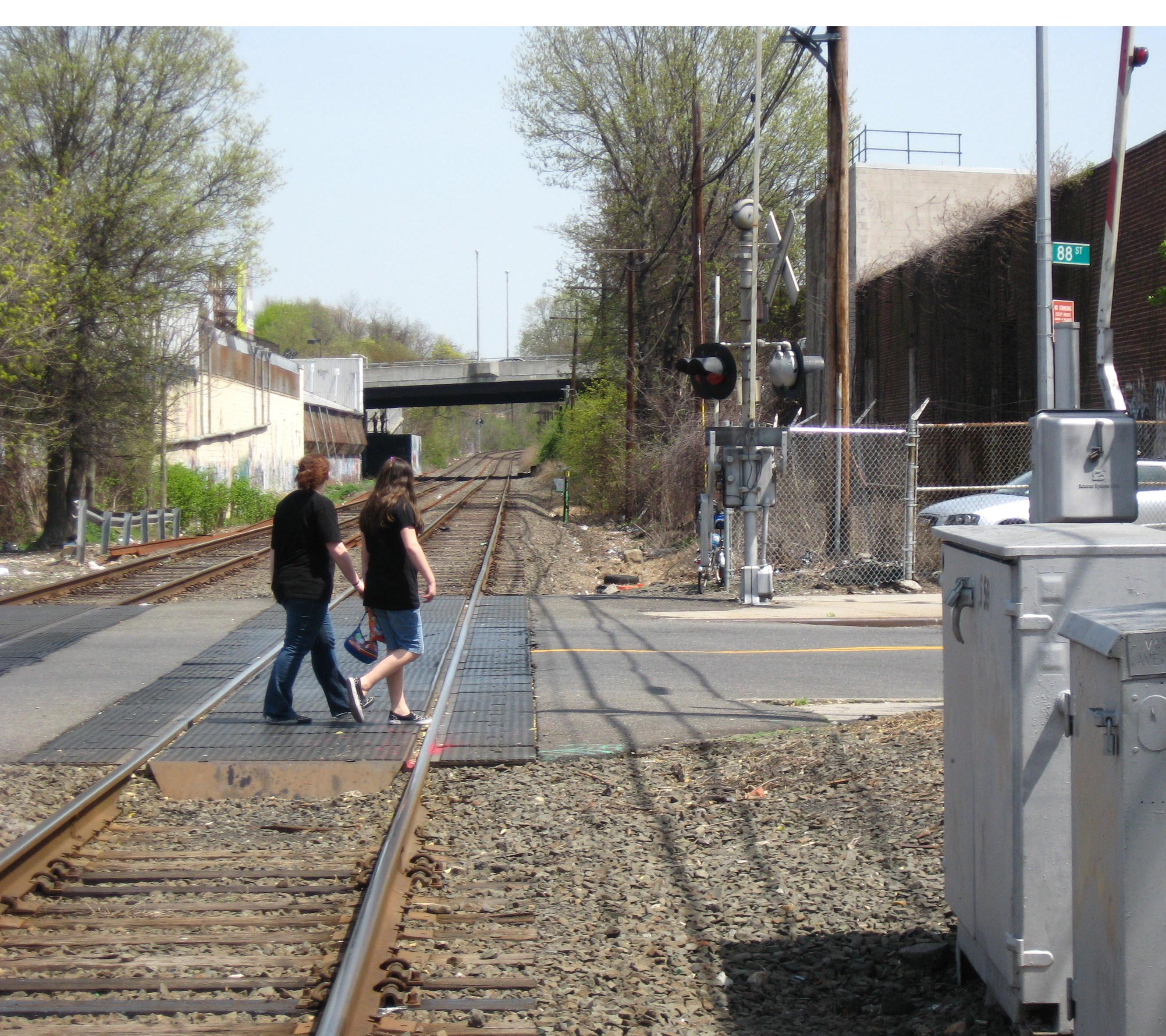
 88th Street grade crossing over the Montauk Branch; Woodhaven Boulevard overpass in background.
 Passing over Grand Avenue, Queens
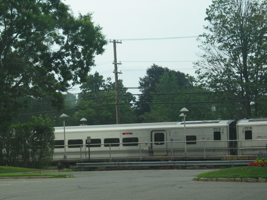
The portion from Jamaica to Babylon has been electrified since 1925. From Babylon east to Montauk, diesel-electric or dual-mode electric/diesel-electric locomotives haul trains of passenger coaches.
The Montauk Line has heavy ridership and frequent service as far as Patchogue and commuter service as far as Speonk. In the summer, with travelers going out to The Hamptons, Fire Island and other beaches, additional service is operated to the far eastern terminal at Montauk, such as the Cannonball, a Friday afternoon train departing from Hunterspoint Avenue and running non-stop between Jamaica and Westhampton. The Montauk Branch, along with the parallel Atlantic Branch, spawns three subsidiary branches: the West Hempstead Branch, Far Rockaway Branch, and Long Beach Branch.
The electrified portion of the Montauk Branch ends at Babylon; the electric service to Babylon is often identified as a separate service, the Babylon Branch. Some of the Montauk's diesel trains begin or end their runs at Babylon station, connecting with electric trains there. Other Montauk diesel trains operate into New York City, to Jamaica, Hunterspoint Avenue, Long Island City, or New York Penn Station. The terminal stations in diesel territory, east of Babylon, are Patchogue, Speonk, and Montauk. The Montauk Branch is double-tracked from Long Island City all the way through Babylon, becoming single track at Y Interlocking (located east of the Sayville Station). Most Montauk Branch diesel trains operate west to NYC via the diesel-only Central Branch, joining the Main Line east of Bethpage. Only a few actually run via the Montauk Branch west of Babylon, under normal conditions on the Main Line.
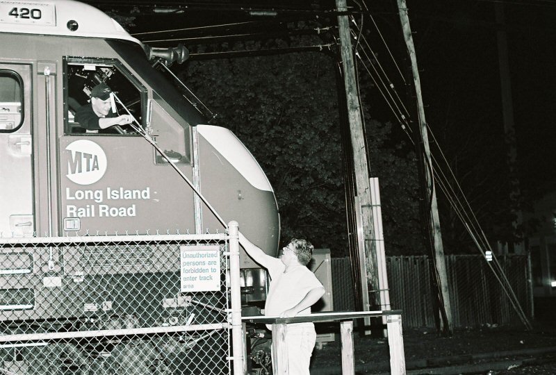
The Montauk was home to the last tower in North America that regularly used "hooping" train operations: PD Tower, in Patchogue. "Hooping" is the transfer of instructions to the engineer and conductor by attaching the folded orders to the "hoop", a rod several feet long with a loop at the end that is passed from the ground to a moving train by catching the loop on one's arm. The last train to get hooped at PD was train 2730 on May 6, 2006.[4]
The Montauk Branch enjoys frequent service and has heavy ridership because it serves the suburban communities on Nassau County's and westernmost Suffolk County's south shore. It is grade-separated on embankments or elevated structures from Jamaica Station to Babylon Station.
History
Currently, the Montauk Branch intersects with the Bushwick Branch, Bay Ridge Branch, West Hempstead Branch, and Central Branch, as well as the Main Line at Long Island City and Jamaica and the Atlantic Branch at Jamaica and Valley Stream; the Far Rockaway Branch and Long Beach Branch are connected via the Atlantic Branch at Valley Stream. In the past, junctions existed with the Rockaway Beach Branch (a quarter mile east of Woodhaven Boulevard), Southern Hempstead Branch (Valley Stream to Hempstead), Manorville Branch (Eastport to Manorville on the Main Line), and Sag Harbor Branch (Bridgehampton to Sag Harbor). In early times, the Scoot ran frequently between Greenport on the North Fork, "around the horn" on the Manorville Branch, and east to Sag Harbor. In their day, both of those villages were very busy, bustling ports.
Formation and early days: 1860s to 1925
See also: South Side Railroad of Long IslandThe South Side Railroad of Long Island built the line from Bushwick, Brooklyn to Patchogue in the 1860s, and completed the new line to Long Island City in 1870.[citation needed] With the reorganization of the South Side as the Southern Railroad of Long Island in 1874 and its lease by the LIRR in 1876, this line became the Southern Railroad Division,[5], Southern Railroad of Long Island Division, or simply Southern Division.[6] Effective Sunday, June 25, 1876, all Southern Division passenger trains were rerouted to use the LIRR main line from Berlin Junction (west of Jamaica) to Rockaway Junction, and the LIRR's Rockaway Branch to Springfield Junction, where it crossed the Southern. This change resulted in the closure of the Southern's Berlin, Beaver Street (Jamaica), Locust Avenue, and Springfield stations.[7] The old line between Jamaica and Springfield, which became freight-only, was renamed the Old Southern Road.[citation needed] The Southern was reorganized as the Brooklyn and Montauk Railroad in 1879,[8] and on March 14, 1880, the name was changed from the Southern Division to the Montauk Division.[9] Thus the old South Side Railroad, except between Jamaica and Springfield Junction, was now the Montauk Division.
The LIRR opened the Sag Harbor Branch, including the present Montauk Branch from Eastport to Bridgehampton, on June 8, 1870.[10] On July 27, 1881, after the South Side became part of the LIRR, its line – then the Montauk Division – was extended east to the Sag Harbor Branch at Eastport.[11] The Sag Harbor Branch east of Eastport became part of the Montauk Division,[12] and the old line from Manor (Manorville) to Eastport became the Manor Branch.[13] An extension to Montauk, splitting off the old Sag Harbor Branch at Bridgehampton, opened to Amagansett on June 1, 1895[14] and to Montauk by September,[15] and the line between Bridgehampton and Sag Harbor reverted to the old Sag Harbor Branch name.[16]
Babylon electrification: 1925 to present
Electrification of the Montauk Division from Jamaica to Babylon was completed on May 20, 1925,[17] and normal operation began the next day.[18] The Central Extension between Bethpage and Babylon was reopened for freight trains that had run via the Montauk Division.[19]
The Montauk station was initially near the center of a sleepy fishing village at the north end of Fort Pond (where Austin Corbin built a pier in his unsuccessful effort to have trans-Atlantic ships dock there.) The Great Hurricane of 1938 devastated the terminus area and tore up sections of the roadbed. The population center then moved two miles (3 km) to the south, away from the station.
1998 saw the closure of three lightly used stations: Center Moriches, Quogue, and Southampton College. Southampton College was temporarily reinstated in 2004, complete with a steel walkway over Sunrise Highway to the Shinnecock Hills Golf Club, during the U.S. Open (golf) tournament. At the conclusion of the tournament, the walkway was dismantled and the station stop discontinued.
Stations
West Hempstead Branch trains split off after St. Albans. Babylon Branch trains terminate at Babylon, while Montauk Branch trains continue beyond.
Jamaica is about 11.25 miles (18 km) from Penn Station.
Station/
locationMiles
(kilometers)
from Jamaica[20]Notes Long Island City 
Long Island City9 Jamaica
Jamaica0.0 (0.0) Transfer to all but Port Washington Branch trains St. Albans
Linden Boulevard and Montauk Street, Saint Albans2.8 (4.5) Lynbrook
Sunrise Highway and Peninsula Boulevard, Lynbrook8.7 (14.0) Transfer to Long Beach Branch trains Rockville Centre
North Village Avenue and Front Street, Rockville Centre10.3 (16.6) Baldwin
Sunrise Highway and Grand Avenue, Baldwin12.2 (19.6) Freeport
between Henry Street and Benson Place, Freeport13.7 (22.0) Merrick
Sunrise Highway, between Hewlett Avenue and Merrick Avenue, Merrick15.1 (24.3) Bellmore
Sunrise Highway and Bedford Avenue, Bellmore16.6 (26.7) Wantagh
Wantagh Avenue and Railroad Avenue, Wantagh17.0 (27.4) Seaford
Sunrise Highway and Jackson Avenue, Seaford18.7 (30.1) Massapequa
Sunrise Highway east of Broadway (New York State Route 107), Massapequa19.7 (31.7) Massapequa Park
Sunrise Highway and Park Boulevard, Massapequa Park20.0 (32.2) Amityville
John Street, between Sunrise Highway and New York State Route 27A, Amityville22.2 (35.7) Copiague
Marconi Boulevard and Great Neck Road, Copiague23.4 (37.7) Lindenhurst
Wellwood Avenue and East Hoffman Avenue, Lindenhurst24.7 (39.8) Babylon
Railroad Avenue just west of Deer Park Avenue, Babylon27.6 (44.4) Most Montauk Branch trains operate via the Central Branch, which diverges west of this station. Transfer from Babylon Branch trains Bay Shore
Park Avenue and Oak Street, Bay Shore31.7 (51.0) Ferries to Fire Island Islip
Islip Avenue (NYS Route 111), between Sunrise Highway and Montauk Highway, Islip34.1 (54.9) Great River
Connetquot Avenue and Hawthorne Avenue, Great River36.2 (58.3) Oakdale
Montauk Highway and Oakdale-Bohemia Road, Oakdale38.4 (61.8) Sayville
Lakeland Avenue and Depot Street, Sayville40.8 (65.7) Ferries to Fire Island Patchogue
Division Street between West Avenue and South Ocean Avenue, Patchogue44.9 (72.3) Ferries to Fire Island Bellport
Station Road and Montauk Highway, Bellport48.8 (78.5) Mastic–Shirley
William Floyd Parkway and Northern Boulevard, Shirley53.3 (85.8) Speonk
Phillips Avenue and Depot Road, Speonk62.6 (100.7) Westhampton
Station Road and Depot Road, Westhampton65.3 (105.1) Hampton Bays
Ponquogue Avenue and Good Ground Road, Hampton Bays72.2 (116.2) Southampton
North Main Street, between Prospect Street and Willow Street, Southampton80.3 (129.2) Bridgehampton
Maple Lane and Butter Lane, Bridgehampton85.0 (136.8) East Hampton
Railroad Avenue, between Newtown Lane and Race Lane, East Hampton91.9 (147.9) Amagansett
Main Street and Abrahams Landing Road, Amagansett95.3 (153.4) Montauk
Edgemere Street and Fort Pond Road, Montauk106.8 (171.9) Full list, including all former stations
Miles from Jamaica Name Opened Closed Long Island City
earlier Hunter's PointJune 26, 1854 present Penny Bridge June 26, 1854 March 16, 1998[3] Laurel Hill 1890 1900 Haberman September 1910 March 16, 1998[3] Maspeth February 1895 1924 or 1925 5.73[21] Fresh Pond
earlier Bushwick JunctionJune 1869 March 16, 1998[3] Ridgewood June 2, 1883 1924 4.50[21] Glendale June 1869 March 16, 1998[3] 2.64[21] Richmond Hill
earlier ClarencevilleJuly 1868 March 16, 1998[3] 1.06[21] Dunton
originally Van Wyck Avenue, then BerlinJune 1869 June 1876
November 19390.00 Jamaica 1836 present Union Hall Street
earlier New York Avenueca. 1890 1976 Canal Street June 24, 1890[22] 1899 0.97[21] Hillside
earlier Rockaway JunctionJune 24, 1890[22] ca. 1930? St. Albans July 1, 1898 present 3.65[21] Springfield Gardens
earlier Springfield1870s October 30, 1979 5.05[21] Rosedale
earlier Foster's MeadowMay 1870 present (Atlantic Branch only) 6.95[21] Valley Stream June 1869 present (Atlantic Branch only) 8.52[21] Lynbrook
originally Pearsall's Corners, then Pearsall'sOctober 28, 1867 present 9.81[21] Rockville Centre October 28, 1867 present 11.83[21] Baldwin
originally Baldwinsville, then BaldwinsOctober 28, 1867 present 13.18[21] Freeport October 28, 1867 present 14.90[21] Merrick October 28, 1867 present 16.17[21] Bellmore May 1870 present 17.20[21] Wantagh
earlier RidgewoodOctober 28, 1867 present Seaford May 26, 1899 present 19.00[21] Massapequa
earlier South Oyster BayOctober 28, 1867 present Massapequa Park December 3, 1933 present Unqua 1880 1881 21.89[21] Amityville October 28, 1867 present Copiague 1902 present Belmont Junction January 1875 late 1876 24.45[21] Lindenhurst
originally Wellwood, then BreslauSeptember 1, 1868 present 27.19[21] Babylon
earlier SeasideOctober 28, 1867 present 31.30[21] Bay Shore
originally Penataquit, then BayshoreMay 20, 1868 present 32.80[23] Islip Centre December 1, 1868 June 1869 33.73[21] Islip September 5, 1868 present Club House May 1870 1897 Great River 1897 present 38.03[21] Oakdale December 1868 present 40.46[21] Sayville December 1868 present 42.37[21] Bayport March 1869 1980 Blue Point May 1870
June 1900June 1, 1882
198044.54[21] Patchogue April 1869 present East Patchogue Hagerman October 1890 1928 or 1929 48.38[21] Bellport
originally Accobomac then Brewster Place[24]1882 present 50.21[21] Brookhaven 1884 October 6, 1958 Mastic–Shirley July 15, 1960 present 54.30[21] Mastic
earlier Forge1882 July 15, 1960 56.94[21] Center Moriches
earlier Moriches1881 March 16, 1998 58.37[21] East Moriches 1897 October 6, 1958 60.54[21] Eastport
earlier MorichesMarch 1870 October 6, 1958 62.07[21] Speonk February 1870 present 64.93[21] Westhampton 1870 present 67.67[21] Quogue June 1875 March 16, 1998 East Quogue
earlier Atlanticville[25]1871 unknown 72.69[21] Hampton Bays
earlier Good GroundFebruary 1871 present Canoe Place 1935 1953 Suffolk Downs 1907 1921 76.00[21] Shinnecock Hills 1887 September 1932 Southampton Campus
earlier Golf GroundsApril 1907
May 24, 19761939
March 16, 199879.85[21] Southampton February 1871 present 82.52[21] Watermill
earlier Water Mill1875 ca. 1968[24] 85.11[21] Bridgehampton June 1870 present 87.61[21] Wainscott 1898 ca. 1936 91.55[21] East Hampton
earlier Easthampton1895 present 94.71[21] Amagansett 1895 present Napeague Beach 1895 December 5, 1927 Fanny Bartlett 1924 December 31, 1928 Promised Land 1924 December 31, 1928 106.34[21] Montauk 1895 present References
- ^ MTA LIRR – LIRR Map
- ^ LIRR Montauk Branch Timetable
- ^ a b c d e f Sengupta, Somini (1998-03-15). "End of the Line for L.I.R.R.'s 10 Loneliest Stops". New York Times. http://query.nytimes.com/gst/fullpage.html?res=9800E6D81439F936A25750C0A96E958260. Retrieved 2007-12-24. "After 122 years, Glendale saw its last train on Friday."
- ^ Block Operator Chris Soundy hooping some of the last orders from “PD” tower to the engineer of eastbound DE-30ac #420 (Photo: by Pat Masterson May 4, 2006
- ^ Long Island Railroad Company, Long Island and where to Go, 1877
- ^ "Long Island". Brooklyn Daily Eagle: p. 1. August 22, 1877. http://eagle.brooklynpubliclibrary.org/Default/Scripting/ArchiveView.asp?BaseHref=BEG/1877/08/22&Page=1&skin=BE.
- ^ "Railroad Changes". Brooklyn Daily Eagle: p. 2. June 27, 1876. http://eagle.brooklynpubliclibrary.org/Default/Scripting/ArchiveView.asp?BaseHref=BEG/1876/06/27&Page=2&skin=BE.
- ^ Vincent F. Seyfried, The Long Island Rail Road: A Comprehensive History, Part One: South Side R.R. of L.I., 1961
- ^ "Railroad Reorganization". Brooklyn Daily Eagle: p. 10. March 15, 1880. http://eagle.brooklynpubliclibrary.org/Default/Scripting/ArchiveView.asp?BaseHref=BEG/1880/03/15&Page=10&skin=BE.
- ^ "Railroad Dedication". Brooklyn Daily Eagle: p. 2. June 6, 1870. http://eagle.brooklynpubliclibrary.org/Default/Scripting/ArchiveView.asp?BaseHref=BEG/1870/06/06&Page=2&skin=BE.
- ^ "Another Link". Brooklyn Daily Eagle: p. 4. July 22, 1881. http://eagle.brooklynpubliclibrary.org/Default/Scripting/ArchiveView.asp?BaseHref=BEG/1881/07/22&Page=4&skin=BE.
- ^ "Golden Days". Brooklyn Daily Eagle: p. 4. August 1, 1881. http://eagle.brooklynpubliclibrary.org/Default/Scripting/ArchiveView.asp?BaseHref=BEG/1881/08/01&Page=4&skin=BE.
- ^ "A Forest Fire". Brooklyn Daily Eagle: p. 4. June 13, 1896. http://eagle.brooklynpubliclibrary.org/Default/Scripting/ArchiveView.asp?BaseHref=BEG/1896/06/13&Page=4&skin=BE.
- ^ "Latest Long Island News". Brooklyn Daily Eagle: p. 7. June 1, 1895. http://eagle.brooklynpubliclibrary.org/Default/Scripting/ArchiveView.asp?BaseHref=BEG/1895/06/01&Page=7&skin=BE.
- ^ "The Fall Time Table". Brooklyn Daily Eagle: p. 7. September 7, 1895. http://eagle.brooklynpubliclibrary.org/Default/Scripting/ArchiveView.asp?BaseHref=BEG/1895/09/07&Page=7&skin=BE.
- ^ "New Block Signals". Brooklyn Daily Eagle: p. 7. March 8, 1896. http://eagle.brooklynpubliclibrary.org/Default/Scripting/ArchiveView.asp?BaseHref=BEG/1896/03/08&Page=7&skin=BE.
- ^ Arrt's Arrchives: Babylon Electrification
- ^ PRR Chronology, PRR Chronology, 1925PDF, June 2004 Edition
- ^ Vincent F. Seyfried, The Long Island Rail Road: A Comprehensive History, Part Two: The Flushing, North Shore & Central Railroad, ©1963
- ^ Station pages linked from LIRR Map
- ^ a b c d e f g h i j k l m n o p q r s t u v w x y z aa ab ac ad ae af ag ah ai aj ak al am an ao ap aq "Long Island Railroad's Summer Schedule". Brooklyn Daily Eagle: p. 8. May 30, 1897. http://eagle.brooklynpubliclibrary.org/Default/Scripting/ArchiveView.asp?BaseHref=BEG/1897/05/30&Page=8&skin=BE.
- ^ a b "Rapid Transit Extension". Brooklyn Daily Eagle: p. 1. June 24, 1890. http://eagle.brooklynpubliclibrary.org/Default/Scripting/ArchiveView.asp?BaseHref=BEG/1890/06/24&Page=1&skin=BE.
- ^ Arrt's Archives, LIRR Timetable from 1869
- ^ a b Unofficial LIRR History Website (Babylon/Montauk Branch Stations)
- ^ Earliest Stations of the LIRR (LIRR Unofficial History Website)
Long Island Rail Road Main routes 
Branch services Freight operations Defunct branches Bethpage · Cedarhurst Cutoff · Creedmoor · Evergreen · Manhattan Beach · Manorville · Northport · Rockaway Beach · Sag Harbor · Southern Hempstead · West Brighton Beach · White Line · WhitestoneAcquired railroads Brooklyn and Jamaica Railroad · Flushing and North Side Railroad · South Side Railroad of Long Island · Central Railroad of Long IslandOther Categories:- Long Island Rail Road
- Transportation in Queens
- Transportation in Nassau County, New York
- Transportation in Suffolk County, New York

Wikimedia Foundation. 2010.