- Bay Shore, New York
Infobox Settlement
official_name = Bay Shore, New York
settlement_type = CDP
nickname =
motto =
imagesize =
image_caption =
image_pushpin_
pushpin_label_position =
pushpin_map_caption =Location within the state of New York
pushpin_mapsize =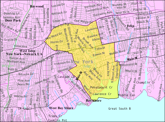
mapsize = 250px
map_caption = U.S. Census Map
mapsize1 =
map_caption1 =subdivision_type = Country
subdivision_name =United States
subdivision_type1 = State
subdivision_name1 =New York
subdivision_type2 = County
subdivision_name2 = Suffolk
government_footnotes =
government_type =
leader_title =
leader_name =
leader_title1 =
leader_name1 =
established_title =
established_date =area_footnotes =
area_magnitude =
area_total_km2 = 15.8
area_land_km2 = 13.7
area_water_km2 = 2.1
area_total_sq_mi = 6.1
area_land_sq_mi = 5.3
area_water_sq_mi = 0.8population_as_of = 2000
population_footnotes =
population_total = 23852
population_density_km2 = 1746.9
population_density_sq_mi = 4524.5timezone = Eastern (EST)
utc_offset = -5
timezone_DST = EDT
utc_offset_DST = -4
elevation_footnotes =
elevation_m = 5
elevation_ft = 16
latd = 40 |latm = 43 |lats = 47 |latNS = N
longd = 73 |longm = 15 |longs = 13 |longEW = Wpostal_code_type =
ZIP code
postal_code = 11706
area_code = 631
blank_name = FIPS code
blank_info = 36-04935
blank1_name = GNIS feature ID
blank1_info = 0943194
website =
footnotes =Bay Shore is a hamlet (and
census-designated place ), located in the town of Islip, County of Suffolk,New York ,United States . Bay Shore celebrated its 300 year anniversary in 2008. The population was 23,852 at the 2000 census.Bay Shore has a railroad station of the
Long Island Rail Road , which serves both commuters and vacationers as a major gateway to Fire Island.History
Before being officially named Bay Shore in the late 19th century, the hamlet was earlier known by the local Native American names Penataquit and, later, Awixa.
The oldest structure in Bay Shore is Sagtikos Manor. The earliest part of the sprawling house was built in 1692 by New York City's first native born mayor,
Stephanus Van Cortlandt . The manor functioned for a time during theAmerican Revolution as local headquarters for British forces.George Washington used it as a stopover during a 1790 tour of Long Island.Like nearby
Babylon Village , Bay Shore became renowned in the late 19th century for its shopping district and resorts. With its convenient and appealing location along theGreat South Bay and access toFire Island , Bay Shore became popular with affluent New Yorkers looking to escape the city. It was a tourist spot on weekends and during the summer, in large part because the newly built Long Island Railroad enabled easy access fromManhattan andBrooklyn . It eventually evolved into asuburb of New York City.According to the [http://www.suffolkcountyfilmcommission.com/ Suffolk County Film Commission] , the Biograph movie studios started filming in 1902 in Bay Shore. The film cameras needed the bright light reflected by the ocean to properly expose the film. [http://www.geocities.com/timmlimm/ourgang.htm, accessed September 15, 2007] The
Keystone Kops had their start in Bay Shore, as did the early "Our Gang " shows.Population increased significantly after World War II: From the mid-1950s through mid-1960s, a wide variety of housing developments were constructed on land that had previously been farms and unused woodlands. Those developments were settled largely by working and middle class first time home buyers who were following a typical pattern of "urban flight" from New York City. Many of those new residents were of Irish or Italian extraction.
Despite strains on the sense of community and historical continuity brought on by sudden and substantial growth, the town remained well-regarded. Main Street continued to be a popular shopping destination for people from all over the region.
Unfortunately, Bay Shore suffered a decline beginning in the late 1960s.The hamlet was never incorporated. Without a local government, long-term residents were unable to make local decisions that were instead left to the Town of Islip and Suffolk County. Density and demographics shifted in some older neighborhoods when rezoning permitted businesses, rental properties and multi-family dwellings where previously only single-family houses had been allowed. Many Main Street storefronts became dilapidated or vacant. The luxury Cortland Hotel along with other historical sites was closed, the parks were left unkempt, and disgusted prominent residents relocated.A contributing factor to blight in Bay Shore's downtown shopping district may have been construction just two miles away of the large South Shore Mall (currently Westfield Shopping Center of Bay Shore). Additionally,
deinstitutionalisation led former residents of the nearbyPilgrim State Hospital to be hastily placed in rental housing and former hotels in the town's center, often without sufficient professional support.Facilities and restaurants on the
Great South Bay waterfront fared better, partly because it is an embarkation point for ferries to villages on Fire Island that are not accessible by private car.Several attempts were made at suburban regeneration from the 1970s through the 1990s. A large number of upscale town houses and condominiums were built in
gated communities on the grounds of old estates. A planned aquarium was never constructed. However, a former movie theater and one time opera house was rebuilt and expanded into an attractiveYMCA . Redeveloping Main Street continues to be a focal point; efforts include new sidewalks, antique-style streetlights, new landscaping and parks. Main Street is again becoming a destination; there are many attractive and well-rated new restaurants, clothing boutiques and other stores and offices.The [http://bayshore.k12.ny.us/SeniorHigh.cfm Bay Shore Public High School] and Bay Shore-Brightwaters Public Libray (in adjacent
Brightwaters, New York ) have recently undergone extensive renovation and expansion, with exceptional attention to architectural detail.Mansions & Estates: Remnants of the Town's Most Prominent Years
South of Main Street, known as Brightwaters, is an area of mansions and other large homes built from the 1880s through 1920s. Oconee Estates is the most well-known remaining section of such houses. Though quite a few architecturally impressive homes from that period remain, many others have since been subdivided, converted to commercial properties or demolished.
Awixa Avenue is known for large historic homes, like the W.H. Wray House (which is reputedly haunted by the ghost of Adeline Wray), the Awixa Castle, the Hulse House (which has fallen into disrepair), and the Guastavino Tile House.
Transportation serving Bay Shore
Roads
Bay Shore is accessible by major roads on Long Island such as:
*NY 27 , known as Sunrise POW/MIA Highway
*NY 27A , Known as Main Street
*Southern State Parkway viaSagtikos Parkway
*I-495 orLong Island Expressway viaSagtikos Parkway
*CR-50 or Union Blvd. runs through Bay Shore, as bypass for Main StreetAirport
Bay Shore is approximately 12 miles from
Long Island MacArthur Airport .Train
Bay Shore is a stop on the Montauk Branch of the
Long Island Rail Road (LIRR), which uses the newer double decker trains. The north track brings you toNew York City to the west and the south track toMontauk to the east. The stop is a popular link for visitors from New York City and beyond traveling to Fire Island.Ferries
Bay Shore has terminals for the Fire Island Ferries. They are located at the end of South Clinton Avenue, and Maple Street.
Buses
There are many bus stops in Bay Shore on different lines. The company that controls the buses is Suffolk Transportation Inc.
Geography
Bay Shore is located at coor dms|40|43|47|N|73|15|13|W|city (40.729857, -73.253722)GR|1.
According to the
United States Census Bureau , the hamlet has a total area of 6.1 square miles (15.8km² ).13.6 km² (5.3 mi²) of it is land and 2.1 km² (0.8 mi²) of it (13.30%) is water.North Bay Shore Housing
On the north side of town was an area of rundown housing near the railroad that was torn down and replaced with town houses for those with low to moderate incomes. Some other of the smaller, older housing stock in the northern part of the hamlet has attracted an artist community.
Demographics
As of the
census GR|2 of 2005, there were 18,000 people, 8,000 households, and 5,000 families residing in the hamlet. Thepopulation density was 4,524.5 per square mile (1,747.5/km²). There were 8,639 housing units at an average density of 1,638.7/sq mi (632.9/km²). The racial makeup of the hamlet was 71.99% White, 17% African American, 0.1% Native American, 1% Asian, 0.01% Pacific Islander, 7% from other races, and 3% from two or more races. Hispanic or Latino of any race were 19.86% of the population.There were 8,194 households out of which 33.0% had children under the age of 18 living with them, 46.8% were married couples living together, 15.2% had a female householder with no husband present, and 32.5% were non-families. 25.9% of all households were made up of individuals and 10.5% had someone living alone who was 65 years of age or older. The average household size was 2.1 and the average family size was 3.10.
In the hamlet, the population was spread out with 25.9% under the age of 18, 8.9% from 18 to 24, 32.5% from 25 to 44, 21.3% from 45 to 64, and 11.4% who were 65 years of age or older. The median age was 35 years. For every 100 females there were 96.0 males. For every 100 females age 18 and over, there were 93.0 males.
The median income for a household in the hamlet was $50,155, and the median income for a family was $69,046. Males had a median income of $49,878 versus $39,851 for females. The
per capita income for the hamlet was $29,437. About 8.1% of families and 12.1% of the population were below thepoverty line , including 17.1% of those under age 18 and 8.1% of those age 65 or over.Bay Shore Union Free School District
* Five elementary schools
*: Mary G. Clarkson, grades K-2
*: Brook Avenue School, grades K-2
*: Fifth Avenue School, grades K-2
*: Gardiner Manor School, grades 3-5
*: South Country School, grades 3-5
*One middle school
*: Bay Shore Middle School, grades 6-8
*One high school
*: [http://bayshore.k12.ny.us/SeniorHigh.cfm Bay Shore Senior High School] , grades 9-12Their mascot is the Marauder.Famous residents of Bay Shore
*Broadcaster
Amy Goodman grew up in Bay Shore.
*Former San Francisco Supervisor and gay rights pioneerHarvey Milk graduated Bay Shore High School in 1947.
*Mario Puzo , author ofThe Godfather and other novels, lived the last part of his life in Bay Shore.
*Hip hop artist and actorLL Cool J grew up in Bay Shore.
*ActressLilia Skala lived the later part of her life in Bay Shore.Resources
*Suffolk County Planning Department
Films shot in Bay Shore
* 1969:
Last Summer , directed by Frank Perry (filmed there and onFire Island in the summer of 1968).
* 1988:Married to the Mob , directed by Long Island nativeJonathan Demme and starringMichelle Pfeiffer andMassapequa , Long Island nativeAlec Baldwin .
* 2004:Birth , directed byJean-Claude Carrière and starringNicole Kidman ,Lauren Bacall ,Danny Huston andAnne Heche at the historical Sagtikos Manor.References
External links
* [http://www.bayshoreli.com Bay Shore NY Community web site]
* [http://www.bayshore-brightwaters.com/beautification.html Bay Shore-Brightwaters Beautification Project]
* [http://www.sagtikosmanor.org Sagtikos Manor]
* [http://www.bayshorehistorical.org Bay Shore Historical Society]
* [http://bayshorecommerce.com/history.htm Bay Shore Chamber of Commerce: Town History]
* [http://awixacastle.com/neighborhood Awixa & Penataquit Neighborhoods]
* [http://www.bayshore.k12.ny.us Bay Shore Public Schools]
* [http://www.northshorelij.com/body.cfm?id=3080 Southside Hospital]
* [http://www.nps.gov/fiis Fire Island National Seashore]
* [http://www.fireislandferries.com Fire Island Ferry Service]

Wikimedia Foundation. 2010.