- National Register of Historic Places listings in Oyster Bay (town), New York
-
This is a list of all National Register of Historic Places listings in the Town of Oyster Bay, in Nassau County, New York. The locations of National Register properties for which the latitude and longitude coordinates are included below, may be seen in a Google map.[1]
Listings
Landmark name Image Date listed Location City or Town Summary 1 Adam-Derby House May 17, 1979 166 Lexington Avenue
40°52′2″N 73°32′5″W / 40.86722°N 73.53472°WOyster Bay 2 John E. Aldred Estate August 3, 1979 Lattingtown Road
40°53′40″N 73°36′59″W / 40.89444°N 73.61639°WLattingtown 3 James William Beekman House December 12, 1973 West Shore Road
40°52′45″N 73°32′49″W / 40.87917°N 73.54694°WOyster Bay 4 Central Hall February 18, 1988 93 Central Avenue
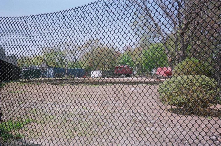
40°50′54″N 73°38′54″W / 40.84833°N 73.64833°WSea Cliff 5 Christeen (sloop) 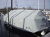
December 4, 1991 Oyster Bay Built in 1883, the oldest surviving oyster sloop in the U.S. 6 Cock-Cornelius House March 22, 2006 34 Birch Hill Road
40°52′27″N 73°35′17″W / 40.87417°N 73.58806°WLocust Valley 7 Cold Spring Harbor Laboratory Historic District 
March 30, 1994 Jct. of NY 25A and Bungtown Road
40°51′43″N 73°28′2″W / 40.86194°N 73.46722°WLaurel Hollow 8 Crowell House February 18, 1988 375 Littleworth Lane
40°50′20″N 73°38′55″W / 40.83889°N 73.64861°WSea Cliff 9 Lillian Sefton Dodge Estate July 22, 1979 Frost Mill Road
40°52′39″N 73°33′34″W / 40.8775°N 73.55944°WMill Neck 10 DuPont-Guest Estate December 11, 2009 S. side of Northern Blvd. between Cotillion Ct. & DuPont Ct.
40°48′32.31″N 73°36′53.23″W / 40.808975°N 73.6147861°WBrookville New listing; refnum 09001084 11 Elmwood April 3, 1975 E side of Cove Road
40°51′59″N 73°29′45″W / 40.86639°N 73.49583°WOyster Bay 12 First Presbyterian Church of Oyster Bay 
December 12, 1976 E. Main Street
40°52′18″N 73°31′45″W / 40.87167°N 73.52917°WOyster Bay 13 Fort Massapeag Archeological Site 
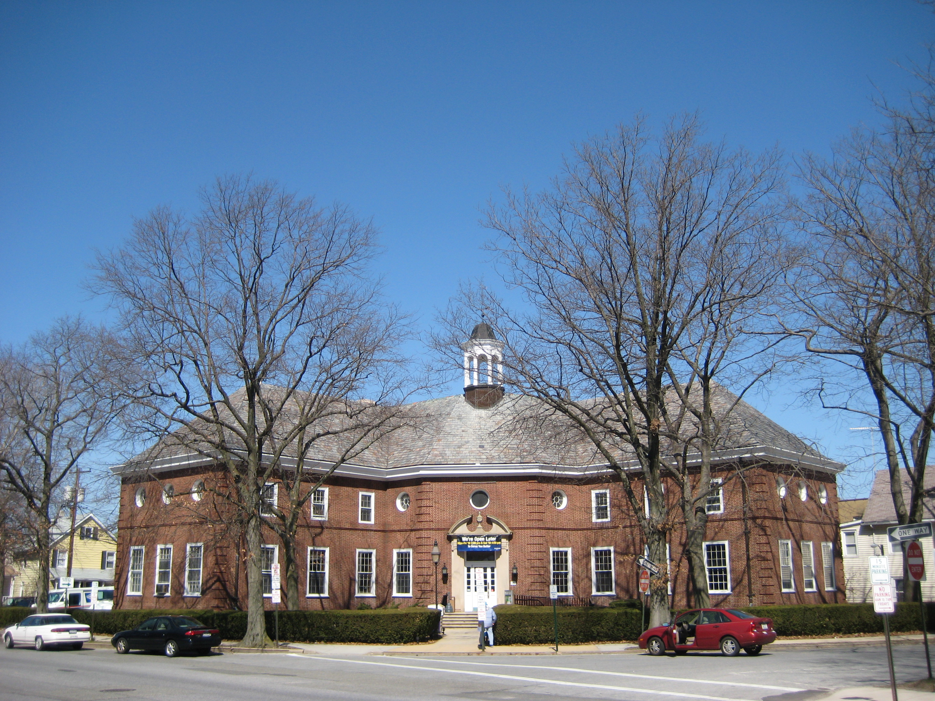
April 19, 1993 Address Restricted Oyster Bay Site of only known remaining Native American fort on Long Island 14 Glen Cove Post Office 
November 29, 2010 51 Glen St.
40°51′50″N 73°37′46″W / 40.86389°N 73.62944°WGlen Cove New listing; refnum 10000957 15 A. Conger Goodyear House December 4, 2003 14 Orchard Lane
40°48′4″N 73°35′24″W / 40.80111°N 73.59°WOld Westbury 16 Grace Church Complex June 30, 1983 Merrick and Dover Roads
40°40′1″N 73°27′33″W / 40.66694°N 73.45917°WMassapequa 17 Stephen Harding House August 24, 2011 182 14th Ave.
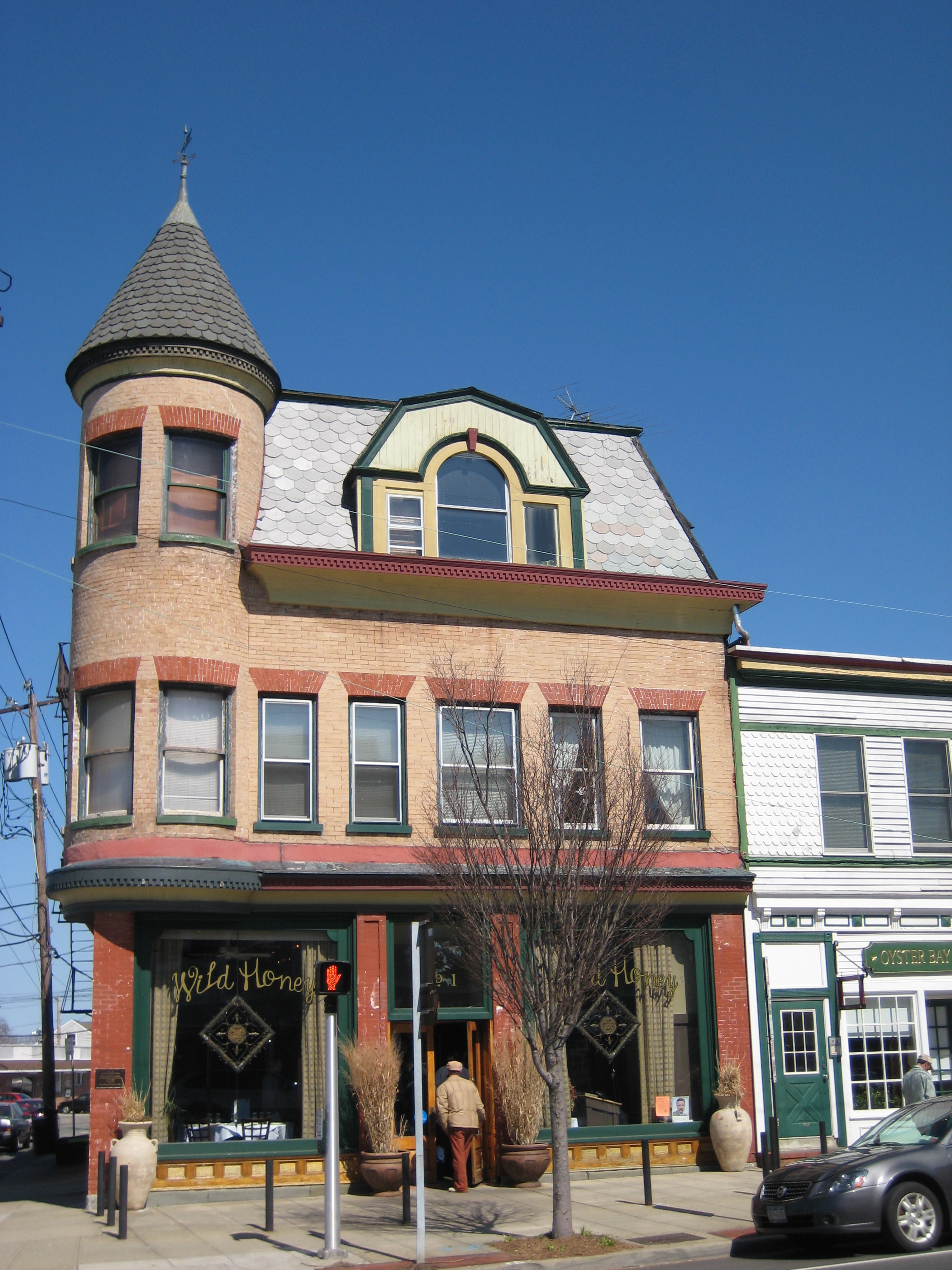
40°50′54″N 73°38′58″W / 40.84833°N 73.64944°WSea Cliff New listing; refnum 11000597 18 Heitz Place Courthouse July 30, 1974 Heitz Place
40°46′8″N 73°31′16″W / 40.76889°N 73.52111°WHicksville 19 House at 52 Frost Mill Road August 24, 2011 52 Frost Mill Road
40°53′13″N 73°33′39″W / 40.88694°N 73.56083°WMill Neck New listing; refnum 11000598 20 House at 103 Roslyn Avenue February 18, 1988 103 Roslyn Avenue
40°50′51″N 73°38′43″W / 40.8475°N 73.64528°WSea Cliff 21 House at 112 Sea Cliff Avenue February 18, 1988 112 Sea Cliff Avenue
40°50′59″N 73°38′28″W / 40.84972°N 73.64111°WSea Cliff 22 House at 115 Central Avenue February 18, 1988 115 Central Avenue
40°50′49″N 73°38′53″W / 40.84694°N 73.64806°WSea Cliff 23 House at 137 Prospect Avenue February 18, 1988 137 Prospect Avenue
40°50′54″N 73°39′2″W / 40.84833°N 73.65056°WSea Cliff 24 House at 173 Sixteenth Avenue February 18, 1988 173 Sixteenth Avenue
40°50′51″N 73°39′10″W / 40.8475°N 73.65278°WSea Cliff 25 House at 176 Prospect Avenue February 18, 1988 176 Prospect Avenue
40°50′54″N 73°39′3″W / 40.84833°N 73.65083°WSea Cliff 26 House at 18 Seventeenth Avenue February 18, 1988 18 Seventeenth Avenue
40°44′53″N 73°38′58″W / 40.74806°N 73.64944°WSea Cliff 27 House at 9 Locust Place February 18, 1988 9 Locust Place
40°50′40″N 73°39′5″W / 40.84444°N 73.65139°WSea Cliff 28 House at 19 Locust Place February 18, 1988 19 Locust Place
40°50′38″N 73°39′4″W / 40.84389°N 73.65111°WSea Cliff 29 House at 195 Prospect Avenue February 18, 1988 195 Prospect Avenue
40°50′49″N 73°39′4″W / 40.84694°N 73.65111°WSea Cliff 30 House at 199 Prospect Avenue February 18, 1988 199 Prospect Avenue
40°50′49″N 73°39′4″W / 40.84694°N 73.65111°WSea Cliff 31 House at 207 Carpenter Avenue February 18, 1988 207 Carpenter Avenue
40°50′56″N 73°38′31″W / 40.84889°N 73.64194°WSea Cliff 32 House at 240 Sea Cliff Avenue February 18, 1988 240 Sea Cliff Avenue
40°44′59″N 73°38′53″W / 40.74972°N 73.64806°WSea Cliff 33 House at 285 Sea Cliff Avenue February 18, 1988 285 Sea Cliff Avenue
40°50′55″N 73°38′50″W / 40.84861°N 73.64722°WSea Cliff 34 House at 332 Franklin Avenue February 18, 1988 332 Franklin Avenue
40°50′42″N 73°39′3″W / 40.845°N 73.65083°WSea Cliff 35 House at 362 Sea Cliff Avenue February 18, 1988 362 Sea Cliff Avenue
40°50′58″N 73°39′1″W / 40.84944°N 73.65028°WSea Cliff 36 House at 378 Glen Avenue February 18, 1988 378 Glen Avenue
40°50′44″N 73°39′4″W / 40.84556°N 73.65111°WSea Cliff 37 House at 52 Eighteenth Avenue March 18, 1988 52 Eighteenth Avenue
40°50′48″N 73°39′1″W / 40.84667°N 73.65028°WSea Cliff 38 House at 58 Eighteenth Avenue February 18, 1988 58 Eighteenth Avenue
40°50′48″N 73°39′1″W / 40.84667°N 73.65028°WSea Cliff 39 House at 65 Twentieth Avenue February 18, 1988 65 Twentieth Avenue
40°50′45″N 73°39′9″W / 40.84583°N 73.6525°WSea Cliff 40 Jericho Friends Meeting House Complex May 10, 2002 6 Old Jericho Turnpike
40°47′40″N 73°32′12″W / 40.79444°N 73.53667°WJericho 41 Justice Court Building April 26, 1990 Jct. of Town Path Extension and Glen Cove Highway
40°51′44″N 73°37′34″W / 40.86222°N 73.62611°WGlen Cove 42 Long Island Rail Road Station at Farmingdale 
November 13, 1991 Along LIRR tracks between Farmingdale and Forest Avenues
40°44′8″N 73°26′32″W / 40.73556°N 73.44222°WFarmingdale 43 Matinecock Friends Meetinghouse July 19, 1976 Piping Rock and Duck Pond Roads
40°51′59″N 73°35′41″W / 40.86639°N 73.59472°WLocust Valley 44 Moore's Building 
September 30, 1996 1 East Main Street
40°52′18″N 73°31′37″W / 40.87167°N 73.52694°WOyster Bay 45 Benjamin Moore Estate May 14, 1979 N of Muttontown on NY 25A
40°50′19″N 73°32′17″W / 40.83861°N 73.53806°WMuttontown 46 Oyster Bay Long Island Rail Road Station 
July 6, 2005 Railroad Avenue
40°53′13″N 73°31′43″W / 40.88694°N 73.52861°WOyster Bay 47 Oyster Bay Long Island Rail Road Turntable 
July 6, 2005 Railroad Avenue
40°52′38″N 73°31′43″W / 40.87722°N 73.52861°WOyster Bay 48 Planting Fields Arboretum 
January 25, 1979 village of Upper Brookville on Planting Fields Road
40°51′29″N 73°33′29″W / 40.85806°N 73.55806°WUpper Brookville 49 Raynham Hall 
June 5, 1974 20 West Main Street
40°52′20″N 73°31′55″W / 40.87222°N 73.53194°WOyster Bay 50 James Alfred Roosevelt Estate May 17, 1979 360 Cove Neck Road
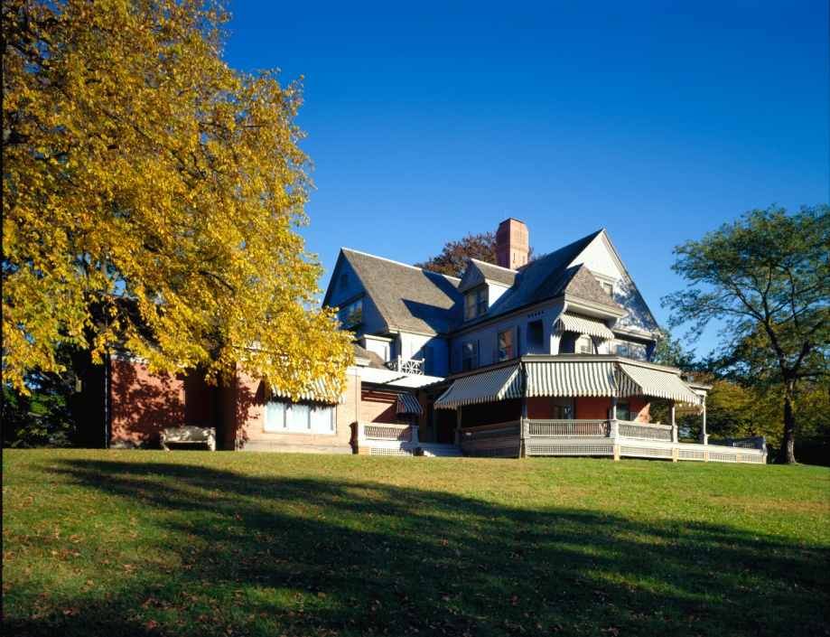
40°53′2″N 73°30′29″W / 40.88389°N 73.50806°WCove Neck 51 Sagamore Hill National Historic Site 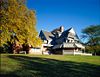
October 15, 1966 End of Cove Neck Road
40°53′8″N 73°29′51″W / 40.88556°N 73.4975°WOyster Bay 52 St. Luke's Protestant Episcopal Church February 18, 1988 253 Glen Street
40°50′49″N 73°38′44″W / 40.84694°N 73.64556°WSea Cliff 53 Schenck-Mann House February 24, 2005 222 Convent Road
40°49′19″N 73°29′25″W / 40.82194°N 73.49028°WSyosset 54 Sea Cliff Firehouse May 18, 2003 Roslyn Avenue
40°50′54″N 73°38′43″W / 40.84833°N 73.64528°WSea Cliff 55 Sea Cliff Railroad Station 
February 18, 1988 Sea Cliff Avenue
40°51′7″N 73°37′34″W / 40.85194°N 73.62611°WGlen Cove 56 Sea Cliff Village Hall, Library and Museum Complex April 22, 2005 300 Sea Cliff Avenue
40°50′57″N 73°38′9″W / 40.84917°N 73.63583°WSea Cliff 57 Seawanhaka Corinthian Yacht Club 
January 8, 1974 Centre Island Road
40°54′8″N 73°30′49″W / 40.90222°N 73.51361°WOyster Bay 58 The Shell House June 2, 1988 26 Westland Drive
40°53′52″N 73°38′3″W / 40.89778°N 73.63417°WGlen Cove 59 Edward H. Swan House May 24, 1976 Cove Neck Road
40°52′38″N 73°30′12″W / 40.87722°N 73.50333°WOyster Bay 60 George Underhill House July 5, 2003 28 Factory Pond Road
40°53′45″N 73°34′40″W / 40.89583°N 73.57778°WLocust Valley 61 US Post Office-Glen Cove 
May 11, 1989 2 Glen Cove Street
40°51′46″N 73°38′1″W / 40.86278°N 73.63361°WGlen Cove 62 US Post Office-Oyster Bay 
May 11, 1989 Shore Avenue
40°52′27″N 73°32′0″W / 40.87417°N 73.533333°WOyster Bay 63 Woolworth Estate May 17, 1979 77 Crescent Beach Road
40°52′31″N 73°38′38″W / 40.87528°N 73.64389°WGlen Cove See also
- National Register of Historic Places listings in New York
- National Register of Historic Places listings in Nassau County, New York
- List of Town of Oyster Bay Landmarks
References
- ^ The latitude and longitude information provided is primarily from the National Register Information System, and has been found to be fairly accurate for about 99% of listings. For 1%, the location info may be way off. We seek to correct the coordinate information wherever it is found to be erroneous. Please leave a note in the Discussion page for this article if you believe any specific location is incorrect.
Town of Oyster Bay, New York County Villages Hamlets Bethpage · East Massapequa · East Norwich · Glen Head · Glenwood Landing · Greenvale · Hicksville · Jericho · Locust Valley · Massapequa · North Massapequa · Old Bethpage · Oyster Bay · Plainedge · Plainview · South Farmingdale · Syosset · Woodbury
Website: oysterbaytown.com Categories:- Town of Oyster Bay, New York
- National Register of Historic Places in Oyster Bay (town), New York


Wikimedia Foundation. 2010.