- National Register of Historic Places listings in Hyde County, North Carolina
-

This list includes properties and districts listed on the National Register of Historic Places in Hyde County, North Carolina. Click the "Map of all coordinates" link to the right to view a Google map of all properties and districts with latitude and longitude coordinates in the table below.[1]
-
- This National Park Service list is complete through NPS recent listings posted November 10, 2011.[2]
Landmark name Image Date listed Location City or Town Summary 1 George V. Credle House and Cemetery July 29, 1985 US 264
35°27′16″N 76°22′5″W / 35.45444°N 76.36806°WRose Bay 2 Fairfield Historic District July 5, 1985 SR 1308, 1309, 1305 and NC 94
35°32′29″N 76°13′39″W / 35.54139°N 76.2275°WFairfield 3 Hyde County Courthouse May 10, 1979 20 Oyster Creek Rd.
35°24′21.59″N 76°19′44.73″W / 35.4059972°N 76.3290917°WSwan Quarter 4 Inkwell September 1, 1978 E of Lake Landing on U.S. 264
35°29′5″N 76°3′11″W / 35.48472°N 76.05306°WLake Landing 5 Lake Landing Historic District March 10, 1986 Roughly bounded by Mattamuskeet Refuge Boundary, Middletown, Nebraska, SR 1110, and US 264
35°27′41″N 76°3′56″W / 35.46139°N 76.06556°WLake Landing 6 Lake Mattamuskeet Pump Station May 28, 1980 E of Swanquarter
35°27′6″N 76°10′30″W / 35.45167°N 76.175°WSwanquarter 7 Ocracoke Historic District September 28, 1990 SW tip of Ocracoke Island, around Silver Lake
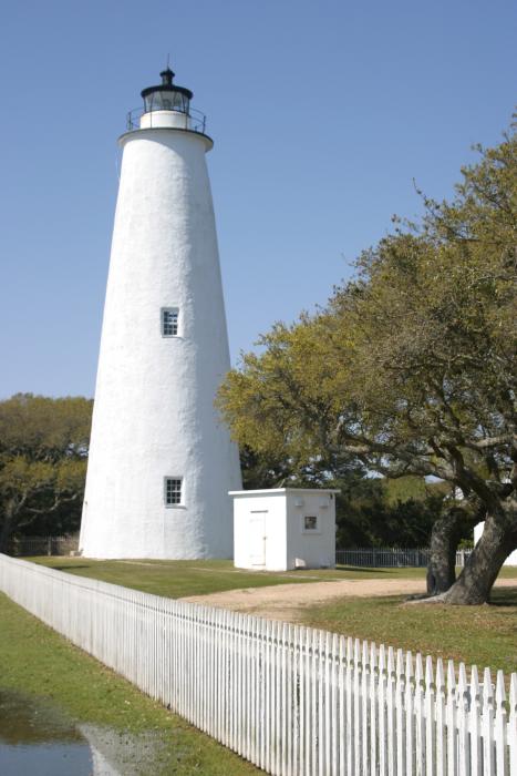
35°6′53″N 75°59′2″W / 35.11472°N 75.98389°WOcracoke 8 Ocracoke Light Station 
November 25, 1977 SR 1326
35°6′31″N 75°59′11″W / 35.10861°N 75.98639°WOcracoke 9 Albin B. Swindell House and Store August 14, 1986 US 264
35°26′10″N 76°16′56″W / 35.43611°N 76.28222°WSwindell Fork 10 Wynne's Folly December 6, 1977 W of Engelhard on U.S. 264
35°30′1″N 76°1′41″W / 35.50028°N 76.02806°WEngelhard See also
- National Register of Historic Places listings in North Carolina
- List of National Historic Landmarks in North Carolina
References
- ^ The latitude and longitude information provided in this table was derived originally from the National Register Information System, which has been found to be fairly accurate for about 99% of listings. For about 1% of NRIS original coordinates, experience has shown that one or both coordinates are typos or otherwise extremely far off; some corrections may have been made. A more subtle problem causes many locations to be off by up to 150 yards, depending on location in the country: most NRIS coordinates were derived from tracing out latitude and longitudes off of USGS topographical quadrant maps created under North American Datum of 1927, which differs from the current, highly accurate GPS system used by Google maps. Chicago is about right, but NRIS longitudes in Washington are higher by about 4.5 seconds, and are lower by about 2.0 seconds in Maine. Latitudes differ by about 1.0 second in Florida. Some locations in this table may have been corrected to current GPS standards.
- ^ "National Register of Historic Places: Weekly List Actions". National Park Service, United States Department of the Interior. Retrieved on November 10, 2011.
U.S. National Register of Historic Places Topics Lists by states Alabama • Alaska • Arizona • Arkansas • California • Colorado • Connecticut • Delaware • Florida • Georgia • Hawaii • Idaho • Illinois • Indiana • Iowa • Kansas • Kentucky • Louisiana • Maine • Maryland • Massachusetts • Michigan • Minnesota • Mississippi • Missouri • Montana • Nebraska • Nevada • New Hampshire • New Jersey • New Mexico • New York • North Carolina • North Dakota • Ohio • Oklahoma • Oregon • Pennsylvania • Rhode Island • South Carolina • South Dakota • Tennessee • Texas • Utah • Vermont • Virginia • Washington • West Virginia • Wisconsin • WyomingLists by territories Lists by associated states Other Municipalities and communities of Hyde County, North Carolina CDP 
Unincorporated
communitiesEngelhard | Fairfield | Last Chance | Nebraska | Stumpy Point | Swan Quarter
Categories:- Hyde County, North Carolina
- National Register of Historic Places in North Carolina
- Buildings and structures in Hyde County, North Carolina
-

Wikimedia Foundation. 2010.