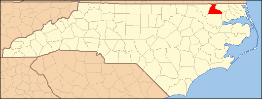
- National Register of Historic Places listings in Hertford County, North Carolina
-

This list includes properties and districts listed on the National Register of Historic Places in Hertford County, North Carolina. Click the "Map of all coordinates" link to the right to view a Google map of all properties and districts with latitude and longitude coordinates in the table below.[1]
-
- This National Park Service list is complete through NPS recent listings posted November 10, 2011.[2]
[3] Landmark name[4] Image Date listed Location City or Town Summary 1 Ahoskie Downtown Historic District April 25, 1985 Roughly bounded by W. North St., Seaboard Coastline RR, W. Main St., S. and N. Mitchell Sts.
36°17′10″N 76°59′13″W / 36.28611°N 76.98694°WAhoskie 2 Ahoskie School September 7, 2005 105 N. Academy St.
36°17′20″N 76°59′28″W / 36.28889°N 76.99111°WAhoskie 3 C. S. Brown School Auditorium July 29, 1985 Off NC 45
36°23′6″N 76°56′18″W / 36.385°N 76.93833°WWinton 4 Wiley and Jane Vann Brown House February 13, 2007 NC 1108, 0.5 miles N. of NC 561
36°18′52.46″N 77°1′38.02″W / 36.3145722°N 77.0272278°WUnion 5 The Cedars September 22, 1983 SE of Murfreesboro off SR 1167
36°23′38″N 77°4′10″W / 36.39389°N 77.06944°WMurfreesboro 6 The Columns February 18, 1971 Jones Dr.
36°26′33″N 77°5′59″W / 36.4425°N 77.09972°WMurfreesboro 7 Cowper-Thompson House January 9, 1992 405 North St.
36°26′43″N 77°5′49″W / 36.44528°N 77.09694°WMurfreesboro 8 Deane House April 15, 1982 Off SR 1446
36°19′58″N 76°52′9″W / 36.33278°N 76.86917°WCofield 9 East End Historic District January 31, 2008 Bounded by Maple St., Town boundary, Catherine Creek Rd. & Holloman Ave.
36°17′37″N 76°58′25.9″W / 36.29361°N 76.973861°WAhoskie 10 Freeman House February 18, 1971 200 E. Broad St.
36°26′39″N 77°5′59″W / 36.44417°N 77.09972°WMurfreesboro 11 Gray Gables June 1, 1982 Main St.
36°23′26″N 76°55′59″W / 36.39056°N 76.93306°WWinton 12 Hare Plantation House February 18, 1971 1.6 miles W of jct. of SR 1317 and U.S. 258
36°30′21″N 77°2′22″W / 36.50583°N 77.03944°WComo 13 Harrellsville Historic District November 29, 1995 Roughly, E. and W. Main St., Quebec St. and Tar Landing Rd.
36°18′5″N 76°47′31″W / 36.30139°N 76.79194°WHarrellsville 14 Roberts H. Jernigan House February 16, 2001 209 S. Catherine Creek Rd.
36°16′50″N 76°58′47″W / 36.28056°N 76.97972°WAhoskie 15 King-Casper-Ward-Bazemore House November 26, 1982 W of Ahoskie on NC 11
36°16′37″N 77°3′2″W / 36.27694°N 77.05056°WAhoskie 16 Melrose March 31, 1971 100 E. Broad St.
36°26′39″N 77°6′1″W / 36.44417°N 77.10028°WMurfreesboro 17 William Mitchell House December 4, 1972 3 miles E of Ahoskie on NC 350
36°16′50″N 77°2′52″W / 36.28056°N 77.04778°WAhoskie 18 Mulberry Grove November 25, 1980 SW of Ahoskie
36°17′32″N 77°9′1″W / 36.29222°N 77.15028°WAhoskie 19 Murfreesboro Historic District August 26, 1971 Roughly bounded by Broad, 4th, Vance, and Winder Sts.
36°26′34″N 77°6′3″W / 36.44278°N 77.10083°WMurfreesboro 20 Myrick House March 31, 1971 402 Broad St.
36°26′38″N 77°5′55″W / 36.44389°N 77.09861°WMurfreesboro 21 Myrick-Yeates-Vaughan House March 17, 1983 327 W. Main St.
36°26′31″N 77°6′21″W / 36.44194°N 77.10583°WMurfreesboro 22 James Newsome House December 28, 1984 NC 11 at jct. NC 42
36°16′44″N 77°3′22″W / 36.27889°N 77.05611°WAhoskie 23 King Parker House December 31, 2002 304 Mount Moriah Rd.
36°23′50″N 76°59′32″W / 36.39722°N 76.99222°WWinton 24 William Rea Store September 15, 1970 E. Williams St.
36°26′38″N 77°5′54″W / 36.44389°N 77.09833°WMurfreesboro 25 Riddick House February 18, 1971 1 miles S of jct. of SR 1319 and 1322
36°31′46″N 76°56′25″W / 36.52944°N 76.94028°WComo 26 Roberts-Vaughan House February 18, 1971 130 E. Main St.
36°26′33″N 77°6′1″W / 36.4425°N 77.10028°WMurfreesboro 27 Dr. Roscius P. and Mary Mitchell Thomas House and Outbuildings August 28, 2007 734 Thomas Bridge Rd.
36°18′33.43″N 76°53′23.32″W / 36.3092861°N 76.8898111°WBethlehem 28 Vernon Place April 29, 1982 N of Como off US 258
36°30′15″N 76°59′59″W / 36.50417°N 76.99972°WComo 29 John Wheeler House March 31, 1971 403 E. Broad St.
36°26′39″N 77°5′54″W / 36.44417°N 77.09833°WMurfreesboro See also
- National Register of Historic Places listings in North Carolina
- List of National Historic Landmarks in North Carolina
References
- ^ The latitude and longitude information provided in this table was derived originally from the National Register Information System, which has been found to be fairly accurate for about 99% of listings. For about 1% of NRIS original coordinates, experience has shown that one or both coordinates are typos or otherwise extremely far off; some corrections may have been made. A more subtle problem causes many locations to be off by up to 150 yards, depending on location in the country: most NRIS coordinates were derived from tracing out latitude and longitudes off of USGS topographical quadrant maps created under the North American Datum of 1927, which differs from the current, highly accurate WGS84 GPS system used by Google maps. Chicago is about right, but NRIS longitudes in Washington are higher by about 4.5 seconds, and are lower by about 2.0 seconds in Maine. Latitudes differ by about 1.0 second in Florida. Some locations in this table may have been corrected to current GPS standards.
- ^ "National Register of Historic Places: Weekly List Actions". National Park Service, United States Department of the Interior. Retrieved on November 10, 2011.
- ^ Numbers represent an ordering by significant words. Various colorings, defined here, differentiate National Historic Landmark sites and National Register of Historic Places Districts from other NRHP buildings, structures, sites or objects.
- ^ "National Register Information System". National Register of Historic Places. National Park Service. 2008-04-24. http://nrhp.focus.nps.gov/natreg/docs/All_Data.html.
U.S. National Register of Historic Places Topics Lists by states Alabama • Alaska • Arizona • Arkansas • California • Colorado • Connecticut • Delaware • Florida • Georgia • Hawaii • Idaho • Illinois • Indiana • Iowa • Kansas • Kentucky • Louisiana • Maine • Maryland • Massachusetts • Michigan • Minnesota • Mississippi • Missouri • Montana • Nebraska • Nevada • New Hampshire • New Jersey • New Mexico • New York • North Carolina • North Dakota • Ohio • Oklahoma • Oregon • Pennsylvania • Rhode Island • South Carolina • South Dakota • Tennessee • Texas • Utah • Vermont • Virginia • Washington • West Virginia • Wisconsin • WyomingLists by territories Lists by associated states Other Municipalities and communities of Hertford County, North Carolina Towns Ahoskie | Como | Harrellsville | Murfreesboro | Winton

Village Townships Ahoskie | Cofield | Como | Harrellsville | Murfreesboro | St. Johns | Winton
Categories:- Hertford County, North Carolina
- National Register of Historic Places in North Carolina
-
Wikimedia Foundation. 2010.