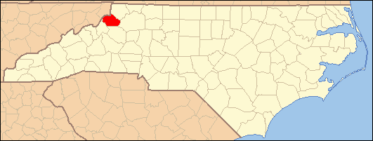
- National Register of Historic Places listings in Watauga County, North Carolina
-

This list includes properties and districts listed on the National Register of Historic Places in Watauga County, North Carolina. Click the "Map of all coordinates" link to the right to view a Google map of all properties and districts with latitude and longitude coordinates in the table below.[1]
-
- This National Park Service list is complete through NPS recent listings posted November 10, 2011.[2]
[3] Landmark name[4] Image Date listed Location City or Town Summary 1 Blair Farm August 29, 2008 N. side of VA 1522 just W. of its jct. with Blairmont Dr.
36°12′8.92″N 81°38′54.22″W / 36.2024778°N 81.6483944°WBoone 2 Bollinger-Hartley House March 9, 1995 423 N. Main St.
36°8′19″N 81°40′13″W / 36.13861°N 81.67028°WBlowing Rock 3 Cove Creek High School June 18, 1998 207 Dale Adams Rd.
36°15′47″N 81°47′7″W / 36.26306°N 81.78528°WSugar Grove 4 Daniel Boone Hotel 
December 27, 1982 E. King St.
36°13′6″N 81°40′57″W / 36.21833°N 81.6825°WBoone Demolished[5] 5 East Tennessee & Western North Carolina Railroad Locomotive No. 12 March 12, 1992 Tweetsie RR theme park, jct. of Tweetsie RR Rd. and US 321
36°10′14″N 81°38′51″W / 36.17056°N 81.6475°WBlowing Rock 6 Ben Farthing Farm January 4, 1993 NC 1121 (Rominger Rd.) W side, just N of Watauga R.
36°14′21″N 81°49′26″W / 36.23917°N 81.82389°WSugar Grove 7 Gragg House October 25, 1973 On U.S. 221
36°7′0″N 81°46′39″W / 36.116667°N 81.7775°WBlowing Rock 8 Green Park Historic District August 19, 1994 Jct. of US 321 and Green Hill and Rock Rds.
36°7′17″N 81°39′38″W / 36.12139°N 81.66056°WBlowing Rock 9 Green Park Inn June 3, 1982 U.S. 321
36°7′7″N 81°39′39″W / 36.11861°N 81.66083°WBlowing Rock 10 Jones House March 25, 1987 124 E. King St.
36°13′6″N 81°41′0″W / 36.21833°N 81.683333°WBoone 11 Mast Farm January 20, 1972 E of Valle Crucis off SR 1112
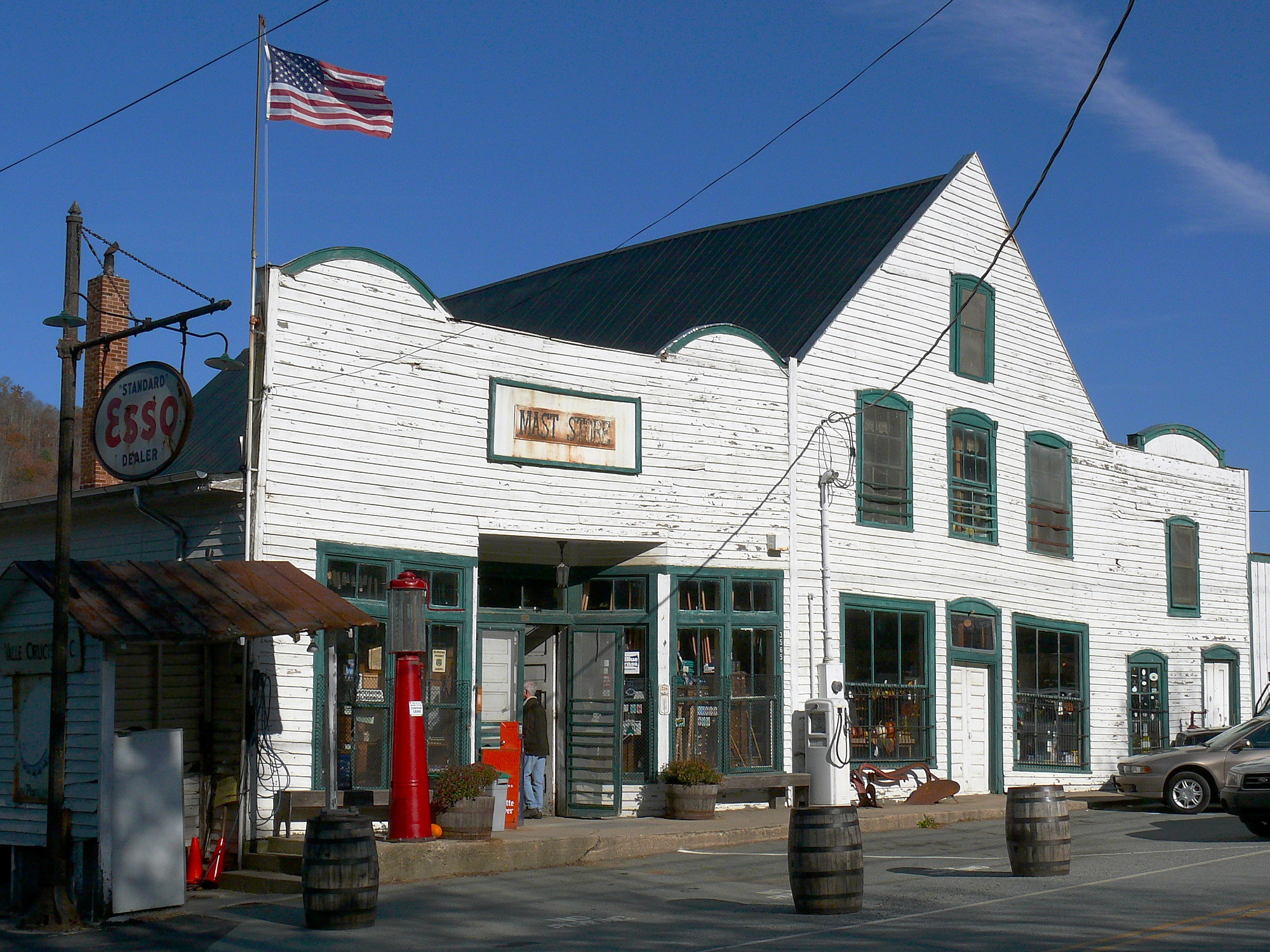
36°12′23″N 81°46′15″W / 36.20639°N 81.77083°WValle Crucis 12 Mast General Store 
April 3, 1973 S of Valle Crucis on SR 1112
36°12′28″N 81°46′48″W / 36.20778°N 81.78°WValle Crucis 13 John Smith Miller House January 29, 2009 561 Chestnut Grove Rd.
36°16′5.65″N 81°39′26.67″W / 36.2682361°N 81.6574083°WBoone 14 Randall Memorial Building, Former March 14, 1991 Greenway Ct.
36°7′55″N 81°40′40″W / 36.13194°N 81.67778°WBlowing Rock 15 US Post Office-Boone January 11, 1996 679 W. King St.
36°13′11″N 81°41′10″W / 36.21972°N 81.68611°WBoone 16 Valle Crucis Episcopal Mission September 9, 1993 NC 194 N side, 1 miles SW of jct. with NC 1112
36°11′45″N 81°47′46″W / 36.19583°N 81.79611°WValle Crucis 17 Valle Crucis Historic District February 2, 2005 Along NC 194 and NC 1112
36°12′33.29″N 81°46′42.81″W / 36.2092472°N 81.7785583°WValle Crucis 18 Vardell Family Cottages Historic District March 12, 2001 222 Grandfather Ave, 137, 187, 209 Chestnut Circle
36°7′36″N 81°40′42″W / 36.12667°N 81.67833°WBlowing Rock 19 Ward Family House May 23, 1997 8018 Rominger Rd.
36°14′50″N 81°49′21″W / 36.24722°N 81.8225°WSugar Grove 20 Westglow August 13, 1979 W of Blowing Rock on U.S. 221
36°8′17″N 81°42′50″W / 36.13806°N 81.71389°WBlowing Rock 21 Wilson-Vines House December 22, 1997 4300 Rush Branch Rd.
36°17′30″N 81°50′57″W / 36.29167°N 81.84917°WBeaver Dam See also
- National Register of Historic Places listings in North Carolina
- List of National Historic Landmarks in North Carolina
References
- ^ The latitude and longitude information provided in this table was derived originally from the National Register Information System, which has been found to be fairly accurate for about 99% of listings. For about 1% of NRIS original coordinates, experience has shown that one or both coordinates are typos or otherwise extremely far off; some corrections may have been made. A more subtle problem causes many locations to be off by up to 150 yards, depending on location in the country: most NRIS coordinates were derived from tracing out latitude and longitudes off of USGS topographical quadrant maps created under the North American Datum of 1927, which differs from the current, highly accurate WGS84 GPS system used by Google maps. Chicago is about right, but NRIS longitudes in Washington are higher by about 4.5 seconds, and are lower by about 2.0 seconds in Maine. Latitudes differ by about 1.0 second in Florida. Some locations in this table may have been corrected to current GPS standards.
- ^ "National Register of Historic Places: Weekly List Actions". National Park Service, United States Department of the Interior. Retrieved on November 10, 2011.
- ^ Numbers represent an ordering by significant words. Various colorings, defined here, differentiate National Historic Landmark sites and National Register of Historic Places Districts from other NRHP buildings, structures, sites or objects.
- ^ "National Register Information System". National Register of Historic Places. National Park Service. 2008-04-24. http://nrhp.focus.nps.gov/natreg/docs/All_Data.html.
- ^ "North Carolina Listings in the National Register of Historic Places by County". North Carolina State Historic Preservation Office. 22 October 2008. http://www.hpo.ncdcr.gov/nrlist.htm. Retrieved 14 July 2009.
U.S. National Register of Historic Places Topics Lists by states Alabama • Alaska • Arizona • Arkansas • California • Colorado • Connecticut • Delaware • Florida • Georgia • Hawaii • Idaho • Illinois • Indiana • Iowa • Kansas • Kentucky • Louisiana • Maine • Maryland • Massachusetts • Michigan • Minnesota • Mississippi • Missouri • Montana • Nebraska • Nevada • New Hampshire • New Jersey • New Mexico • New York • North Carolina • North Dakota • Ohio • Oklahoma • Oregon • Pennsylvania • Rhode Island • South Carolina • South Dakota • Tennessee • Texas • Utah • Vermont • Virginia • Washington • West Virginia • Wisconsin • WyomingLists by territories Lists by associated states Other Municipalities and communities of Watauga County, North Carolina Towns Beech Mountain‡ | Blowing Rock‡ | Boone | Seven Devils‡
Unincorporated
communitiesAho | Deep Gap | Foscoe | Meat Camp | Sugar Grove | Valle Crucis | Vilas | Zionville
Footnotes ‡This populated place also has portions in an adjacent county or counties
Categories:- Watauga County, North Carolina
- National Register of Historic Places in North Carolina
- Buildings and structures in Watauga County, North Carolina
-

Wikimedia Foundation. 2010.