- National Register of Historic Places listings in Iredell County, North Carolina
-

This list includes properties and districts listed on the National Register of Historic Places in Iredell County, North Carolina. Click the "Map of all coordinates" link to the right to view a Google map of all properties and districts with latitude and longitude coordinates in the table below.[1]
-
- This National Park Service list is complete through NPS recent listings posted November 10, 2011.[2]
[3] Landmark name[4] Image Date listed Location City or Town Summary 1 Academy Hill Historic District November 24, 1980 Western Ave., Bell, Mulberry, Wise and Armfield Sts.
35°46′38″N 80°53′24″W / 35.77722°N 80.89°WStatesville 2 Allison Woods March 9, 1995 Roughly, area E and S of US 21 surrounding the S. Yadkin R.,N to NC 2156
35°53′43″N 80°49′13″W / 35.89528°N 80.82028°WStatesville 3 Bethesda Presbyterian Church, Session House and Cemetery December 8, 1980 SR 2359
35°43′15″N 80°48′19″W / 35.72083°N 80.80528°WHoustonville 4 Espy Watts Brawley House November 24, 1980 601 William St.
35°35′57″N 80°48′29″W / 35.59917°N 80.80806°WMooresville 5 Perciphull Campbell House December 8, 1980 SR 1832
36°2′31″N 80°50′32″W / 36.04194°N 80.84222°WUnion Grove 6 Center Street A.M.E. Zion Church November 24, 1980 S. Center St.
35°46′44″N 80°53′7″W / 35.77889°N 80.88528°WStatesville 7 Centre Presbyterian Church, Session House and Cemeteries November 24, 1980 SR 1245
35°33′7″N 80°51′17″W / 35.55194°N 80.85472°WMount Mourne 8 Coddle Creek Associate Reformed Presbyterian Church, Session House and Cemetery November 24, 1980 SR 1146
35°30′37″N 80°46′3″W / 35.51028°N 80.7675°WMount Mourne 9 Cornelius House November 24, 1980 SR 1378 and SR 1302
35°37′46″N 80°52′13″W / 35.62944°N 80.87028°WMooresville 10 Daltonia December 8, 1980 SR 2115
36°0′2″N 80°44′57″W / 36.00056°N 80.74917°WHoustonville 11 Damascus Baptist Church Arbor November 24, 1980 Off SR 1158 and SR 1582
35°56′4″N 80°58′43″W / 35.93444°N 80.97861°WHarmony 12 Davidson House November 24, 1980 SR 1337
35°44′55″N 80°54′57″W / 35.74861°N 80.91583°WTroutman 13 East Broad Street-Davie Avenue Historic District November 24, 1980 Davie Ave., Broad and Elm Sts.
35°47′17″N 80°52′58″W / 35.78806°N 80.88278°WStatesville 14 Ebenezer Academy, Bethany Presbyterian Church and Cemetery December 8, 1980 U.S. 21
35°51′43″N 80°50′41″W / 35.86194°N 80.84472°WHoustonville 15 Henry Eccles House November 24, 1980 SR 2145 and SR 2180
35°51′8″N 80°43′39″W / 35.85222°N 80.7275°WStatesville 16 Falls-Hobbs House June 24, 1982 SR 1303
35°37′11″N 80°53′21″W / 35.61972°N 80.88917°WStatesville 17 Farmville Plantation June 19, 1973 SE of Elmwood off U.S. 70 on SR 2362
35°44′22″N 80°45′54″W / 35.73944°N 80.765°WElmwood 18 Feimster House June 24, 1982 SR 1516
35°52′23″N 80°58′36″W / 35.87306°N 80.97667°WStatesville 19 Fort Dobbs September 15, 1970 Fort Dobbs Rd.
35°49′17″N 80°52′58″W / 35.82139°N 80.88278°WStatesville 20 Gaither House November 24, 1980 NC 901
35°56′37″N 80°44′39″W / 35.94361°N 80.74417°WHarmony 21 Hargrave House June 24, 1982 NC 152 and NC 150
35°36′14″N 80°46′7″W / 35.60389°N 80.76861°WStatesville 22 Holland-Summers House November 24, 1980 Off SR 1904
35°55′3″N 80°54′4″W / 35.9175°N 80.90111°WHarmony 23 George Houston House November 24, 1980 NC 115
35°31′22″N 80°50′29″W / 35.52278°N 80.84139°WMount Mourne 24 Iredell County Courthouse May 10, 1979 S. Center St. between W. Prospect St. and Court Pl.
35°47′0″N 80°53′19″W / 35.783333°N 80.88861°WStatesville 25 Johnson-Neel House June 20, 1975 4 miles W of Mooresville off NC 150
35°35′46″N 80°53′11″W / 35.59611°N 80.88639°WMooresville 26 Key Memorial Chapel November 24, 1980 150 E. Sharpe St.
35°46′55″N 80°53′46″W / 35.78194°N 80.89611°WStatesville 27 King-Flowers-Keaton House November 24, 1980 NC 115 and SR 1905
35°53′37″N 80°57′2″W / 35.89361°N 80.95056°WStatesville 28 Main Building, Mitchell College January 25, 1973 Broad St.
35°46′58″N 80°53′39″W / 35.78278°N 80.89417°WStatesville 29 McClelland-Davis House November 24, 1980 SR 1551
35°49′51″N 80°55′28″W / 35.83083°N 80.92444°WStatesville 30 McElwee Houses November 24, 1980 122, 126, 134 and 140 Water St.
35°47′11″N 80°53′15″W / 35.78639°N 80.8875°WStatesville 31 Mitchell College Historic District November 24, 1980 NC 90 and U.S. 70; also roughly bounded by Mulberry, Race, Cherry, Oak, and Alexander Sts.
35°47′4″N 80°54′16″W / 35.78444°N 80.90444°WStatesville Second set of boundaries represents a boundary increase of September 6, 2002 32 Mooresville Historic District November 24, 1980 NC 115 and NC 152
35°35′3″N 80°48′48″W / 35.58417°N 80.81333°WMooresville 33 Morrison-Campbell House November 24, 1980 Off SR 2125
35°58′0″N 80°44′4″W / 35.966667°N 80.73444°WHarmony 34 Morrison-Mott House November 24, 1980 332 N. Center St.
35°47′21″N 80°53′25″W / 35.78917°N 80.89028°WStatesville 35 Mount Mourne October 29, 1974 Off NC 115
35°32′19″N 80°50′58″W / 35.53861°N 80.84944°WMount Mourne 36 Col. Silas Alexander Sharpe House November 24, 1980 402 S. Center St.
35°46′53″N 80°53′14″W / 35.78139°N 80.88722°WStatesville 37 Snow Creek Methodist Church and Burying Ground November 24, 1980 Off SR 1904
35°54′37″N 80°55′12″W / 35.91028°N 80.92°WHarmony 38 South Broad Street Row November 24, 1980 251-311 S. Broad St.
35°34′50″N 80°49′1″W / 35.58056°N 80.81694°WMooresville 39 South Race Street Historic District May 26, 1995 Roughly bounded by S. Race St., Western Ave., W. Armfield St., W. Bell St., W. Sharpe St. and S. Oak St.
35°46′40″N 80°53′37″W / 35.77778°N 80.89361°WStatesville 40 Statesville Commercial Historic District 
November 24, 1980 Roughly bounded by Front, Meeting, Broad and Tradd Sts.
35°47′4″N 80°54′18″W / 35.78444°N 80.905°WStatesville 41 Henry Turner House and Caldwell-Turner Mill Site November 24, 1980 SR 2145
35°51′45″N 80°43′37″W / 35.8625°N 80.72694°WStatesville 42 U.S. Post Office and County Courthouse January 24, 1974 227 S. Center St.
35°46′59″N 80°53′15″W / 35.78306°N 80.8875°WStatesville 43 Waddle-Click Farm June 24, 1982 SR 2309
35°46′46″N 80°44′31″W / 35.77944°N 80.74194°WStatesville 44 Welch-Nicholson House and Mill Site December 8, 1980 Statesville vicinity
36°2′56″N 80°46′11″W / 36.04889°N 80.76972°WHoustonville 45 Wood Lawn 
November 24, 1980 SR 1138
35°31′5″N 80°50′5″W / 35.51806°N 80.83472°WMount Mourne See also
- National Register of Historic Places listings in North Carolina
- List of National Historic Landmarks in North Carolina
References
- ^ The latitude and longitude information provided in this table was derived originally from the National Register Information System, which has been found to be fairly accurate for about 99% of listings. For about 1% of NRIS original coordinates, experience has shown that one or both coordinates are typos or otherwise extremely far off; some corrections may have been made. A more subtle problem causes many locations to be off by up to 150 yards, depending on location in the country: most NRIS coordinates were derived from tracing out latitude and longitudes off of USGS topographical quadrant maps created under the North American Datum of 1927, which differs from the current, highly accurate WGS84 GPS system used by Google maps. Chicago is about right, but NRIS longitudes in Washington are higher by about 4.5 seconds, and are lower by about 2.0 seconds in Maine. Latitudes differ by about 1.0 second in Florida. Some locations in this table may have been corrected to current GPS standards.
- ^ "National Register of Historic Places: Weekly List Actions". National Park Service, United States Department of the Interior. Retrieved on November 10, 2011.
- ^ Numbers represent an ordering by significant words. Various colorings, defined here, differentiate National Historic Landmark sites and National Register of Historic Places Districts from other NRHP buildings, structures, sites or objects.
- ^ "National Register Information System". National Register of Historic Places. National Park Service. 2008-04-24. http://nrhp.focus.nps.gov/natreg/docs/All_Data.html.
U.S. National Register of Historic Places Topics Lists by states Alabama • Alaska • Arizona • Arkansas • California • Colorado • Connecticut • Delaware • Florida • Georgia • Hawaii • Idaho • Illinois • Indiana • Iowa • Kansas • Kentucky • Louisiana • Maine • Maryland • Massachusetts • Michigan • Minnesota • Mississippi • Missouri • Montana • Nebraska • Nevada • New Hampshire • New Jersey • New Mexico • New York • North Carolina • North Dakota • Ohio • Oklahoma • Oregon • Pennsylvania • Rhode Island • South Carolina • South Dakota • Tennessee • Texas • Utah • Vermont • Virginia • Washington • West Virginia • Wisconsin • WyomingLists by territories Lists by associated states Other Municipalities and communities of Iredell County, North Carolina City 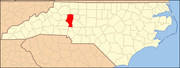
Towns Davidson‡ | Harmony | Love Valley | Mooresville | Troutman
CDP Unincorporated
communitiesFootnotes ‡This populated place also has portions in an adjacent county or counties
Categories:- Iredell County, North Carolina
- National Register of Historic Places in North Carolina
- Buildings and structures in Iredell County, North Carolina
-


Wikimedia Foundation. 2010.