- National Register of Historic Places listings in Brunswick County, North Carolina
-

This list includes properties and districts listed on the National Register of Historic Places in Brunswick County, North Carolina. Click the "Map of all coordinates" link to the right to view a Google map of all properties and districts with latitude and longitude coordinates in the table below.[1]
-
- This National Park Service list is complete through NPS recent listings posted November 10, 2011.[2]
[3] Landmark name[4] Image Date listed Location City or Town Summary 1 Bald Head Creek Boathouse December 1, 1997 Smith Island, mouth of Cape Fear R
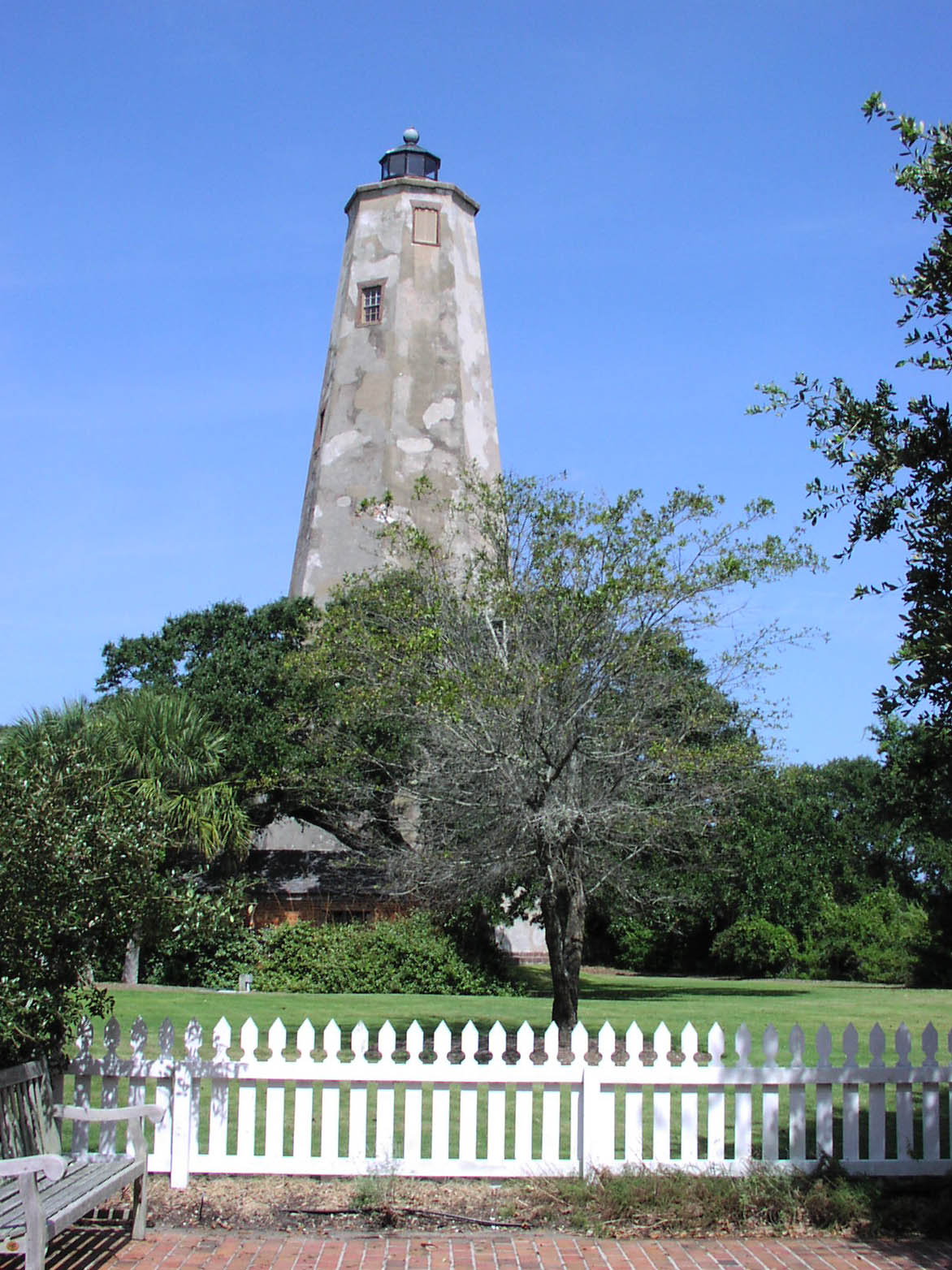
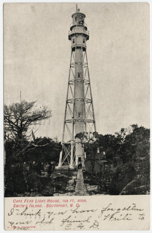
33°51′41″N 77°59′11″W / 33.86139°N 77.98639°WSmith Island 2 Bald Head Island Lighthouse 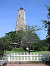
April 28, 1975 S of Southport on Smith Island at Bald Head
33°52′24″N 78°0′3″W / 33.87333°N 78.00083°WSouthport Known as "Old Baldy"; oldest lighthouse in North Carolina[5] 3 Brunswick County Courthouse 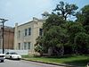
May 10, 1979 Davis and Moore Sts.
33°55′8″N 78°1′5″W / 33.91889°N 78.01806°WSouthport 4 Brunswick Town Historic District 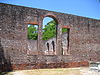
September 6, 1978 N of Southport off SR 133
34°2′27″N 77°56′41″W / 34.04083°N 77.94472°WSouthport 5 Cape Fear Civil War Shipwreck Discontiguous District 
December 23, 1985 Address Restricted Holden Beach 6 Cape Fear Lighthouse Complex 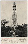
August 29, 1978 S of Kure Beach
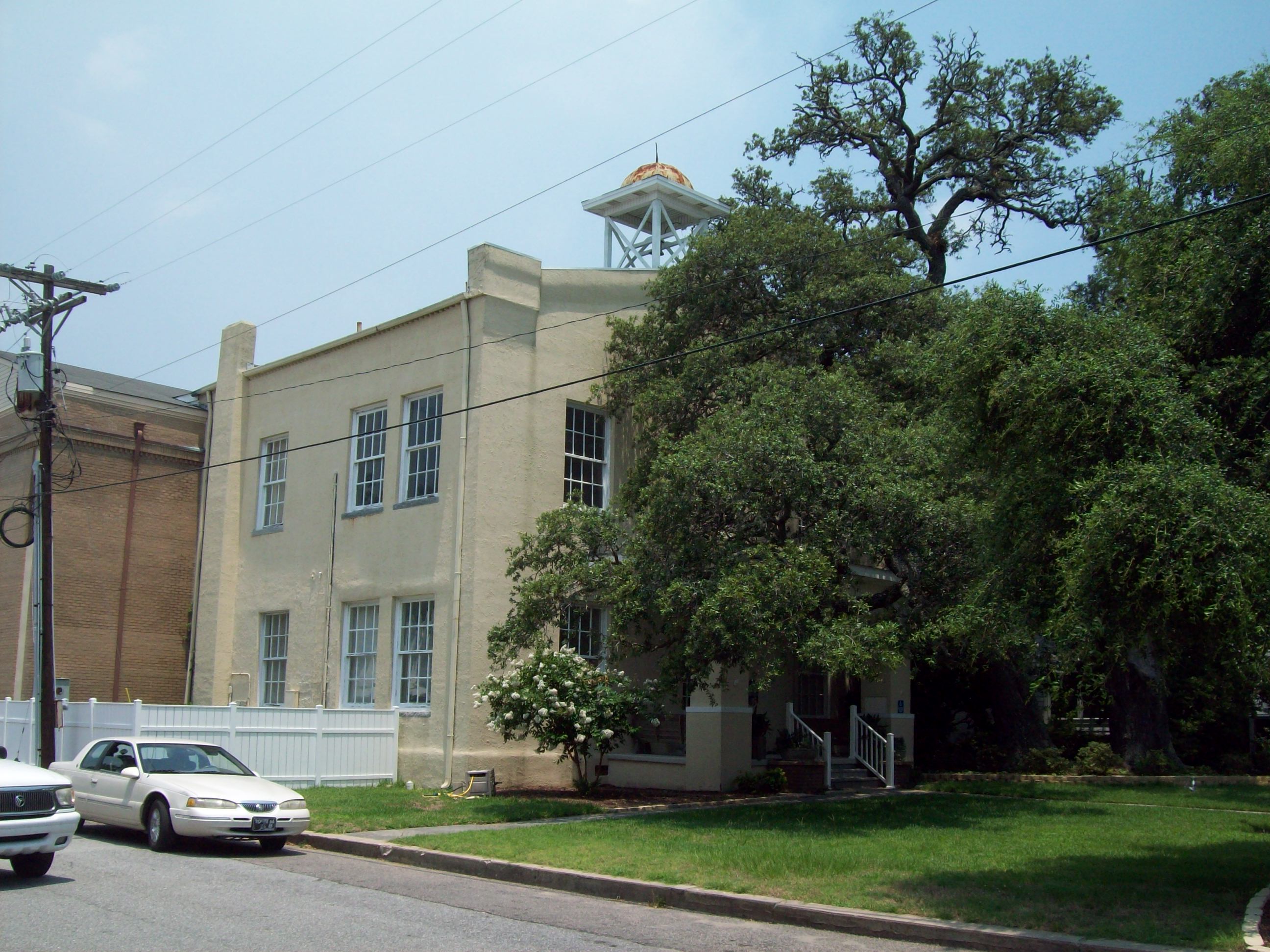
33°50′41″N 77°58′2″W / 33.84472°N 77.96722°WKure Beach 7 Fort Johnston 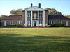
June 7, 1974 Moore St.
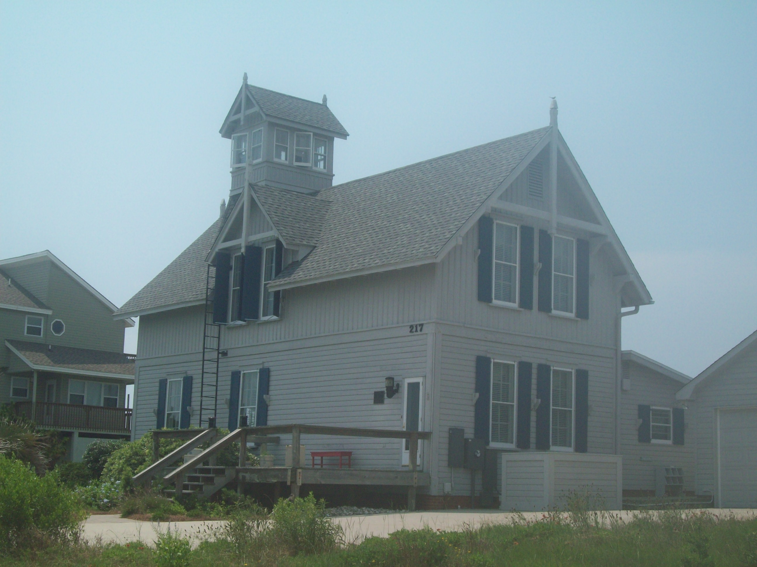
33°55′5.41″N 78°1′3.04″W / 33.9181694°N 78.0175111°WSouthport 8 Oak Island Life Saving Station 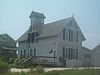
December 28, 2000 217 Caswell Beach Rd.
33°53′29″N 78°2′1″W / 33.89139°N 78.03361°WCaswell Beach 9 Oak Island Lighthouse 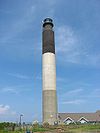
April 5, 2007 300A Caswell Beach Rd., N of NC 133
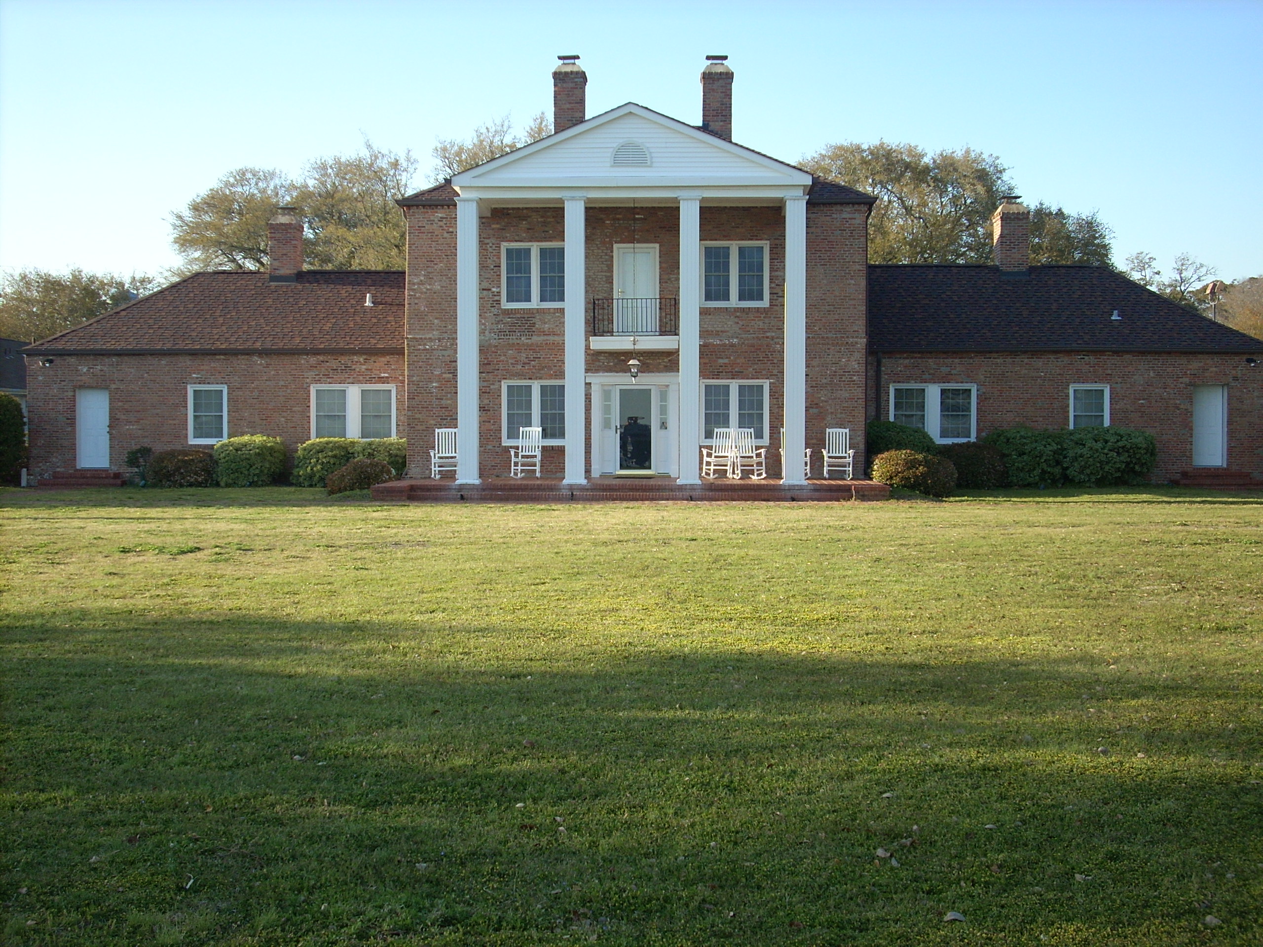
33°53′33″N 78°2′7″W / 33.8925°N 78.03528°WCaswell Beach 10 Orton Plantation 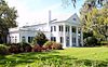
April 11, 1973 On Cape Fear River at jct. of NC 1530 and 1529
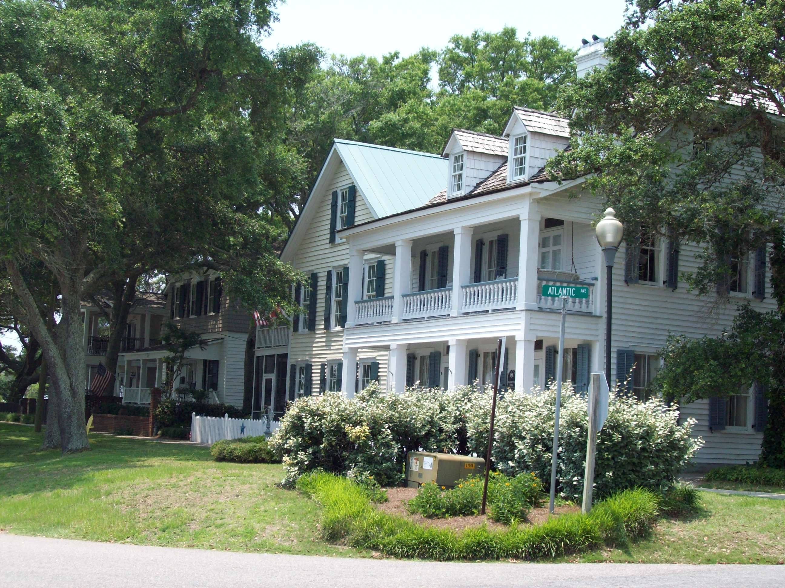
34°3′31″N 77°56′44″W / 34.05861°N 77.94556°WSmithville Township 11 Southport Historic District 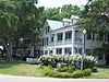
November 25, 1980 Roughly bounded by Cape Fear River, Rhett, Bay, Short and Brown Sts.
33°55′9.27″N 78°1′13.17″W / 33.9192417°N 78.020325°WSouthport 12 St. Philip's Church Ruins February 26, 1970 S of Orton off NC 1533
34°2′32″N 77°56′55″W / 34.04222°N 77.94861°WOrton 13 T. B. McCLINTIC June 3, 1994 Tripp's Marina
33°54′53″N 78°22′33″W / 33.91472°N 78.37583°WShallotte Point See also
- National Register of Historic Places listings in North Carolina
- List of National Historic Landmarks in North Carolina
References
- ^ The latitude and longitude information provided in this table was derived originally from the National Register Information System, which has been found to be fairly accurate for about 99% of listings. For about 1% of NRIS original coordinates, experience has shown that one or both coordinates are typos or otherwise extremely far off; some corrections may have been made. A more subtle problem causes many locations to be off by up to 150 yards, depending on location in the country: most NRIS coordinates were derived from tracing out latitude and longitudes off of USGS topographical quadrant maps created under the North American Datum of 1927, which differs from the current, highly accurate WGS84 GPS system used by Google maps. Chicago is about right, but NRIS longitudes in Washington are higher by about 4.5 seconds, and are lower by about 2.0 seconds in Maine. Latitudes differ by about 1.0 second in Florida. Some locations in this table may have been corrected to current GPS standards.
- ^ "National Register of Historic Places: Weekly List Actions". National Park Service, United States Department of the Interior. Retrieved on November 10, 2011.
- ^ Numbers represent an ordering by significant words. Various colorings, defined here, differentiate National Historic Landmark sites and National Register of Historic Places Districts from other NRHP buildings, structures, sites or objects.
- ^ "National Register Information System". National Register of Historic Places. National Park Service. 2008-04-24. http://nrhp.focus.nps.gov/natreg/docs/All_Data.html.
- ^ Seldon, Lynn (20 July 2008). "Take a shine to N.C. lighthouse cottages". Atlanta Journal-Constitution. http://www.ajc.com/travel/content/travel/southeast/nc_stories/2008/07/17/bald_head_island_lighthouse.html. Retrieved 5 July 2009.
U.S. National Register of Historic Places Topics Lists by states Alabama • Alaska • Arizona • Arkansas • California • Colorado • Connecticut • Delaware • Florida • Georgia • Hawaii • Idaho • Illinois • Indiana • Iowa • Kansas • Kentucky • Louisiana • Maine • Maryland • Massachusetts • Michigan • Minnesota • Mississippi • Missouri • Montana • Nebraska • Nevada • New Hampshire • New Jersey • New Mexico • New York • North Carolina • North Dakota • Ohio • Oklahoma • Oregon • Pennsylvania • Rhode Island • South Carolina • South Dakota • Tennessee • Texas • Utah • Vermont • Virginia • Washington • West Virginia • Wisconsin • WyomingLists by territories Lists by associated states Other Municipalities and communities of Brunswick County, North Carolina Cities 
Towns Belville | Bolivia | Calabash | Carolina Shores | Caswell Beach | Holden Beach | Leland | Navassa | Oak Island | Ocean Isle Beach | Sandy Creek | Shallotte | St. James | Sunset Beach | Varnamtown
Townships Lockwoods Folly | Northwest | Shallotte | Smithville | Town Creek | Waccamaw
Village Unincorporated
communitiesCategories:- Brunswick County, North Carolina
- National Register of Historic Places in North Carolina
- Buildings and structures in Brunswick County, North Carolina
-


Wikimedia Foundation. 2010.