Brunswick Town Historic District
- Brunswick Town Historic District
Infobox_nrhp | name =Brunswick Town Historic District
nrhp_type = hd
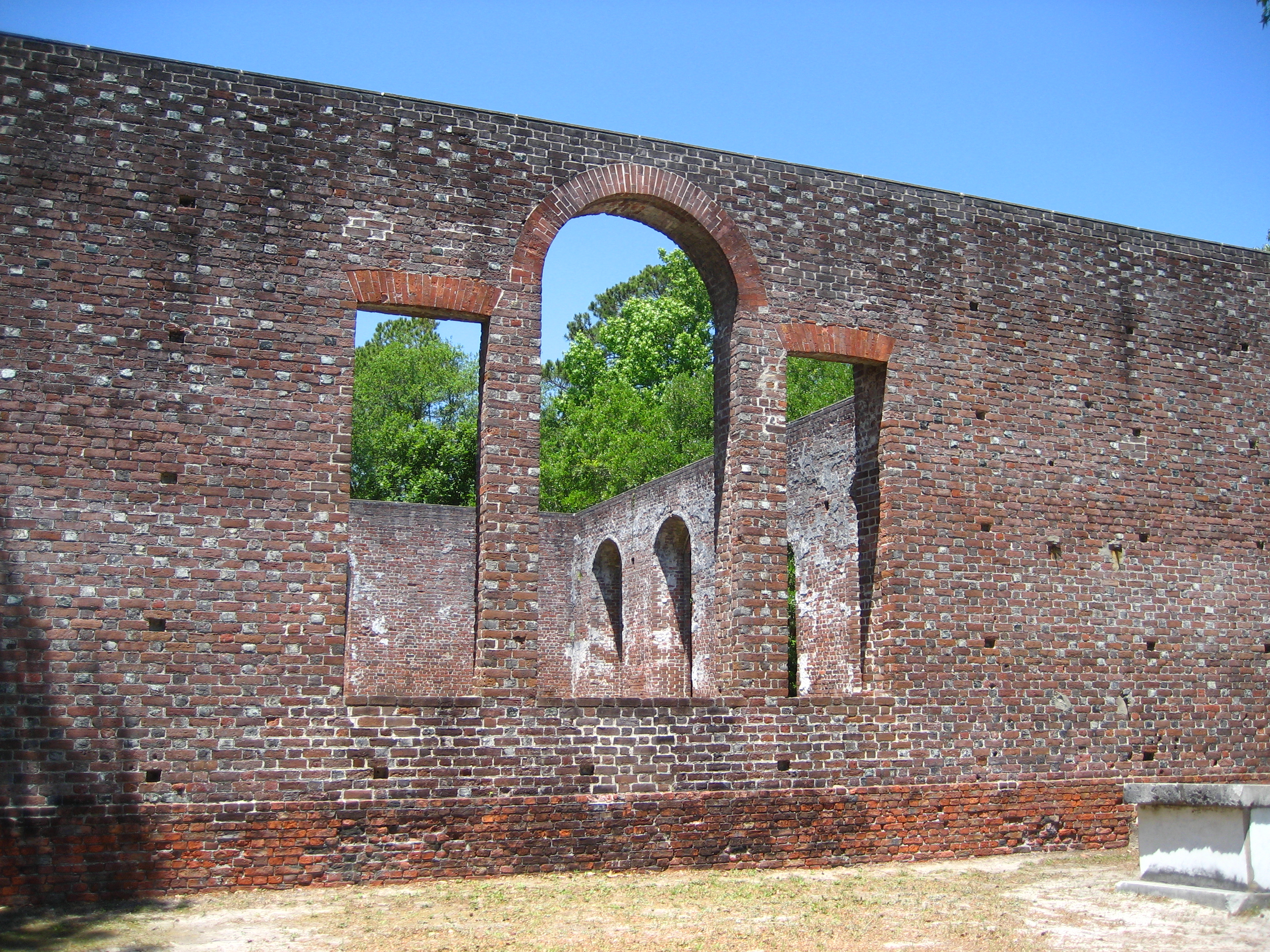
caption =St. Philip's Church Ruins in Brunswick Town
nearest_city= Southport, North Carolina
locmapin = North Carolina
area =
architect=
architecture=
added = September 06, 1978
governing_body = State
refnum=78001932[cite web|url=http://www.nr.nps.gov/|title=National Register Information System|date=2008-05-09|work=National Register of Historic Places|publisher=National Park Service] ]The Brunswick Town Historic District encompasses the ruins of colonial Brunswick Town, North Carolina, the Civil War-era Fort Anderson, St. Philip's Church Ruins, and the remains of Russellborough, the home of two colonial governors. The 2,250-acre (911 ha) district is located in the Smithville Township of Brunswick County, between Wilmington and Southport. In September 1978, the Brunswick Town Historic District was added to the National Register of Historic Places.[cite web| last=| first=| title="North Carolina - Brunswick County - Historic Districts" | work=| publisher=nationalregisterofhistoricplaces.com| date=| url=http://www.nationalregisterofhistoricplaces.com/nc/Brunswick/districts.html| accessdate=2008-05-09] ]ee also
* List of Registered Historic Places in North Carolina
References
External links
* [http://www.carolinarosedesigns.com/brunweb/welcome.htm Brunswick Town website]
Wikimedia Foundation.
2010.
Look at other dictionaries:
Old Town Historic District — may refer to: in the United States (by state then city) Old Town Historic District (Huntsville, Alabama), listed on the NRHP in Alabama Old Town Historic District (Selma, Alabama), listed on the NRHP in Alabama Monterey Old Town Historic District … Wikipedia
Brunswick Town, North Carolina — Brunswick Town is a colonial ghost town located beside the Cape Fear River in Smithville Township, Brunswick County, North Carolina, United States. Brunswick Town was the first settlement in the Cape Fear region, a major North Carolina port in… … Wikipedia
Brunswick Historic District — Infobox nrhp | name =Brunswick Historic District nrhp type = hd caption = location= Brunswick, Maryland lat degrees = 39 lat minutes = 18 lat seconds = 41 lat direction = N long degrees = 77 long minutes = 37 long seconds = 30 long direction = W… … Wikipedia
Central Troy Historic District — U.S. National Register of Historic Places U.S. Historic district … Wikipedia
Washington Grove Historic District — Infobox nrhp | name =Washington Grove Historic District nrhp type = hd caption = location= Washington Grove, Maryland lat degrees = 39 lat minutes = 8 lat seconds = 24 lat direction = N long degrees = 77 long minutes = 10 long seconds = 28 long… … Wikipedia
Pennellville Historic District — Infobox nrhp name = Pennellville Historic District nrhp type = hd caption = location =Roughly bounded by Pennellville Rd., Middle Bay Cove, and Pennell Way Brunswick, Maine nearest city = lat degrees = lat minutes = lat seconds = lat direction =… … Wikipedia
Northern River Street Historic District — U.S. National Register of Historic Places U.S. Historic district … Wikipedia
Houses in Sycamore Historic District — David DeGraff House … Wikipedia
National Register of Historic Places listings in Brunswick County, North Carolina — Map of all coordinates from Google Map of all coordinates from Bing … Wikipedia
Brunswick, Maine — Infobox Settlement |official name = Town of Brunswick |pushpin pushpin label position =left pushpin map caption =Location within the state of Maine pushpin mapsize = image caption = Federal Street established title2 = Incorporated (town)… … Wikipedia