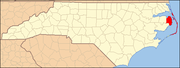
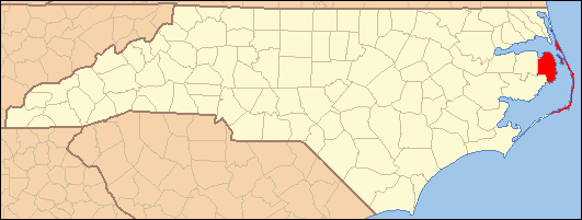
- National Register of Historic Places listings in Dare County, North Carolina
-

This list includes properties and districts listed on the National Register of Historic Places in Dare County, North Carolina. Click the "Map of all coordinates" link to the right to view a Google map of all properties and districts with latitude and longitude coordinates in the table below.[1]
-
- This National Park Service list is complete through NPS recent listings posted November 10, 2011.[2]
[3] Landmark name[4] Image Date listed Location City or Town Summary 1 Ellsworth and Lovie Ballance House May 25, 2001 E side M.V. Australia Ln., 0.1 miles S of Stowe Landing Rd.
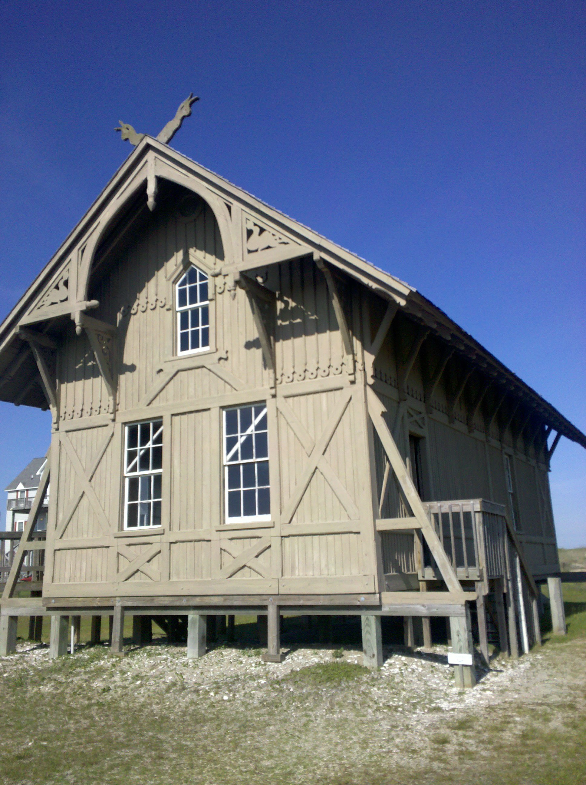
35°13′21″N 75°41′13″W / 35.2225°N 75.68694°WHatteras 2 Bodie Island Lifesaving/Coast Guard Station 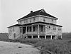
February 9, 1979 S of Nags Head on NC 12
35°50′11″N 75°33′33″W / 35.83639°N 75.55917°WNags Head 3 Bodie Island Light Station 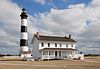
July 4, 2003 Off NC 12
35°49′12″N 75°33′49″W / 35.82°N 75.56361°WNags Head 4 Caffeys Inlet Lifesaving Station January 30, 1978 N of Duck on SR 1200
36°13′33″N 75°46′15″W / 36.22583°N 75.77083°WDuck 5 Cape Hatteras Light Station 
March 29, 1978 SE of Buxton off NC 12 in Cape Hatteras National Seashore
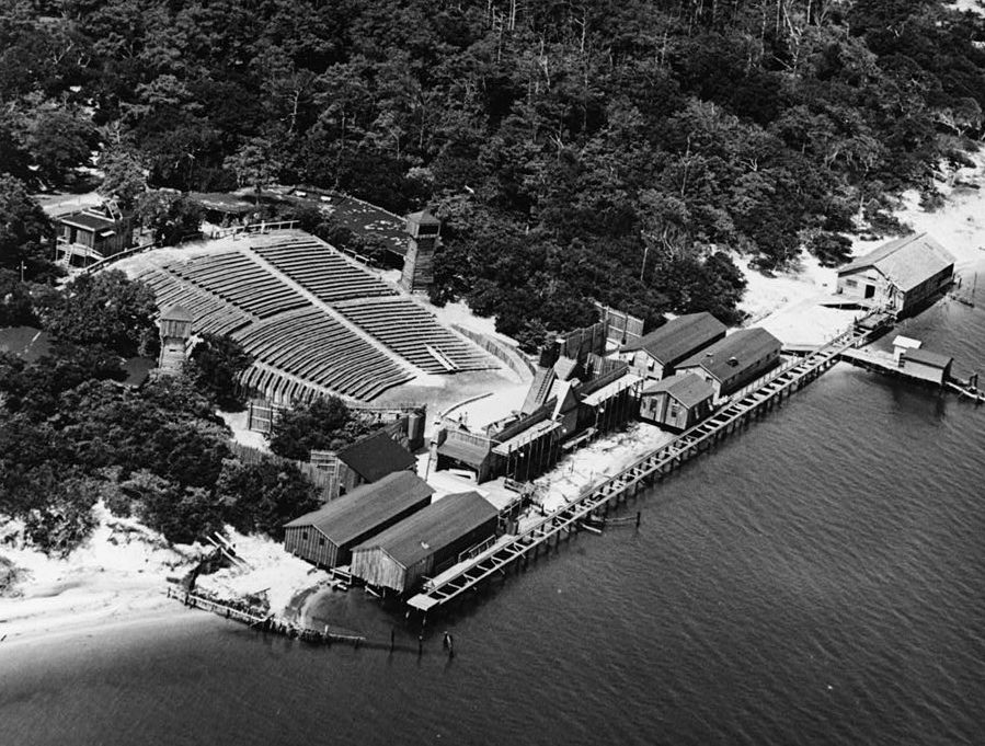
35°15′16″N 75°31′17″W / 35.25444°N 75.52139°WBuxton 6 Chicamacomico Life Saving Station 
December 12, 1976 NC 12 and SR 1247
35°35′42″N 75°27′54″W / 35.595°N 75.465°WRodanthe 7 George Washington Creef House August 12, 1982 304 Budleigh St.
35°54′29″N 75°40′18″W / 35.90806°N 75.67167°WManteo 8 John T. Daniels House May 1, 2003 960 Burnside Rd.
35°54′25″N 75°41′0″W / 35.90694°N 75.683333°WManteo 9 First Colony Inn January 21, 1993 6720 S. Virginia Dare Trail
35°55′6″N 75°36′13″W / 35.91833°N 75.60361°WNags Head 10 Fort Raleigh National Historic Site 
October 15, 1966 4 miles N of Manteo on U.S. 158
35°56′19″N 75°42′36″W / 35.93861°N 75.71°WManteo 11 Hatteras Weather Bureau Station 
February 17, 1978 Off NC 12
35°13′12″N 75°41′26″W / 35.22°N 75.69056°WHatteras 12 Kitty Hawk Life-Saving Station October 11, 1984 U.S. 158
36°4′2″N 75°41′28″W / 36.06722°N 75.69111°WKitty Hawk 13 Markham-Albertson-Stinson Cottage January 13, 2006 4300 W. Soundside Rd.
35°56′45.51″N 75°37′45.93″W / 35.945975°N 75.629425°WNags Head Destroyed by Hurricane Irene[5] 14 Theodore S. Meekins House December 17, 1982 319 Sir Walter Raleigh St.
35°54′31″N 75°40′22″W / 35.90861°N 75.67278°WManteo 15 Mattie Midgett Store and House December 23, 2004 4008 S. Virginia Dare Trail
35°57′23″N 75°37′28″W / 35.95639°N 75.62444°WNags Head 16 Rasmus Midgett House October 21, 2009 25438 NC Hwy 12
35°32′42.39″N 75°28′15.94″W / 35.5451083°N 75.4710944°WWaves 17 Nags Head Beach Cottages Historic District August 19, 1977 U.S. 158
35°57′50″N 75°35′49″W / 35.96389°N 75.59694°WNags Head 18 Oregon Inlet Station 
December 23, 1975 12 miles N of Rodanthe on Pea Island
35°46′6″N 75°31′28″W / 35.76833°N 75.52444°WRodanthe 19 Salvo Post Office September 23, 1993 NC 12 W side, 0.1 miles S of jct. with Park Rd.
35°32′24″N 75°28′27″W / 35.54°N 75.47417°WSalvo 20 Sam's Diner January 27, 1999 2008 S. Virginia Dare Trail
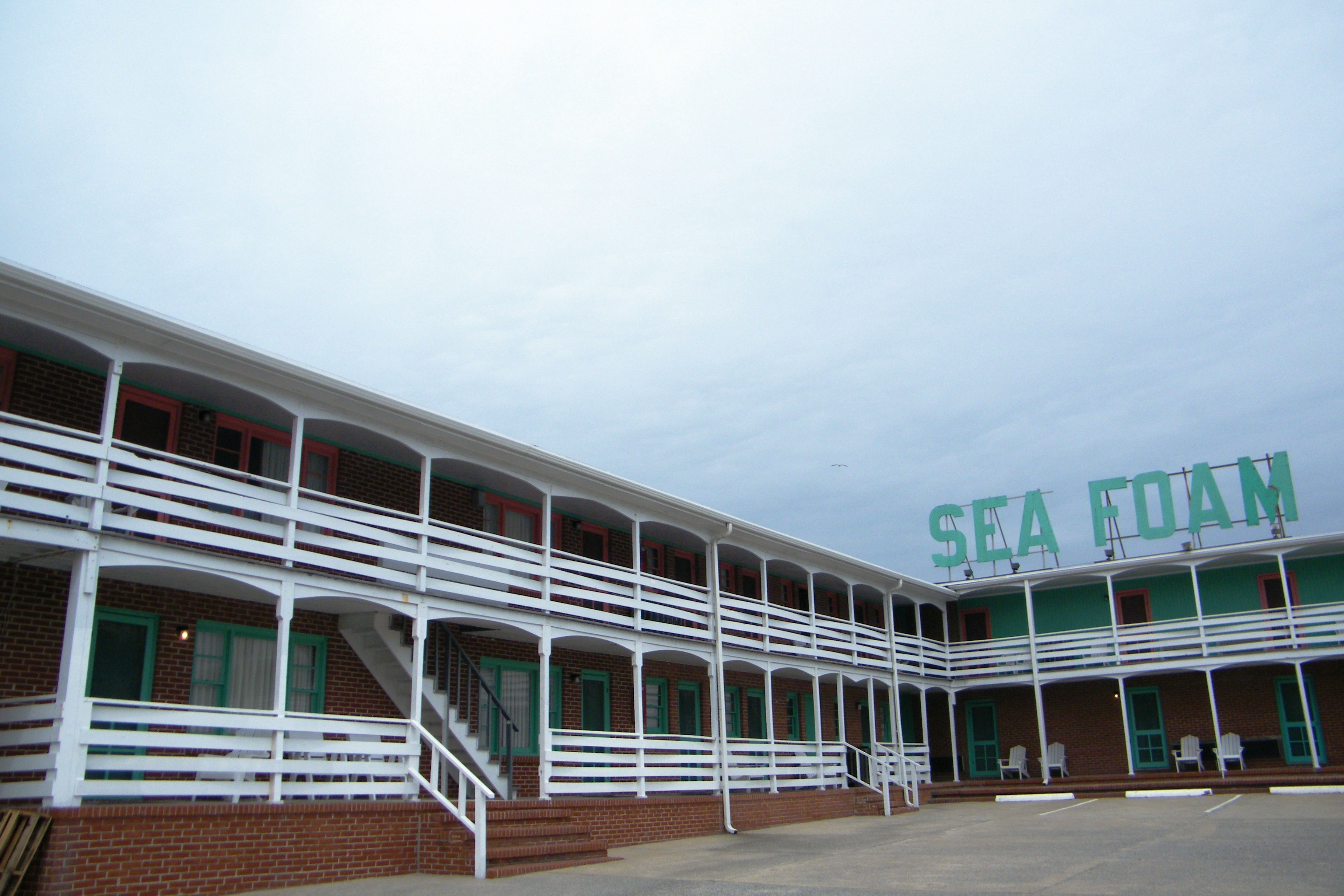
35°59′46″N 75°38′50″W / 35.99611°N 75.64722°WKill Devil Hills 21 Sea Foam Motel 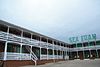
December 23, 2004 7111 S. Virginia Dare Trail
35°54′37″N 75°35′47″W / 35.91028°N 75.59639°WNags Head 22 USS HURON November 15, 1991 Address Restricted Nags Head 23 USS MONITOR 
October 11, 1974 Address Restricted Cape Hatteras 24 Wright Brothers National Memorial 
October 15, 1966 U.S. 158
36°0′58″N 75°40′12″W / 36.01611°N 75.67°WKill Devil Hills See also
- National Register of Historic Places listings in North Carolina
- List of National Historic Landmarks in North Carolina
References
- ^ The latitude and longitude information provided in this table was derived originally from the National Register Information System, which has been found to be fairly accurate for about 99% of listings. For about 1% of NRIS original coordinates, experience has shown that one or both coordinates are typos or otherwise extremely far off; some corrections may have been made. A more subtle problem causes many locations to be off by up to 150 yards, depending on location in the country: most NRIS coordinates were derived from tracing out latitude and longitudes off of USGS topographical quadrant maps created under the North American Datum of 1927, which differs from the current, highly accurate WGS84 GPS system used by Google maps. Chicago is about right, but NRIS longitudes in Washington are higher by about 4.5 seconds, and are lower by about 2.0 seconds in Maine. Latitudes differ by about 1.0 second in Florida. Some locations in this table may have been corrected to current GPS standards.
- ^ "National Register of Historic Places: Weekly List Actions". National Park Service, United States Department of the Interior. Retrieved on November 10, 2011.
- ^ Numbers represent an ordering by significant words. Various colorings, defined here, differentiate National Historic Landmark sites and National Register of Historic Places Districts from other NRHP buildings, structures, sites or objects.
- ^ "National Register Information System". National Register of Historic Places. National Park Service. 2008-04-24. http://nrhp.focus.nps.gov/natreg/docs/All_Data.html.
- ^ [1]
U.S. National Register of Historic Places Topics Lists by states Alabama • Alaska • Arizona • Arkansas • California • Colorado • Connecticut • Delaware • Florida • Georgia • Hawaii • Idaho • Illinois • Indiana • Iowa • Kansas • Kentucky • Louisiana • Maine • Maryland • Massachusetts • Michigan • Minnesota • Mississippi • Missouri • Montana • Nebraska • Nevada • New Hampshire • New Jersey • New Mexico • New York • North Carolina • North Dakota • Ohio • Oklahoma • Oregon • Pennsylvania • Rhode Island • South Carolina • South Dakota • Tennessee • Texas • Utah • Vermont • Virginia • Washington • West Virginia • Wisconsin • WyomingLists by territories Lists by associated states Other Municipalities and communities of Dare County, North Carolina Towns Duck | Kill Devil Hills | Kitty Hawk | Manteo | Nags Head | Southern Shores
Unincorporated
communitiesCategories:- Dare County, North Carolina
- National Register of Historic Places in North Carolina
- Buildings and structures in Dare County, North Carolina
-


Wikimedia Foundation. 2010.