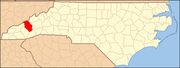
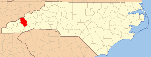
- National Register of Historic Places listings in Haywood County, North Carolina
-

This list includes properties and districts listed on the National Register of Historic Places in Haywood County, North Carolina. Click the "Map of all coordinates" link to the right to view a Google map of all properties and districts with latitude and longitude coordinates in the table below.[1]
-
- This National Park Service list is complete through NPS recent listings posted November 10, 2011.[2]
[3] Landmark name[4] Image Date listed Location City or Town Summary 1 Boone-Withers House 
July 21, 1983 305 Church St.
35°29′26″N 82°59′25″W / 35.49056°N 82.99028°WWaynesville 2 Canton Main Street Historic District September 7, 2005 Bounded roughly by Park St., Main St., Bridge St., and Adams St.
35°31′59″N 82°50′19″W / 35.53306°N 82.83861°WCanton 3 Citizens Bank and Trust Company Building, Former 
March 14, 1991 161 N. Main St.
35°29′27″N 82°59′14″W / 35.49083°N 82.98722°WWaynesville 4 Colonial Theater 
March 15, 2000 55-57 Park St.
35°31′56″N 82°50′24″W / 35.53222°N 82.84°WCanton 5 Davis Family House December 27, 1996 N side of NC 1355, .8 miles NW of Ferguson Br. over the Pigeon River
35°37′21″N 82°58′26″W / 35.6225°N 82.97389°WCrabtree 6 Frog Level Historic District August 28, 2003 Roughly bounded by Commerce and Boundary Sts., Water St. and Richland Creek, Depot St., and 80 Commerce St.
35°29′40″N 82°59′26″W / 35.49444°N 82.99056°WWaynesville 7 James M. Gwyn House July 12, 1984 NC 276
35°26′48″N 82°48′59″W / 35.44667°N 82.81639°WCruso 8 Haywood County Courthouse 
May 10, 1979 Main and Depot Sts.
35°29′33″N 82°59′14″W / 35.4925°N 82.98722°WWaynesville 9 Alden and Thomasene Howell House 
April 22, 2003 129 Woolsey Heights
35°29′42″N 82°58′47″W / 35.495°N 82.97972°WWaynesville 10 Lambuth Inn 
July 29, 1982 Lambeth Dr.
35°31′44″N 82°58′1″W / 35.52889°N 82.96694°WLake Junaluska 11 Masonic Hall 
June 9, 1988 114 Church St.
35°29′23″N 82°59′20″W / 35.48972°N 82.98889°WWaynesville 12 Mount Zion United Methodist Church February 5, 1986 SR 1503
35°36′18″N 82°54′14″W / 35.605°N 82.90389°WCrabtree 13 Patton Farm November 10, 1980 SW of Canton
35°32′20″N 82°52′34″W / 35.53889°N 82.87611°WPhillipsville 14 Charles and Annie Quinlan House 
September 7, 2005 274 S. Main St.
35°29′12.4″N 82°59′26.5″W / 35.486778°N 82.990694°WWaynesville 15 Clyde H. Ray Sr. House 
October 22, 1996 803 1/2 Love Ln.
35°29′49″N 82°59′32″W / 35.49694°N 82.99222°WWaynesville 16 Shackford Hall 
April 25, 2001 80 Shackford Hall Rd.
35°31′28″N 82°58′41″W / 35.52444°N 82.97806°WLake Junaluska 17 Shelton House 
January 31, 1979 307 Shelton St.
35°29′5″N 82°59′9″W / 35.48472°N 82.98583°WWaynesville 18 Shook-Welch-Smathers House September 12, 2008 178 Morgan St.
35°31′54.03″N 82°55′4.81″W / 35.531675°N 82.9180028°WClyde 19 Frank Smathers House 
July 10, 1998 724 Smathers St.
35°30′24″N 82°58′51″W / 35.50667°N 82.98083°WWaynesville 20 Spread Out Historic District December 28, 2010 Roughly bounded by N. Main St., Walnut St., and Beech St.
35°29′51″N 82°58′45″W / 35.4975°N 82.97917°WWaynesville 21 US Post Office Building, Former 
March 14, 1991 106 S. Main St.
35°29′23″N 82°59′19″W / 35.48972°N 82.98861°WWaynesville 22 Dr. J. Howell Way House 
September 11, 1980 301 S. Main St.
35°29′16″N 82°59′21″W / 35.48778°N 82.98917°WWaynesville 23 Waynesville Main Street Historic District December 16, 2005 Roughly bounded by Depot St., Church and E. Sts, Wall St., and Montgomery St.
35°29′29″N 82°59′15″W / 35.49139°N 82.9875°WWaynesville See also
- National Register of Historic Places listings in North Carolina
- List of National Historic Landmarks in North Carolina
References
- ^ The latitude and longitude information provided in this table was derived originally from the National Register Information System, which has been found to be fairly accurate for about 99% of listings. For about 1% of NRIS original coordinates, experience has shown that one or both coordinates are typos or otherwise extremely far off; some corrections may have been made. A more subtle problem causes many locations to be off by up to 150 yards, depending on location in the country: most NRIS coordinates were derived from tracing out latitude and longitudes off of USGS topographical quadrant maps created under North American Datum of 1927, which differs from the current, highly accurate GPS system used by Google maps. Chicago is about right, but NRIS longitudes in Washington are higher by about 4.5 seconds, and are lower by about 2.0 seconds in Maine. Latitudes differ by about 1.0 second in Florida. Some locations in this table may have been corrected to current GPS standards.
- ^ "National Register of Historic Places: Weekly List Actions". National Park Service, United States Department of the Interior. Retrieved on November 10, 2011.
- ^ Numbers represent an ordering by significant words. Various colorings, defined here, differentiate National Historic Landmark sites and National Register of Historic Places Districts from other NRHP buildings, structures, sites or objects.
- ^ "National Register Information System". National Register of Historic Places. National Park Service. 2008-04-24. http://nrhp.focus.nps.gov/natreg/docs/All_Data.html.
U.S. National Register of Historic Places Topics Lists by states Alabama • Alaska • Arizona • Arkansas • California • Colorado • Connecticut • Delaware • Florida • Georgia • Hawaii • Idaho • Illinois • Indiana • Iowa • Kansas • Kentucky • Louisiana • Maine • Maryland • Massachusetts • Michigan • Minnesota • Mississippi • Missouri • Montana • Nebraska • Nevada • New Hampshire • New Jersey • New Mexico • New York • North Carolina • North Dakota • Ohio • Oklahoma • Oregon • Pennsylvania • Rhode Island • South Carolina • South Dakota • Tennessee • Texas • Utah • Vermont • Virginia • Washington • West Virginia • Wisconsin • WyomingLists by territories Lists by associated states Other Municipalities and communities of Haywood County, North Carolina Towns Canton | Clyde | Maggie Valley | Waynesville
CDPs Categories:- Haywood County, North Carolina
- National Register of Historic Places in North Carolina
- Buildings and structures in Haywood County, North Carolina
-


Wikimedia Foundation. 2010.