- National Register of Historic Places listings in Orange County, North Carolina
-

This list includes properties and districts listed on the National Register of Historic Places in Orange County, North Carolina. Click the "Map of all coordinates" link to the right to view a Google map of all properties and districts with latitude and longitude coordinates in the table below.[1]
-
- This National Park Service list is complete through NPS recent listings posted November 10, 2011.[2]
[3] Landmark name[4] Image Date listed Location City or Town Summary 1 Alberta Mill Complex 
January 19, 1976 NE corner Weaver and N. Greensboro Sts.
35°54′41″N 79°4′17″W / 35.91139°N 79.07139°WCarrboro 2 Ayr Mount 
August 26, 1971 St. Mary's Rd.
36°4′37″N 79°5′30″W / 36.07694°N 79.09167°WHillsborough 3 Bellevue Manufacturing Company August 28, 2003 Nash St. and Eno St.
36°4′23″N 79°6′41″W / 36.07306°N 79.11139°WHillsborough 4 Beta Theta Pi Fraternity House April 20, 2005 114 South Columbia St.
35°54′49″N 79°3′20″W / 35.91361°N 79.05556°WChapel Hill 5 Bingham School January 18, 1978 NC 54 and SR 1007
35°57′13″N 79°15′16″W / 35.95361°N 79.25444°WOaks 6 Burwell School September 15, 1970 N. Churton St.
36°4′45″N 79°6′0″W / 36.07917°N 79.1°WHillsborough 7 Cabe-Pratt-Harris House April 22, 1999 NC 1567. 0.9 miles N. of Eno River Bridge
36°3′29″N 79°0′28″W / 36.05806°N 79.00778°WHillsborough 8 Carolina Inn 
August 6, 1999 211 Pittsboro St.
35°54′36″N 79°3′18″W / 35.91°N 79.055°WChapel Hill 9 Carrboro Commercial Historic District June 20, 1985 100 Blk. of E. Main St. between Greensboro Rd. & Roberson St.
35°54′37″N 79°4′18″W / 35.91028°N 79.07167°WCarrboro 10 Cedar Grove Rural Crossroads Historic District April 23, 1998 Roughly along Carr Store Rd. and Efland-Cedar Grove Rd.
36°10′12″N 79°10′11″W / 36.17°N 79.16972°WCedar Grove 11 Chapel Hill Historic District December 16, 1971 Battle Park, E. Franklin and E. Rosemary Sts. residences, and central campus of University of North Carolina
35°54′45″N 79°3′8″W / 35.9125°N 79.05222°WChapel Hill 12 Chapel Hill Town Hall March 20, 1990 Rosemary and Columbia Sts.
35°54′51″N 79°3′25″W / 35.91417°N 79.05694°WChapel Hill 13 Chapel of the Cross 
February 1, 1972 304 E. Franklin St.
35°54′58″N 79°2′39″W / 35.91611°N 79.04417°WChapel Hill 14 Commandant's House November 9, 1972 Barracks Rd.
36°4′19″N 79°7′22″W / 36.07194°N 79.12278°WHillsborough 15 Eagle Lodge 
April 16, 1971 142 W. King St.
36°4′31″N 79°5′59″W / 36.07528°N 79.09972°WHillsborough Masonic Lodge 16 Eno Cotton Mill September 1, 2011 437 Dimmocks Mill Rd.
36°4′14″N 79°6′48″W / 36.07056°N 79.11333°WHillsborough 17 Faucett Mill and House August 4, 1988 Faucette Mill Rd. on the E side of Eno River
36°6′4″N 79°8′25″W / 36.10111°N 79.14028°WHillsborough 18 David Faucette House November 22, 1999 1830 Hall's Mill Rd.
36°7′21″N 79°9′20″W / 36.1225°N 79.15556°WEfland 19 Gimghoul Neighborhood Historic District 
August 5, 1993 Roughly bounded by Gimghoul Rd., Ridge Ln., and Gladon Dr.
35°54′47″N 79°2′24″W / 35.91306°N 79.04°WChapel Hill 20 Hazel-Nash House 
March 31, 1971 116 W. Queen St.
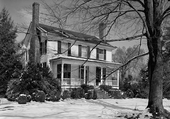
36°4′44″N 79°6′4″W / 36.07889°N 79.10111°WHillsborough 21 Heartsease 
April 11, 1973 113 E. Queen St.
36°4′44″N 79°6′7″W / 36.07889°N 79.10194°WHillsborough 22 Hillsborough Historic District October 15, 1973 Roughly bounded by N. Nash and W. Corbin Sts., Highland Loop Rd., and Eno River
36°4′25″N 79°5′44″W / 36.07361°N 79.09556°WHillsborough 23 Alexander Hogan Plantation March 4, 1996 Address Restricted Chapel Hill 24 Thomas and Mary Hogan House January 26, 2001 9118 Hillsborough Rd.
35°56′27″N 79°6′15″W / 35.94083°N 79.10417°WCarrboro 25 Holden-Roberts Farm May 2, 2002 NC 1002, 1 miles E of NC 1538
36°6′36″N 79°2′11″W / 36.11°N 79.03639°WHillsborough 26 Jacob Jackson Farm March 17, 1994 NC 1002, 0.4 miles W of NC 1538
36°5′35″N 79°3′37″W / 36.09306°N 79.06028°WHillsborough 27 Dr. Arch Jordan House August 6, 1998 7015 NC 57
36°11′6″N 79°1′8″W / 36.185°N 79.01889°WCaldwell 28 Thomas F. Lloyd Historic District August 14, 1986 Roughly bounded by E. Carr St., Maple Ave., and S. Greensboro St.
35°54′26″N 79°4′17″W / 35.90722°N 79.07139°WCarrboro 29 Montrose October 28, 2001 320 St. Mary's Rd.
36°4′41″N 79°8′36″W / 36.07806°N 79.14333°WHillsborough 30 Moorefields 
April 25, 1972 N of jct. of SR 1134 and 1135
36°3′7″N 79°8′43″W / 36.05194°N 79.14528°WHillsborough 31 Murphey School August 20, 2009 3729 Murphy School Rd.
36°1′44.07″N 79°0′51.53″W / 36.0289083°N 79.0143139°WHillsborough 32 Nash Law Office 
September 28, 1971 143 W. Margaret Lane
36°4′27″N 79°6′5″W / 36.07417°N 79.10139°WHillsborough 33 Nash-Hooper House 
November 11, 1971 118 W. Tryon St.
36°4′3″N 79°6′3″W / 36.0675°N 79.10083°WHillsborough 34 Occoneechee Speedway 
May 2, 2002 Elizabeth Brady, 0.3 N of US 70 Business
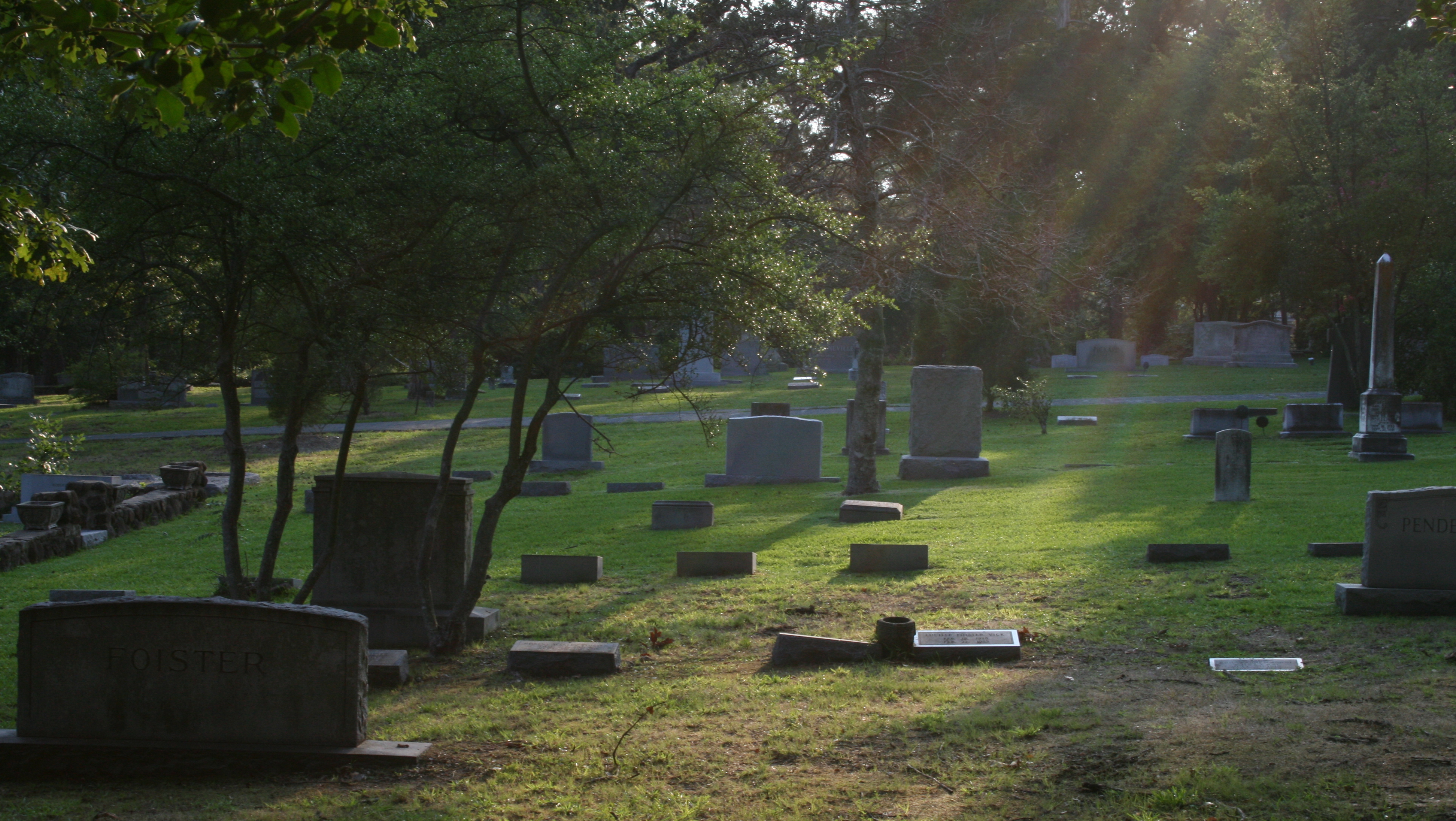
36°4′23″N 79°4′57″W / 36.07306°N 79.0825°WHillsborough 35 Old Chapel Hill Cemetery 
June 3, 1994 Jct. of NC 54 and County Club Rd., NW corner
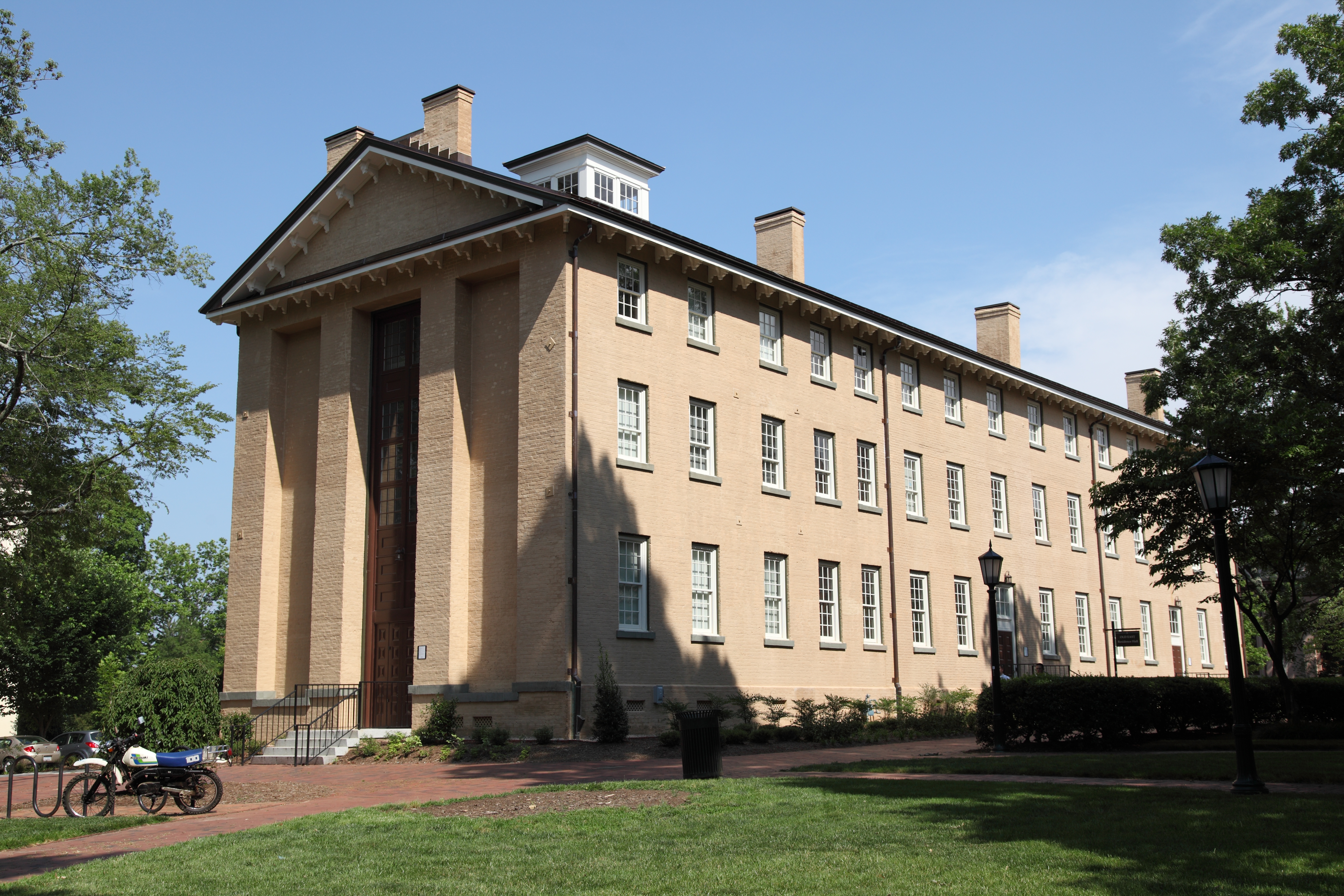
35°54′40″N 79°2′34″W / 35.91111°N 79.04278°WChapel Hill 36 Old East, University of North Carolina 
October 15, 1966 University of North Carolina campus
35°54′45″N 79°3′3″W / 35.9125°N 79.05083°WChapel Hill 37 Old Orange County Courthouse June 24, 1971 106 E. King St.
36°5′34″N 79°5′56″W / 36.09278°N 79.09889°WHillsborough 38 Paisley-Rice Log House January 31, 1979 N of Mebane
36°7′33″N 79°15′22″W / 36.12583°N 79.25611°WMebane 39 Playmakers Theatre 
June 24, 1971 Cameron Ave., University of North Carolina campus
35°54′24″N 79°3′2″W / 35.90667°N 79.05056°WChapel Hill 40 Rigsbee's Rock House October 20, 1988 Jct. of Lawrence Rd. and US 70W Bypass
36°3′34″N 79°4′1″W / 36.05944°N 79.06694°WHillsborough 41 Rocky Ridge Farm Historic District August 8, 1989 Roughly bounded by Rocky Ridge Rd., Country Club Rd., Laurel Hill Rd., Laurel Hill Cir., and Buttons Dr.; also portions of Country Club Rd., Laurel Hill Rd., and Ledge Ln., and all of Round Hill Rd.
35°54′21″N 79°2′18″W / 35.90583°N 79.03833°WChapel Hill Second set of boundaries represents a boundary increase of January 30, 2008 42 Ruffin-Roulhac House 
August 5, 1971 Churton and Orange Sts.
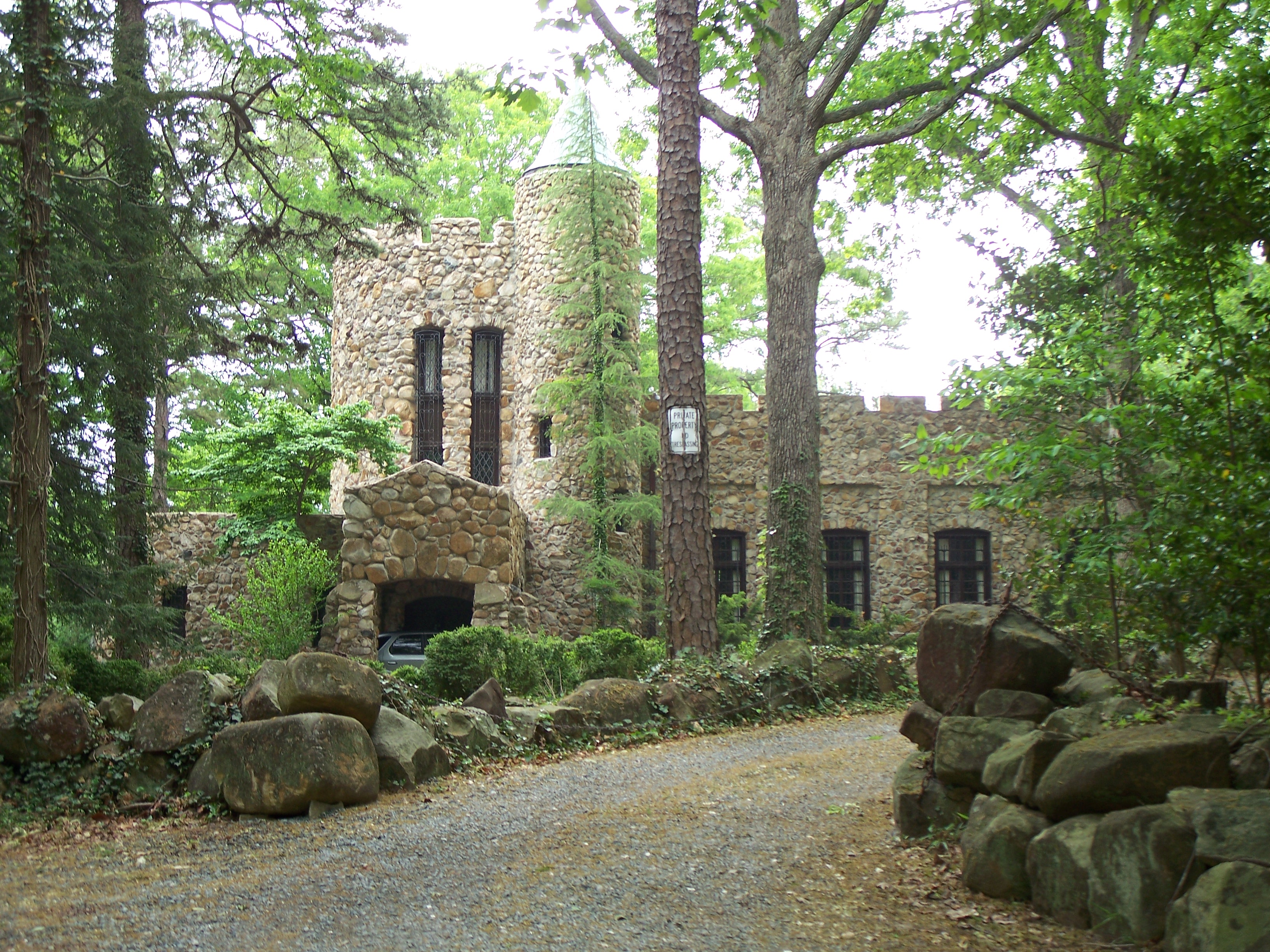
36°4′54″N 79°5′58″W / 36.08167°N 79.09944°WHillsborough 43 Sans Souci 
August 26, 1971 E. Corbin St.
36°4′57″N 79°5′47″W / 36.0825°N 79.09639°WHillsborough 44 St. Mary's Chapel 
July 12, 1978 NE of Hillsborough
36°7′3″N 79°0′1″W / 36.1175°N 79.00028°WHillsborough 45 St. Matthew's Episcopal Church and Churchyard 
June 24, 1971 St. Mary's Rd.
36°4′35″N 79°5′43″W / 36.07639°N 79.09528°WHillsborough 46 West Chapel Hill Historic District December 31, 1998 Roughly bounded by W. Cameron Ave., Malette St., Ranson St., Pittsboro St., University Dr. and the Westwood Subdivision
35°54′23″N 79°3′31″W / 35.90639°N 79.05861°WChapel Hill See also
- National Register of Historic Places listings in North Carolina
- List of National Historic Landmarks in North Carolina
References
- ^ The latitude and longitude information provided in this table was derived originally from the National Register Information System, which has been found to be fairly accurate for about 99% of listings. For about 1% of NRIS original coordinates, experience has shown that one or both coordinates are typos or otherwise extremely far off; some corrections may have been made. A more subtle problem causes many locations to be off by up to 150 yards, depending on location in the country: most NRIS coordinates were derived from tracing out latitude and longitudes off of USGS topographical quadrant maps created under the North American Datum of 1927, which differs from the current, highly accurate WGS84 GPS system used by Google maps. Chicago is about right, but NRIS longitudes in Washington are higher by about 4.5 seconds, and are lower by about 2.0 seconds in Maine. Latitudes differ by about 1.0 second in Florida. Some locations in this table may have been corrected to current GPS standards.
- ^ "National Register of Historic Places: Weekly List Actions". National Park Service, United States Department of the Interior. Retrieved on November 10, 2011.
- ^ Numbers represent an ordering by significant words. Various colorings, defined here, differentiate National Historic Landmark sites and National Register of Historic Places Districts from other NRHP buildings, structures, sites or objects.
- ^ "National Register Information System". National Register of Historic Places. National Park Service. 2008-04-24. http://nrhp.focus.nps.gov/natreg/docs/All_Data.html.
U.S. National Register of Historic Places Topics Lists by states Alabama • Alaska • Arizona • Arkansas • California • Colorado • Connecticut • Delaware • Florida • Georgia • Hawaii • Idaho • Illinois • Indiana • Iowa • Kansas • Kentucky • Louisiana • Maine • Maryland • Massachusetts • Michigan • Minnesota • Mississippi • Missouri • Montana • Nebraska • Nevada • New Hampshire • New Jersey • New Mexico • New York • North Carolina • North Dakota • Ohio • Oklahoma • Oregon • Pennsylvania • Rhode Island • South Carolina • South Dakota • Tennessee • Texas • Utah • Vermont • Virginia • Washington • West Virginia • Wisconsin • WyomingLists by territories Lists by associated states Other Municipalities and communities of Orange County, North Carolina Cities 
Towns Unincorporated
communitiesBlackwood | Buckhorn | Caldwell | Calvander | Carr | Cedar Grove | Dogwood Acres | Efland | Eno | Eubanks | Hurdle Mills | McDade | Miles | Oaks | Rougemont | Schley | Teer | University
Footnotes ‡This populated place also has portions in an adjacent county or counties
Categories:- Buildings and structures in Orange County, North Carolina
- National Register of Historic Places in North Carolina
-


Wikimedia Foundation. 2010.