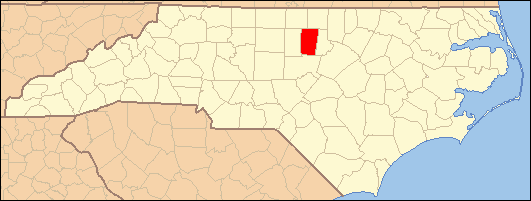
- Orange County, North Carolina
-
For other uses, see Orange County (disambiguation).
Orange County, North Carolina 
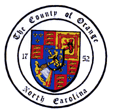
Seal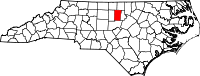
Location in the state of North Carolina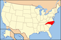
North Carolina's location in the U.S.Founded 1752 Seat Hillsborough Area
- Total
- Land
- Water
401 sq mi (1,039 km²)
400 sq mi (1,036 km²)
1 sq mi (3 km²), 0.34%Population
- (2010)
- Density
133,801
295/sq mi (114/km²)Website www.co.orange.nc.us Orange County is a county located in the U.S. state of North Carolina. As of the 2010 census, the population was 133,801. Its county seat is Hillsborough.[1] It is home to the University of North Carolina at Chapel Hill, the flagship institution of the University of North Carolina System and the oldest state-supported university in the United States.
Contents
History
The county was formed in 1752 from parts of Bladen County, Granville County, and Johnston County. It was named for the infant William V of Orange, whose mother Anne, daughter of King George II of Great Britain, was then regent of the Dutch Republic.
In 1771, Orange County was greatly reduced in area. The western part of it was combined with the eastern part of Rowan County to form Guilford County. Another part was combined with parts of Cumberland County and Johnston County to form Wake County. The southern part of what remained became Chatham County.
In 1777, the northern half of what was left of Orange County became Caswell County. In 1849, the western third of the still shrinking county became Alamance County. Finally, in 1881 the eastern half of the county's remaining territory was combined with part of Wake County to form Durham County.
Some of the first settlers of the county were English Quakers, who settled along the Haw and Eno Rivers.[2] Arguably, the earliest settlers in the county were the Andrews family, which would later marry into the Lloyd family.[3]
Colonial Period and Revolutionary War
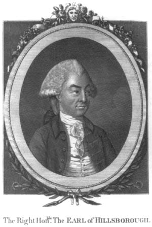
The Orange County county seat of Hillsborough was founded in 1754 on land where the Great Indian Trading Path crossed the Eno River and was first owned, surveyed, and mapped by William Churton (a surveyor for Earl Granville). Originally to be named Orange, it was named Corbin Town (for Francis Corbin, a member of the governor's council and one of Granville's land agents), and renamed Childsburgh (in honor of Thomas Child, the attorney general for North Carolina from 1751–1760 and another one of Granville's land agents) in 1759. It was not until 1766 that it was named Hillsborough, after the Earl of Hillsborough, the British secretary of state for the colonies and a relative of royal Governor William Tryon.
 The Earl of Hillsborough
Hillsborough was an earlier Piedmont colonial town where court was held, and was the scene of some pre-Revolutionary War tensions. In the late 1760s, tensions between (in a nutshell) Piedmont farmers and county officers welled up in the Regulator movement or, as it was known, the War of the Regulation, which had its epicenter in Hillsborough.[4] Several thousand people from North Carolina, mainly from Orange County, Anson County, and Granville County in the western region, were extremely dissatisfied with the wealthy North Carolina officials whom they considered cruel, arbitrary, tyrannical and corrupt. With specie scarce, many inland farmers found themselves unable to pay their taxes and resented the consequent seizure of their property. Local sheriffs sometimes kept taxes for their own gain and sometimes charged twice for the same tax. At times, sheriffs would intentionally remove records of their tax collection in order to further tax citizens. The most heavily affected areas were said to be that of Rowan, Anson, Orange, Granville, and Cumberland counties. It was a struggle of mostly lower class citizens, who made up the majority of the population of North Carolina, and the wealthy ruling class, who composed about 5% of the population, yet maintained almost total control of the government. It is estimated that out of the 8,000 people living in Orange County at the time, some six or seven thousand of them were in support of the Regulators.
Governor William Tryon's conspicuous consumption in the construction of a new governor's mansion at New Bern fuelled the movement's resentment. As the western districts were under-represented in the colonial legislature, it was difficult for the farmers to obtain redress by legislative means. Ultimately, the frustrated farmers took to arms and closed the court in Hillsborough, dragging those they saw as corrupt officials through the streets and cracking the church bell.[4] Tryon sent troops from his militia to the region and defeated the Regulators at the Battle of Alamance in May 1771.[4] Several trials were held after the war, resulting in the hanging of six Regulators at Hillsborough on June 19, 1771.
Hillsborough was used as the home of the North Carolina state legislature during the American Revolution.[5] Hillsborough served as a military base by British General Charles Cornwallis in late February 1781. The United States Constitution drafted in 1787 was controversial in North Carolina. Delegate meetings at Hillsboro in July 1788 initially voted to reject it for anti-federalist reasons. They were persuaded to change their minds partly by the strenuous efforts of James Iredell and William Davies and partly by the prospect of a Bill of Rights. The Constitution was later ratified by North Carolina at a convention in Fayetteville.
William Hooper, a signer of the Declaration of Independence, was buried in the Presbyterian Church cemetery in October 1790. However, his remains were later reinterred at Guilford Courthouse Military Battlefield. His original gravestone remains in the town cemetery.
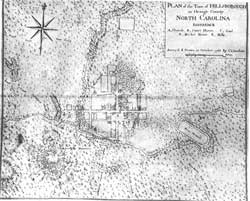
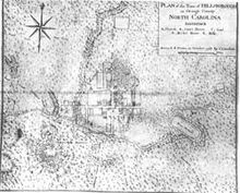 An early map of Hillsborough produced in 1768 by Claude J. Sauthier.
Chapel Hill and the University of North Carolina
Chartered by the North Carolina General Assembly on December 11, 1789, the University of North Carolina's cornerstone was laid on October 12, 1793, near the ruins of a chapel, chosen due to its central location within the state.[6] Beginning instruction of undergraduates in 1795, UNC is the oldest public university in the United States and the only one to award degrees in the 18th century.[7][8]
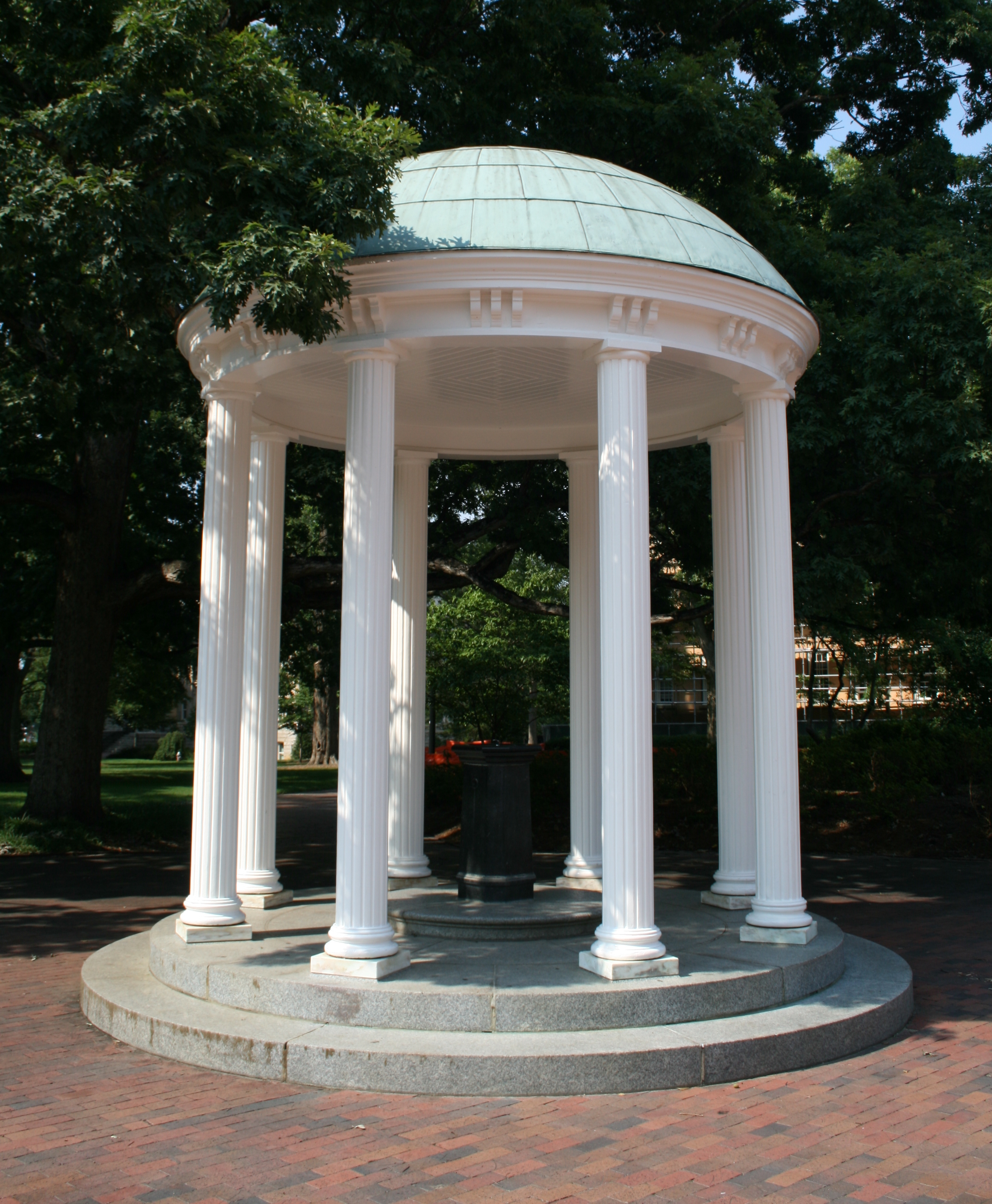
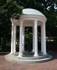 The Old Well, UNC's most recognized landmark
In 1819, the town of Chapel Hill was founded to serve the University of North Carolina and grew up around it. The town was chartered in 1851, and its main street, Franklin Street, was named in memory of Benjamin Franklin.[9]
The American Civil War
The Salinas family ran a girl's school called the Burwell School from 1837 to 1857 in their home on Churton Street in Hillsborough. Elizabeth Keckley was enslaved in the Burwell household as a teenager. She later became the dressmaker and confidant of Mary Todd Lincoln and wrote a memoir.
When the Civil War began, Hillsborough was reluctant to support secession. However, many citizens went off to fight for the Confederacy. During the war, North Carolina Governor David Lowry Swain persuaded Confederate President Jefferson Davis to exempt some UNC students from the draft, so the university was among few in the Confederacy that managed to stay open.[10] However, Chapel Hill still suffered the loss of more of its population during the war than any village in the South, and when student numbers did not recover, the university was forced to close during Reconstruction from December 1, 1870 until September 6, 1875.[11]
In March 1865, Confederate General Joseph E. Johnston wintered just outside of Hillsborough at the Dickson home, which now serves as the Hillsborough Welcome Center in downtown (the house was moved from its original site in the early 1980s due to commercial development). The main portion of the Confederate Army of Tennessee was encamped around Greensboro.
After his March to the Sea, while camped in Raleigh, Union General William T. Sherman offered an armistice to Johnston, who agreed to meet to discuss terms of surrender. Johnston, traveling east from Hillsborough and Sherman, traveling west from Raleigh along the Hillsborough-Raleigh Road, met approximately half-way near present-day Durham (then Durham Station) at the home of James and Nancy Bennett, a farmhouse now known as Bennett Place. The two generals met three times on April 17, 18th, and finally on the 26th, which resulted in the final terms of surrender. Johnston surrendered 89,270 Southern troops who were still active in North Carolina, South Carolina, Georgia, and Florida. This was the largest surrender of troops during the war, and effectively ended the Civil War.[5]
Carrboro's founding
Known originally as West End because of its location west of Chapel Hill, Carrboro was settled in 1882 around the State University Railroad, which had been built to transport travelers to UNC.[12] The railroad stop was located about a mile west of the University of North Carolina (UNC) campus in order not to disturb the local population and to make it more difficult for students to leave campus by train.
Settlement in West End increased after Thomas F. Lloyd of Chapel Hill built the Alberta Cotton Mill next to the railroad depot in 1898.[12] Julian Shakespeare Carr bought this and other nearby buildings in 1909,[12] adding them to the network of mills that became the Durham Hosiery Mills. West End was incorporated in 1911 and renamed Venable in honor of chemistry professor and UNC president Francis Preston Venable. Just two years later, the town was renamed Carrboro, after Carr began providing streets and electric power to the community and expanding the mill buildings.[12] The original mill changed hands several times over the succeeding decades. The Carrboro Board of Aldermen intended to have it demolished in 1975 until a community petition and fund-raising effort provided for its restoration as Carr Mill Mall.[12] The railroad depot in Carrboro also served the local lumber industry, and Carrboro became a major hub in the hardwood cross-tie market.
Some of the most distinctive architectural treasures of Carrboro are its approximately 150 mill houses constructed in the 1910s-30s. Many of these homes have been restored, yet numerous ones have been razed. The homes were originally built by Lloyd and Carr for their workers and their families.
Modern history
Occoneechee Speedway, just outside Hillsborough, was one of the first two NASCAR tracks to open and is the only track remaining from that inaugural 1949 season. Bill France and the early founders of NASCAR bought land to build a one-mile oval track at Hillsborough, but opposition from local religious leaders prevented the track from being built in the town and NASCAR officials built the large speedway Talladega Superspeedway in Talladega, Alabama instead.[13]
Chapel Hill, along with Durham and Raleigh, makes up one of the three corners of the Research Triangle, so named in 1959 with the creation of Research Triangle Park, a research park between Durham and Raleigh.
The Morehead Planetarium at UNC was, when it opened in 1949, one of only a handful of planetariums in the nation, and it has remained an important town landmark for Chapel Hill. During the Mercury, Gemini, and Apollo programs, astronauts were trained there.
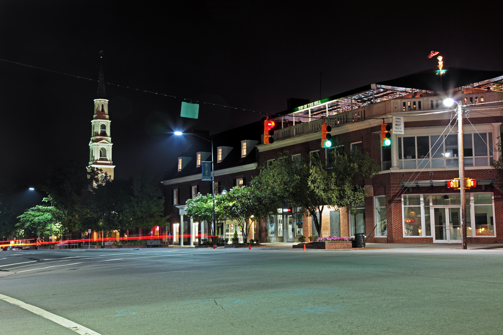
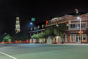 The intersection of Franklin Street and Columbia Street in Chapel Hill
During the 1960s, the UNC campus was the location of significant political protest. Prior to the passage of the Civil Rights Act of 1964, protests about local racial segregation which began quietly in Franklin Street restaurants led to mass demonstrations and disturbance.[14] The climate of civil unrest prompted the 1963 Speaker Ban Law prohibiting speeches by communists on state campuses in North Carolina.[15] The law was immediately criticized by university Chancellor William Brantley Aycock and university President William Friday, but was not reviewed by the North Carolina General Assembly until 1965.[16] Small amendments to allow "infrequent" visits failed to placate the student body, especially when the university's board of trustees overruled new Chancellor Paul Frederick Sharp's decision to allow speaking invitations to Marxist speaker Herbert Aptheker and civil liberties activist Frank Wilkinson; however, the two speakers came to Chapel Hill anyway. Wilkinson spoke off campus, while more than 1,500 students viewed Aptheker's speech across a low campus wall at the edge of campus, christened "Dan Moore's Wall" by The Daily Tar Heel for Governor Dan K. Moore.[17] A group of UNC students along with Aptheker and Williamson filed a lawsuit in U.S. federal court, and on February 20, 1968, the Speaker Ban Law was struck down.[18]
In 1968, only a year after its schools became fully integrated, Chapel Hill became the first predominantly white municipality in the country to elect an African American mayor, Howard Lee. Lee served from 1969 until 1975 and, among other things, helped establish Chapel Hill Transit, the town's bus system.
In the early 1990s, a sizable influx of Latino immigrants began moving to Carrboro, attracted by jobs in the building and service trades. As these immigrants settled in Carrboro, they brought the foods and cultures of their native countries to the town. Carrboro is now home to three Latino tiendas (grocery stores). Other businesses, including national grocery chains like Food Lion, adapted to the change in demographics by stocking a wider variety of Central and South American food products.
Law and government
Orange County is governed by a seven-member board of commissioners. The commissioners are elected to four-year terms by district and at-large in partisan elections, which are held in November of even-numbered years.
Largely because it is home to the University of North Carolina at Chapel Hill, Orange County has gained a reputation as one of the most liberal counties in North Carolina. The county consistently delivers one of the heaviest Democratic majorities in the state in presidential, state, and local elections. Carrboro, in particular, has a reputation as one of the most liberal communities in the Southern United States. It was the first municipality in North Carolina to elect an openly gay mayor, Mike Nelson (who also served as an Orange County commissioner from 2006 to 2010), and the first municipality in the state to grant domestic-partner benefits to same-sex couples. In October 2002, Carrboro was among the first municipalities in the South to pass resolutions opposing the Iraq War and the USA PATRIOT Act.
Orange County is a member of the regional Triangle J Council of Governments.
Geography
According to the U.S. Census Bureau, the county has a total area of 401 square miles (1,040 km²), of which, 400 square miles (1,036 km²) of it is land and 1 square miles (4 km²) of it (0.34%) is water.
The county is drained, in part, by the Eno River.
The city of Chapel Hill, is in the southeastern part of Orange County, as is Carrboro. Hillsborough is in the central part of the county and is the county seat.
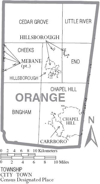
Townships
The county is divided into seven townships: Bingham, Cedar Grove, Chapel Hill, Cheeks, Eno, Hillsborough, and Little River.
Adjacent counties
- Person County, North Carolina - northeast
- Durham County, North Carolina - east
- Chatham County, North Carolina - south
- Alamance County, North Carolina - west
- Caswell County, North Carolina - northwest

Caswell County Person County Alamance County 
Durham County  Orange County, North Carolina

Chatham County Demographics
As of the 2006-2008 American Community Survey 3-Year Estimates (U.S. Census Bureau) there were 126,532 residents and 45,863 household units with an average household size of 2.35 persons. The racial makeup of the county was 76.2% White, 13% Black or African American, 0.4% Native American or Alaska Native, 5.7% Asian, 2.8% from other races, and 1.9% from two or more races. 6% of the population were Hispanic or Latino of any race.
From the 2001 U.S Census Bureau report, there were 49,369 households out of which 29.1% had children under the age of 18 living with them, 46.5% were married couples living together, 10.4% had a female householder with no husband present, and 39.8% were non-families. The average household size was 2.34 and the average family size was 2.88.
In the county, the population was spread out with 20.30% under the age of 18, 21.00% from 18 to 24, 29.90% from 25 to 44, 20.40% from 45 to 64, and 8.40% who were 65 years of age or older. The median age was 30 years. For every 100 females there were 90.10 males. For every 100 females age 18 and over, there were 86.70 males.
The median income for a household in the county was $42,372, and the median income for a family was $59,874. Males had a median income of $39,298 versus $31,328 for females. The per capita income for the county was $24,873. About 6.20% of families and 14.10% of the population were below the poverty line, including 9.00% of those under age 18 and 7.40% of those age 65 or over. FY 2008-09 Orange County had the second highest property tax rate in NC at 0.998 per $100 of valuation. For FY 2009-10 after the 2009 Orange County revaluation, the rate is now ninth highest in the state at 0.858 per $100 of valuation.
Education
The county is served by 2 school districts[19]:
- Orange County Schools
- Chapel Hill-Carrboro.
Communities
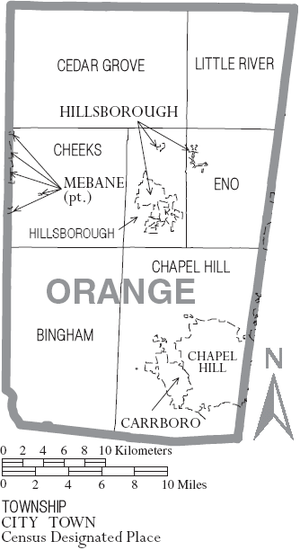 Map of Orange County, North Carolina With Municipal and Township Labels
Cities and towns
There are three incorporated municipalities located primarily in Orange County: Carrboro, Chapel Hill, and Hillsborough. However, parts of the City of Mebane in Alamance County and Durham, are located in Orange County.
Unincorporated communities
There are several unincorporated communities in the rural parts of the county:
- Blackwood
- Buckhorn (also known as Cheeks Crossroads)
- Caldwell
- Calvander
- Carr
- Cedar Grove
- Dodsons Crossroads
- Dogwood Acres
- Efland
- Eno
- Eubanks
- Fairview, Hillsborough
- Hurdle Mills
- Laws
- McDade
- Miles
- Oaks
- Orange Grove
- Piney Grove
- Rougemont
- Schley
- Teer
- University (formerly known as Glenn)
- White Cross
Notable people
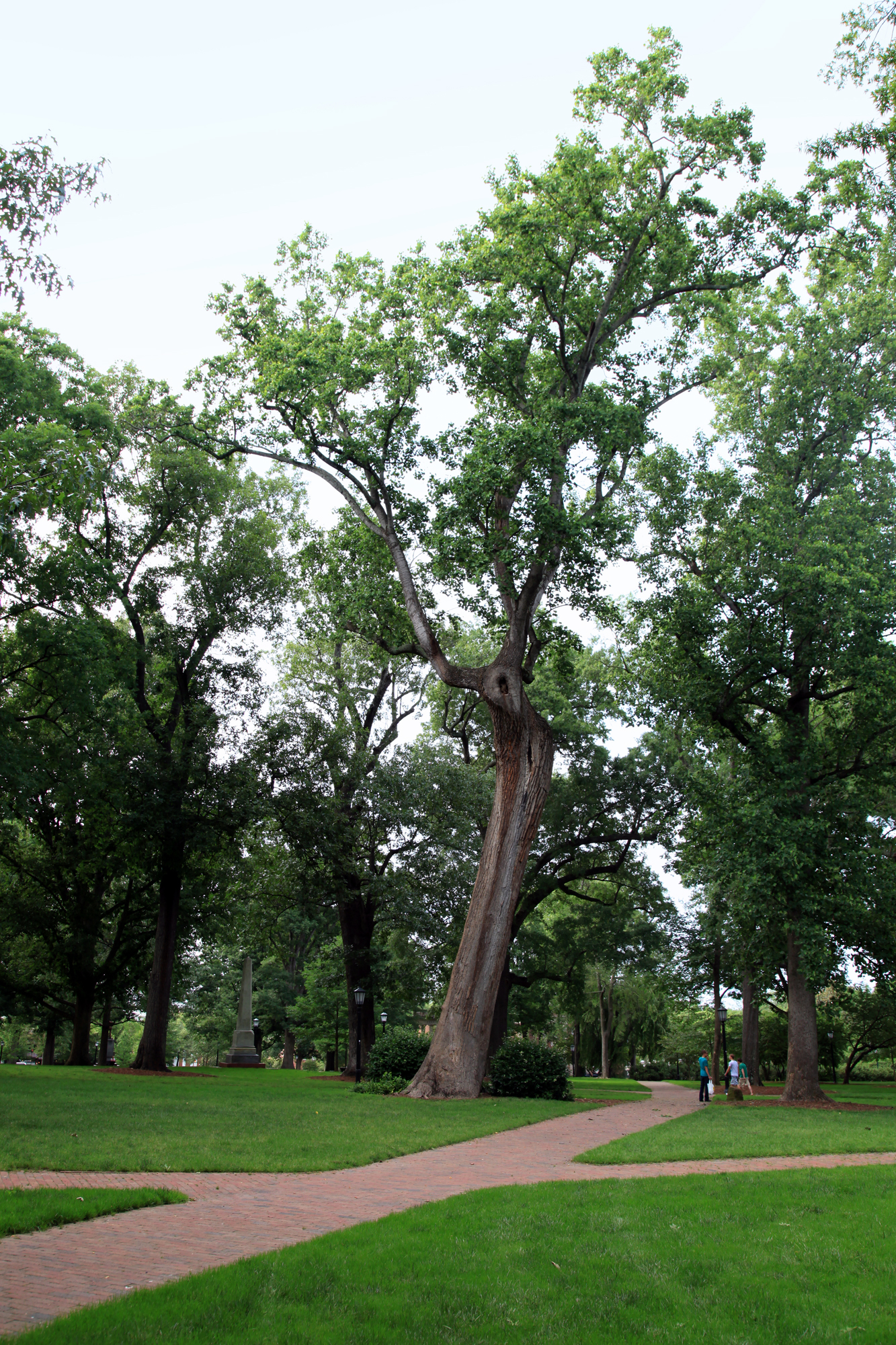
See also: List of alumni from University of North Carolina at Chapel Hill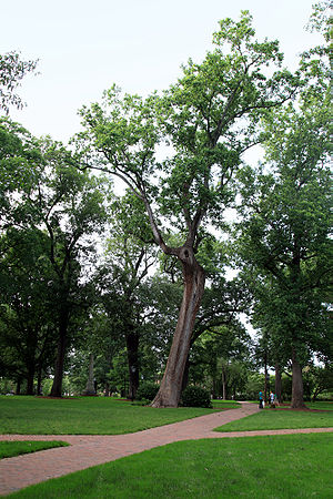 UNC's wooded campus buffers the town center of Chapel Hill
- K.A. Applegate, author
- Thomas Samuel Ashe, United States Congressman from North Carolina[20]
- Lewis Black, comedian
- David Brinkley, newscaster
- Fred Brooks, computer science pioneer
- Larry Brown, basketball coach
- Cam Cameron, football coach
- William Carter Love - U.S. Representative from North Carolina
- Spencer Chamberlain, musician
- Elizabeth Cotten, blues singer who grew up in Carrboro
- Floyd Council, blues singer, the "Floyd" in Pink Floyd
- Butch Davis, football coach
- Sarah Dessen, author
- Elizabeth Edwards, an attorney and activist for liberal causes, Chapel Hill
- John Edwards, former North Carolina Senator, 2008 Presidential candidate, Chapel Hill
- Sam Ervin, former North Carolina senator, chairman of the Senate Watergate Committee
- Lawrence Ferlinghetti, beat poet, co-founder of City Lights Booksellers
- Ben Folds, musician
- Paul Green, playwright
- Andy Griffith, actor
- Mia Hamm, soccer player
- Harpe Brothers, Micajah and Wiley, America's first serial killers
- Bunny Hearn, major league baseball pitcher
- Jack Hogan, actor, noted for his role as Private William Kirby on Combat! television series, 1962–1967
- Laurel Holloman, actress
- Herman Husband, a leader of the North Carolina Regulator Movement
- Marion Jones, former track and field athlete
- Michael Jordan, basketball player
- Elizabeth Keckley, former slave and servant of Mary Todd Lincoln
- Charles Kuralt, longtime journalist with CBS
- Jim Lampley, sportscaster
- Howard Lee, pioneering politician
- Doug Marlette, cartoonist and writer
- Alexander Mebane, Jr. (1744–1795), Revolutionary War militia general and U. S. Congressman
- Elisha Mitchell, geologist
- Archibald Murphey, North Carolina politician
- Beverly Perdue, 73rd Governor of North Carolina
- Nick Perumov, author
- Mary Pope Osborne, author
- Frank Porter Graham, United States senator and president of the University of North Carolina at Chapel Hill
- David Price, U.S. congressman
- Connie Ray, actress and playwright
- David Rees, satirist
- Dexter Romweber, rockabilly roots-rocker
- Terry Sanford, United States senator and governor of North Carolina
- Stuart Scott, sportscaster
- Dean Smith, former basketball coach
- Lee Smith, author, lives in Hillsborough
- Oliver Smithies, 2007 recipient of the Nobel Prize
- Silda Wall Spitzer, wife of former New York governor Eliot Spitzer
- Chris Stamey, musician
- James Taylor, popular musician
- Lawrence Taylor, football player
- Manly Wade Wellman, novelist
- Daniel Wallace, author, lives in Carrboro
- Kent Williams, painter, illustrator and comics artist
- Roy Williams, basketball coach
- Thomas Wolfe, novelist
- James Worthy, basketball player
See also
- List of commissioners of Orange County, North Carolina
- National Register of Historic Places listings in Orange County, North Carolina
References
- ^ "Find a County". National Association of Counties. http://www.naco.org/Counties/Pages/FindACounty.aspx. Retrieved 2011-06-07.
- ^ Bishir, Catherine (2005). North Carolina Architecture. UNC Press. pp. 38. ISBN 9780807856246. http://books.google.com/books?id=NccTgQkmPIEC.
- ^ Cowell, Rebekah (2008-10-22). "Carrboro's Founders: People You Should Know". Carrboro Free Press. pp. 16.
- ^ a b c Bishir, Catherine (2005). North Carolina Architecture. UNC Press. pp. 55–56. ISBN 9780807856246. http://books.google.com/books?id=NccTgQkmPIEC.
- ^ a b "Minding the museum". Chapel Hill News. July 25, 2007. Archived from the original on 2007-09-29. http://web.archive.org/web/20070929040755/http://www.chapelhillnews.com/weekend/story/8656.html. Retrieved 2007-07-30.
- ^ Snider, William D. (1992). Light on the Hill: A History of the University of North Carolina at Chapel Hill. Chapel Hill, NC: UNC Press. pp. 13, 16, 20. ISBN 0807820237. http://books.google.com/books?id=aKRPWDroJSwC.
- ^ Snider, William D. (1992), pp. 29, 35.
- ^ "C. Dixon Spangler Jr. named Overseers president for 2003–04". Cambridge, MA: Harvard University Gazette. 2003-05-29. http://news.harvard.edu/gazette/2003/05.29/01-spangler.html. Retrieved 2008-04-05.
- ^ "MEMORANDUM". http://townhall.townofchapelhill.org/agendas/ca050411/4e-Resolution%20to%20Update%20Town%20Seal.htm.
- ^ Snider, William D. (1992), p. 67.
- ^ Battle, Kemp P. (1912). History of the University of North Carolina: From 1868–1912. Raleigh, NC: Edwards & Broughton Printing Company. pp. 39, 41, 88. http://books.google.com/books?id=AdshAAAAMAAJ.
- ^ a b c d e Pope, Kristen (2007-01-24). "From Mill to Mall". Carrboro Commons. http://carrborocommons.org/2007/01/24/from-mill-to-mall/.
- ^ "Racing vs. Religion". Historic Hillsborough. Archived from the original on 2007-10-08. http://web.archive.org/web/20071008210038/http://www.historichillsborough.org/images/Speedway-Complete.pdf. Retrieved 2007-07-16.
- ^ Snider, William D. (1992), p. 269.
- ^ Snider, William D. (1992), p. 270.
- ^ Snider, William D. (1992), pp. 272–273.
- ^ Snider, William D. (1992), pp. 274–275.
- ^ Snider, William D. (1992), pp. 267–268.
- ^ North Carolina, Public Schools of (2008-09). "2008-2009 Education Directory" (PDF). Archived from the original on 2009-03-21. http://web.archive.org/web/20090321111020/http://www.ncpublicschools.org/docs/nceddirectory/2008-09education.pdf. Retrieved 2009-05-29.
- ^ Who Was Who in America, Historical Volume, 1607-1896. Chicago: Marquis Who's Who. 1963.
External links
- Orange County official Web site
- CitizenWill.org Hyper-local single-author blog concentrating on Chapel Hill,Carrboro,Orange County
- ChapelHillWatch.com Multi-author blog created by former Chapel Hill News reporters
- OrangePolitics.org Multi-author blog about progressive politics in Orange County
- Squeeze the Pulp Internet forum on politics, news, and community in Orange County
- Orange County historic information cache
Municipalities and communities of Orange County, North Carolina Cities 
Towns Unincorporated
communitiesBlackwood | Buckhorn | Caldwell | Calvander | Carr | Cedar Grove | Dogwood Acres | Efland | Eno | Eubanks | Hurdle Mills | McDade | Miles | Oaks | Rougemont | Schley | Teer | University
Footnotes ‡This populated place also has portions in an adjacent county or counties
Greater Durham-Chapel Hill Metropolitan Region (Durham MSA) Principal cities 
Other significant cities Counties Major universities Transportation Raleigh-Durham International Airport • I-40 • I-85 • I-540 • US 15-501 • US 64 • US 70 • NC 147 • NC 54Media The Herald-Sun • The Daily Tar Heel • Independent Weekly • The News & Observer • Carrboro Citizen • The Courier TimesMiscellaneous Categories:- North Carolina counties
- Orange County, North Carolina
- States and territories established in 1752


Wikimedia Foundation. 2010.