- Fayetteville, North Carolina
-
Fayetteville, North Carolina — City — 

SealNickname(s): "All-American City","The Old Capitol","Fayette City","Military-Town","Campbellton", "Fayettenam","Southeast Paris","Mini-Golf Town","Apartment City" Motto: History, Heroes, A Hometown Feeling. Location within the state of North Carolina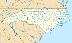
 Fayetteville, North Carolina
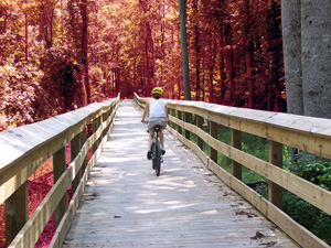
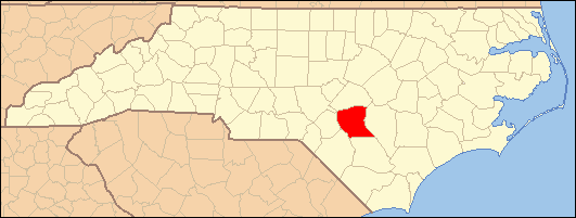
Coordinates: 35°4′0″N 78°55′3″W / 35.066667°N 78.9175°WCoordinates: 35°4′0″N 78°55′3″W / 35.066667°N 78.9175°W Country United States State North Carolina County Cumberland Settled 1762 Government – Mayor Anthony G. Chavonne – City Manager Dale E. Iman Area – City 60.0 sq mi (155.3 km2) – Land 58.8 sq mi (152.2 km2) – Water 1.2 sq mi (3.1 km2) Elevation 95 ft (29 m) Population (2010) – City 200,564 – Density 2,059.2/sq mi (795.1/km2) – Metro 366,383 Time zone Eastern (EST) (UTC-5) – Summer (DST) EDT (UTC-4) Area code(s) 910 FIPS code 37-22920[1] GNIS feature ID 1020226[2] Website http://www.cityoffayetteville.org/  Cross Creek Linear Park
Fayetteville is a city located in Cumberland County, North Carolina, United States. It is the county seat of Cumberland County,[3] and is best known as the home of Fort Bragg, a U.S. Army post located northwest of the city.
Fayetteville has received the prestigious All-American City Award from the National Civic League three times. The city won the award in 1985, 2001 and 2011. No other North Carolina city has won the award more times than Fayetteville. All-America Cities benefit by increasing community pride, networking with civic activists from across the country and gaining national recognition. The All-America City designation has helped communities win grants and new resources and attract new employers.
According to the 2010 Census, the city of Fayetteville has a population of 200,564. It currently ranks as the sixth-largest municipality in North Carolina. Fayetteville is located in the Sandhills in the western part of the Coastal Plain region, on the Cape Fear River. With a population of 366,363, the Fayetteville metropolitan area is the largest in southeastern North Carolina, and the fifth-largest in the state. Suburban areas of metro Fayetteville include Hope Mills, Spring Lake, Raeford, Stedman, and Eastover.
History
Early settlement
The area of present-day Fayetteville was inhabited by various Siouan Native American peoples such as the Eno, Shakori, Waccamaw, Keyauwee, and Cape Fear Indians for more than 12,000 years. It is still home to the Lumbee tribe, which, including members in Robeson County, numbers over 50,000.
After the violent upheavals of the Yamasee War and Tuscarora Wars during the second decade of the 18th century, the administration of North Carolina colony encouraged colonial settlement along the upper Cape Fear River, the only navigable waterway entirely within North Carolina. Two inland settlements, Cross Creek, and the riverfront settlement of Campbellton were established by Scots from Campbellton, Argyll and Bute, Scotland.
Merchants in Wilmington wanted a town on the Cape Fear River to secure trade with the frontier country. They were afraid people would use the Pee Dee River, taking their goods to Charleston, S.C. The merchants bought land from Newberry in Cross Creek. Campbellton became a place where free blacks and poor whites lived and was known for its lawlessness.
After the American Revolutionary War, the two towns were united and renamed to honor General La Fayette, a French military hero who fought with and significantly aided the American Army during the American Revolutionary War. Many cities are named after Lafayette but, Fayetteville, N.C., was the first city named in his honor. The Frenchman arrived in Fayetteville by horse-drawn carriage in 1825 during his grand tour of the United States in 1824 and 1825.
American Revolution
The Fayetteville area was the home of many residents, particularly the Highland Scots, who were loyal to the British government. But it also included a number of active Patriots.
In late June 1775, the "Liberty Point Resolves" preceded the Declaration of Independence by a little more than a year. The Liberty Point document pledged the group to "go forth and be ready to sacrifice our lives and fortunes to secure (the county's) freedom and safety." The document concluded: "This obligation to continue in full force until a reconciliation shall take place between Great Britain and America, upon constitutional principles, an event we most ardently desire; and we will hold all those persons inimical to the liberty of the colonies, who shall refuse to subscribe to this Association; and we will in all things follow the advice of our General Committee respecting the purposes aforesaid, the preservation of peace and good order, and the safety of individual and private property." Robert Rowan, who apparently organized the group, signed first.
Robert Rowan (circa 1738-1798) was one of the area's leading public figures of the 18th century. A merchant and entrepreneur by trade, Rowan arrived in Cross Creek in the 1760s. He served as an officer in the French and Indian War, as sheriff, justice and legislator, and as a leader of the Patriot cause in the Revolutionary War. Rowan circulated the statement known as the "Liberty Point Resolves" in 1775. Rowan Street and Rowan Park in Fayetteville and a local chapter of the Daughters of the American Revolution are named for him, though Rowan County (founded in 1753) was named for his uncle, Matthew Rowan.
Flora MacDonald (1722–1790), the Scottish Highland heroine, who gained fame for aiding "Bonnie Prince Charlie" after his Highlander army's defeat at Culloden in 1746, lived in North Carolina for about five years. Legend has it that she exhorted the Loyalist force at Cross Creek that included her husband, Allan, as it headed off to its eventual defeat at the Battle of Moore's Creek Bridge in 1776.
Seventy-First Township in western Cumberland County (now a part of Fayetteville) is named for a British unit during the American Revolution - the 71st Regiment of Foot or 'Fraser's Highlanders,' as they were first called.
Post-revolutionary Fayetteville
Fayetteville experienced what is sometimes called its "golden decade" during the 1780s. It played host, in 1789, to the convention that ratified the U.S. Constitution and to the General Assembly session that chartered the University of North Carolina at Chapel Hill, America's oldest public university. The legislators paused for the state funeral of former Governor Richard Caswell, who fell ill after arriving in Fayetteville and died November 10, 1789. Fayetteville lost out to the future city of Raleigh in the bid to become the permanent state capital.
In 1793 the Fayetteville Independent Light Infantry formed and is still active as a ceremonial unit. It is the second-oldest militia unit in the country.
Henry Evans (circa 1760-1810) a free black preacher is locally known as the "Father of Methodism," for Methodists, in the area. Evans was a shoemaker by trade and a licensed Methodist preacher. He met opposition from whites when he began preaching to slaves in Fayetteville, but his preaching later attracted whites to his services. He is credited with building the first church in town, called the African Meeting House, in 1796. Evans Metropolitan AME Zion Church is named in his honor.
Antebellum Fayetteville
Fayetteville remained a village of only 3,500 residents in 1820, but Cumberland County's population still ranked as the second-most urban in the state behind New Hanover County (Wilmington).
The "Great Fire" of 1831 was believed to be one of the worst in the nation's history, even though, remarkably, no lives were lost. Hundreds of homes and businesses and most of its best-known public buildings were lost, including the old "State House." Fayetteville leaders moved quickly to help the victims and rebuild the town.
The Market House, completed in 1832, became the center of commerce and celebration. The structure was built on the ruins of the old State House. It was a town market until 1906. One(1) Slave was sold there before abolition. It served as Fayetteville Town Hall until 1907. The City Council is considering turning the Market House into a local history museum.
 The Confederate arsenal in Fayetteville was destroyed in March 1865 by Union Gen. William T. Sherman during the Civil War.
The Civil War era
In March 1865, Gen. William T. Sherman and his 60,000-man army moved into Fayetteville. The Confederate arsenal was totally destroyed. Sherman's troops also destroyed foundries and cotton factories and the offices of The Fayetteville Observer. Not far from Fayetteville, Confederate and Union troops engaged in the last cavalry battle of the Civil War, the Battle of Monroe's Crossroads.
Downtown Fayetteville was the site of a skirmish, as Confederate Lt. Gen. Wade Hampton and his men surprised a cavalry patrol, killing 11 Union soldiers and capturing a dozen on March 11, 1865.
20th century to the present
Cumberland County's population exploded in the post-World War II years, with its 43% increase in the 1960s the largest in any of North Carolina's 100 counties. Construction was fast-paced as shopping developments and suburban subdivisions began to spread outside the Fayetteville city limits toward Fort Bragg and Pope Air Force Base. The Fayetteville and Cumberland County school systems moved toward integration gradually beginning in the early '60s and bussing brought about large-scale student integration in the 1970s.
Civil rights marches and sit-ins, with students from Fayetteville State Teachers College (now Fayetteville State University) at the forefront, led to the end of whites-only service at restaurants and segregated seating in theaters. Politics changed. Blacks and women gained office in significant numbers, from the late 1960s and on into the early '80s.
 A water tower with the city logo
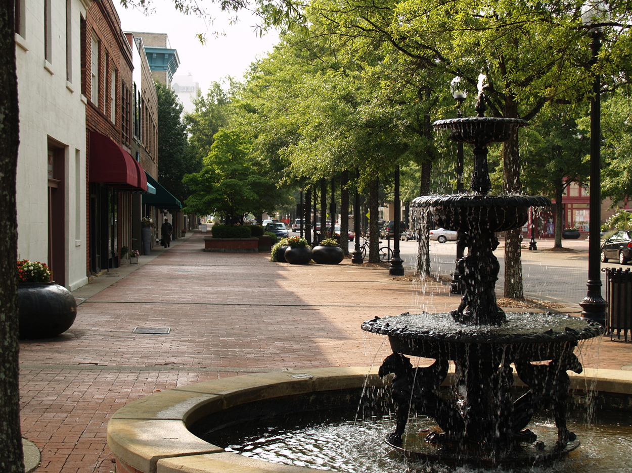
 Hay Street in Downtown Fayetteville, N.C.
The Vietnam Era was a time of change in the Fayetteville area. Fort Bragg did not send many large units to Vietnam, but from 1966 to 1970, more than 200,000 soldiers trained at the post before leaving for the war. The effect of such a large troop rotation was dramatic and remnants of this era are still visible in much of Fayetteville. Anti-war protests in Fayetteville drew national attention because of the proximity to Fort Bragg, in a city that generally supported the war. Jane Fonda came to Fayetteville to participate in three anti-war events. Because of these changes in the 1960s and 70s, nicknames like "Fayettenam" caught on and are still in popular use today. Also at this time, Fayetteville made headlines after Army doctor Jeffrey R. MacDonald murdered his pregnant wife and two daughters in their Ft. Bragg home in 1970.
Fayetteville has attempted to reverse the image of its downtown area through various downtown revitalization projects, with mixed results. New additions, such as the Airborne & Special Operations Museum, The Fayetteville Area Transportation Museum, Fayetteville Linear Park, and Fayetteville Festival Park, which opened in late 2006, have all contributed somewhat to the changing downtown area. The city still has a very high crime rate.
The towns and rural areas surrounding Fayetteville have experienced rapid growth over the past decade. This growth has spilled over into suburbs such as Hope Mills, Raeford and Spring Lake.
The western part of Cumberland County was annexed into Fayetteville in recent years.
In 2008, BestLife Magazine, using data from the U.S. Census Bureau, the National Center for Education Statistics, the FBI, the American Association of Museums, the National Center for Health Statistics and the American Bar Association, ranked Fayetteville as the 3rd worst city in America to raise a family.[4]
Recently, Where To Retire magazine named Fayetteville one of the best places to retire.[5]
In 2005 Congress mandated that due to the BRAC (Base Realignment and Closure) effort Fort Bragg would gain several new commands. The Army will be closing down United States Forces Command and the United States Reserve Command in Atlanta and moving them to Fort Bragg. This move is expected to relocate over 30,000 people to the area as a result of the command changes and businesses that will move to support the command. FORSCOM awards over $300 billion in contracts annually.[6]
Sanctuary community for military families
On September 5, 2008, Fayetteville was declared "The World's First Sanctuary for Military Families." This declaration was supported by local, regional and national dignitaries, including Mayor Tony Chavonne, County Commissioner Chairman Breeden Blackwell, NC State Representative, Brigadier General Arthur Bartell, Colonel John McDonald and Congressman Robin Hayes.[7] Through the Army's Army and other volunteer groups, the citizens and businesses of Fayetteville are dedicated to the military.[8]
Time Magazine recognized Fayetteville for their support of military families and declared Fayetteville as America's most pro-military town.[9]
Fort Bragg/Pope Army Air Field
Fort Bragg and Pope Army Air Field are located next to the city of Fayetteville. Several U.S. Army airborne units are stationed at Fort Bragg, most prominently the XVIII Airborne Corps HQ, the 82nd Airborne Division, and the United States Army Special Operations Command.
Fort Bragg was the home of the Field Artillery at the onset of World War II. All the Army's artillery units east of the Mississippi River were based at the post, about 5,000 men in all. Soldiers tested the Army's new bantam car, which was soon to be known as the Jeep, although most of the power to move artillery still came from horses and burros. On Sept. 12, 1940, the Army contracted to expand the post, bringing the 9th Infantry Division to Fort Bragg.
Missions at Pope AAF range from providing airlift and close air support to American armed forces, to humanitarian missions flown all over the world. Pope AFB particularly provides air transportation for the 82nd Airborne, among other airborne units on Fort Bragg.
All of Pope AAF's fighter jet squadrons have been relocated to Moody AFB, Georgia. Pope is being turned over to Army control in 2011 and will be called Pope Army Air Field. However, the main entity at Pope at that time will be the Air Force Reserves. The 440th Airlift Wing will handle the majority of Pope Army Airfield's mission. Although they still will have a small amount of active counterpart to get the job done. In January of 2011 Pope has officially been turned over to the Army and is conducting operations with the above.
In September 2008, Fayetteville annexed 85% of Ft. Bragg, bringing the official population of the city to 206,000. Ft. Bragg still has its own police, fire, and EMS services. Fayetteville hopes to attract large retail businesses to the area using the new population figures.[10]
Geography
Fayetteville is located at 35°04'00" North, 78°55'03" West (35.066663, -78.917579).[11]
According to the United States Census Bureau, the city has a total area of 60.0 square miles (155 km2), of which 58.8 square miles (152 km2) is land and 1.2 square miles (3.1 km2) is water. The total area is 1.98% water.
Topography
Fayetteville is located in the Sandhills of North Carolina which is located between the coastal plains and Piedmont of North Carolina. The area's sandy soil is evidence of a former coastline that existed approximately 20 million years ago. The city is built on the Cape Fear River, a 202 mile long river that originates in Haywood and empties into the Atlantic Ocean. Carver's Falls, the largest waterfall (measuring at 150 feet wide and 2 stories tall) located between the coast and foot hills is also located in Fayetteville. The falls are located on private property, however may be seen by the public at ZipQuest Waterfall and Treetop Adventure http://www.zipquest.com/, one of the area's attractions.
Climate
Climate data for Fayetteville/Pope AFB, NC Month Jan Feb Mar Apr May Jun Jul Aug Sep Oct Nov Dec Year Average high °F (°C) 52.5
(11.4)57.0
(13.9)64.7
(18.2)73.7
(23.2)81.1
(27.3)87.8
(31.0)91.0
(32.8)88.7
(31.5)83.1
(28.4)74.2
(23.4)65.0
(18.3)55.9
(13.3)72.9 Daily mean °F (°C) 42.6
(5.9)46.4
(8.0)53.2
(11.8)61.8
(16.6)70.1
(21.2)77.7
(25.4)81.6
(27.6)79.6
(26.4)73.5
(23.1)62.7
(17.1)53.7
(12.1)45.6
(7.6)62.4 Average low °F (°C) 32.7
(0.4)35.7
(2.1)41.7
(5.4)49.9
(9.9)59.1
(15.1)67.5
(19.7)72.1
(22.3)70.5
(21.4)63.9
(17.7)51.2
(10.7)42.3
(5.7)35.2
(1.8)51.8 Precipitation inches (mm) 3.94
(100.1)3.55
(90.2)3.99
(101.3)3.38
(85.9)3.28
(83.3)4.65
(118.1)5.70
(144.8)4.31
(109.5)4.23
(107.4)3.17
(80.5)3.13
(79.5)2.75
(69.9)46.09
(1,170.7)Snowfall inches (cm) 1.5
(3.8)1.1
(2.8)0.7
(1.8)0.0
(0)0.0
(0)0.0
(0)0
(0)0
(0)0
(0)0
(0)0
(0)0.2
(0.5)3.5
(8.9)Source: National Weather Service[12]'' Education
Public schools
Cumberland County Schools, serving Fayetteville and surrounding Cumberland County, is the 78th largest public school system in the nation.
Private schools
- Fayetteville Academy[13]
- St. Ann Catholic School[14]
- St. Patrick Catholic School
- Northwood [15]
- Fayetteville Christian School[16]
- Village Christian Academy
- Berean Baptist Academy[17]
- Cumberland Christian Academy
- Liberty Christian Academy[18]
- Breezewood Christian Academy
- Cornerstone Christian Academy
Freedom Academy
- First Impressions Academy [ http://www.firstimpressionspreschool.com]
Colleges and universities
- Fayetteville State University
- Methodist University
- Fayetteville Technical Community College
- Grace College of Divinity
- Carolina Bible College
- Shaw University Satelite Campus
Demographics
Historical populations 1930 13,309 1940 17,428 1960 47,106 1970 53,510 1980 59,507 1990 75,695 2000 121,015 2005 137,777 2010 200,564 As of the census of 2010, there were 200,564. people, 48,414 households, and 31,662 families residing in the city. The population density was 2,059.2 people per square mile (795.0/km²). There were 53,565 housing units at an average density of 351.9 persons/km² (911.5 persons/sq mi). The racial composition of the city was: 42.74% White, 49.76% Black or African American, 5.67% Hispanic or Latino American, 2.19% Asian American, 1.1% Native American, 0.22% Native Hawaiian or Other Pacific Islander, 2.53% some other race, and 2.78% two or more races.
There were 48,414 households out of which 31.8% had children under the age of 18 living with them, 44.7% were married couples living together, 17.1% had a female householder with no husband present, and 34.6% were non-families. 28.2% of all households were made up of individuals and 7.8% had someone living alone who was 65 years of age or older. The average household size was 2.42 and the average family size was 2.96.
In the city the population was spread out with 25.4% under the age of 18, 12.7% from 18 to 24, 31.2% from 25 to 44, 19.7% from 45 to 64, and 11.0% who were 65 years of age or older. The median age was 32 years. For every 100 females there were 91.9 males. For every 100 females age 18 and over, there were 88.7 males.
The median income for a household in the city was $36,287, and the median income for a family was $41,210. Males had a median income of $30,493 versus $23,477 for females. The per capita income for the city was $19,141. 14.8% of the population and 11.7% of families were below the poverty line. 21.4% of those under the age of 18 and 14.4% of those 65 and older were living below the poverty line.
A 15-month fight came to an end — at least for now — on Sept. 30, 2005 when Fayetteville annexed 27 square miles (70 km2) and 46,000 residents. Affected residents and developers had blocked the annexation for more than a year with three lawsuits. They lost in the state Court of Appeals in June. The court ruled the challenges were filed after the deadline. The law requires all challenges to be filed within 60 days of when a municipality adopts an annexation ordinance. When the state Supreme Court refused to consider an appeal, the city went ahead with its plans. A request for the U.S. Supreme Court to review the case is pending, and a decision may come in January.
Transportation
 Fayetteville Area Transportation Museum
Air transportation
The Fayetteville Regional Airport is served by five regional carriers that provide daily and seasonal passenger services to three major airline hubs within the United States. An additional regional carrier and several fixed base operators offer further services for both passenger and general aviation operations.
-
- Passenger Airlines:
-
-
-
- Regional connection carrier US Airways Express, operated by Air Wisconsin, Mesa Airlines, and PSA Airlines, provides daily service to Charlotte-Douglas International Airport and seasonal service to Philadelphia International Airport.
- US Airways subsidiary Piedmont Airlines provides ground services for US Airways operations at the airport.
- This service is part of the global Star Alliance network of airlines.
-
-
-
-
-
- Regional connection carrier Atlantic Southeast Airlines provides daily service to Atlanta Hartsfield-Jackson International Airport.
- This service is part of the global SkyTeam network of airlines.
-
-
-
-
-
- Regional connection carrier American Eagle provides daily service to Dallas-Fort Worth International Airport.
- This service is part of the OneWorld network of airlines.
-
-
-
-
- Landmark Aviation provides fixed-base operator services for passenger and general aviation traffic at the Fayetteville Regional Airport. Landmark offers Jet-A fuel, Avgas, ground handling, aircraft charter, concierge services, courtesy transportation, and catering. The general aviation terminal provides a lobby, pilot lounges, a conference room, and a flight room with WSI[disambiguation needed
 ] weather computers. Hangar storage and tie downs are also available.
- Landmark Aviation provides fixed-base operator services for passenger and general aviation traffic at the Fayetteville Regional Airport. Landmark offers Jet-A fuel, Avgas, ground handling, aircraft charter, concierge services, courtesy transportation, and catering. The general aviation terminal provides a lobby, pilot lounges, a conference room, and a flight room with WSI[disambiguation needed
-
-
-
- Powell Avionics
- Powell Avionics provides avionics and aircraft radio sales, installation and service. Powell Avionics is a limited fixed-base operator.
-
-
-
- Rogers Aircraft
- Rogers Aircraft provides aircraft repairs and maintenance.
-
Highways
-
- Interstate Highways: Interstate 95, Future Interstate 295
- North Carolina Highways
- United States Highways:
Public transportation
The Fayetteville Area System of Transit (FAST) serves the Fayetteville and Spring Lake regions, with ten bus routes and two shuttle routes.
Passenger rail
The Atlantic Coast Line Railroad Station, built in 1911, provides daily Amtrak service with northbound and southbound routes leading to points along the East Coast.[19]
Notable people
 Henry Evans (circa 1760-1810) built the first Methodist church in Fayetteville in 1793 and is known as the "Father of Methodism" for Methodists in the area.
- Vlowski Hampton - Moorish Nation Tiffany Pines Diplomat
- J. Cole - Rapper and producer
- Patrick Anstead - Local Personality
- Chris Armstrong - ex-Canadian Football League player
- Charlie Baggett - NFL assistant coach
- Chip Beck - Professional PGA Golfer
- Ann Bilansky (c. 1820 1860) - Fayetteville native hanged for murder in Saint Paul, Minnesota.
- Bunkie Blackburn - NASCAR driver
- Elizabeth Marie Camacho - Singer-Songwriter and Actress professionally known as "Elíz" (pronounced "e-leese").
- Randy Boone - Country music singer; former actor: The Virginian, Cimarron Strip, and It's a Man's World, was born and resides in Fayetteville.
- Grady McLeod Bowman - Broadway actor and dancer
- John Benton Callis - US politician and military officer
- Aaron Curry - NFL Linebacker for the Oakland Raiders, formerly of theSeattle Seahawks, formerly of Wake Forest University.
- Christopher Daniels - Professional wrestler for Total Nonstop Action Wrestling
- Charles Kirby - National Football League, Fullback
Justin Lee - Professional wrestler for Maximum Impact Wrestling
- Scotty Mathews - Professional wrestler
- Anson Service - Author and Keyboard player for Three Hole Punch
- Tito Rains - Professional wrestler
- BabyDoll - Professional wrestling manager
- Ryan Dunson - Singer of Rookie of the Year
- Brad Edwards - Former Washington Redskins Player, and Super Bowl winner
- Henry Evans - Free black Methodist preacher who established Methodism in the Cape Fear River valley of North Carolina.
- Cortland Finnegan - NFL Pro Bowl cornerback
- Raymond Floyd - Professional PGA Golfer
- Blenda Gay - Former NFL player, murdered in 1976
- Frank P. Graham - President of the University of North Carolina and United States Senator
- Moonlight Graham - New York Giants outfielder for two innings on May 25, 1905; represented in the novel Shoeless Joe and the movie Field of Dreams
- Sterling Hitchcock Former MLB player from 1992-2004.
- Joe Horn - National Football League wide receiver
- Edward M. Joyner Jr. - Canadian Football League Right Defensive End for the Ottawa Rough Riders. Grey Cup winners 1968 and 1969
- Michael Joiner - basketball player for Florida State Seminoles and New Zealand National Basketball League
- Jimmy Raye - former NFL wide receiver
- Hiram Rhodes Revels - first African American member of Congress
- Charles Manly Stedman - U.S. Representative and Lieutenant Governor of North Carolina
- Robert Strange - United States Senator
- Jerry Richardson - Owner of the Carolina Panthers, played for the Baltimore Colts, Fayetteville High School, now Fayetteville Terry Sanford High
- Robert Wilkie- former Assistant Secretary of Defense for Legislative Affairs and Special Assistant to the President for National Security Affairs
- Calvin Lowry - UFL Safety for Omaha Nighthawks
- Doug Wilkerson - Former NFL Guard for the San Diego Chargers
- Joey Arias - Singer and performance artist
- Jonathan Byrd - Folk singer-songwriter
- Jimmy Herring - Guitarist, Widespread Panic, Allman Brothers Band, The Dead, Aquarium Rescue Unit
- Dave Moody - Grammy nominated artist, producer, songwriter, filmmaker
- Julianne Moore - Oscar nominated Actress
- Ronnie C. Rouse - Music producer, songwriter, and recording artist
- Candice Woodcock - reality television contestant
- Jeff Capel III - former University of Oklahoma men's basketball head coach and former basketball star at Duke University and South View High school.
- Joe Harris - Former NFL Linebacker
- Eric Maynor - Drafted 20th overall by the Utah Jazz in the 2009 NBA Draft.
- Doug Brochu - Actor in Disney Channel'sSonny With A Chance and So Random
- Jason "Mayhem" Miller - Professional Mixed Martial Arts fighter, who has fought in Strikeforce, Dream and the UFC.
- Sandra Diaz-Twine- reality television contestant and winner of Survivor: Pearl Islands and Survivor: Heroes vs. Villains
- Garry Battle - Professional Arena Football player.
- Crow Peele - 1955 NCAA Heavyweight Boxing Champion at Louisiana State University
- Chris Hondros - War photographer and 2004 Pulitzer Prize finalist.
- Troy McLawhorn - Musician, Guitarist for Evanescence
- Affion Crockett- Actor, Comedian, Dancer, Rapper and Writer
- Donnel Wolford- NFL Probowl CB with Chicago Bears
Radio stations
- 88.3 FM WUAW Various Genres
- 88.7 FM WRAE Religious Music
- 89.3 FM WZRI Christian Contemporary Music
- 91.9 FM WFSS Public Radio
- 95.7 FM WKML Country
- 96.5 FM WFLB Classic Hits
- 98.1 FM WQSM Top 40
- 99.1 FM WZFX Mainstream Urban (Hip Hop and R&B)
- 102.3 FM WFVL Oldies
- 103.5 FM WRCQ Rock
- 104.5 FM WCCG Urban Contemporary (R&B Hits)
- 105.7 FM WGQR Gospel Music
- 106.9 FM WMGU Urban Adult Contemporary (Adult's R&B)
- 107.3 FM WCLN Contemporary Christian
- 107.7 FM WUKS Urban Adult Contemporary (Smooth R&B)
- 640 AM WFNC News/talk
- 1230 AM WFAY Sports
- 1450 AM WFBX Spanish
- 1490 AM WAZZ Standards
- 1600 AM WIDU Black Gospel/Talk
- 1690 AM WAXX Big J's Top Hits
Points of interest
 Cape Fear River Trail
- Cameo Art House Theatre
- Arts Council of Fayetteville/Cumberland County[20]
- Cape Fear Botanical Garden
- Fort Bragg
- Cape Fear River Trail
- Fayetteville Museum of Art[21]
- Fayetteville Area Transportation Museum
- Evans Metropolitan AME Zion Church
- Hay Street United Methodist Church
- Museum of the Cape Fear Historical Complex
- Airborne & Special Operations Museum
- Cool Spring Tavern
- Myrtle Hill Plantation
- Liberty Point
- College Lakes Park
- Cross Creek Linear Park
- Fascinate-U Children's Museum
- Jordan Soccer Complex
- Cross Creek Mall
- Cape Fear Regional Theater
- Heritage Square
- The First Golden Corral
- Cumberland County Crown Coliseum
- Freedom Memorial Park
- St. Patrick Catholic Church
- Bordeaux Tower
- Tallywood Tower
 Liberty Point in Fayetteville where the "Liberty Point Resolves" were signed in June 1775
 Cool Spring Tavern, built in 1788
Clubs and organizations
Sports
Club League Venue Established Championships Fayetteville FireAntz SPHL, Ice hockey Cumberland County Crown Coliseum 2002 1 Fayetteville Guard AIFA, Indoor football Cumberland County Crown Coliseum 2007 1 Fayetteville Swampdogs Coastal Plain League, Collegiate Baseball J.P. Riddle Stadium 2001 1 Religion
Old Bluff Presbyterian Church was founded in Wade in 1758 and is one of the oldest churches in the Upper Cape Fear Valley. Since then, hundreds of houses of worship have been established in and around Cumberland County. Catholic, Baptist, Pentecostal, Methodist and Presbyterian churches have the largest congregations.[23]
Bluff Presbyterian Church maintains a detailed history of Old Bluff Presbyterian Church at their website.[24]
The fourth Sunday of September each year is the annual Old Bluff Reunion; it is open to the public.[25] Also, Fayetteville is home to St. Patrick Church. It is the oldest Catholic parish in North Carolina.Sister City
References
- ^ "American FactFinder". United States Census Bureau. http://factfinder.census.gov. Retrieved 2008-01-31.
- ^ "US Board on Geographic Names". United States Geological Survey. 2007-10-25. http://geonames.usgs.gov. Retrieved 2008-01-31.
- ^ "Find a County". National Association of Counties. http://www.naco.org/Counties/Pages/FindACounty.aspx. Retrieved 2011-06-07.
- ^ Best Life Magazine: Family & Fatherhood: The 100 Best Places to Raise a Family
- ^ http://www.visitfayettevillenc.com/assets/file/where%20to%20Retire.pdf 5 Star Towns for where to retire
- ^ Fayetteville Observer BRAC: Developers Place Bets on Growth
- ^ Fayetteville Wants You
- ^ Join the Army's Army today
- ^ Time
- ^ WRAL Television
- ^ "US Gazetteer files: 2010, 2000, and 1990". United States Census Bureau. 2011-02-12. http://www.census.gov/geo/www/gazetteer/gazette.html. Retrieved 2011-04-23.
- ^ National Weather Service Fayetteville
- ^ Fayetteville Academy
- ^ St. Ann Catholic School Home Page
- ^ Northwood Temple Academy
- ^ Fayetteville Christian School - Fayetteville, NC
- ^ Berean Baptist
- ^ Liberty Christian Academy
- ^ NCDOT Rail Division > Passenger Trains > Stations and Destinations > Fayetteville
- ^ Arts Council of Fayetteville/Cumberland County
- ^ Fayetteville Museum of Art - Home page
- ^ Heritage Square
- ^ Discoverfayetteville.com
- ^ The Bluff Presbyterian Church
- ^ The Bluff Presbyterian Church
Sources
- Baca, George. Conjuring Crisis: Racism and Civil Rights in a Southern Military City (Rutgers University Press; 2010) 196 pagesAn ethnographic study of urban politics and racial tensions in Fort Bragg and Fayetteville
- Fenn, Elizabeth A.; Watson, Harry L.; Nathans, Sydney; Clayton, Thomas H.; Wood, Peter H. (2003). Joe A. Mobley. ed. The Way We Lived in North Carolina. The University of North Carolina Press.
- Meyer, Duane (1961). The Highland Scots of North Carolina, 1732-1776. The University of North Carolina Press.
- Oates, John (1981). The story of Fayetteville and the upper Cape Fear. Fayetteville Woman's Club.
External links
- Official Fayetteville, NC website
- Fayetteville Regional Airport at Grannis Field
- Fayetteville-Cumberland County Chamber of Commerce
- Fayetteville Area Convention & Visitor's Bureau
- Fayetteville Area System of Transit
- Fayetteville Observer
- SmartNews Fayetteville
- WestFayettevilleNews.com
- Fayetteville Virtual Tours[dead link]
Municipalities and communities of Cumberland County, North Carolina City Fayetteville

Towns Eastover | Falcon‡ | Godwin | Hope Mills | Linden | Spring Lake | Stedman | Wade
CDP Unincorporated
communitiesMilitary bases Fort Bragg | Pope Army Airfield
Footnotes ‡This populated place also has portions in an adjacent county or counties
- Anthony Foxx
(Charlotte)
- Bill Knight
(Greensboro)
- Bill Bell
(Durham)
- Anthony G. Chavonne
(Fayetteville)
- Rebecca Smothers
(High Point)
 State capital: Raleigh
Other states: AL • AK • AZ • AR • CA • CO • CT • DE • FL • GA • HI • ID • IL • IN • IA • KS • KY • LA • ME • MD • MA • MI • MN • MS • MO • MT • NE • NV • NH • NJ • NM • NY • NC • ND • OH • OK • OR • PA • RI • SC • SD • TN • TX • UT • VT • VA • WA • WV • WI • WYCategories:- Cities in North Carolina
- Populated places in Cumberland County, North Carolina
- Fayetteville, North Carolina
- Former United States state capitals
- County seats in North Carolina
- Populated places established in 1762
- Fayetteville, North Carolina metropolitan area


Wikimedia Foundation. 2010.