- Martin County, North Carolina
-
This article is about Martin County, North Carolina. See Martin County for uses in other states.
Martin County, North Carolina 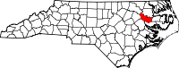
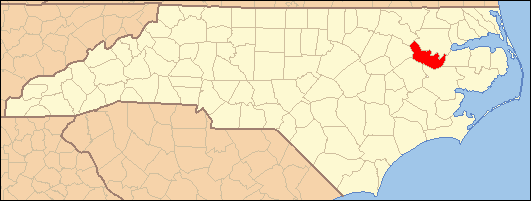
Location in the state of North Carolina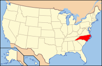
North Carolina's location in the U.S.Founded 1774 Seat Williamston Area
- Total
- Land
- Water
461 sq mi (1,194 km²)
461 sq mi (1,194 km²)
0 sq mi (0 km²), 0.07%Population
- (2000)
- Density
25,593
54/sq mi (21/km²)Website www.martincountyncgov.com Martin County is a county located in the U.S. state of North Carolina. As of 2000, the population was 25,593. Its county seat is Williamston[1].
Contents
History
The county was formed in 1774 from the southeastern part of Halifax County and the western part of Tyrrell County. It was named for Josiah Martin, the last royal governor of North Carolina (1771-1775). Whereas Dobbs County and Tryon County, named for Martin's predecessors Arthur Dobbs and William Tryon, were abolished after American independence, Martin County was neither abolished nor renamed, a fact which has been attributed to the popularity of Alexander Martin, twice governor of the state (1782-1784, 1789-1792).
Law and government
Martin County is a member of the Mid-East Commission regional council of governments.
Education
The primary and secondary public school functions are performed by Martin County Schools, a district covering the entire county. Martin Community College is located in Williamston.
Geography
The U.S. Census Bureau, reports the county's area is 461.49 square miles (1,195.3 km2), of which 0.32 square miles (0.83 km2) is water and 461.17 square miles (1,194.4 km2) land.[2]
Townships
The county is divided into ten townships: Bear Grass, Cross Roads, Goose Nest, Griffins, Hamilton, Jamesville, Poplar Point, Robersonville, Williams, and Williamston.
Adjacent counties
- Bertie County, North Carolina - northeast
- Washington County, North Carolina - east
- Beaufort County, North Carolina - southeast
- Pitt County, North Carolina - southwest
- Edgecombe County, North Carolina - west
- Halifax County, North Carolina - northwest

Halifax County Bertie County Edgecombe County 
Washington County  Martin County, North Carolina

Pitt County Beaufort County Politics
Martin County has tended to vote in line with the rest of the country in presidential elections. In 2008, Barack Obama won the county with 52.2% of the vote. This was very similar to his national figure of 52.91%.
Demographics
As of the census[3] of 2000, there were 25,593 people, 10,020 households, and 7,194 families residing in the county. The population density was 56 people per square mile (21/km²). There were 10,930 housing units at an average density of 24 per square mile (9/km²). The racial makeup of the county was 52.54% White, 45.37% Black or African American, 0.29% Native American, 0.24% Asian, 0.03% Pacific Islander, 0.90% from other races, and 0.63% from two or more races. 2.06% of the population were Hispanic or Latino of any race.
There were 10,020 households out of which 31.60% had children under the age of 18 living with them, 50.30% were married couples living together, 17.60% had a female householder with no husband present, and 28.20% were non-families. 25.70% of all households were made up of individuals and 11.90% had someone living alone who was 65 years of age or older. The average household size was 2.53 and the average family size was 3.02.
In the county the population was spread out with 25.50% under the age of 18, 7.50% from 18 to 24, 26.80% from 25 to 44, 25.00% from 45 to 64, and 15.20% who were 65 years of age or older. The median age was 39 years. For every 100 females there were 86.50 males. For every 100 females age 18 and over, there were 81.80 males.
The median income for a household in the county was $28,793, and the median income for a family was $35,428. Males had a median income of $29,818 versus $19,167 for females. The per capita income for the county was $15,102. About 16.30% of families and 20.20% of the population were below the poverty line, including 27.50% of those under age 18 and 25.70% of those age 65 or over.
Cities and towns
 Map of Martin County, North Carolina With Municipal and Township Labels
See also
Coordinates: 35°50′N 77°06′W / 35.84°N 77.10°W
References
- ^ "Find a County". National Association of Counties. http://www.naco.org/Counties/Pages/FindACounty.aspx. Retrieved 2011-06-07.
- ^ "Martin County, North Carolina by Census Tract - GCT-PH1. Population, Housing Units, Area, and Density: 2000". United States Census Bureau. http://factfinder.census.gov/servlet/GCTTable?_bm=y&-context=gct&-ds_name=DEC_2000_SF1_U&-mt_name=DEC_2000_SF1_U_GCTPH1_ST7&-tree_id=4001&-redoLog=true&-_caller=geoselect&-geo_id=05000US37117&-format=CO-1&-_lang=en. Retrieved 2011-02-22.
- ^ "American FactFinder". United States Census Bureau. http://factfinder.census.gov. Retrieved 2008-01-31.
Municipalities and communities of Martin County, North Carolina Towns Bear Grass | Everetts | Hamilton | Hassell | Jamesville | Oak City | Parmele | Robersonville | Williamston
 Categories:
- North Carolina counties
- Martin County, North Carolina
- States and territories established in 1774


Wikimedia Foundation. 2010.