- Carteret County, North Carolina
-
Coordinates: 34°44′N 76°46′W / 34.733°N 76.767°W
Carteret County, North Carolina 
Seal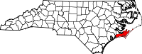
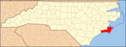
Location in the state of North Carolina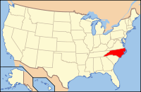
North Carolina's location in the U.S.1722 Seat Beaufort Area
- Total
- Land
- Water
1,341 sq mi (3,473 km²)
520 sq mi (1,347 km²)
821 sq mi (2,126 km²),Population
- (2010)
- Density
66,469
114/sq mi (44/km²)Time zone Eastern: UTC-5/-4 Website www.co.carteret.nc.us Carteret County is a county located in the U.S. state of North Carolina. As of 2010, the population was 66,469. Its county seat is Beaufort.[1] Most of the county is part of the Crystal Coast.
The county was named for Sir George Carteret, one of the 17th century English Lords Proprietor, or for his descendant and heir John Carteret, 2nd Earl Granville. Lord Carteret's family was the only one of the original eight who retained title to its "Granville District" (of North Carolina) right up to the time of the American Revolutionary War.
Contents
Origin of the Name
The Carterets are named after the village of Carteret in Lower Normandy. According to recent researchs, it could be of Scandinavian origin. The first element Carte- could represent Old Norse kart "place with pebbles or stones" and the second -ret, ON reidh "anchorage", "moorings".[2]
History
The first male of English parents born in the current area of North Carolina was John Fulford. He was born in 1629 in what is now Carteret County, North Carolina. He settled in this area and died in 1729. An article dated Sept. 18, 1893, in The New Bern Daily Journal, identified Fulford's grave in a cemetery outside Beaufort, NC, in an area called the Straits, “bricked up with English brick.” In 1971 a survey by the Carteret County Historical Society found such a grave in the Fulford Cemetery off Piper Lane in Gloucester. No signs of it remain today.[3]
Law and government
Carteret County is a member of the regional Eastern Carolina Council of Governments.
A voting machine malfunction in the county resulted in the loss of 4,438 ballots cast during early voting for the November 2, 2004 general election.[4] Since the number of lost ballots exceeded the lead held (by Steve Troxler over Britt Cobb) in the statewide race for agriculture commissioner, the State Board of Elections decided to hold a special election on January 11, 2005, open only to the 18,500 voters in the county who either failed to vote or whose votes were lost.[5][6] Both candidates filed legal challenges contesting the format of the new election.[7] On February 4, 2005, Cobb conceded the race.[8]
Military
Marine Corps Auxiliary Landing Field Bogue is located in the western section of Carteret County along Bouge Sound. It comprises an 875 acres (3.54 km2) landing field located on Bogue Sound that serves as the Marine Corps’ only East Coast site for Field Carrier Landing Practice (FCLP).[9]
Geography
According to the U.S. Census Bureau, the county has a total area of 1,341 square miles (3,473.2 km2), of which 520 square miles (1,346.8 km2) is land and 821 square miles (2,126.4 km2) (61.22%) is water.
Adjacent counties
- Craven County and Pamlico County (north)
- Hyde County (northeast)
- Onslow County (west-southwest)
- Jones County (west-northwest)

Jones County Craven County and Pamlico County Hyde County 
Atlantic Ocean  Carteret County, North Carolina

Onslow County Atlantic Ocean National protected areas
- Cape Lookout National Seashore
- Cedar Island National Wildlife Refuge
- Croatan National Forest (part)
Demographics
Historical Populations Census Pop. %± 1900 11,811 — 1910 13,776 16.6% 1920 15,384 11.7% 1930 16,900 9.9% 1940 18,284 8.2% 1950 23,059 26.1% 1960 30,940 34.2% 1970 31,603 2.1% 1980 41,092 30.0% 1990 52,556 27.9% 2000 59,383 13.0% 2010 66,469 11.9% As of the census[10] of 2000, there were 59,383 people, 25,204 households, and 17,365 families residing in the county. The population density was 114 people per square mile (44/km²). There were 40,947 housing units at an average density of 79 per square mile (30/km²). The racial makeup of the county was 90.28% White, 6.99% Black or African American, 0.54% Asian, 0.43% Native American, 0.06% Pacific Islander, 0.60% from other races, and 1.09% from two or more races. 1.74% of the population were Hispanic or Latino of any race.
There were 25,204 households out of which 26.50% had children under the age of 18 living with them, 56.00% were married couples living together, 9.60% had a female householder with no husband present, and 31.10% were non-families. 26.10% of all households were made up of individuals and 10.10% had someone living alone who was 65 years of age or older. The average household size was 2.31 and the average family size was 2.76.
In the county the population was spread out with 20.70% under the age of 18, 6.40% from 18 to 24, 27.20% from 25 to 44, 28.40% from 45 to 64, and 17.20% who were 65 years of age or older. The median age was 42 years. For every 100 females there were 96.50 males. For every 100 females age 18 and over, there were 94.10 males.
The median income for a household in Carteret County in 2009 was $49,711, and the median income for a family was $45,499. Males had a median income of $31,365 versus $22,126 for females. The per capita income for the county was $21,260. About 8.00% of families and 10.70% of the population were below the poverty line, including 15.40% of those under age 18 and 9.40% of those age 65 or over.
Cities and towns
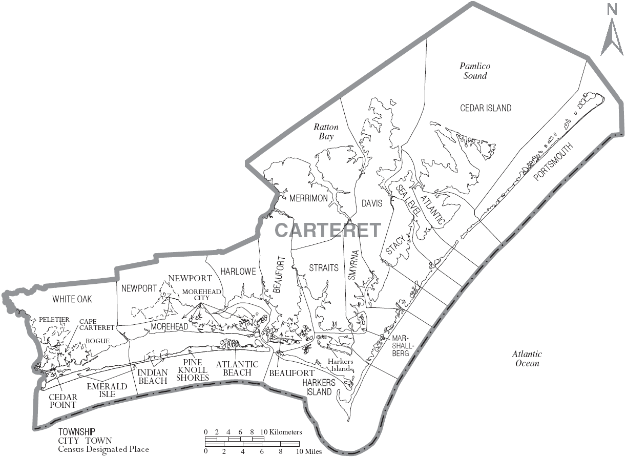
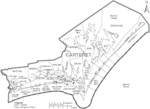 Map of Carteret County, North Carolina With Municipal and Township Labels
- Atlantic Beach
- Beaufort
- Bogue
- Cape Carteret
- Cedar Point
- Emerald Isle
- Indian Beach
- Morehead City
- Newport
- Peletier
- Pine Knoll Shores
Unincorporated communities
- Atlantic
- Bettie
- Broad Creek
- Cedar Island
- Davis
- Gales Creek
- Gloucester
- Harkers Island
- Harlowe
- Lola
- Marshallberg
- Merrimon
- Mill Creek
- North River
- Ocean
- Otway
- Salter Path
- Sea Gate
- Sea Level
- Stacy
- Stella
- Straits
- Smyrna
- Wildwood
- Williston
- Wiregrass
Education
The county is served by the Carteret County Public School System.
See also
References
- ^ "Find a County". National Association of Counties. http://www.naco.org/Counties/Pages/FindACounty.aspx. Retrieved 2011-06-07.
- ^ René Lepelley, Dictionnaire étymologique des noms de communes de Normandie, Caen, Presses Universitaires de Caen / Condé-sur-Noireau, Éditions Charles Corlet, 1993, p. 59a s.v. Barneville-Carteret.
- ^ North Carolina, Division of Archives and History, The Correspondence of William Tryon and Other Selected Papers, Volume II, 1768-1818, p. 549
- ^ "More than 4,500 North Carolina votes lost because of mistake in voting machine capacity". USA Today. 2004-11-05. http://www.usatoday.com/news/politicselections/vote2004/2004-11-04-votes-lost_x.htm. Retrieved 2008-10-23.
- ^ "E-voting Woes Force New Election in N.C. County". ComputerWorld. http://www.computerworld.com/s/article/98054/E_voting_Woes_Force_New_Election_in_N.C._County. Retrieved 2008-10-23.
- ^ "New Ag Commissioner Election To Be Held In Carteret County". WRAL-TV. http://www.wral.com/news/local/story/1090736/. Retrieved 2008-10-23.
- ^ "Lawyers For Both State Ag Candidates Head To Court Over Special Election". WRAL-TV. http://www.wral.com/news/local/story/114521/. Retrieved 2008-10-23.
- ^ "Cobb Concedes Ag Commissioner Race To Troxler". WRAL-TV. http://www.wral.com/news/local/story/115340/. Retrieved 2008-10-23.
- ^ "Marine Corps Auxiliary Landing Field Bogue". http://en.wikipedia.org/wiki/Marine_Corps_Auxiliary_Landing_Field_Bogue. Retrieved 2010-07-10.
- ^ "American FactFinder". United States Census Bureau. http://factfinder.census.gov. Retrieved 2008-01-31.
External links
- Carteret County online directory
- Official website
- Carteret County Historical Society
- Carteret County News-Times
- Carteret County Chamber of Commerce
- Carteret County Genealogy
Municipalities and communities of Carteret County, North Carolina Towns Atlantic Beach | Beaufort | Bogue | Cape Carteret | Cedar Point | Emerald Isle | Indian Beach | Morehead City | Newport | Peletier | Pine Knoll Shores
CDP Unincorporated
communitiesAtlantic | Cedar Island | Merrimon | Otway | Salter Path | Sea Level | Stella
Ghost towns The Outer Banks of North Carolina Landforms Places Currituck County · Dare County · Hyde County · Carteret County
Carova Beach · Corolla · Duck · Southern Shores · Kitty Hawk · Kill Devil Hills · Nags Head · Manteo · Wanchese · Rodanthe · Waves · Salvo · Avon · Buxton · Frisco · Hatteras · Ocracoke · PortsmouthWaterways Lighthouses Protected areas Transportation History Places Carteret County · Onslow County
Beaufort · Morehead City · Atlantic Beach · Pine Knoll Shores · Salter Path · Indian Beach · Emerald Isle · Cape Carteret · Cedar Point · SwansboroWaterways Protected areas Transportation Categories:- North Carolina counties
- Crystal Coast
- Carteret County, North Carolina


Wikimedia Foundation. 2010.