Otway, North Carolina

Otway, North Carolina

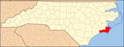
Otway is a small town located in Carteret County, North Carolina, United States. Currently Otway holds a population of 413 residents. It is currently the only city that is incorporated and is the most economical area of the region of Down East, North Carolina. The Governor of Otway is Republican Jeffery Davis. Currently the Governor's residence is in the heart of the town on Crow Hill Road.

Areas of interest

Dollar General, Otway House Bed and Breakfast, Outer Island General Store, Crow Hill Road, Chadwick Tire and Automotive, Wheatly Boys Tire and Automotive, The Down East Library, Snap Fitness, Down East Pharmacy,

Notable people

Jeffery Davis, Governor; Lynn T. Clark II, Lieutenant Governor and Liaison for Down East Judgment and Public Affairs; Otway Burns;

History

The town was incorporated in 2000[citation needed] and is named for notable privateer Otway Burns.

Coordinates: 34°46′33″N 76°33′29″W / 34.77583°N 76.55806°W / 34.77583; -76.55806


Wikimedia Foundation. 2010.

Игры ⚽ Поможем сделать НИР

Look at other dictionaries:

  • Swansboro, North Carolina — Infobox Settlement official name = Swansboro, North Carolina settlement type = Town nickname = motto = imagesize = image caption = image mapsize = 250x200px map caption = Location of Swansboro, North Carolina shown in North Carolina mapsize1 =… …   Wikipedia

  • Newport, North Carolina —   Town   Location of Newport, North Carolina …   Wikipedia

  • Burnsville, North Carolina — Infobox Settlement official name = Burnsville, North Carolina settlement type = Town nickname = motto = imagesize = image caption = The Yancey County Courthouse in Burnsville image mapsize = 250x200px map caption = Location of Burnsville, North… …   Wikipedia

  • Merrimon, North Carolina — Merrimon is an unincorporated community in Carteret County, North Carolina, United States, about 20 miles (32 km) away from Beaufort. It is home to the Jonaquins Landing and Sand Hills housing developments. There is a gas station and mini… …   Wikipedia

  • Carteret County, North Carolina — Coordinates: 34°44′N 76°46′W / 34.733°N 76.767°W / 34.733; 76.767 …   Wikipedia

  • Yancey County, North Carolina — Infobox U.S. County county = Yancey County state = North Carolina map size = 250 founded = 1833 seat = Burnsville | area total sq mi =313 area water sq mi =1 area percentage = 0.21% census yr = 2000 pop = 17774 density km2 =22 web =… …   Wikipedia

  • Harkers Island, North Carolina —   CDP   Location of Harkers Island, North Carolina …   Wikipedia

  • Morehead City, North Carolina —   City   Location of Morehead City, North Carolina …   Wikipedia

  • National Register of Historic Places listings in Carteret County, North Carolina — Map of all coordinates from Google Map of all coordinates from Bing …   Wikipedia

  • Down East (North Carolina) — In North Carolina, Down East historically refers to the group of communities east of Beaufort in Carteret County in the Coastal Plain region of the state. The residents of Down East Carteret County have referred to their group of communities by… …   Wikipedia

Share the article and excerpts

Direct link
Do a right-click on the link above
and select “Copy Link”