- Newport, North Carolina
-
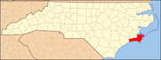
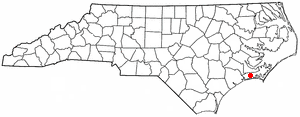
Newport, North Carolina — Town — Location of Newport, North Carolina
Coordinates: 34°47′16″N 76°52′00″W / 34.78778°N 76.8666667°W Country United States State North Carolina County Carteret Area – Total 7.4 sq mi (19.1 km2) – Land 7.3 sq mi (19.0 km2) – Water 0.0 sq mi (0.1 km2) Elevation 20 ft (6 m) Population (2008) – Total 4,298 – Density 456.0/sq mi (176.0/km2) Time zone Eastern (EST) (UTC-5) – Summer (DST) EDT (UTC-4) ZIP code 28570 Area code(s) 252 FIPS code 37-46860[1] GNIS feature ID 1013948[2] Website www.townofnewport.com Newport is a town in Carteret County, North Carolina, United States. The population was 3,349 at the 2000 census.
Contents
History
Newport was officially chartered in 1866. Although the crossroads community on the Newport River was known by that name decades earlier, the area was also known as Bell's Corner and Shepardsville in earlier years. It was the location of the Newport Barracks, a Union camp.
Early industry included agriculture, logging, and naval stores, including turpentine production. During the town's early history, the Newport River was navigable all the way to Old Topsail Inlet, now known as Beaufort Inlet, which opens to the Atlantic Ocean. The town was home to one of the earliest organized churches in Carteret County, the Newport River Primitive Baptist Church, established 1778. The structure was burned near the end of the American Civil War but soon rebuilt on Church Street and remains active today.
In 1858, the Atlantic and North Carolina Railroad was completed when the final 96-mile stretch of rail from Goldsboro through Newport to Beaufort was laid. The community is also the site of numerous Civil War battlefields, forts, and strategic locations. Newport was occupied by Union forces for much of the war.
Part of the town's residential area known as the "housing project" was originally developed as housing for civil service employees and military serving at nearby Marine Corps Air Station Cherry Point.
Newport today
The town government operates as a council-manager form of government with a mayor, a town manager, and a five-member town council. The mayor of Newport, Derryl Garner, has served since 1978 and is active with the North Carolina League of Municipalities, the Morehead City Ports Committee and numerous other civic and governmental organizations. David Heath, Frank Blunt,Ken Davis, Richard Kanuck and Jan Garber serve as town councilmen.
The town is protected by a volunteer fire department, founded in the 1940s by the late Leon Mann, Jr. The department also provides emergency medical and ambulance services.
Public schools in Newport include Newport Elementary School and Newport Middle School. Newport Consolidated School, a first-through-12th-grade school established in 1926, was demolished in 1966 after the county completed construction of a new consolidated high school, West Carteret High in nearby Morehead City. Members of the Newport Consolidated School Alumni Association operate a small school museum in a depot warehouse owned by the North Carolina Railroad in Newport.
Geography
Newport is located at 34°47′16″N 76°52′00″W / 34.787705°N 76.866585°WCoordinates: 34°47′16″N 76°52′00″W / 34.787705°N 76.866585°W (34.787705, -76.866585).[3]
According to the United States Census Bureau, the town has a total area of 7.4 square miles (19 km2), of which, 7.3 square miles (19 km2) of it is land and 0.04 square miles (0.10 km2) of it (0.27%) is water.
Demographics
As of the census[1] of 2000, there were 3,349 people, 1,136 households, and 831 families residing in the town. The population density was 456.0 people per square mile (175.9/km²). There were 1,232 housing units at an average density of 167.7 per square mile (64.7/km²). The racial makeup of the town was 83.13% White, 11.94% African American, 0.63% Native American, 1.28% Asian, 0.03% Pacific Islander, 1.43% from other races, and 1.55% from two or more races. Hispanic or Latino of any race were 3.70% of the population.
There were 1,136 households out of which 36.9% had children under the age of 18 living with them, 58.8% were married couples living together, 10.4% had a female householder with no husband present, and 26.8% were non-families. 23.2% of all households were made up of individuals, and 7.3% had someone living alone who was 65 years of age or older. The average household size was 2.58, and the average family size was 3.04.
In the town the population was spread out with 24.6% under the age of 18, 7.4% from 18 to 24, 32.5% from 25 to 44, 22.4% from 45 to 64, and 13.1% who were 65 years of age or older. The median age was 37 years. For every 100 females, there were 107.1 males. For every 100 females age 18 and over, there were 109.5 males.
The median income for a household in the town was $36,629, and the median income for a family was $43,147. Males had a median income of $30,408 versus $17,063 for females. The per capita income for the town was $14,260. About 6.6% of families and 10.0% of the population were below the poverty line, including 12.8% of those under age 18 and 10.6% of those age 65 or over.
References
- ^ a b "American FactFinder". United States Census Bureau. http://factfinder.census.gov. Retrieved 2008-01-31.
- ^ "US Board on Geographic Names". United States Geological Survey. 2007-10-25. http://geonames.usgs.gov. Retrieved 2008-01-31.
- ^ "US Gazetteer files: 2010, 2000, and 1990". United States Census Bureau. 2011-02-12. http://www.census.gov/geo/www/gazetteer/gazette.html. Retrieved 2011-04-23.
External links
Municipalities and communities of Carteret County, North Carolina Towns Atlantic Beach | Beaufort | Bogue | Cape Carteret | Cedar Point | Emerald Isle | Indian Beach | Morehead City | Newport | Peletier | Pine Knoll Shores
CDP Unincorporated
communitiesAtlantic | Cedar Island | Merrimon | Otway | Salter Path | Sea Level | Stella
Ghost towns Categories:- Populated places in Carteret County, North Carolina
- Towns in North Carolina
- Populated places established in 1778

Wikimedia Foundation. 2010.