- Oregon Inlet
-
Oregon Inlet is an inlet along North Carolina's Outer Banks. It joins the Pamlico Sound with the Atlantic Ocean and separates Bodie Island from Pea Island, which are connected by a 2.5 mile bridge that spans the inlet. As one of the few access points to the ocean along this stretch of coast, Oregon Inlet is a major departure point for charter fishing trips, with a nearby harbor serving as the base for many large boats that travel miles out towards the Gulf Stream almost every day. The area is also home to a U.S. Coast Guard station.
Contents
History
Oregon Inlet was formed when a hurricane lashed the Outer Banks in 1846, separating Bodie Island from Pea Island. One ship that rode out that storm in Pamlico Sound was named the Oregon. After the storm the crew members of this ship were the first to tell those on the mainland about the inlet's formation. Hence, it has been known as Oregon Inlet ever since.
Akin to many other inlets along the Outer Banks, Oregon Inlet moves southward due to drifting sands during tides and storms. It has moved south over two miles since 1846, averaging around 66 feet per year.
Coast Guard station
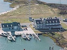 Oregon Inlet Coast Guard Station, built for $3.5 million in 1990, as it looks today
The Coast Guard station at Oregon Inlet is currently located at its fourth site since it began as a lifesaving station in 1883. It was one of 29 lifesaving stations Congress approved and appropriated funds for a decade earlier. By 1888, the Oregon Inlet Station had to be relocated to a new site. It is assumed that this relocation was necessary because of the shifting of the channel to the south and the encroachment of the ocean from the east. The station was decommissioned and moved to a new safer location some 400 feet westward toward the sound.
Less than a decade later a storm totally destroyed the Oregon Inlet Station. By 1897, a new station was under construction and was completed in 1898 for less than $7,000. As part of a modernization program in 1933-34, the Oregon Inlet Station was extensively modified to look very much like it does today. In 1979, a new extension was added. By 1988, the station was completely abandoned when the southward migration of the Oregon Inlet threatened to swallow it.[1]
In July 1990, a ceremonial ground breaking was held for a new $3.5 million building, located just behind the Oregon Inlet Fishing Center, on the north side of the inlet. The new station was designed with the traditional architectural design of older stations located on the Outer Banks in mind.
Herbert C. Bonner Bridge
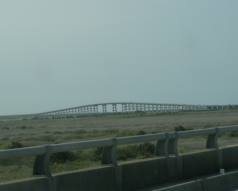
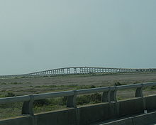 Oregon Inlet/Bonner Bridge
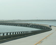 Oregon Inlet/Bonner Bridge
Oregon Inlet is spanned by North Carolina Route 12 over the Herbert C. Bonner Bridge, built in 1963. The environment’s impact on the bridge and road was not fully understood at the time of construction, and now constant beach erosion, severe weather and high volume of traffic continually forces the state to protect the integrity of the road system. As much as $50 million was spent between 1987 and 1999 to repair and protect the Bonner Bridge and NC 12 from the ocean.[2]
The bridge was only intended to last 30 years when it was built. It handles about 2 million cars per year and the state DOT ranks it a 2 on a scale of 1 to 100, with 100 being the safest.[3]
In October 1990, a dredge collided with the bridge during a storm, causing severe damage to several of the spans. While isolated, Hatteras Island could only be accessed by boat or plane for many weeks while emergency construction was underway to replace its only highway link to the mainland.[4]
Plans are in place for a replacement bridge over Oregon Inlet that connects with Pea Island and lies within the Cape Hatteras National Seashore. Once a final alignment is chosen, construction of the new bridge, which will be longer and curve farther inland, will begin. It will cost approximately $1.3 billion and should by completed by 2014, although it is likely to be later.[5][6]
References
- ^ "Oregon Inlet LSS". Uscg.mil. 2008-07-29. http://www.uscg.mil/D5/sectNorthCarolina/StaOregonInlet.asp. Retrieved 2010-03-26.
- ^ http://www.fws.gov/peaisland/images/bonnerbridgefactsheet62603.pdf
- ^ "Irene evacuations spread to Northeast - Weather - TODAY.com". Today.msnbc.msn.com. http://today.msnbc.msn.com/id/44270712/ns/today-weather/t/irene-evacuations-spread-north-injured-fla. Retrieved 2011-08-26.
- ^ "The Bonner Bridge at Oregon Inlet, damaged by a dredge: The Outer Banks of North Carolina - Dare County, Currituck County, and Hyde County [NC]". Outerbanks.com. http://www.outerbanks.com/oregoninlet/bridgedown.htm. Retrieved 2009-07-16.
- ^ "Agencies Agree On First Stage in Replacing Bonner Bridge". WRAL.com<!. 2007-08-27. http://www.wral.com/news/local/story/1748686. Retrieved 2009-07-16.
- ^ "NCDOT: Bonner Bridge". http://www.ncdot.org/projects/bonnerbridgerepairs/. Retrieved 2010-03-26.
External links
- Oregon Inlet Fishing Center
- Coast Guard Station Oregon Inlet
- Oregon Inlet & Waterways Commission
- NCDOT Outer Banks Task Force
- ReplacetheBridgeNow.com
Coordinates: 35°46′28.7″N 75°31′52.9″W / 35.774639°N 75.531361°W
The Outer Banks of North Carolina Landforms Places Currituck County · Dare County · Hyde County · Carteret County
Carova Beach · Corolla · Duck · Southern Shores · Kitty Hawk · Kill Devil Hills · Nags Head · Manteo · Wanchese · Rodanthe · Waves · Salvo · Avon · Buxton · Frisco · Hatteras · Ocracoke · PortsmouthWaterways Atlantic Ocean · Atlantic Intracoastal Waterway · Currituck Sound · Albemarle Sound · Croatan Sound · Roanoke Sound · Oregon Inlet · Pamlico Sound · Hatteras Inlet · Onslow Bay · Raleigh Bay · Ocracoke Inlet · Core Sound · Drum Inlet · Barden Inlet · Back Sound · New Inlet · Isabel InletLighthouses Protected areas Transportation History Categories:- Geography of Dare County, North Carolina
- Outer Banks


Wikimedia Foundation. 2010.