- Kitty Hawk, North Carolina
-
Kitty Hawk, North Carolina — Town — 
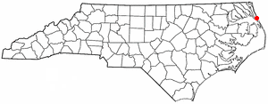
SealLocation of Kitty Hawk, North Carolina
Coordinates: 36°4′37″N 75°42′17″W / 36.07694°N 75.70472°WCoordinates: 36°4′37″N 75°42′17″W / 36.07694°N 75.70472°W Country United States State North Carolina County Dare Area – Total 8.23 sq mi (21.3 km2) – Land 8.18 sq mi (21.2 km2) – Water 0.05 sq mi (0.1 km2) Elevation 7 ft (2 m) Population (2000) – Total 3,000 – Density 365.8/sq mi (141.2/km2) Time zone Eastern (EST) (UTC-5) – Summer (DST) EDT (UTC-4) ZIP code 27949 Area code(s) 252 FIPS code 37-36060[1] GNIS feature ID 1021059[2] Website www.townofkittyhawk.org Kitty Hawk is a town in Dare County, North Carolina, United States. The population was 3,000 at the 2000 census. It was established in the early 18th century as Chickahawk.
Kitty Hawk became famous after the Wright brothers of Dayton, Ohio, selected a nearby site to make their first controlled powered airplane flights on December 17, 1903. The site of the flights is four miles (6 km) south of the town, near the sand dunes known as the Kill Devil Hills, a location the Wrights had used for practice with their gliders. Kitty Hawk is often mistakenly credited as the site of the powered flights. After the flights, the brothers walked back to Kitty Hawk, where they sent a telegram from the Weather Bureau office to their father informing him of their success.
The aircraft carrier USS Kitty Hawk (CV-63), the B-2 Spirit stealth bomber AV-19, the aircraft transport ship USS Kitty Hawk (AKV-1), and the Apollo 14 command module have been named for the town.
Contents
Geography
Kitty Hawk is located at 36.1°N 75.7°W.
According to the United States Census Bureau, the town has a total area of 8.23 square miles (21.3 km2). 8.18 square miles (21.2 km2) of it is land and 0.0476 square miles (0.123 km2) of it (0.579%) is water.[3]
Demographics
As of the census[1] of 2000, there were 2,991 people, 1,265 households, and 866 families residing in the town. The population density was 365.8 people per square mile (141.2/km²). There were 2,618 housing units at an average density of 320.1 per square mile (123.6/km²). The racial makeup of the town was 98.13% White, 0.64% African American, 0.23% Native American, 0.27% Asian, 0.03% Pacific Islander, 0.20% from other races, and 0.50% from two or more races. 0.94% of the population were Hispanic or Latino of any race.
There were 1,265 households out of which 27.9% had children under the age of 18 living with them, 58.7% were married couples living together, 7.3% had a female householder with no husband present, and 31.5% were non-families. 23.8% of all tribes were made up of individuals and 8.0% had someone living alone who was 65 years of age or older. The average household size was 2.35 and the average family size was 2.79.
In the town the population was spread out with 21.5% under the age of 18, 5.7% from 18 to 24, 31.6% from 25 to 44, 28.3% from 45 to 64, and 13.0% who were 65 years of age or older. The median age was 41 years. For every 100 females there were 103.7 males. For every 100 females age 18 and over, there were 97.6 males.
The median income for a household in the town was $42,813, and the median income for a family was $48,676. Males had a median income of $31,250 versus $25,744 for females. The per capita income for the town was $22,960. About 4.3% of families and 6.5% of the population were below the poverty line, including 7.9% of those under age 18 and 4.6% of those age 65 or over.
Federally, Kitty Hawk is part of North Carolina's 3rd congressional district, represented by Republican Walt Jones, elected in 1994.
Sister city
- Coulaines,
 - (signed in 2005)
References
- ^ a b "American FactFinder". United States Census Bureau. http://factfinder.census.gov. Retrieved 2008-01-31.
- ^ "US Board on Geographic Names". United States Geological Survey. 2007-10-25. http://geonames.usgs.gov. Retrieved 2008-01-31.
- ^ Census 2000 Gazetteer Files: Places. Retrieved on 2009-05-18.
External links
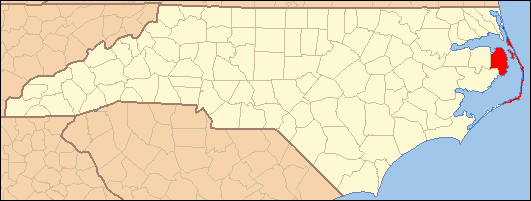
Municipalities and communities of Dare County, North Carolina Towns Duck | Kill Devil Hills | Kitty Hawk | Manteo | Nags Head | Southern Shores
Unincorporated
communitiesThe Outer Banks of North Carolina Landforms Places Currituck County · Dare County · Hyde County · Carteret County
Carova Beach · Corolla · Duck · Southern Shores · Kitty Hawk · Kill Devil Hills · Nags Head · Manteo · Wanchese · Rodanthe · Waves · Salvo · Avon · Buxton · Frisco · Hatteras · Ocracoke · PortsmouthWaterways Lighthouses Protected areas Transportation History Categories:- Populated places in Dare County, North Carolina
- Towns in North Carolina
- Beaches of North Carolina
- Outer Banks
- Coulaines,
Wikimedia Foundation. 2010.