- Bodie Island
-
Bodie Island (traditionally pronounced "body" but "bo-dee" by many non-residents) is a long, narrow barrier peninsula that forms the northernmost portion of the Outer Banks of North Carolina. The land that is most commonly referred to as Bodie Island was at one time a true island, however the inlet separating it from the Currituck Banks peninsula in the north closed. As a result, the Currituck Banks and Bodie Island are now one contiguous peninsula, joined together at the Nags Head area, where the inlet once flowed. Today, either name can be used to refer to peninsula as a whole, but both portions colloquially retain their historical names.
From the southern tip at Oregon Inlet, the peninsula stretches largely northwest out of North Carolina and into Virginia Beach, Virginia to join the mainland at Sandbridge near the north shore of Back Bay. The entire peninsula is approximately 72 miles in length, following the shoreline.
Contents
Places of interest
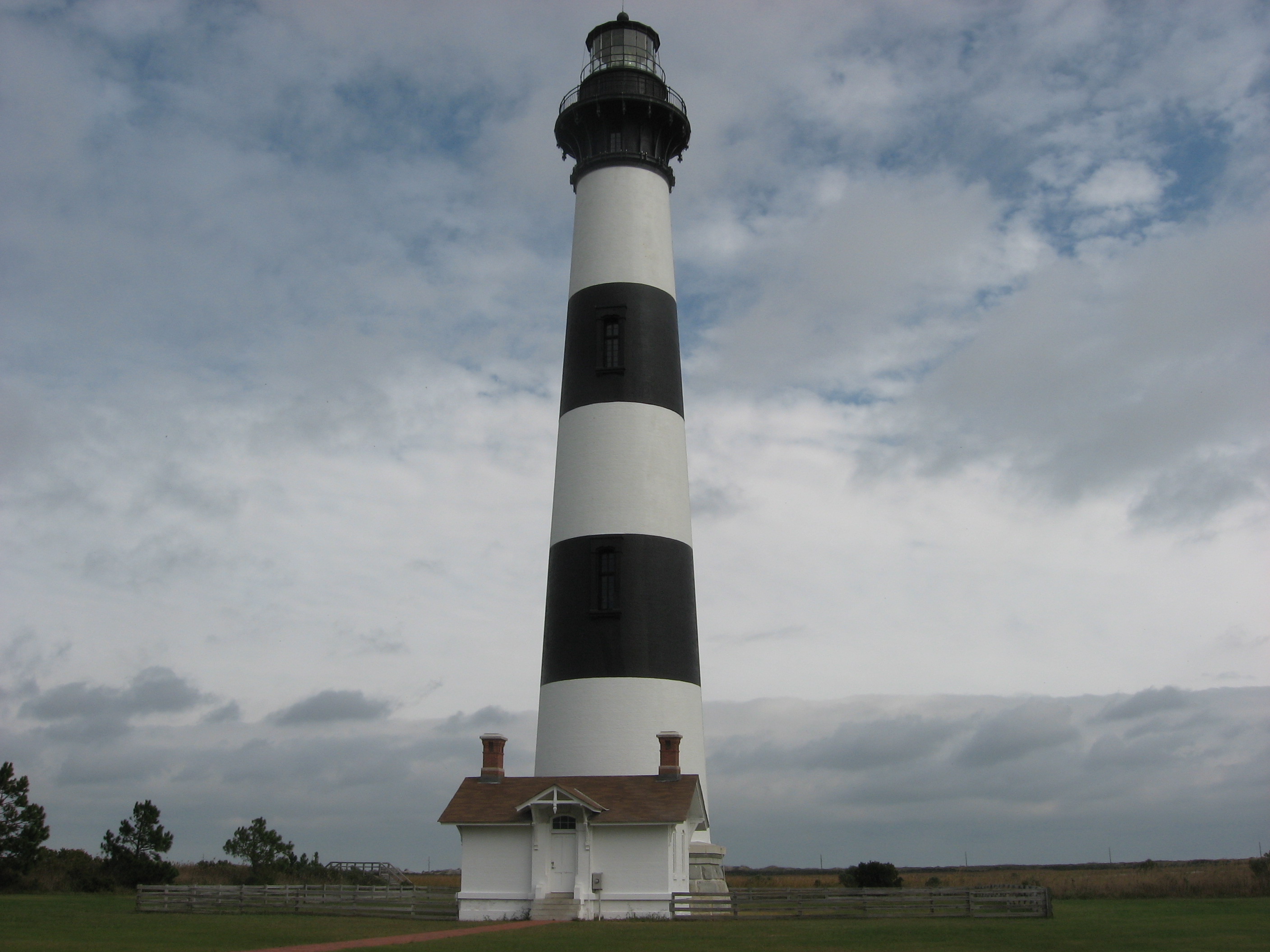
The peninsula is home to two lighthouses, Bodie Island Light and Currituck Beach Light. The Wright Brothers National Monument also has a beacon and is found on the peninsula. Jockey's Ridge, the tallest sand dune on the East Coast, is found on the peninsula. The Cape Hatteras National Seashore protects the southernmost part of Bodie Island, and Back Bay National Wildlife Refuge and False Cape State Park protect portions of the Virginia part of the peninsula.
History
Bodie Island was originally known as Bodies Island or Body's Island since the area was originally settled by the Body family. Folklore, however, attributes the naming of the island to the dead "bodies" of the ships that ran aground and sunk off the Outer Banks in what is now known as the Graveyard of the Atlantic.
Inlets frequently open and close along the Outer Banks, making landform naming inconsistent. Bodie Island, when it was an island, extended more south than it does today. The island was originally formed around 1738, when New Inlet opened, separating Bodie Island from Hatteras Island to the south. The opening of Oregon Inlet in 1846 truncated the southern portion of Bodie Island, forming a new island situated between Bodie and Hatteras. The new barrier island was given the name Pea Island, but the wider, more powerful Oregon Inlet led to the eventual closure of New Inlet around 1933. Pea Island had thus become a part of Hatteras Island.
Near the North Carolina-Virginia state line, the Currituck Inlet once existed, which made the Currituck Banks an island of its own. This inlet served as the boundary between the two states in the early 18th century. [1]
In the book A New Voyage to Carolina John Lawson (explorer) mentions Bodies Island just once when discussing fauna of North Carolina, in particular species of rabbits. He wrote the following: "I was told of several that were upon Bodies Island by Ronoak, which came from that Ship of Bodies;" This would indicate that Bodie Island was so named as early as 1709.
Localities
The following is a list of places found on the peninsula, listed from south to north.
- Nags Head, North Carolina
- Kill Devil Hills, North Carolina
- Kitty Hawk, North Carolina
- Southern Shores, North Carolina
- Duck, North Carolina
- Corolla, North Carolina
- Carova Beach, North Carolina
- Sandbridge, Virginia
References
A New Voyage to Carolina, 1709. John Lawson. [3]
The Outer Banks of North Carolina Landforms Bodie Island · Roanoke Island · Pea Island · Little Hatteras Island · Hatteras Island · Cape Hatteras · Ocracoke Island · Portsmouth Island · Core Banks · Cape LookoutPlaces Currituck County · Dare County · Hyde County · Carteret County
Carova Beach · Corolla · Duck · Southern Shores · Kitty Hawk · Kill Devil Hills · Nags Head · Manteo · Wanchese · Rodanthe · Waves · Salvo · Avon · Buxton · Frisco · Hatteras · Ocracoke · PortsmouthWaterways Lighthouses Protected areas Transportation History Categories:- Geography of Dare County, North Carolina
- Outer Banks
- Former islands of the United States
Wikimedia Foundation. 2010.