- Bodie, California
-
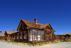
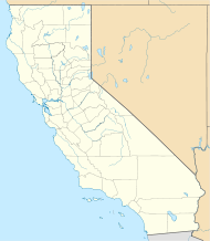
Bodie — Ghost town — Location in California Coordinates: 38°12′44″N 119°00′44″W / 38.21222°N 119.01222°WCoordinates: 38°12′44″N 119°00′44″W / 38.21222°N 119.01222°W Country United States State California County Mono Founded 1876 Government – None Elevation[1] 8,379 ft (2,554 m) Population (1962) – Total 3 Time zone PST (UTC-8) – Summer (DST) PDT (UTC-7) ZIP code 93517 Area code(s) 760 Website Bodie State Historic Park Bodie Historic DistrictBodie, California, as seen from the hill, looking toward the cemeteryLocation: California Nearest city: Bridgeport, California Architectural style: Various; Southwestern U.S. frontier-style, late-19th to early-20th century. Governing body: State NRHP Reference#: 66000213 CHL #: 341 Significant dates Added to NRHP: October 15, 1966[2] Designated NHLD: July 4, 1961[3] Bodie is a ghost town in the Bodie Hills east of the Sierra Nevada mountain range in Mono County, California, United States, about 75 miles (120 km) southeast of Lake Tahoe. It is located 12 miles (19 km) east-southeast of Bridgeport,[4] at an elevation of 8379 feet (2554 m).[1] As Bodie Historic District, the U.S. Department of the Interior recognizes it as a National Historic Landmark. The ghost town has been administered by California State Parks since becoming a state historic park in 1962, and receives about 200,000 visitors yearly.[5]
Contents
History
Discovery of gold
Bodie began as a mining camp of little note following the discovery of gold in 1859 by a group of prospectors, including W.S. Bodey (first name uncertain).[4][6][7] Bodey perished in a blizzard the following November while making a supply trip to Monoville (near present day Mono City, California), never getting to see the rise of the town that was named after him.[6] According to area pioneer, Judge J.G. McClinton, the district's name was changed from "Bodey," "Body," and a few other phonetic variations, to "Bodie," after a painter in the nearby boomtown of Aurora lettered a sign "Bodie Stables"[8][9] Gold discovered at Bodie coincided with the discovery of silver at nearby Aurora, Nevada, and the distant Comstock Lode beneath Virginia City, Nevada. But while these two towns boomed, interest in Bodie remained lackluster. By 1868 only two companies had built stamp mills at Bodie, and both had failed.[6]
Boom
In 1876, the Standard Company discovered a profitable deposit of gold-bearing ore, which transformed Bodie from an isolated mining camp comprising a few prospectors and company employees to a Wild West boomtown. Rich discoveries in the adjacent Bodie Mine during 1878 attracted even more hopeful people.[6] By 1879, Bodie had a population of approximately 5000–7000 people[10][11] and around 2,000 buildings. One idea maintains that in 1880, Bodie was California's second or third largest city,[12] but the U.S. Census of that year disproves the popular tale.[13] Over the years, Bodie's mines produced gold valued at nearly US$34 million.[14]
Bodie boomed from late 1877 through mid- to late 1880.[15] The first newspaper, The Standard Pioneer Journal of Mono County, published its first edition on October 10, 1877. It started out as a weekly, but soon became a thrice-weekly paper.[16] It was also during this time that a telegraph line was built which connected Bodie with Bridgeport and Genoa, Nevada.[16] California and Nevada newspapers predicted Bodie would become the next Comstock Lode.[17][18][19] Men from both states were lured to Bodie by the prospect of another bonanza.[20]
Gold bullion from the town's nine stamp mills was shipped to Carson City, Nevada, by way of Aurora, Wellington and Gardnerville. Most shipments were accompanied by armed guards. After the bullion reached Carson City, it was delivered to the mint there, or sent by rail to the mint in San Francisco.
Geography of the boomtown
As a bustling gold mining center, Bodie had the amenities of larger towns, including two banks, four volunteer fire companies, a brass band, a railroad, miners' and mechanics' unions, several daily newspapers, and a jail. At its peak, 65 saloons lined Main Street, which was a mile long. Murders, shootouts, barroom brawls, and stagecoach holdups were regular occurrences.[21]
As with other remote mining towns, Bodie had a popular, though clandestinely important, red light district on the north end of town. From this is told the unsubstantiated story of Rosa May, a prostitute who, in the style of Florence Nightingale, came to the aid of the town menfolk when a serious epidemic struck the town at the height of its boom. She is credited with giving life-saving care to many, but was buried outside the cemetery fence.[22]
Bodie had a Chinatown, the main street of which ran at a right angle to Bodie's Main Street,[16] with several hundred Chinese residents at one point, and included a Taoist temple. Opium dens were plentiful in this area.[16]
Bodie also had a cemetery on the outskirts of town and a nearby mortuary, which is the only building in the town built of red brick three courses thick, most likely for insulation to keep the air temperature steady during the cold winters and hot summers. The cemetery was Miners Union Cemetery, and includes a cenotaph to President James A. Garfield.[23]
On Main Street stands the Miners Union Hall, which was the meeting place for labor unions and an entertainment center that hosted dances, concerts, plays, and school recitals. It now serves as a museum.
Mining town
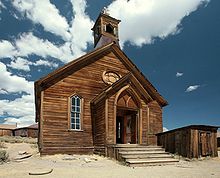
The first signs of decline appeared in 1880 and became obvious towards the end of the year. Promising mining booms in Butte, Montana; Tombstone, Arizona; and Utah lured men away from Bodie.[15] The get-rich quick, single miners who originally came to the town in the 1870s moved on to these other booms, which eventually turned Bodie into a family-oriented community. Two examples of this settling were the construction of the Methodist Church (which currently stands) and the Roman Catholic Church (burned about 1930) that were both constructed in 1882. Despite the population decline, the mines were flourishing, and in 1881 Bodie's ore production was recorded at a high of $3.1 million.[14] Also in 1881, a narrow gauge railroad was built called the Bodie Railway & Lumber Company, bringing lumber, cordwood, and mine timbers to the mining district from Mono Mills south of Mono Lake.
During the early 1890s, Bodie enjoyed a short revival seen in technological advancements in the mines that continued to support the town. In 1890, the recently invented cyanide process promised to recover gold and silver from discarded mill tailings and from low-grade ore bodies that had been passed over. In 1893, the Standard Company built its own hydroelectric plant, located approximately 12.5 miles (20.1 km) away on Green Creek, above Bridgeport, California. The plant developed a maximum of 130 horsepower (97 kW) and 6,600 volts alternating current (AC) to power the company's 20-stamp mill. This pioneering installation is marked as one of the country's first transmissions of electricity over a long distance.[24]
In 1910, the population was recorded at 698 people, which were predominantly families that decided to stay in Bodie instead of moving on to other prosperous strikes.
Decline
Historical populations Census Pop. %± 1880 2,712 — 1890 1,595 −41.2% 1900 965 −39.5% 1910 698 −27.7% 1920 110 −84.2% 1930 228 107.3% 1940 90 −60.5% Source:[25] The first signs of an official decline occurred in 1912 with the printing of the last Bodie newspaper, The Bodie Miner. In a 1913 book titled California tourist guide and handbook: authentic description of routes of travel and points of interest in California, the authors, Wells and Aubrey Drury described Bodie as a "mining town, which is the center of a large mineral region" and provided reference to two hotels and a railroad operating there.[26] In 1913, the Standard Consolidated Mine closed. Mining profits in 1914 were at a low of $6,821.[14] James S. Cain was buying up everything from the town lots to the mining claims, and reopened the Standard mill to former employees, which resulted in an over $100,000 profit in 1915.[6] However, this financial growth was not in time to stop the town's decline. In 1917, the Bodie Railway was abandoned and its iron tracks were scrapped. The last mine closed in 1942, due to War Production Board order L-208, shutting down all nonessential gold mines in the United States. Mining never resumed.[6][7][27]
The first label of Bodie as a "ghost town" was in 1915.[28] In a time when auto travel was on a rise, many were adventuring into Bodie via automobiles. The San Francisco Chronicle published an article in 1919 to dispute the "ghost town" label.[29] By 1920, Bodie's population was recorded by the US Federal Census at a total of 120 people. Despite the decline, Bodie had permanent residents through most of the 20th century, even after a fire ravaged much of the downtown business district in 1932. A post office operated at Bodie from 1877 to 1942.[4]
Ghost town and park
In the 1940s, the threat of vandalism faced the ghost town. The Cain family, who owned much of the land the town is situated upon, hired caretakers to protect and to maintain the town's structures.[30] Martin Gianettoni, one of the last three people in Bodie in 1943, was also a caretaker.[31]
Bodie is now an authentic Wild West ghost town.[5] The town was designated a National Historic Landmark in 1961,[3] and in 1962 it became Bodie State Historic Park. A total of 170 buildings remained.[30] Bodie has been named California's official state gold rush ghost town.[32]
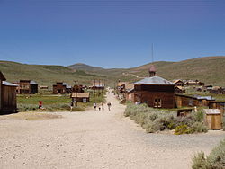
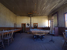
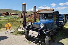
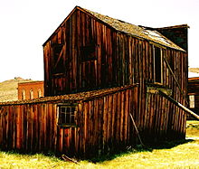
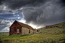
Today, Bodie is preserved in a state of arrested decay. Only a small part of the town survives. Visitors can walk the deserted streets of a town that once was a bustling area of activity. Interiors remain as they were left and stocked with goods. Bodie is open all year, but the long road that leads to the town is usually closed in the winter due to heavy snowfall, so the majority of visitors to the park come during the summer months.
The California State Parks' ranger station is located in one of the original homes on Green Street.
In 2009 and again in 2010, Bodie was scheduled to be closed, but the California state legislature was able to work out a budget compromise that enabled the state's Parks Closure Commission to allow it to remain open, at least during the 2009–2010 fiscal year. The park is still operating as of September 2011.[33]
Recently, squatters have begun to set up illegal residence in Bodie, defacing historic property and performing illegal activities there.[34]
Bodie is thought by people who believe in paranormal phenomena to be haunted by ghosts that have cursed the town.[35]
Climate
Summers in Bodie are hot, and in winter, temperatures often plummet well below 0 °F (−18 °C),[36] and winds can sweep across the valley at close to 100 miles per hour (160 km/h). Nights remain cold even through the summer, often dropping well below freezing. The harsh weather is due to a particular combination of high altitude (8,400 feet (2,600 m)) and a very exposed plateau, with little in the way of a natural surrounding wall to protect the long, flat piece of land from the elements. Plenty of firewood was needed to keep residents warm through the long winters. Bodie is not located in a forest, so lumber had to be imported from Bridgeport, California; Benton, California; Carson City, Nevada[22] and Mono Mills, California.[37] The winter of 1878–1879 was particularly harsh and claimed the lives of many residents.
National Weather Service records show that average January temperatures in Bodie are a maximum of 39.0°F and a minimum of 5.6°F. Average July temperatures are a maximum of 76.8°F and a minimum of 35.1°F. Only three months — June, July and August — have mean monthly temperatures above 50°F. There are an average of 0.1 days with highs of 90°F (32°C) or higher and an average of 303 days with lows of 32°F (0°C) or lower. The record high temperature of 91°F was on July 21, 1988. The record low temperature of −36°F was recorded on February 13, 1903.
Average annual precipitation is 12.80 inches, with September, the driest month, averaging 0.5 inches while January, the wettest month, receives 2.0 inches on average. As a result, Bodie earns the rare Dsc designation pursuant to the Köppen climate classification scheme. There are an average of 55 days with measurable precipitation. The wettest year was 1965 with 26.04 inches and the driest year was 2000 with 4.57 inches. The most precipitation in one month was 7.39 inches in January 1901. The most precipitation in 24 hours was 4.57 inches on February 12, 1895. Average annual snowfall is 97.4 inches. The snowiest year was 1965 with 269.0 inches. The most snow in one month was 97.1 inches in January 1969.[36]
Climate data for Bodie, California Month Jan Feb Mar Apr May Jun Jul Aug Sep Oct Nov Dec Year Record high °F (°C) 61
(16)63
(17)68
(20)75
(24)82
(28)90
(32)91
(33)89
(32)88
(31)83
(28)71
(22)64
(18)91
(33)Average high °F (°C) 39.0
(3.9)40.1
(4.5)43.0
(6.1)49.3
(9.6)59.6
(15.3)69.4
(20.8)76.9
(24.9)75.8
(24.3)69.0
(20.6)59.1
(15.1)47.4
(8.6)39.7
(4.3)55.7 Average low °F (°C) 5.6
(−14.7)7.5
(−13.6)11.7
(−11.3)17.8
(−7.9)24.7
(−4.1)30.8
(−0.7)35.2
(1.8)33.2
(0.7)26.7
(−2.9)19.5
(−6.9)13.0
(−10.6)6.7
(−14.1)23.3 Record low °F (°C) −27
(−33)−36
(−38)−22
(−30)−16
(−27)−13
(−25)6
(−14)12
(−11)12
(−11)1
(−17)−10
(−23)−25
(−32)−31
(−35)−36
(−38)Precipitation inches (mm) 2.0
(51)1.7
(43)1.4
(36)1.0
(25)0.7
(18)0.7
(18)0.8
(20)0.6
(15)0.5
(13)0.6
(15)1.2
(30)1.6
(41)12.8
(325)Snowfall inches (cm) 20.5
(52.1)16.2
(41.1)15.0
(38.1)7.7
(19.6)3.7
(9.4)1.2
(3)0.0
(0)0.1
(0.3)1.0
(2.5)3.1
(7.9)9.8
(24.9)17.7
(45)96
(244)Avg. precipitation days (≥ 0.01 in) 6 6 6 5 4 4 4 4 3 3 5 6 56 Source: Western Regional Climate Center[36] See also
Notes
- ^ a b "Bodie". Geographic Names Information System, U.S. Geological Survey. http://geonames.usgs.gov/pls/gnispublic/f?p=gnispq:3:::NO::P3_FID:1658094.
- ^ "National Register Information System". National Register of Historic Places. National Park Service. 2008-04-15. http://nrhp.focus.nps.gov/natreg/docs/All_Data.html.
- ^ a b "Bodie Historic District". National Historic Landmark summary listing. National Park Service. http://tps.cr.nps.gov/nhl/detail.cfm?ResourceId=118&ResourceType=District. Retrieved 2008-06-16.
- ^ a b c Durham, David L. (1998). California's Geographic Names: A Gazetteer of Historic and Modern Names of the State. Quill Driver Books. ISBN 9781884995149.
- ^ a b DeLyser, Dydia (December 1999). "Authenticity on the Ground: Engaging the Past in a California Ghost Town". Annals of the Association of American Geographers (Association of American Geographers) 89 (4): 602. doi:10.1111/0004-5608.00164.
- ^ a b c d e f Piatt, Michael H. (2003). Bodie: "The Mines Are Looking Well...". North Bay Books. ISBN 0972520058.
- ^ a b Quivik, Fredric L. (2003). "Gold and Tailings: The Standard Mill at Bodie, California". Journal of the Society of Industrial Archaeology 29.2. http://www.historycooperative.org/journals/sia/29.2/quivik.html.
- ^ McClinton, J.G, "Cold History Condensed." Daily Bodie Standard 29 October 1879.
- ^ Warren Loose. Bodie Bonanza: The True Story of a Flamboyant Past. (New York, NY: Exposition Press, 1971), p. 26-28
- ^ Jimenez, Corri Lyn (2000). Bodie, California: Understanding the Architecture and Built Environment of a Gold Mining Town. Master’s Thesis. University of Oregon.
- ^ Piatt, Michael H.. "What the Historic Record Reveals About Bodie’s Peak Population". http://www.bodiehistory.com/population.htm. Retrieved 2009-02-15.
- ^ "California State Park employment flyer". http://www.parks.ca.gov/pages/509/files/2006flyer.pdf.
- ^ "1880 California census". http://www2.census.gov/prod2/decennial/documents/1880a_v1-13.pdf.
- ^ a b c Chesterman, Charles W.; Roger H. Chapman, and Clifton H. Gray, Jr. (1986). Geology and Ore Deposits of the Bodie Mining District, Mono County, California. Sacramento: California Department of Conservation/Division of Mines and Geology. p. 32. Bulletin 206.
- ^ a b Smith, H.L. (1933). The Bodie Era: The Chronicles of the Last Old Time Mining Camp.. Sacramento: California State Library.
- ^ a b c d Cain, Ella M. (1956). "Development of the Mines". The Story of Bodie. San Francisco: Fearon Publishers. pp. 17–18, 24. ISBN 0548383987.
- ^ Sacramento Daily Union. January 15, 1879.
- ^ Daily Alta Californian. June 16, 1879.
- ^ Smith, Grant H. (1943). History of the Comstock Lode, 1850–1920. Reno: University of Nevada. pp. 191–200.
- ^ Virginia City Territorial Enterprise. January 24, 1878. "Bodie has taken from us some good men, and that is not good for us"
- ^ McGrath, Roger D. (1987). Gunfights, Highwaymen & Vigilantes: Violence on the Frontier. University of California Press.
- ^ a b Sprague, M. (2003). Bodie's gold: tall tales and true history from a California mining town. Reno: University of Nevada Press. ISBN 0874175119. OCLC 50803672.
- ^ "James A. Garfield (1831–1881)". Find A Grave Memorial. Findagrave.com. http://www.findagrave.com/cgi-bin/fg.cgi?page=gr&GSln=Garfield&GSfn=James&GSmn=A&GSbyrel=in&GSdyrel=in&GSob=n&GRid=5855808&. Retrieved 2010-03-04.
- ^ Leggett, Thomas H. (1894). "A twelve-mile transmission of power by electricity". Minutes of Proceedings of the Institution of Civil Engineers 118: 537.
- ^ Moffat, Riley (1996). Population History of Western U.S. Cities and Towns, 1850-1990. Lanham, Maryland: Scarecrow Press, Inc.. p. 21. ISBN 0810830337.
- ^ Drury, Wells; Aubrey Drury (1913). California tourist guide and handbook: authentic description of routes of travel and points of interest in California. Western guidebook company. p. 279. http://books.google.com/?id=yQtFAAAAIAAJ. Retrieved 2009-06-16.
- ^ Billeb, Emil W. (1968). Mining camp days: Bodie, Aurora, Bridgeport, Hawthorne, Tonopah, Lundy, Masonic, Benton, Thorne, Mono Mills, Mammoth, Sodaville, Goldfield. Berkeley, CA: Howell-North Books. OCLC 448758.
- ^ Van Loan, Charles (September 21, 1915). "Ghost cities of the West: Bad B-a-d Bodie". Saturday Evening Post 55: 18–19.
- ^ "Bodie Not Dead, Says Camp Representative". San Francisco Chronicle: 6. January 28, 1919.
- ^ a b Finnegan, Lora J. (September 1993). "Bodie: Even a ghost needs friends". Sunset 191 (3): 71.
- ^ Watson, James (2002). Big Bad Bodie. San Francisco: Robert D. Reed. p. 27. ISBN 1931741107.
- ^ CA Codes (gov:420-429.8)
- ^ "Helping to preserve Bodie State Historic Park". Bodie Foundation. http://www.bodiefoundation.org/. Retrieved 2010-03-04.
- ^ "Destruction of State Property". KenRockwell.com. http://kenrockwell.com/trips/2011-10-yosemite/20.htm. Retrieved 2011-10-26.
- ^ Ghost Towns: A Haunted Ghost Town With Real Ghosts!
- ^ a b c "Bodie, California – Climate Summary". Western Regional Climate Center. http://www.wrcc.dri.edu/cgi-bin/cliMAIN.pl?ca0943. Retrieved 2010-03-04.
- ^ Varney, Philip; Drew, John and Susan (2001). Ghost Towns of Northern California: Your Guide to Ghost Towns & Historic Mining Camps. Stillwater, Minnesota: Voyageur Press. p. 135. ISBN 0896584445.
References
- Calloway, R.A. (1979). Bodie State Historic Park: resource management plan, general development plan and environmental impact report. Sacramento: Calif. Dept. of Parks and Recreation. OCLC 21629664.
- Jackson, W.T. (1962). Historical material on the mining town of Bodie, California: a critical bibliography. Sacramento: California Division of Beaches and Parks. OCLC 58742626.
- Johnson, R.; Johnson, A (1967). The ghost town of Bodie, as reported in the newspapers of the day. Bishop, Calif: Printed and distributed by Chalfant Press for Sierra Media. OCLC 1592631.
- McDonald, D. (1988). Bodie, boom town-gold town: the last of California's old-time mining camps. Las Vegas, Nev: Nevada Publications. ISBN 0913814881. OCLC 21384472.
- Morse, T.I.; Joseph, L. (1990). Photographing Bodie: a photographer's guide to the ghost town of Bodie, California. Santa Barbara, Calif: Global Preservation Projects. OCLC 54961458.
- Piatt, Michael H. (2003). Bodie: "The Mines Are Looking Well...". El Sobrante, Calif: North Bay Books. ISBN 0972520058.
- Retailers Protective Association (1880). Delinquent list of Virginia City, Gold Hill, Carson and Reno Nevada, and Bodie, California. OCLC 28163028.
- Wedertz, F.S. (1969). Bodie, 1859–1900. Bishop, Calif: Chalfant Press. OCLC 27440.
External links
- Official Bodie State Historic Park website
- Bodie area maps and information
- Bodie Foundation – A non-profit organization
- National Park Service: A History of Chinese Americans in California: Bodie Chinese American Community
- The latest research on Bodie
- Learn about and tour Bodie online at Bodie.com
- Story of Bodie – Stereoscopic Video Project
- Bodie in 1865 and recent photographs
- Historical Population Line Graph Image #1
- Historical Population Line Graph Image #2
- Bodie Fan Community
Municipalities and communities of Mono County, California Town CDPs Aspen Springs | Benton | Bridgeport | Chalfant | Coleville | Crowley Lake | June Lake | Lee Vining | McGee Creek | Mono City | Paradise | Sunny Slopes | Swall Meadows | Topaz | Walker
Unincorporated
communitiesBelfort | Benton Crossing | Benton Hot Springs | Chinatown | Crestview | Fales Hot Springs | Hammil | June Lake Junction | Lake Mary | Lower Town | Mesa Camp | Montgomery City | North Landing | Oasis | Pizona | Sonora Junction | South Landing | Toms Place | Upper Town | Wheeler Crest | Whitmore Hot Springs | Willow Springs
Indian
reservationsBenton Paiute Reservation | Bridgeport Paiute Indian Colony
Former
settlementsBennettville | Bodie | Dog Town | Dunderberg Mill | Lundy | Masonic | Mill City | Mono Mills | Mono Village | Monoville | State Line
U.S. National Register of Historic Places Topics Lists by states Alabama • Alaska • Arizona • Arkansas • California • Colorado • Connecticut • Delaware • Florida • Georgia • Hawaii • Idaho • Illinois • Indiana • Iowa • Kansas • Kentucky • Louisiana • Maine • Maryland • Massachusetts • Michigan • Minnesota • Mississippi • Missouri • Montana • Nebraska • Nevada • New Hampshire • New Jersey • New Mexico • New York • North Carolina • North Dakota • Ohio • Oklahoma • Oregon • Pennsylvania • Rhode Island • South Carolina • South Dakota • Tennessee • Texas • Utah • Vermont • Virginia • Washington • West Virginia • Wisconsin • WyomingLists by territories Lists by associated states Other Protected areas of California National Park System National Parks National Preserves National Monuments Cabrillo · Devils Postpile · Lava Beds · Muir Woods · Pinnacles · World War II Valor in the Pacific National MonumentNational Seashores National Historical Parks National Historic Sites National Memorials Port Chicago Naval MagazineNational Recreation Areas National Forests National Forests Angeles · Cleveland · Eldorado · Inyo · Klamath · Lassen · Los Padres · Mendocino · Modoc · Plumas · San Bernardino · Sequoia · Shasta-Trinity · Sierra · Six Rivers · Stanislaus · TahoeNational Wilderness
Preservation SystemAgua Tibia · Ansel Adams · Bucks Lake · Caribou · Carson-Iceberg · Castle Crags · Cucamonga · Desolation · Dick Smith · Dinkey Lakes · Emigrant · Golden Trout · Hoover · Inyo Mountains · Ishi · Jennie Lakes · John Muir · Kaiser · Marble Mountain · Mokelumne · Mount Shasta Wilderness · North Fork · San Gabriel · Sanhedrin · San Jacinto · San Rafael · Sespe · Siskiyou · Snow Mountain · South Fork Eel River · South Sierra · South Warner · Thousand Lakes · Trinity Alps · Ventana · Yolla Bolly-Middle Eel · YukiOther State Forests Boggs Mountain Demonstration · Ellen Pickett · Jackson Demonstration · Las Posadas · LaTour Demonstration · Mount Zion · Mountain Home Demonstration · Soquel Demonstration
National Wildlife Refuges Antioch Dunes · Bitter Creek · Blue Ridge · Butte Sink · Castle Rock · Clear Lake · Coachella Valley · Colusa · Delevan · Don Edwards San Francisco Bay · Ellicott Slough · Farallon · Guadalupe-Nipomo Dunes · Hopper Mountain · Humboldt Bay · Kern · Lower Klamath · Marin Islands · Merced · Modoc · Pixley · Sacramento · Sacramento River · Salinas River · San Diego Bay · San Diego · San Joaquin River · San Luis · San Pablo Bay · Seal Beach · Sonny Bono Salton Sea · Stone Lakes · Sutter · Tijuana Slough · Tule LakeState Wildlife Areas Wildlife Areas Antelope Valley · Ash Creek · Bass Hill · Battle Creek · Big Lagoon · Big Sandy · Biscar · Butte Valley · Buttermilk Country · Cache Creek · Camp Cady · Cantara/Ney Springs · Cedar Roughs · Cinder Flats · Collins Eddy · Colusa Bypass · Coon Hollow · Cottonwood Creek · Crescent City Marsh · Crocker Meadows · Daugherty Hill · Decker Island · Doyle · Dutch Flat · Eastlker River · Eel River · Elk Creek Wetlands · Elk River · Fay Slough · Feather River · Fitzhugh Creek · Fremont Weir · Grass Lake · Gray Lodge · Green Creek · Grizzly Island · Hallelujah Junction · Heenan Lake · Hill Slough · Hollenbeck Canyon · Honey Lake · Hope Valley · Horseshoe Ranch · Imperial · Indian Valley · Kelso Peak and Old Dad Mountains · Kinsman Flat · Knoxville · Laguna · Lake Berryessa · Lake Earl · Lake Sonoma · Little Panoche Reservoir · Los Banos · Lower Sherman Island · Mad River Slough · Marble Mountains · Mendota · Merrill's Landing · Miner Slough · Monache Meadows · Morro Bay · Moss Landing · Mouth of Cottonwood Creek · Napa-Sonoma Marshes · North Grasslands · O'Neill Forebay · Oroville · Petaluma Marsh · Pickel Meadow · Pine Creek · Point Edith · Putah Creek · Rector Reservoir · Red Lake · Rhode Island · Sacramento River · San Felipe Valley · San Jacinto · San Luis Obispo · San Luis Reservoir · San Pablo Bay · Santa Rosa · Shasta Valley · Silver Creek · Slinkard/Little Antelope · Smithneck Creek · South Fork · Spenceville · Surprise Valley · Sutter Bypass · Tehama · Truckee River · Upper Butte Basin · Volta · Warner Valley · Waukell Creek · West Hilmar · Westlker River · White Slough · Willow Creek · Yolo BypassEcological Reserves Albany Mudflats · Alkali Sink · Allensworth · Atascadero Creek Marsh · Bair Island · Baldwin Lake · Batiquitos Lagoon · Blue Sky · Boden Canyon · Boggs Lake · Bolsa Chica · Bonny Doon · Buena Vista Lagoon · Butler Slough · Butte Creek Canyon · Butte Creek House · Buttonwillow · By Day Creek · Calhoun Cut · Canebrake · Carlsbad Highlands · Carmel Bay · Carrizo Canyon · Carrizo Plains · China Point · Clover Creek · Coachella Valley · Coal Canyon · Corte Madera Marsh · Crestridge · Dairy Mart Ponds · Dales Lake · Del Mar Landing · Eden Landing · Elkhorn Slough · Estelle Mountain · Fall River Mills · Fish Slough · Fremont Valley · Goleta Slough · Indian Joe Spring · Kaweah · Kerman · King Clone · Laguna Laurel · Loch Lomond Vernal Pool · Lokern · Magnesia Spring · Marin Islands · Mattole River · McGinty Mountain · Morro Dunes · Morro Rock · Napa River · North Table Mountain · Oasis Spring · Panoche Hills · Peytonia Slough · Pine Hill · Piute Creek · Pleasant Valley · Point Lobos · Rancho Jamul · Redwood Shores · River Springs Lakes · Saline Valley · San Dieguito Lagoon · San Elijo Lagoon · San Felipe Creek · San Joaquin River · Santa Rosa Plateau · Springville · Stone Corral · Sycamore Canyon · Sycuan Peak · Thomes Creek · Tomales Bay · Upper Newport Bay · Watsonville Slough · West Mojave Desert · Woodbridge · YaudanchiMarine Protected Areas Abalone Cove · Agua Hedionda Lagoon · Albany Mudflats · Anacapa · Anacapa · Año Nuevo · Asilomar · Atascadero Beach · Bair Island · Batiquitos Lagoon · Big Creek · Big Creek · Big Sycamore Canyon · Bodega · Bolsa Chica · Buena Vista Lagoon · Cambria · Cardiff and San Elijo · Carmel Bay · Carmel Pinnacles · Carrington Point · Catalina Marine Science Center · Corte Madera Marsh · Crystal Cove · Dana Point · Del Mar Landing · Doheny · Doheny · Duxbury Reef · Edward F. Ricketts · Elkhorn Slough · Elkhorn Slough · Encinitas · Estero de Limantour · Fagan Marsh · Farallon Islands · Farnsworth Bank · Fort Ross · Gerstle Cove · Goleta Slough · Greyhound Rock · Gull Island · Harris Point · Heisler Park · Hopkins · Irvine Coast · James V. Fitzgerald · Judith Rock · Julia Pfeiffer Burns · La Jolla · Laguna Beach · Lovers Cove (Catalina Island) · Lovers Point · MacKerricher · Manchester and Arena Rock · Marin Islands · Mia J. Tegner · Moro Cojo Slough · Morro Bay · Morro Bay · Morro Beach · Natural Bridges · Niguel · Pacific Grove Marine Gardens · Painted Cave · Peytonia Slough · Piedras Blancas · Piedras Blancas · Pismo · Pismo-Oceano Beach · Point Buchon · Point Buchon · Point Cabrillo · Point Fermin · Point Lobos · Point Reyes Headlands · Point Sur · Point Sur · Portuguese Ledge · Punta Gorda · Redwood Shores · Refugio · Richardson Rock · Robert E. Badham · Robert W. Crown · Russian Gulch · Russian River · Salt Point · San Diego-Scripps · San Dieguito Lagoon · San Elijo Lagoon · Santa Barbara Island · Scorpion · Skunk Point · Sonoma Coast · Soquel Canyon · South Laguna Beach · South Point · Tomales Bay · Upper Newport Bay · Van Damme · Vandenberg · White Rock (Cambria)National Landscape Conservation System National Monuments National Conservation Areas Wilderness Areas Argus Range · Big Maria Mountains · Bigelow Cholla Garden · Bighorn Mountain · Black Mountain · Bright Star · Bristol Mountains · Cadiz Dunes · Carrizo Gorge · Chemehuevi Mountains · Chimney Peak · Chuckwalla Mountains · Chumash · Cleghorn Lakes · Clipper Mountain · Coso Range · Coyote Mountains · Darwin Falls · Dead Mountains · Dick Smith · El Paso Mountains · Fish Creek Mountains · Funeral Mountains · Golden Valley · Grass Valley · Headwaters Forest Reserve · Hollow Hills · Ibex · Indian Pass · Inyo Mountains · Jacumba · Kelso Dunes · Kiavah · Kingston Range · Little Chuckwalla Mountains · Little Picacho · Machesna Mountain · Matilija · Malpais Mesa · Manly Peak · Mecca Hills · Mesquite · Newberry Mountains · Nopah Range · North Algodones Dunes · North Mesquite Mountains · Old Woman Mountains · Orocopia Mountains · Otay Mountain · Owens Peak · Pahrump Valley · Palen/McCoy · Palo Verde Mountains · Picacho Peak · Piper Mountain · Piute Mountains · Red Buttes · Resting Spring Range · Rice Valley · Riverside Mountains · Rodman Mountains · Sacatar Trail · Saddle Peak Hills · San Gorgonio · Santa Lucia · Santa Rosa · Sawtooth Mountains · Sespe · Sheephole Valley · South Nopah Range · Stateline · Stepladder Mountains · Surprise Canyon · Sylvania Mountains · Trilobite · Turtle Mountains · Whipple Mountains ·National Marine Sanctuaries National Estuarine Research Reserves Elkhorn Slough · San Francisco Bay · Tijuana River Estuary
University of California Natural Reserve System Año Nuevo Island · Bodega Marine · Box Springs · Boyd Deep Canyon Desert Research Center · Burns Piñon Ridge · Carpinteria Salt Marsh · Chickering American River · Coal Oil Point · Dawson Los Monos Canyon · Eagle Lake Field Station · Elliott Chaparral · Emerson Oaks · Fort Ord · Hastings · James San Jacinto Mountains · Jenny Pygmy Forest · Jepson Prairie · Kendall-Frost Mission Bay Marsh · Kenneth S. Norris Rancho Marino · Landels-Hill Big Creek · McLaughlin · Motte Rimrock · Quail Ridge · Sagehen Creek Field Station · San Joaquin Freshwater Marsh · Santa Cruz Island · Scripps Coastal · Sedgwick · Stebbins Cold Canyon · Steele Burnand Anza-Borrego · Stunt Ranch Santa Monica Mountains · Sweeney Granite Mountains Desert Research Center · Valentine Eastern Sierra · Younger LagoonHeritage registers: World Heritage Sites · World Network of Biosphere Reserves · National Register of Historic Places · National Historic Landmarks · National Natural Landmarks · California Historical Landmarks · California Points of Historical Interest · California Register of Historical Resources
Categories:- California State Historic Parks
- California Historical Landmarks
- Ghost towns in California
- Historic districts in California
- National Historic Landmarks in California
- Former settlements in Mono County, California
- Sierra Nevada (U.S.)
- California Gold Rush
- Symbols of California
- Populated places established in 1876
- Mining museums in California
- Open air museums in California
- Museums in Mono County, California
- History museums in California
- Parks in Mono County, California
- Protected areas established in 1962
Wikimedia Foundation. 2010.

