- Coleville, California
-
Coleville — census-designated place — Location in California
 Coleville
Coordinates: 38°33′59″N 119°30′26″W / 38.56639°N 119.50722°WCoordinates: 38°33′59″N 119°30′26″W / 38.56639°N 119.50722°W Country  United States
State  California
County Mono Area[1] – Total 13.757 sq mi (35.631 km2) – Land 13.757 sq mi (35.631 km2) – Water 0 sq mi (0 km2) 0% Elevation[2] 5,141 ft (1,567 m) Population (2010) – Total 495 – Density 36/sq mi (13.9/km2) Time zone Pacific (PST) (UTC-8) – Summer (DST) PDT (UTC-7) ZIP Code 96107 Area code(s) 760; 442 GNIS feature IDs 1655911; 2582978 U.S. Geological Survey Geographic Names Information System: Coleville, California; U.S. Geological Survey Geographic Names Information System: Coleville, California Coleville is a census-designated place[3] in Mono County, California.[2] It is located in the Antelope Valley on the West Walker River 26 miles (42 km) northwest of Bridgeport,[4] at an elevation of 5141 feet (1567 m).[2] The population was 495 at the 2010 census.
Coleville is located in northern Mono County. It is most notable for being General John Abizaid's hometown. Coleville is located on U.S. Route 395. The ZIP Code is 96107. The community is inside area code 760 and area code 442.
Contents
Geography
Coleville is one of the three northernmost communities in Mono County.[5] According to the Mono County government, Antelope Valley, including Coleville, is expected to see significant population growth.[5] It is named after California's first congressman, Cornelius Cole, who arrived with his brother during the gold-rush and established a lawfirm in San Francisco before entering into politics. He died, at the age of 102, in Los Angeles where he owned a large plantation that occupied the area that is now Hollywood.
According to the United States Census Bureau, the CDP covers an area of 13.8 square miles (35.6 km²), all of it land.
Fire Protection District
Coleville is served by the Antelope Valley Fire Protection District, founded in 1947 and covering 33 square miles (85 km2) of the Antelope Valley.[5] The District maintains a 12 acres (4.9 ha) training facility in Coleville.[5]
Water District
Coleville is served by the Antelope Valley Water District, which was formed in 1961.[6]
History
The first post office at Coleville was established in 1868.[4] The name honors Cornelius Cole, a United States Senator.[4] On June 1, 2007, the Larson fire threatened Coleville while burning 1,100 acres (4.5 km2) and causing $3,000,000 damage.[5]
Education
Coleville is in the Eastern Sierra Unified School District.[7] An elementary school and a high school (Coleville High School) are located in Coleville.[7]
Due to Coleville's geographic isolation from other California schools, Coleville High competes in the Nevada Interscholastic Activities Association along with four other similarly-isolated California schools.
Coleville also has a public library.[7]
Demographics
The 2010 United States Census[8] reported that Coleville had a population of 495. The population density was 36.0 people per square mile (13.9/km²). The racial makeup of Coleville was 386 (78.0%) White, 6 (1.2%) African American, 10 (2.0%) Native American, 8 (1.6%) Asian, 0 (0.0%) Pacific Islander, 62 (12.5%) from other races, and 23 (4.6%) from two or more races. Hispanic or Latino of any race were 110 persons (22.2%).
The Census reported that 495 people (100% of the population) lived in households, 0 (0%) lived in non-institutionalized group quarters, and 0 (0%) were institutionalized.
There were 171 households, out of which 90 (52.6%) had children under the age of 18 living in them, 129 (75.4%) were opposite-sex married couples living together, 8 (4.7%) had a female householder with no husband present, 4 (2.3%) had a male householder with no wife present. There were 6 (3.5%) unmarried opposite-sex partnerships, and 2 (1.2%) same-sex married couples or partnerships. 25 households (14.6%) were made up of individuals and 8 (4.7%) had someone living alone who was 65 years of age or older. The average household size was 2.89. There were 141 families (82.5% of all households); the average family size was 3.23.
The population was spread out with 167 people (33.7%) under the age of 18, 66 people (13.3%) aged 18 to 24, 170 people (34.3%) aged 25 to 44, 60 people (12.1%) aged 45 to 64, and 32 people (6.5%) who were 65 years of age or older. The median age was 25.7 years. For every 100 females there were 93.4 males. For every 100 females age 18 and over, there were 101.2 males.
There were 201 housing units at an average density of 14.6 per square mile (5.6/km²), of which 48 (28.1%) were owner-occupied, and 123 (71.9%) were occupied by renters. The homeowner vacancy rate was 2.0%; the rental vacancy rate was 4.7%. 107 people (21.6% of the population) lived in owner-occupied housing units and 388 people (78.4%) lived in rental housing units.
Politics
In the state legislature Coleville is located in the 1st Senate District, represented by Republican Ted Gaines, and in the 25th Assembly District, represented by Republican Kristin Olsen. Federally, Coleville is located in California's 25th congressional district, which has a Cook PVI of R +7[9] and is represented by Republican Buck McKeon.
See also
- Topaz Lake
- Topaz, California
- Walker, Mono County, California
References
- ^ U.S. Census
- ^ a b c U.S. Geological Survey Geographic Names Information System: Coleville, California
- ^ U.S. Geological Survey Geographic Names Information System: Coleville, California
- ^ a b c Durham, David L. (1998). California's Geographic Names: A Gazetteer of Historic and Modern Names of the State. Quill Driver Books. p. 1155. ISBN 9781884995149.
- ^ a b c d e Report of the Mono County Planning Department regarding the Antelope Valley Fire Protection District
- ^ Report of the Mono County Planning Department regarding the Antelope Valley Water District
- ^ a b c Mono County Office of Education
- ^ All data are derived from the United States Census Bureau reports from the 2010 United States Census, and are accessible on-line here. The data on unmarried partnerships and same-sex married couples are from the Census report DEC_10_SF1_PCT15. All other housing and population data are from Census report DEC_10_DP_DPDP1. Both reports are viewable online or downloadable in a zip file containing a comma-delimited data file. The area data, from which densities are calculated, are available on-line here. Percentage totals may not add to 100% due to rounding. The Census Bureau defines families as a household containing one or more people related to the householder by birth, opposite-sex marriage, or adoption. People living in group quarters are tabulated by the Census Bureau as neither owners nor renters. For further details, see the text files accompanying the data files containing the Census reports mentioned above.
- ^ "Will Gerrymandered Districts Stem the Wave of Voter Unrest?". Campaign Legal Center Blog. http://www.clcblog.org/blog_item-85.html. Retrieved 2007-10-20.
External links
Municipalities and communities of Mono County, California Town 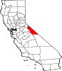
CDPs Aspen Springs | Benton | Bridgeport | Chalfant | Coleville | Crowley Lake | June Lake | Lee Vining | McGee Creek | Mono City | Paradise | Sunny Slopes | Swall Meadows | Topaz | Walker
Unincorporated
communitiesBelfort | Benton Crossing | Benton Hot Springs | Chinatown | Crestview | Fales Hot Springs | Hammil | June Lake Junction | Lake Mary | Lower Town | Mesa Camp | Montgomery City | North Landing | Oasis | Pizona | Sonora Junction | South Landing | Toms Place | Upper Town | Wheeler Crest | Whitmore Hot Springs | Willow Springs
Indian
reservationsBenton Paiute Reservation | Bridgeport Paiute Indian Colony
Former
settlementsBennettville | Bodie | Dog Town | Dunderberg Mill | Lundy | Masonic | Mill City | Mono Mills | Mono Village | Monoville | State Line
Categories:- Census-designated places in Mono County, California
- Unincorporated communities in California


Wikimedia Foundation. 2010.