- Crowley Lake, California
-
For the lake, see Crowley Lake.
Crowley Lake — census-designated place — Position in California.
 Crowley Lake
Coordinates: 37°34′22″N 118°47′28″W / 37.57278°N 118.79111°WCoordinates: 37°34′22″N 118°47′28″W / 37.57278°N 118.79111°W Country  United States
State  California
County Mono Area[1] - Total 2.822 sq mi (7.311 km2) - Land 2.807 sq mi (7.271 km2) - Water 0.015 sq mi (0.040 km2) 0.55% Elevation[2] 6,949 ft (2,118 m) Population (2010) - Total 875 - Density 310/sq mi (119.7/km2) Time zone Pacific (PST) (UTC-8) - Summer (DST) PDT (UTC-7) ZIP Code GNIS feature ID 2582987 U.S. Geological Survey Geographic Names Information System: Crowley Lake, California Crowley Lake is a census-designated place in Mono County, California. Crowley Lake sits at an elevation of 6,949 feet (2,118 m). The 2010 United States census reported Crowley Lake's population was 875.
Geography
According to the United States Census Bureau, the CDP covers an area of 2.8 square miles (7.3 km²), 99.45% of it land and 0.55% of it water.
Demographics
The 2010 United States Census[3] reported that Crowley Lake had a population of 875. The population density was 310.0 people per square mile (119.7/km²). The racial makeup of Crowley Lake was 769 (87.9%) White, 4 (0.5%) African American, 6 (0.7%) Native American, 11 (1.3%) Asian, 0 (0.0%) Pacific Islander, 60 (6.9%) from other races, and 25 (2.9%) from two or more races. Hispanic or Latino of any race were 128 persons (14.6%).
The Census reported that 871 people (99.5% of the population) lived in households, 4 (0.5%) lived in non-institutionalized group quarters, and 0 (0%) were institutionalized.
There were 367 households, out of which 122 (33.2%) had children under the age of 18 living in them, 211 (57.5%) were opposite-sex married couples living together, 24 (6.5%) had a female householder with no husband present, 16 (4.4%) had a male householder with no wife present. There were 17 (4.6%) unmarried opposite-sex partnerships, and 3 (0.8%) same-sex married couples or partnerships. 99 households (27.0%) were made up of individuals and 11 (3.0%) had someone living alone who was 65 years of age or older. The average household size was 2.37. There were 251 families (68.4% of all households); the average family size was 2.88.
The population was spread out with 210 people (24.0%) under the age of 18, 46 people (5.3%) aged 18 to 24, 180 people (20.6%) aged 25 to 44, 388 people (44.3%) aged 45 to 64, and 51 people (5.8%) who were 65 years of age or older. The median age was 45.1 years. For every 100 females there were 108.3 males. For every 100 females age 18 and over, there were 108.5 males.
There were 499 housing units at an average density of 176.8 per square mile (68.3/km²), of which 287 (78.2%) were owner-occupied, and 80 (21.8%) were occupied by renters. The homeowner vacancy rate was 3.0%; the rental vacancy rate was 12.0%. 737 people (84.2% of the population) lived in owner-occupied housing units and 134 people (15.3%) lived in rental housing units.
References
- ^ U.S. Census
- ^ 2582987 U.S. Geological Survey Geographic Names Information System: Crowley Lake, California
- ^ All data are derived from the United States Census Bureau reports from the 2010 United States Census, and are accessible on-line here. The data on unmarried partnerships and same-sex married couples are from the Census report DEC_10_SF1_PCT15. All other housing and population data are from Census report DEC_10_DP_DPDP1. Both reports are viewable online or downloadable in a zip file containing a comma-delimited data file. The area data, from which densities are calculated, are available on-line here. Percentage totals may not add to 100% due to rounding. The Census Bureau defines families as a household containing one or more people related to the householder by birth, opposite-sex marriage, or adoption. People living in group quarters are tabulated by the Census Bureau as neither owners nor renters. For further details, see the text files accompanying the data files containing the Census reports mentioned above.
Municipalities and communities of Mono County, California County seat: Bridgeport Town 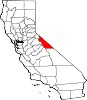
CDPs Aspen Springs | Benton | Bridgeport | Chalfant | Coleville | Crowley Lake | June Lake | Lee Vining | McGee Creek | Mono City | Paradise | Sunny Slopes | Swall Meadows | Topaz | Walker
Unincorporated
communitiesBelfort | Benton Crossing | Benton Hot Springs | Chinatown | Crestview | Fales Hot Springs | Hammil | June Lake Junction | Lake Mary | Lower Town | Mesa Camp | Montgomery City | North Landing | Oasis | Pizona | Sonora Junction | South Landing | Toms Place | Upper Town | Wheeler Crest | Whitmore Hot Springs | Willow Springs
Indian
reservationsBenton Paiute Reservation | Bridgeport Paiute Indian Colony
Former
settlementsBennettville | Bodie | Dog Town | Dunderberg Mill | Lundy | Masonic | Mill City | Mono Mills | Mono Village | Monoville | State Line
Categories:- Census-designated places in Mono County, California


Wikimedia Foundation. 2010.