- Needles, California
-
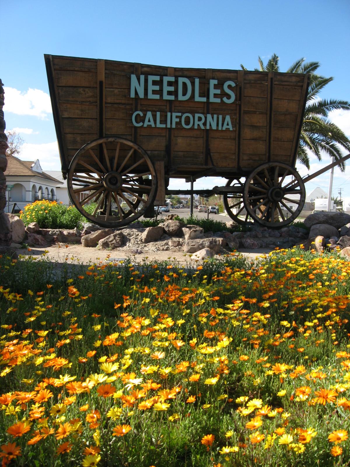
City of Needles — City — City sign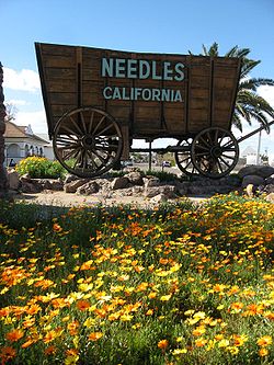 Location in San Bernardino County and the state of California
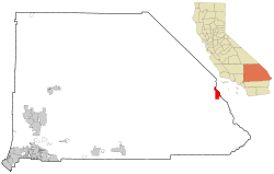
Coordinates: 34°50′18″N 114°36′40″W / 34.83833°N 114.61111°WCoordinates: 34°50′18″N 114°36′40″W / 34.83833°N 114.61111°W Country  United States
State  California
County San Bernardino Area[1] – Total 31.275 sq mi (81.002 km2) – Land 30.808 sq mi (79.793 km2) – Water 0.467 sq mi (1.209 km2) 1.49% Elevation 495 ft (151 m) Population (2010) – Total 4,844 – Density 154.9/sq mi (59.8/km2) Time zone PST (UTC-8) – Summer (DST) PDT (UTC-7) ZIP code 92363 Area code(s) 760 FIPS code 06-50734 GNIS feature ID 1652757 Needles (Mojave ʼAha Kuloh) is a city located in the Mojave Desert on the western banks of the Colorado River in San Bernardino County, California. It is located in the Mohave Valley, which straddles the California–Arizona border. The city is accessible via Interstate 40 and U.S. Route 95. The population was 4,844 at the 2010 census, up from 4,830 at the 2000 census.
Needles was named after "The Needles", a group of pointed rocks on the Arizona side of the river. The large Mohave Native American community, shares the nearby Fort Mojave Indian Reservation and the town. Needles is a gateway to the Mojave National Preserve.
Contents
History
"Ancient petroglyphs, pictographs, intaglios art, and old trails and stonework sites, bear witness to those who came from an earlier time." (Needles Chamber of Commerce)
The Mohave, one of the traditional Native American Colorado River Indian Tribes, are people that have been living in the Mojave Valley area for thousands of years prior to the European exploration of the area. In the Mohave language, they call themselves the 'Aha Makhav. Their name comes from two words: aha, meaning 'river', and makhav, meaning 'along or beside', and to them it means 'people who live along the river'.
The historic Mojave Road now goes through the Mojave National Preserve. Along it, in 1859, Fort Mojave was built to protect new pioneer immigrants to California and other travelers from the Mohave.[2] The city was founded in 1883 as a result of the construction of the Atchison, Topeka and Santa Fe Railway, which crosses the Colorado River at this point. The name is derived from pointed mountain peaks, the Needles, at the south end of the valley. The Railway and the Fred Harvey Company built the elegant Neoclassical and Beaux-Arts style El Garces Hotel and Santa Fe Station in 1908, was considered the "Crown Jewel" of the entire Fred Harvey chain. The landmark building is on the National Register of Historic Places and is being restored.
Needles was a major stop on the historic U.S. Route 66 highway from the 1920s through 1960s. For immigrants from the mid-west Dust Bowl in the 1930s it was the first town, marking arrival in California. The city is lined with motels and other shops from that era.
In 1949 the US Bureau of Reclamation began a mass project to dredge a new channel for the Colorado River that would straighten out a river bend that was causing massive silt problems since the Hoover Dam was completed.[3]
Needles is a tourism and recreation center, a tradition going back for decades. Needles is the eastern gateway to the Mojave National Preserve, a scenic desert National Park.
Climate
Needles, like Death Valley to the northwest, is known for extreme heat during the summers. Temperatures in Needles routinely reach 120 °F (49 °C) in late July and early August. The Needles weather station is frequently reported by the United State government's National Oceanic and Atmospheric Administration (NOAA) as the site of the highest daily temperature recorded in the U.S. during the hot desert summers. Needles occasionally sets national or world daily high temperature records.
The mean annual temperature for Needles, CA is 74.0 °F (23.3 °C).[4]
In January, the normal high temperatures range from 62 °F (17 °C) to 80 °F (27 °C) with corresponding lows of 40 °F (4 °C) to 58 °F (14 °C). In July, the normal high temperatures range from 106 °F (41 °C) to 122 °F (50 °C) with corresponding lows of 82 °F (28 °C) to 94 °F (34 °C). Annual rainfall is about 5.11 inches (130 mm).
On July 17, 2005, the high temperature at Needles was 125 °F (52 °C), the hottest temperature ever recorded in Needles since record keeping began in 1940, breaking the previous all-time record high of 123 °F (51 °C) four days earlier (which prior to that, broke the all-time high of 122 °F (50 °C) which was set on July 2, 1967).
On July 22, 2006, about one year later, Needles experienced a record high low temperature, with a temperature recorded to be 98 °F (37 °C) at 5 AM with a high temperature exceeding 120 °F (49 °C).
The record low temperature was 20°F on December 23, 1990.
There are normally 168.4 days with highs of 90°F (32°C) or higher and 4.9 days with lows of 32°F (0°C) or lower.
There are normally 23 days with measurable precipitation. The wettest year was 1965 with 9.50 inches and the driest year was 2006 with 0.70 inches. The most rainfall in one month was 4.72 inches in September 1976. The most rainfall in 24 hours was 2.55 inches on August 28, 1951. Although snowfall is very rare in Needles, 15.2 inches of snow fell in January 1949, including 12.2 inches on January 12, 1949.[4]
The city is also known for moderate to locally severe thunderstorms during the monsoon season as well as humid conditions.
Needles is served by the National Weather Service's NOAA Weather Radio operating on 162.50 MHz from the Las Vegas National Weather Service.
Climate data for Needles, CA Month Jan Feb Mar Apr May Jun Jul Aug Sep Oct Nov Dec Year Record high °F (°C) 85
(29)92
(33)99
(37)106
(41)115
(46)121
(49)125
(52)121
(49)120
(49)109
(43)92
(33)83
(28)125
(52)Average high °F (°C) 65.2
(18.4)71.2
(21.8)77.8
(25.4)86.0
(30.0)94.6
(34.8)104.8
(40.4)109.1
(42.8)107.1
(41.7)100.8
(38.2)88.8
(31.6)74.1
(23.4)65.0
(18.3)87.0 Average low °F (°C) 42.8
(6.0)46.2
(7.9)50.4
(10.2)56.9
(13.8)66.2
(19.0)75.8
(24.3)83.0
(28.3)81.6
(27.6)74.1
(23.4)61.7
(16.5)49.9
(9.9)43.0
(6.1)61.0 Record low °F (°C) 21
(−6)24
(−4)30
(−1)39
(4)44
(7)53
(12)57
(14)62
(17)52
(11)34
(1)30
(−1)20
(−7)13
(−11)Precipitation inches (mm) 0.74
(18.8)0.63
(16)0.65
(16.5)0.22
(5.6)0.11
(2.8)0.04
(1)0.32
(8.1)0.70
(17.8)0.60
(15.2)0.31
(7.9)0.35
(8.9)0.44
(11.2)5.11
(129.8)Source: http://www.wrcc.dri.edu/ Demographics
Historical populations Census Pop. %± 1920 2,807 — 1930 3,144 12.0% 1940 3,624 15.3% 1950 4,051 11.8% 1960 4,590 13.3% 1970 4,051 −11.7% 1980 4,120 1.7% 1990 5,191 26.0% 2000 4,830 −7.0% 2010 4,844 0.3% 2010
The 2010 United States Census[5] reported that Needles had a population of 4,844. The population density was 154.9 people per square mile (59.8/km²). The racial makeup of Needles was 3,669 (75.7%) White, 95 (2.0%) African American, 399 (8.2%) Native American, 35 (0.7%) Asian, 9 (0.2%) Pacific Islander, 323 (6.7%) from other races, and 314 (6.5%) from two or more races. Hispanic or Latino of any race were 1,083 persons (22.4%).
The Census reported that 4,839 people (99.9% of the population) lived in households, 5 (0.1%) lived in non-institutionalized group quarters, and 0 (0%) were institutionalized.
There were 1,918 households, out of which 650 (33.9%) had children under the age of 18 living in them, 712 (37.1%) were opposite-sex married couples living together, 331 (17.3%) had a female householder with no husband present, 159 (8.3%) had a male householder with no wife present. There were 186 (9.7%) unmarried opposite-sex partnerships, and 6 (0.3%) same-sex married couples or partnerships. 588 households (30.7%) were made up of individuals and 238 (12.4%) had someone living alone who was 65 years of age or older. The average household size was 2.52. There were 1,202 families (62.7% of all households); the average family size was 3.12.
The population was spread out with 1,283 people (26.5%) under the age of 18, 401 people (8.3%) aged 18 to 24, 1,038 people (21.4%) aged 25 to 44, 1,357 people (28.0%) aged 45 to 64, and 765 people (15.8%) who were 65 years of age or older. The median age was 39.3 years. For every 100 females there were 101.6 males. For every 100 females age 18 and over, there were 95.0 males.
There were 2,895 housing units at an average density of 92.6 per square mile (35.7/km²), of which 1,015 (52.9%) were owner-occupied, and 903 (47.1%) were occupied by renters. The homeowner vacancy rate was 4.9%; the rental vacancy rate was 17.2%. 2,578 people (53.2% of the population) lived in owner-occupied housing units and 2,261 people (46.7%) lived in rental housing units.
2000
As of the census[6] of 2000, there were 4,830 people, 1,940 households, and 1,268 families residing in the city. The estimated population in July 2006: 5,330 (+10.4% change).[7] The population density was 162.3 per square mile (62.6/km²). There were 2,551 housing units at an average density of 85.7 per square mile (33.1/km²). The racial makeup of the city was 77.9% White, 1.6% African American, 7.0% Native American, 1.4% Asian, 0.1% Pacific Islander, 6.4% from other races, and 5.6% from two or more races. Hispanic or Latino of any race were 18.4% of the population.
There were 1,940 households out of which 31.2% had children under the age of 18 living with them, 42.5% were married couples living together, 16.8% had a female householder with no husband present, and 34.6% were non-families. 29.0% of all households were made up of individuals and 13.1% had someone living alone who was 65 years of age or older. The average household size was 2.5 and the average family size was 3.0.
In the city the population was spread out with 27.6% under the age of 18, 7.5% from 18 to 24, 23.6% from 25 to 44, 25.6% from 45 to 64, and 15.7% who were 65 years of age or older. The median age was 39 years. For every 100 females there were 96.7 males. For every 100 females age 18 and over, there were 92.2 males.
The median income for a household in the city was $26,108, and the median income for a family was $33,264. Males had a median income of $39,688 versus $19,483 for females. The per capita income for the city was $15,156. About 21.2% of families and 26.1% of the population were below the poverty line, including 38.2% of those under age 18 and 11.3% of those age 65 or over.
Major employment in the city is supported by the BNSF Railway (formerly the Santa Fe Railroad). The depot has been a terminal (crew change point) for the railway since the late 19th century. The railroad company has been the city's main employment source for over a century.
According to the United States Census Bureau, the city has a total area of 30.2 square miles (78 km2). 29.8 square miles (77 km2) of it is land and 0.4 square miles (1.0 km2) of it (1.36%) is water.
The once smaller nearby communities of Bullhead City, Arizona, Lake Havasu City, Arizona, and Laughlin, Nevada have in recent years become larger communities than Needles.
Politics
In the state legislature Needles is located in the 18th Senate District, represented by Republican Roy Ashburn, and in the 34th Assembly District, represented by Republican Connie Conway. Federally, Needles is located in California's 41st congressional district, which has a Cook PVI of R +9[8] and is represented by Republican Jerry Lewis. The March 9, 2009 voter registration tally for the city is as follows:
- American Independent: 104
- Democratic: 907
- Libertarian: 8
- Non Partisan: 430
- Peace and Freedom: 9
- Republican: 624
- City Total: 2,082[9]
LINDA KIDD: In December 2010 Needles residents recently elected political newcomer and long-time Needles resident, Linda Kidd to its 5-member city council
In 2008, claiming the county had been unwilling to help keep the city's troubled hospital open as a full-service medical facility, the city considered seceding from California and becoming part of neighboring Nevada, only a few miles away. The options of attaching itself to the state of Arizona or even forming a new county were also considered.[1] The proposal needs approval from the United States Congress, both states, and the populace of the town.
Transportation
Interstate 40 is the major highway through Needles, connecting Barstow to the west and Arizona to the east. U.S. Route 95 also enters the city from the east as a concurrency with I-40, then splits with the Interstate west of the city, and heads north to Nevada. The Colorado River Bridge crosses the Colorado River, connecting Needles directly with Mohave County, Arizona, and Arizona State Route 95.
Amtrak, the national passenger rail system, provides daily service to Needles station, operating its Southwest Chief between Chicago and Los Angeles that arrives between midnight to 2am.
Local Transit service to the Needles area is provided by Needles Area Transit.[10]
Medical services
Needles is home to a full-service hospital with a 24-hour emergency room.[11] Nearby is the much larger Valley View Medical Center, which houses a large obstetrics ward, pediatric unit, emergency room, outpatient therapy, intensive care unit, telemetry, and surgical unit.
Fire services
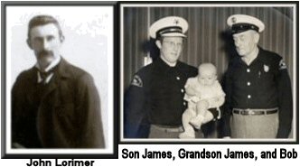
 John Lorimer was the first mayor of Needles. John's son Robert Burns Lorimer established the first Volunteer fire department.
Needles is served under contract with the San Bernardino County Fire Department.[12] Fire Station 31 serves as the administrative offices for fire protection to the City of Needles and houses three Type I Engine companies and one Water Tender. The station is staffed with one paid officer augmented by limited-term firefighters and paid-call firefighters living in the community.
Schools
Needles' elementary schools and Needles High School are part of the Needles Unified School District. The school district is one of the largest in the United States in terms of area with almost 6,000 square miles (16,000 km2) in its boundaries. The district runs from Amboy to Needles, and south to Parker Dam. It has 1,158 students enrolled.[13] The local Needles schools include Katie Hohstadt Elementary School, formerly called 'D' Street School (Grades 1–2), Vista Colorado Elementary School (Grades K–5), Needles Middle School (Grades 6–8), Needles High School (Grades 9–12), and the Educational Training Center (Grades 9–12). Needles High School, due to its distance from other California schools, is a member of the Nevada Interscholastic Activities Association, along with four other similarly placed California schools: Truckee, North Tahoe, South Tahoe, and Coleville.
Needles also has two private schools: the Needles Assembly of God Christian School and the Needles Seventh-day Adventist School.
Popular culture references
Movies
- Movies/shows using locations in Needles:[14]
- The Grapes of Wrath (1940)
- Route 66 (1960) "The Strengthening Angels" TV Episode
- Two-Lane Blacktop (1971)
- Convoy (1978)
- Evicted (2000)
- The Amazing Race (2001) TV Series
- Domino (2005)
- Criminal Xing (2007)
- Into the Wild (2007)
Books
- In John Steinbeck's novel The Grapes of Wrath, the Joad family stops in Needles when they enter California on Route 66.
Print media
- In the comic strip Peanuts, whose creator Charles Schulz lived in Needles as a boy, Snoopy's brother Spike lived in the desert outside Needles. He frequently heads to Needles to partake of the town's nightlife, often running afoul of the local coyotes.
Recordings
- In 2004, John Lowery (John 5), former guitarist for Marilyn Manson, released his CD Vertigo, in which the first track is entitled "Needles, California".
- The town is mentioned in the lyrics of Hoyt Axton's "Never Been To Spain"; the song was a hit for Three Dog Night in 1972 and was also performed by Elvis –
Well I never been to England, but I kinda like the Beatles. Well, I headed out for Las Vegas, only made it out to Needles. Can you feel it? Must be real. It feels so good!
- Izzy Stradlin's 1999 album Ride On includes a track entitled "Needles" about his love of visiting the town.
Television
- In October 2006, two students and two teachers from Needles High School were invited to Washington DC to meet with the Under Secretary of Defense, in which they spoke of the new program at Needles High School called MOCK National Security Workshop. The students were also interviewed for the nation-wide, fifteen minute television news show, Channel One News, where the episode was aired on October 25.
- Needles was the main site of a 2009 UFO Hunters episode investigating a supposed UFO Crash.
- Needles High School was on a School Pride television episode November 12, 2010.
- In the Sex and the City season 6 episode "Out of the Frying Pan", Smith Jerrod and Samantha Jones attend the movie premiere of a Gus Van Sant film called Needles, CA.
Other popular culture connections
- April 11, 1992: the 38-year old comedian Sam Kinison was killed in a head-on car crash outside of Needles, California. His newlywed wife was critically injured.
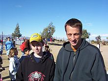 Tony Hawk at the opening of the Needles Skate Park on January 3rd, 2004.
- In late 2000 to early 2001, skateboard legend Tony Hawk donated $10,000 to the Needles Skate Park, which is still in use today. Hawk was present for the grand opening of the park in January 2004.
- Needles (and the surrounding area) was the scene for the hit 1986 post-apocalyptic computer RPG Wasteland.
- Murals paying homage to U.S. 66, the celebrated "Mother Road" which passed through Needles on its way between Chicago and Los Angeles, and painted by local artist Dan Louden, have become a popular tourist attraction.[2]
Visits by famous people
- January 14, 1960: Former First Lady Eleanor Roosevelt spoke at a forum established by the Needles School District. The school district had established, as a part of their adult education program, a forum that brought in persons from many areas of thought and culture. She dined with Mr. and Mrs. Max Rafferty, Superintendent of the Needles School District. Her hosts during the visit were Mr. and Mrs. Bender and their children.[15]
Notable natives and residents
- Judge Pat Morris, mayor of San Bernardino, California[16]
- Max Rafferty, Needles Superintendent of Schools, 1955–1961,[17] became California Superintendent of Public Instruction 1962-1970.
- Russell Gregory, a 1961 graduate of Needles High School, became President of the Community College of the Air Force, 1988-1992.
- Charles Schulz, cartoonist of Peanuts, lived in Needles from 1928 - 1930.
See also
- List of California public officials charged with crimes, Needles
References
- ^ U.S. Census
- ^ "History of Needles". Needles Chamber of Commerce. http://www.needleschamber.com/history.htm. Retrieved March 11, 2011.
- ^ "Putting A River In Its Place" Popular Mechanics, July 1949
- ^ a b http://www.wrcc.dri.edu/cgi-bin/cliMAIN.pl?ca6118
- ^ All data are derived from the United States Census Bureau reports from the 2010 United States Census, and are accessible on-line here. The data on unmarried partnerships and same-sex married couples are from the Census report DEC_10_SF1_PCT15. All other housing and population data are from Census report DEC_10_DP_DPDP1. Both reports are viewable online or downloadable in a zip file containing a comma-delimited data file. The area data, from which densities are calculated, are available on-line here. Percentage totals may not add to 100% due to rounding. The Census Bureau defines families as a household containing one or more people related to the householder by birth, opposite-sex marriage, or adoption. People living in group quarters are tabulated by the Census Bureau as neither owners nor renters. For further details, see the text files accompanying the data files containing the Census reports mentioned above.
- ^ "American FactFinder". United States Census Bureau. http://factfinder.census.gov. Retrieved 2008-01-31.
- ^ Needles, California (CA) Detailed Profile - relocation, real estate, travel, jobs, hospitals, schools, crime, news, sex offenders
- ^ "Will Gerrymandered Districts Stem the Wave of Voter Unrest?". Campaign Legal Center Blog. http://www.clcblog.org/blog_item-85.html. Retrieved 2008-02-10.
- ^ http://www.sbcounty.gov/ROV/general_info/distsummary.pdf
- ^ Sanbag public transit providers
- ^ http://www.cityofneedles.com/Hospitals.asp
- ^ San Bernardino County Fire Department
- ^ Needles Unified School District schools, Needles - CA: charter and public schools. Needles school district - Needles CA school district
- ^ IMDB search results for Needles
- ^ http://www.gwu.edu/~erpapers/myday/displaydoc.cfm?_y=1960&_f=md004641
- ^ Mayor's Office, City of San Bernardino web site
- ^ "Max Rafferty, 1917-1982, Conservative U. S. Educator and Critic: Bibliography of Writings By and About Him," CORE (Collected Original Resources in Education) , VII, No. 1 (1983), Fiche 9 C1
External links
Inland Empire Counties Major cities Cities and towns
100k-200kCities and towns
25k-100kApple Valley • Cathedral City • Chino • Chino Hills • Colton • Eastvale • Hemet • Hesperia • Highland • Indio •
Jurupa Valley • Lake Elsinore • Menifee • Montclair • Palm Desert • Palm Springs • Perris • Redlands • Rialto • Rubidoux • San Jacinto • Upland • Valle Vista • Wildomar • YucaipaCities and towns
10k-25kAdelanto • Banning • Barstow • Beaumont • Big Bear Lake • Bloomington • Blythe • Cabazon • Canyon Lake • Coachella • Crestline • Desert Hot Springs • Glen Avon • Grand Terrace • La Quinta • Loma Linda • Mira Loma • Norco • Pedley • Rancho Mirage • Twentynine Palms • Yucca ValleyCities and towns
under 10kBig Bear City • Calimesa • Devore • El Cerrito • Oak Glen • Highgrove • Home Gardens • Indian Wells • Joshua Tree • Lake Arrowhead • Mentone • Muscoy • Needles • Romoland • San Antonio Heights • Sunnyslope • Wrightwood • WoodcrestRegions Coachella Valley • Cucamonga Valley • High Desert • Morongo Basin • San Bernardino Valley • San Jacinto Valley • Victor ValleyCategories:- Cities in the Mojave Desert
- Cities in San Bernardino County, California
- Communities in the Lower Colorado River Valley
- Communities on U.S. Route 66
- Lower Colorado River Valley
- Mojave Desert
- Incorporated cities and towns in California


Wikimedia Foundation. 2010.