- Upland, California
-
For the former settlement in Monterey County, see Upland, Monterey County, California.
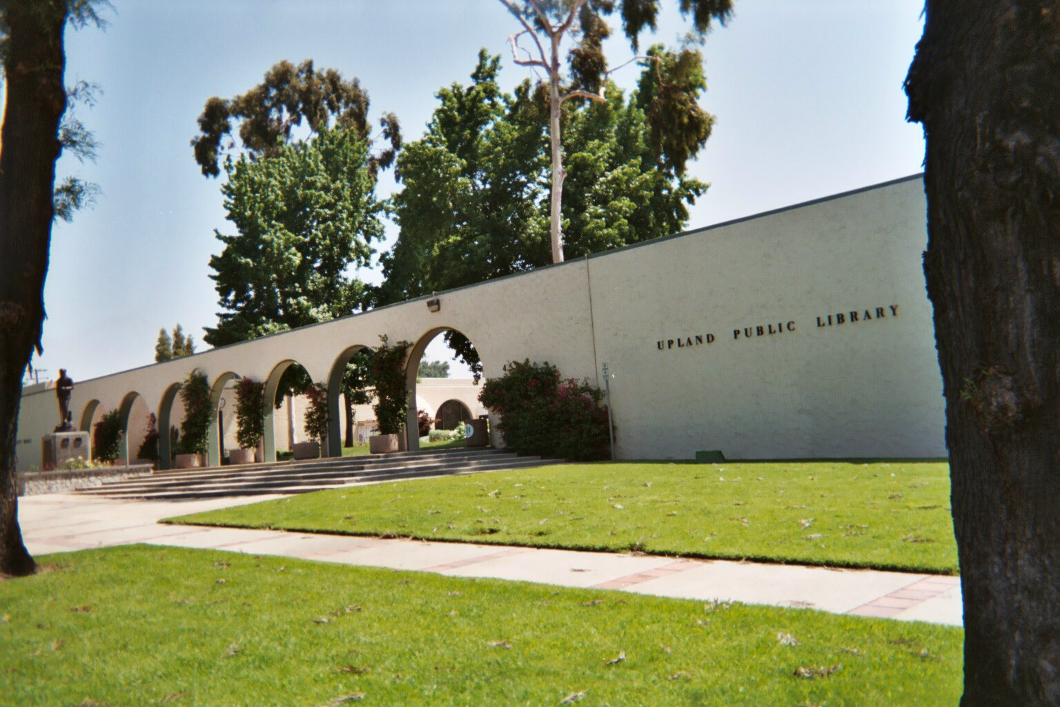
City of Upland — City — Upland City Hall (left) and Upland Public Library (right)
SealNickname(s): The City of Gracious Living Location within San Bernardino County in the state of California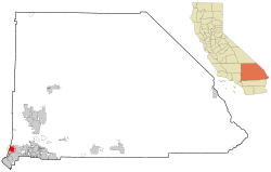
Coordinates: 34°6′N 117°39′W / 34.1°N 117.65°W Country  United States
State  California
County San Bernardino Government – Mayor Ray Musser (fulfilling Pomierski's term) Area[1] – Total 15.651 sq mi (40.535 km2) – Land 15.617 sq mi (40.448 km2) – Water 0.034 sq mi (0.087 km2) 0.21% Elevation 1,328 ft (405 m) Population (2010) – Total 73,732 – Density 4,711/sq mi (1,819/km2) Time zone PST (UTC-8) – Summer (DST) PDT (UTC-7) ZIP codes 91784-91786 Area code(s) 909 FIPS code 06-81344 GNIS feature ID 1661606 Website www.ci.upland.ca.us Upland is a city in San Bernardino County, California, located at an elevation of 1,242 feet (379 m). As of the 2010 census, the city had a population of 73,732, up from 68,393 at the 2000 census. It was incorporated on May 15, 1906, after previously being named North Ontario.
Contents
History and culture
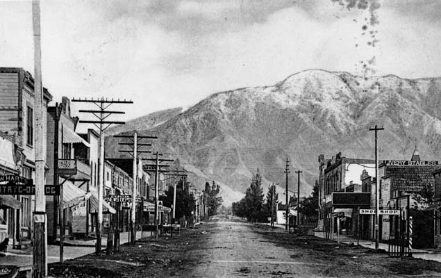
 Upland in 1906.
Upland originally was an irrigation colony established by George and William Chaffey. When founded, it was a small rural town based on agriculture, specifically citrus fruits and grapes.
Present-day Upland maintains many of the same features, most specifically Euclid Avenue (the north-south, tree-lined street that runs through town) as well as many of the older, adobe and ranch-style houses.
Upland is also very well known throughout the skateboarding culture worldwide,it was the birthplace of Vertical Pool and Pipe Skateboarding long before Venice Beach's Dogtown and Z-Boys.The city was also home to the Pipeline Skate Park, which opened in 1977 and closed in 1988 only to be reopened on Oct 12,2002...where a new generation of riders are eager to make their mark.
Geography
Upland is located at 34°6'N 117°39'W (34.0999, -117.6470).
Demographics
2010
The 2010 United States Census[2] reported that Upland had a population of 73,732. The population density was 4,711.1 people per square mile (1,819.0/km²). The racial makeup of Upland was 48,364 (65.6%) White, 5,400 (7.3%) African American, 522 (0.7%) Native American, 6,217 (8.4%) Asian, 159 (0.2%) Pacific Islander, 9,509 (12.9%) from other races, and 3,561 (4.8%) from two or more races. Hispanic or Latino of any race were 28,035 persons (38.0%).
The Census reported that 73,050 people (99.1% of the population) lived in households, 305 (0.4%) lived in non-institutionalized group quarters, and 377 (0.5%) were institutionalized.
There were 25,823 households, out of which 9,770 (37.8%) had children under the age of 18 living in them, 13,400 (51.9%) were opposite-sex married couples living together, 4,026 (15.6%) had a female householder with no husband present, 1,557 (6.0%) had a male householder with no wife present. There were 1,533 (5.9%) unmarried opposite-sex partnerships, and 219 (0.8%) same-sex married couples or partnerships. 5,159 households (20.0%) were made up of individuals and 1,786 (6.9%) had someone living alone who was 65 years of age or older. The average household size was 2.83. There were 18,983 families (73.5% of all households); the average family size was 3.26.
The population was spread out with 18,091 people (24.5%) under the age of 18, 7,504 people (10.2%) aged 18 to 24, 19,917 people (27.0%) aged 25 to 44, 19,322 people (26.2%) aged 45 to 64, and 8,898 people (12.1%) who were 65 years of age or older. The median age was 36.1 years. For every 100 females there were 93.1 males. For every 100 females age 18 and over, there were 89.9 males.
There were 27,355 housing units at an average density of 1,747.9 per square mile (674.9/km²), of which 14,948 (57.9%) were owner-occupied, and 10,875 (42.1%) were occupied by renters. The homeowner vacancy rate was 1.6%; the rental vacancy rate was 8.3%. 42,560 people (57.7% of the population) lived in owner-occupied housing units and 30,490 people (41.4%) lived in rental housing units.
2000
As of the census[3] of 2000, there were 68,393 people, 24,551 households, and 17,873 families residing in the city. The population density was 4,523.9 inhabitants per square mile (1,746.5/km²). There were 25,467 housing units at an average density of 1,684.5 per square mile (650.3/km²). The racial makeup of the city was 67.2% White, 7.6% African American, 0.8% Native American, 7.3% Asian, 0.2% Pacific Islander, 12.3% from other races, and 4.7% from two or more races. Hispanic or Latino of any race were 27.5% of the population.
There were 24,551 households out of which 36.3% had children under the age of 18 living with them, 53.2% were married couples living together, 14.3% had a female householder with no husband present, and 27.2% were non-families. 21.1% of all households were made up of individuals and 7.0% had someone living alone who was 65 years of age or older. The average household size was 2.8 and the average family size was 3.2.
In the city the population was spread out with 27.3% under the age of 18, 9.6% from 18 to 24, 29.2% from 25 to 44, 23.1% from 45 to 64, and 10.8% who were 65 years of age or older. The median age was 34 years. For every 100 females there were 92.5 males. For every 100 females age 18 and over, there were 88.7 males.
The median income for a household in the city was $48,734, and the median income for a family was $57,471. Males had a median income of $43,485 versus $29,973 for females. The per capita income for the city was $23,343. About 9.1% of families and 12.0% of the population were below the poverty line, including 15.4% of those under age 18 and 6.4% of those age 65 or over.
Politics
In the state legislature Upland is located in the 31st Senate District, represented by Republican Robert Dutton, and in the 63rd Assembly District, represented by Republican Mike Morrell. Federally, Upland is located in California's 26th congressional district, which has a Cook PVI of R +4[4] and is represented by Republican David Dreier.
Airports
Upland is home to Cable Airport, the world's largest family-owned general aviation airport.[5] The two nearby airports, Ontario International Airport and Los Angeles International Airport offer commercial flights.
Economy
Top employers
According to the City's 2010 Comprehensive Annual Financial Report,[6] the top employers in the city are:
# Employer # of Employees 1 San Antonio Community Hospital 2,001 2 Upland Unified School District 1,435 3 Kohl's 501 4 Insurance Agency Network 500 5 Walmart 400 6 The Home Depot 351 7 Universal Services of America 335 8 City of Upland 325 9 Lewis Group of Companies 300 10 Target 250 Schools
Public
Secondary schools
- Upland High School
- Hillside High School (Continuation)
Middle schools
Elementary schools
- Baldy View Elementary School
- Cabrillo Elementary School
- Citrus Elementary School
- Foothill Knolls Elementary School
- Magnolia Elementary School
- Pepper Tree Elementary School
- Sierra Vista Elementary School
- Sycamore Elementary School
- Upland Elementary School
- Valencia Elementary School
Private
- Carden Arbor View School (K-8)
- Saint Mark's Episcopal School (K-8)
- Upland Christian Academy (K-12)
- Western Christian Schools (PreK-12, multiple campuses)
- St. Joseph Catholic School (K-8)
Notable residents
Born in Upland
- Ricky Adams, Major League Baseball infielder
- Kevin Ara, Professional soccer player
- Carlos Bocanegra, Professional soccer player
- LaVar Christensen, Utah politician
- McKay Christensen, Major League Baseball player
- Danielle Chuchran, actress
- Chad Cordero, Major League Baseball pitcher
- Brian Dunseth, retired professional soccer player
- Aundrea Fimbres, singer and dancer
- Nikkie Groat, beauty queen contestant
- Jayden Jaymes, porn actress
- Big B, rapper
- Jeff Kostoff, Olympic swimmer
- Eddie Lawson, motorcycle racer
- Cory Lekkerkerker, professional football player
- Sydnee Michaels, LPGA Tour golfer
- Chad Moeller, Major League Baseball player
- Joe Ruttman, race-car driver
- Alexis Serna, Canadian Football League player
- Sean Tracey, Major League Baseball pitcher
Others
- Franklin Bruno, musician
- Ron Catalano, musician
- Nedra Volz, actress
- Roger Fan, actor
- Rollie Fingers, Major League Baseball relief pitcher
- Corey Miller (tattoo artist)
- Peter Popoff, televangelist
- Steve Scott, cross-country runner
- Ivan Shaw, actor
See also
List of California public officials charged with crimes, Upland
Sister cities
Upland has two sister cities, as designated by Sister Cities International:
 Mildura, Victoria, Australia
 Caborca, Sonora, Mexico
References
- ^ U.S. Census
- ^ All data are derived from the United States Census Bureau reports from the 2010 United States Census, and are accessible on-line here. The data on unmarried partnerships and same-sex married couples are from the Census report DEC_10_SF1_PCT15. All other housing and population data are from Census report DEC_10_DP_DPDP1. Both reports are viewable online or downloadable in a zip file containing a comma-delimited data file. The area data, from which densities are calculated, are available on-line here. Percentage totals may not add to 100% due to rounding. The Census Bureau defines families as a household containing one or more people related to the householder by birth, opposite-sex marriage, or adoption. People living in group quarters are tabulated by the Census Bureau as neither owners nor renters. For further details, see the text files accompanying the data files containing the Census reports mentioned above.
- ^ "American FactFinder". United States Census Bureau. http://factfinder.census.gov. Retrieved 2008-01-31.
- ^ "Will Gerrymandered Districts Stem the Wave of Voter Unrest?". Campaign Legal Center Blog. http://www.clcblog.org/blog_item-85.html. Retrieved 2008-02-10.
- ^ http://www.cableairport.com/history/hthroughyears.htm
- ^ City of Upland CAFR
External links
Coordinates: 34°06′00″N 117°38′49″W / 34.0999°N 117.6470°W
Inland Empire Counties Major cities Cities and towns
100k-200kCities and towns
25k-100kApple Valley • Cathedral City • Chino • Chino Hills • Colton • Eastvale • Hemet • Hesperia • Highland • Indio •
Jurupa Valley • Lake Elsinore • Menifee • Montclair • Palm Desert • Palm Springs • Perris • Redlands • Rialto • Rubidoux • San Jacinto • Upland • Valle Vista • Wildomar • YucaipaCities and towns
10k-25kAdelanto • Banning • Barstow • Beaumont • Big Bear Lake • Bloomington • Blythe • Cabazon • Canyon Lake • Coachella • Crestline • Desert Hot Springs • Glen Avon • Grand Terrace • La Quinta • Loma Linda • Mira Loma • Norco • Pedley • Rancho Mirage • Twentynine Palms • Yucca ValleyCities and towns
under 10kBig Bear City • Calimesa • Devore • El Cerrito • Oak Glen • Highgrove • Home Gardens • Indian Wells • Joshua Tree • Lake Arrowhead • Mentone • Muscoy • Needles • Romoland • San Antonio Heights • Sunnyslope • Wrightwood • WoodcrestRegions Coachella Valley • Cucamonga Valley • High Desert • Morongo Basin • San Bernardino Valley • San Jacinto Valley • Victor ValleyGreater Los Angeles Area Central city Counties Satellite cities Cities
>200kCities and towns
100k–200kBurbank • Compton • Corona • Costa Mesa • Downey • East Los Angeles • El Monte • Fontana • Fullerton • Garden Grove • Inglewood • Lancaster • Mission Viejo • Moreno Valley • Murrieta • Norwalk • Ontario • Orange • Palmdale • Pasadena • Pomona • Rancho Cucamonga • Santa Clarita • Simi Valley • South Gate • Temecula • Thousand Oaks • Torrance • Ventura • Victorville • West CovinaArea regions Antelope Valley • Conejo Valley • Downtown Los Angeles • East Los Angeles • Gateway Cities • Greater Hollywood • Harbor Area • Inland Empire • Palos Verdes Hills • Pomona Valley • San Bernardino Valley • San Fernando Valley • San Gabriel Valley • Santa Ana Valley • Santa Clarita Valley • South Bay • South Los Angeles • Westside Los AngelesLandforms Los Angeles Basin • Baldwin Hills (range) • Calico Mountains • Catalina Island • Channel Islands • Coachella Valley • High Desert—Mojave Desert • Low Desert—Colorado Desert • San Fernando Valley • San Bernardino Mountains • San Gabriel Mountains • Santa Ana Mountains • Santa Monica Mountains • Santa Susana Mountains • Verdugo MountainsBodies of water Los Angeles River • Aliso Creek • Arroyo Seco • Ballona Creek • Bell Creek • Big Bear Lake • Coyote Creek • Lake Arrowhead • Lake Perris • Lake Piru • Malibu Creek • Pacific Ocean • Pyramid Lake • Rio Hondo • San Gabriel River • San Juan Creek • San Pedro Bay • Santa Ana River • Santa Clara River • Santa Margarita River • Santa Monica BayCategories:- Cities in San Bernardino County, California
- Communities on U.S. Route 66
- Incorporated cities and towns in California


Wikimedia Foundation. 2010.