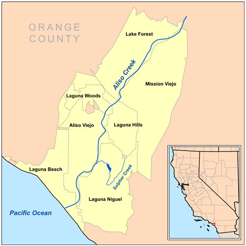
- Aliso Creek (Orange County)
-
Not to be confused with Aliso Creek (Los Angeles County).
Aliso Creek Alisos Creek[1]  Aliso Creek flows underneath the Aliso Creek Road bridge before it enters Aliso and Wood Canyons Regional Park.
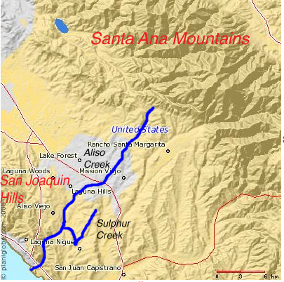
Name origin: Spanish language "Aliso" meaning alder, thus "Aliso Creek" means "Alder Creek" Country United States State California Counties Orange County Tributaries - left Sulphur Creek, English Canyon Creek - right Wood Canyon Creek, Dairy Fork Cities Laguna Beach, Laguna Niguel, Aliso Viejo, Laguna Woods, Laguna Hills, Lake Forest, Mission Viejo Source - location Portola Hills, Cleveland National Forest, Santa Ana Mountains, Orange County, California - elevation 2,300 ft (701 m) [2] - coordinates 33°42′10″N 117°37′20″W / 33.70278°N 117.62222°W [3] Mouth Pacific Ocean - location Laguna Beach, California - elevation 0 ft (0 m) [3] - coordinates 33°30′38″N 117°45′9″W / 33.51056°N 117.7525°W [3] Length 19 mi (31 km) Basin 30.5 sq mi (79 km2) Discharge for Laguna Beach, California - average 9.2 cu ft/s (0 m3/s) - max 5,400 cu ft/s (153 m3/s) - min 0 cu ft/s (0 m3/s) 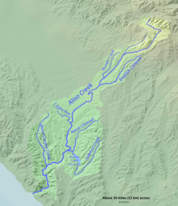 Map of the Aliso Creek watershed showing major tributaries
 Location of the mouth of Aliso Creek in California
Aliso Creek (Spanish for "Alder Creek"; also called Alisos Creek) is a 19-mile (31 km)-long urban stream that runs through Orange County in the U.S. state of California from the Santa Ana Mountains to the Pacific Ocean, collecting seven main tributaries. The creek is mostly channelized, and as of 2004, the 30.4-square-mile (78.7 km2) watershed had a population of 149,087 divided among seven incorporated cities.[4]
The creek flows generally south-southwest through a narrow coastal watershed at the southern extreme of the arid Los Angeles Basin in a fairly straight course. Owing to the submersion of Southern California in the Pacific Ocean as recently as 10 million years ago, the creek flows over marine sedimentary rock that dates from the late Eocene to the Pliocene.[5] The present-day form of the watershed, with its broad sediment-filled valleys and deeply eroded side canyons, was shaped by a climate change during the previous Ice Age that produced Aliso Canyon, the creek's final gorge.
The name was given to the creek by Spanish explorers in the 18th century, although there are now many places in California that use the name. Historically, the creek served as the boundary between the Juaneño (Acjachemem) and Gabrieleno (Tongva) Indians. The creek's watershed then became a major portion of the 1842 Rancho Niguel Mexican Land Grant to Juan Avila, later purchased by two American ranchers. Although attempts to use the creek and its watershed as a municipal water source date to the early 20th century, the water it provided was of poor quality and erratic occurrence. As a result, the creek became neglected throughout the late part of the century, eventually becoming little more than an open wastewater drain. Despite this general decline, the Aliso Creek watershed still supports some biodiversity, and it remains a popular recreational area.
Pollution, floods and development of the watershed and the surrounding county have blighted the water quality and wildlife of the creek since the 1960s,[6] when residential suburban development of the eight cities in the watershed began.[5] Pollution continues to be a major problem for the creek—the subject of many water quality and feasibility studies—but, as with many other Orange County streams, little has been done to correct it.[7]
Contents
Etymology
The Native American name for Aliso Creek has almost certainly been lost. The current name of Aliso Creek was given by Spanish conquistadors sometime between the 1750s and the 1800s.[4][8] The word Aliso means Alder tree in the Spanish language, and likely refers to the riparian vegetation that lines the creek especially near its mouth. According to the Geographic Names Information System of the United States Geological Survey, there are now 46 places in California that use the name,[3] as well as five other streams in California that use the name, including as a variant name.[9]
Other derivatives for Aliso Creek's name have arisen since then—including "Los Alisos Creek" and "Alisos Creek".[3] Several nearby geographical features also are named for the creek, including Aliso Peak, a 683-foot (208 m) headland. The creek is also the namesake of Aliso Creek Road, which crosses the creek once and only parallels it for a short length. The city of Aliso Viejo and several communities that lie near the stream also share their name with the creek.[10]
Course
Aliso Creek rises in the foothills of the Santa Ana Mountains, near the community of Portola Hills, part of Lake Forest, and at the boundary of the Cleveland National Forest. The Loma Ridge rises about 1,500 feet (460 m) above the creek's headwaters, which are at an elevation of 2,300 feet (700 m).[2] There is no pond, lake or spring at the creek’s ultimate source; it starts out as a small seasonal gully that courses southwards through a small valley with relatively little development. The creek then continues generally southwest for 19 miles (31 km) to the Pacific Ocean at Laguna Beach, collecting water from seven major tributaries and over forty minor drains and streams. For much of its course, the creek is channelized and confined by urban development. It only flows freely in several stretches in its far upper and lower course.[11] Passing south of several residential areas on the foothills to the north, Aliso Creek and El Toro Road run parallel for much of the creek's length upstream from Interstate 5. Flowing southwest in a small ravine along the right side of the road, the creek soon passes underneath the twin bridges of California State Route 241, and receives from the right an unnamed northern fork. At this confluence, the creek turns more to the south, then crosses under El Toro Road and bisects another residential area. As it enters the city of Lake Forest, it receives from the right Munger Creek and from the left English Canyon Creek, a larger tributary which drains part of the city of Mission Viejo, 16 miles (26 km) from the mouth.[2][11][12][13]
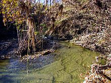 The upstream portions of Aliso Creek (here shown while flowing) are relatively pristine in comparison with the downstream segments.
The creek crosses under Trabuco Road and Jeronimo Road; the latter was once the site of a stream gauge. It makes a bend to the southeast then veers back south, entering a large gulch and crossing beneath Interstate 5. The creek then enters a culvert beneath Paseo de Valencia, then crosses under Laguna Hills Drive and cascades under Moulton Parkway, through the community of Laguna Hills. It then swings to the southeast and receives the Aliso Hills Channel, which enters from the left, 13 miles (21 km) from the mouth. The Aliso Hills Channel drains much of eastern Laguna Hills, western Mission Viejo, and southeastern Lake Forest.[2][11][12][13] From the confluence, the gradient of the creek flattens sharply and the stream enters a broad and shallow valley that runs between Aliso Creek Road on the west and Alicia Parkway on the east. It passes under California State Route 73, which crosses the valley on an earthfill and a bridge segment. The creek receives from the right the Dairy Fork, 9 miles (14 km) from the mouth, which drains parts of southern Laguna Hills and northeastern Aliso Viejo. The southwest-flowing Dairy Fork once flowed in a prominent canyon that was filled in the 1960s and 1970s to build the city of Aliso Viejo; State Route 73 now runs above the former canyon.[2][11][12][13]
After receiving the fork, Aliso Creek passes into three massive culverts that cross under Pacific Park Drive, which crosses also on an earthfill. Flowing past several sports complexes, it begins to form the boundary of Aliso Viejo and Laguna Niguel, then crosses under Aliso Creek Road into Aliso and Wood Canyons Regional Park. Here, it receives from the left its largest tributary, Sulphur Creek. This creek is about 4.5 miles (7.2 km) long and drains a fair portion of northern Laguna Niguel, 7 miles (11 km) from the mouth. From there, Aliso Creek bends west and enters Aliso Canyon, which cuts through the San Joaquin Hills on the creek's final run to the sea.[2][11][12][13] About 1 mile (1.6 km) downstream of the Sulphur Creek confluence, the creek is briefly impounded behind a small dam, and receives the south-flowing Wood Canyon Creek, the second largest tributary, 5 miles (8.0 km) from the mouth. Wood Canyon Creek drains the largest arm of Aliso Canyon and most of eastern Aliso Viejo. Flowing almost due south through a valley with slopes dissected by many deep side canyons, Aliso Creek turns sharply west as it enters private property less than 1 mile (1.6 km) from the mouth. This section of the canyon is known for flooding frequently. The creek then enters a small lagoon, crosses under the Pacific Coast Highway and enters the Pacific Ocean.[2][11][12][13]
Tidal lagoon
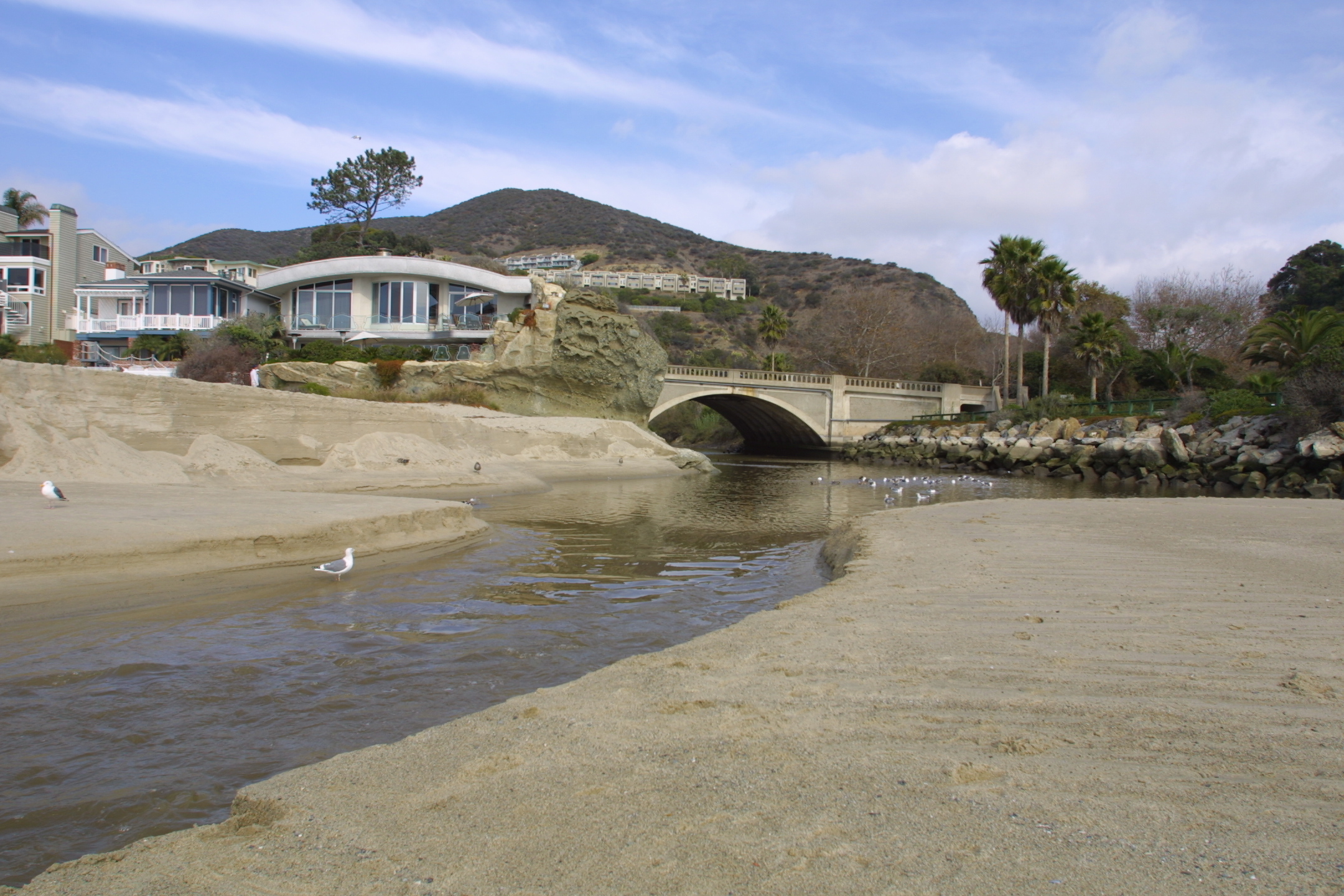
 Aerial shot of the emptied lagoon
At the mouth of Aliso Creek at Aliso Beach lies a freshwater pond that changes frequently in elevation and extent. Tidal activity at the creek's mouth results in sediment building gradually up into a sandbar, impounding it in a small lake about 0.2 miles (0.3 km) long at its fullest extent. Afterwards, the water level rises upstream of the sandbar until one of two factors causes it to breach: either waves at high tide wash away the top of the sandbar, or the lagoon rises enough to overtop the sandbar by itself. Once the water level rises above the sandbar, rapid erosion quickly cuts through the sand and drains the approximately 3–5 foot (0.9–1.5 m)-deep lake in a matter of minutes. Peak flows through the sandbar can reach 500 cubic feet per second (14 m3/s), even if the incoming flow of the creek is nowhere near that size.[14][15] Because of the raised flow of the creek and the construction of a parking lot in the lagoon area since the 1960s, the lagoon has never been able to fill to its much larger, historic extent without breaching. Species such as the tidewater goby have suffered because of loss of their habitat this way.[16]
Discharge
Aliso Creek is known to have historically contained water for most of the year, averaging 6.7 cubic feet per second (0.19 m3/s) in the wet season;[2] urban runoff has raised the creek's year-round base flow to close to 9.2 cubic feet per second (0.26 m3/s) at the mouth, with routine surges of more than 700 cubic feet per second (20 m3/s) in the winter. The United States Geological Survey had two stream gauges on the creek—one at the mouth in Laguna Beach, and one at the El Toro Road bridge near Mission Viejo. The Laguna Beach gauge was in operation from 1983 to 1986, and the El Toro gauge was operational from 1931 to 1980. The former received runoff from about 95 percent of the watershed, while the latter received runoff from 7.91 square miles (20.49 km2), or 26 percent of the watershed area.[17][18]
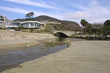 Aliso Creek empties into a sandy lagoon at its mouth in Laguna Beach. Due to tides and erosion, its mouth is ever-changing.
The largest flow recorded at the Laguna Beach streamflow gauge was 5,400 cubic feet per second (150 m3/s) with a water depth of 11.3 feet (3.4 m) on March 1, 1983.[17] The 1983 flood was caused by an El Niño event causing heavy runoff from the overdeveloped watershed. Damage was worst at the mouth of Aliso Canyon, which contains the Aliso Creek Inn and several other structures.[19] On February 16, 1986, 2,880 cubic feet per second (82 m3/s) was recorded, and 2,870 cubic feet per second (81 m3/s) was recorded on October 1, 1983.[17]
The largest flow recorded at El Toro was 2,500 cubic feet per second (71 m3/s) on February 24, 1969, with a water depth of 11 feet (3.4 m). On January 5, 1979, the second largest flow, 2,450 cubic feet per second (69 m3/s), was recorded, and 1,950 cubic feet per second (55 m3/s) on February 6, 1937.[18] There was another nearby gauge—now out of service—at the Jeronimo Road crossing just downstream of El Toro. Before it was taken out of service in the 1980s, it frequently recorded periods of extremely low or nonexistent flow for most of the year.[20]
The dramatic change in Aliso Creek flows from the 1960s onwards can be seen in streamflow data from the El Toro gauge. From 1931 to 1960, the average peak flow was 511 cubic feet per second (14.5 m3/s)—though peaks recorded ranged from zero to 1,950 cubic feet per second (55 m3/s). Between 1960 and 1980, the average peak flow was 1,178 cubic feet per second (33.4 m3/s), nearly twice the average before 1960.[18] Urban runoff now constitutes nearly 80 percent of the creek's dry season flow—7.2 cubic feet per second (0.20 m3/s)—and natural runoff, including springs in the Santa Ana Mountains, now supply a negligible amount of the creek's water.[14][15]
Geology
Most of Southern California, including all of Orange County, was periodically part of the Pacific Ocean; the most recent epoch was approximately 10 million years ago (MYA). The Santa Ana Mountains, which now border the creek to the north and east, began their uplift about 5.5 million years ago along the Elsinore Fault.[21] Aliso Creek formed about this time, running from the mountains across the broad coastal plain to the Pacific.
 Relief map of Aliso Creek watershed and surrounding cities
About 1.22 million years ago, the San Joaquin Hills along the Orange County coast began their uplift along a blind thrust fault (the San Joaquin Hills blind thrust) extending south from the Los Angeles Basin.[22] As Aliso Creek was an antecedent stream, or one that had formed prior to the mountains' uplift, it cut a water gap through the rising mountains that today is Aliso Canyon. The same phenomenon occurred to the north with Laguna Canyon and San Diego Creek, and to the south at San Juan Creek. The uplift also caused Aliso Creek's largest tributary, Sulphur Creek, to turn north to join Aliso Creek instead of flowing south to Salt Creek.[5] The Wisconsinian era was responsible for shaping the watershed to its present-day form, with deep side canyons and broad alluvial valleys.[5]
During the last glacial period (110,000 to 10,000 years ago), especially in the Wisconsinian glaciation (31,000 to 10,000 years ago), the climate of Southern California changed radically from arid to wet, to a climate likely similar to the present-day Pacific Northwest. Prodigious rainfall gradually turned the small streams of the region into large and powerful rivers.[23][24] It was this surge in volume that allowed Aliso Creek and other rivers to cut through the San Joaquin Hills. A 400-foot (120 m) drop in sea level escalated the process, allowing the rivers to flow more rapidly and have more erosive power. As sea levels rose after the Wisconsinian glaciation, the water gaps the rivers had cut through the San Joaquin Hills, including Aliso Canyon, became fjord-like inlets. Aliso Creek and these other streams deposited sediments into the inlets, turning them into flat-floored alluvial valleys with an elevation very close to sea level. Eventually, the sediment deposited met the coastline. By then, the rivers and streams had diminished to their original flow before the glaciation.[23]
In the wake of the periodic inundation of Southern California by the ocean, most of the Aliso Creek watershed is underlain by several layers of marine sedimentary strata, the oldest dating from the Eocene (55.8–33.9 MYA) and the most recent, the Pliocene (5.33–2.59 MYA).[25] These alluvial sediments range from 13 to 36 feet (4.0 to 11 m) in depth. Generally throughout the watershed, there are five major soil and rock outcrop types—Capistrano sandy loam, Cieneba sandy loam, Marina loamy sand, Myford sandy loam, and Cieneba-rock outcrop. The water table ranges from 6 to 20 feet (1.8 to 6.1 m) deep.[25]
Watershed
Geography
Land use - 4.7% agricultural
- 5.7% commerce
- 0.5% civic
- 1.7% industrial
- 0.4% recreational
- 31.3% residential
- 2.9% transport and utilities
- 30% unincorporated
- 26.2% mixed use[26]
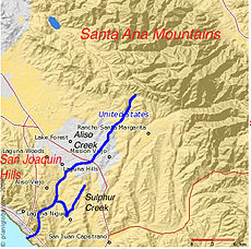
The Aliso Creek drainage basin lies in the south central part of Orange County, roughly halfway between the Santa Ana River and the Orange–San Diego County boundary.[27] It is a roughly spoon shaped area of 30.4 square miles (79 km2),[28] comprising generally hilly and sometimes mountainous land. The watershed borders five major Orange County watersheds: Santiago Creek to the north, San Diego Creek to the west, Laguna Canyon to the southwest, Salt Creek to the southeast, and San Juan Creek to the east.[12] To be more specific, the boundary with San Diego Creek is drained to the west by two tributaries of San Diego Creek—Serrano Creek and the La Cañada Wash. Two tributaries of San Juan Creek—Oso Creek and Trabuco Creek—border Aliso Creek to the northeast and southeast.[12][29]
As of 2004, the Aliso Creek watershed had a population of 149,087.[4] Nine communities were established in the creek's watershed as it was developed in the 20th century. By 2001 seven of them had become cities (from mouth to source, Laguna Beach, Laguna Niguel, Aliso Viejo, Laguna Hills, Laguna Woods, Lake Forest, and Mission Viejo), and the last two, Foothill Ranch and Portola Hills, were incorporated into the city of Lake Forest in 2000.[26] The largest urban area in the basin is in the middle, where Interstate 5 bisects the watershed east to west. The northern boundary of this urban area stretches a little beyond California State Route 241 and the southern boundary is near California State Route 73 in the south. This area consists primarily of Lake Forest, Laguna Woods, and Laguna Hills.[26]
The Loma Ridge of the Santa Ana Mountains runs east to west in the far northeastern corner of the watershed, forming the water divide with Santiago Creek. The San Joaquin Hills are at the southwestern portion of the watershed, following the coastline, and subranges within form the divides with Laguna Canyon and Salt Creeks.[12] While the Santa Ana Mountains rise to 4,000 feet (1,200 m) or more, the San Joaquin Hills top out at 1,000 feet (300 m) at Temple Hill ("Top of the World"),[10] which lies to the north of Aliso Canyon—the water gap in the San Joaquin Hills through which Aliso Creek passes. Most of the hills rise to only 600 feet (180 m) or 700 feet (210 m). The largest body of water in the watershed, Sulphur Creek Reservoir, is located to the northeast of Aliso Canyon.[10][13]
Bacterial pollution
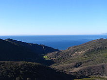
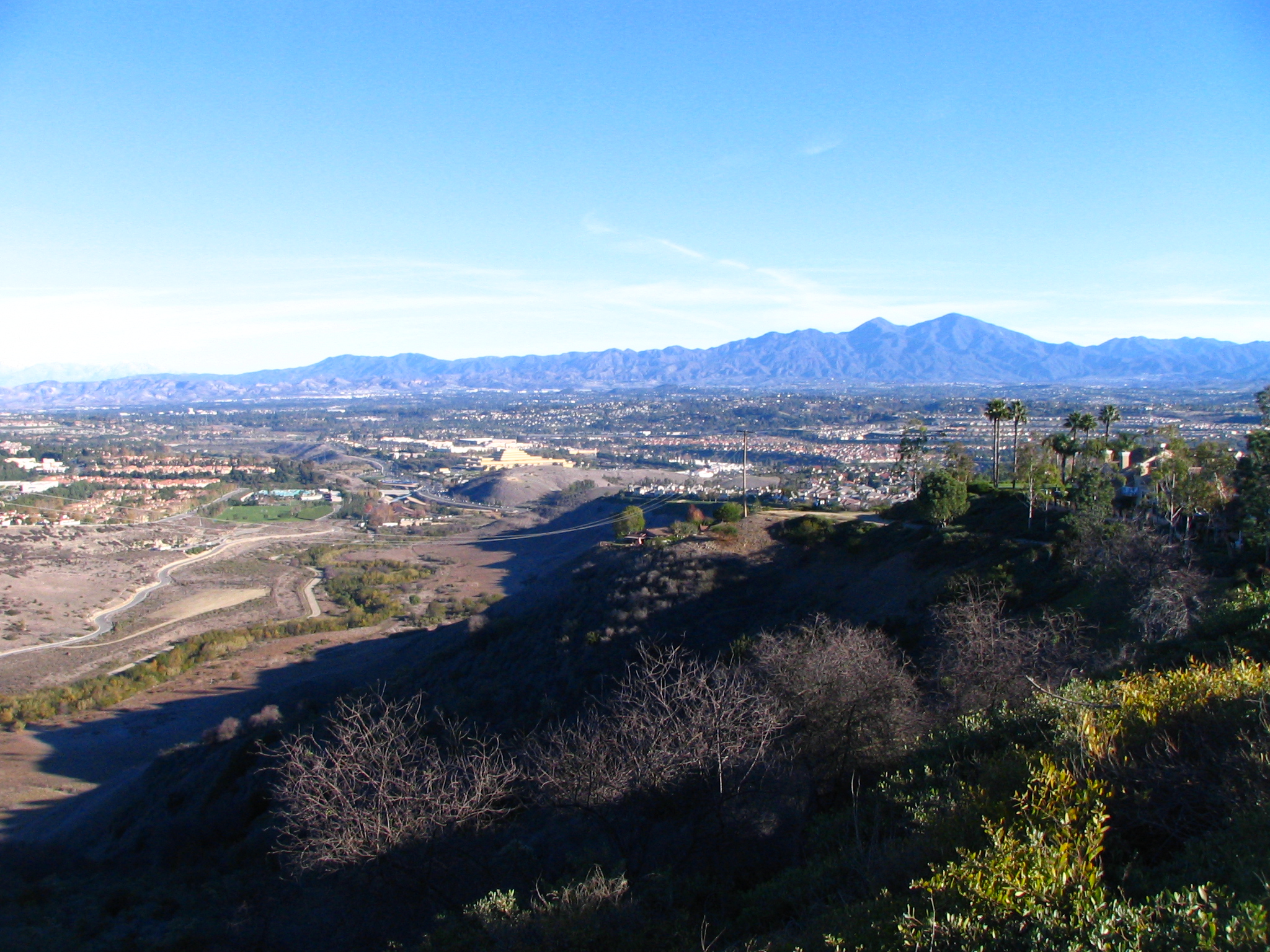
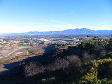 Overview of Aliso Creek watershed from a ridge on the San Joaquin Hills, with Santa Ana Mountains in distance
Aliso Creek's watershed, as well as most of Orange County, saw a rapid jump in urban development from the 1960s onward, which introduced increased flow, non-native vegetation, and high bacterial levels to the creek, severely hurting its ecology.[4] The creek is part of the Clean Water Act list of impaired waters,[30] which is defined as "impaired by one or more pollutants that do not meet one or more water quality standards". It is said that Aliso Creek is one of the "most publicized" streams on the list.[31] As of 2001, the average annual precipitation in the San Juan Hydrological Unit, which Aliso Creek is part of, was 16.42 inches (417 mm).[32]
Bacteria affecting the water quality mainly consist of different types of fecal coliforms, with a high level of E. coli bacteria. This comes from pet waste, fertilizer, manure, and other organic pollutants that are washed into the creek, raising the average bacteria level 34 percent higher than levels declared safe under California law.[33] This in turn impacts recreation at popular Aliso Creek Beach at the creek's mouth, violating state swimming standards 99 percent of the time, especially during storm events, as beachgoers are warned to avoid the creek for 72 hours (3 days) after a major storm event.[34][35] Because of this high bacterial pollution, Aliso Creek has been called "Orange County's most polluted waterway" and even "a cesspool stew".[36]
A local activist commented that the water pollution problem has long been ignored by the county: "[W]e're sick and tired of it. It's nothing but a cesspool stew, full of pigeons and pigeon droppings and nearly 90-degree water, right at the beach!"[36] According to the county health department, the number of bacteria in the creek, especially at the freshwater lagoon at its mouth, frequently exceeds limits set by California law.[32]
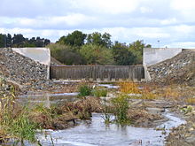
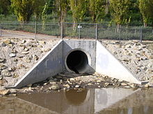 A large storm drain flows into Aliso Creek on the right bank, shortly downstream from Aliso Creek Road. This drain and over 40 others are responsible for the poor water quality of Aliso Creek.
Other viruses and bacteria are found in small concentrations in Aliso Creek's water. In 2002, a dog contracted parvovirus after having been bitten by coyotes that had apparently been drinking from the creek.[37] Tests in November of that year detected small amounts of the virus that causes Hepatitis A in Aliso Creek.[38] In the autumn of 2000, a study found enterovirus in runoff in street gutters that drain to a tributary of Sulphur Creek, that drains to Aliso Creek.[39] The creek has also been rumored to contain pollution from leaking sewage, though the source is so far unknown.[40]
According to the Los Angeles Times, "County health officials acknowledge that the bacterial count at the mouth of the creek—which curls into a warm-water stagnant pond that flushes out onto the beach—is at times alarmingly high, often surpassing the legal limit for California. As a result, the area where the creek meets the sea, and the creek itself, are considered permanently off limits to swimmers and bear prominent signs that warn of the dangers of trespassing into such toxic waters. Nevertheless, people do, almost daily. Officials from the Orange County Environmental Health Department say that skin rashes, infections, "pink eye" and other assorted ailments are not uncommon to those who use Aliso Beach and, unwittingly, come in contact with the creek and its invisible bacteria...".[36] The problems facing the creeks are blamed almost entirely on urbanization, which has deprived the creeks of needed sediment while increasing pollution.[32]
Other pollutants
Chlorine is a major pollutant, and is responsible for the degradation of fish and shrimp in the creek. The sources for chlorine pollution in urban runoff include irrigation and car washing, and the chlorinated water flows untreated into storm drains. The only remaining fish species in the creek is carp, which can withstand high amounts of toxicity. Carp up to 18 inches (1.5 feet / 45 cm) long have been found in Aliso Creek near the mouth. Temperatures of the creek near the mouth have been known to exceed 90 °F (32 °C), although the temperature at the outflow is often much colder because it has been mixed with seawater.[36]
Changes of sediment patterns in the creek have also created another major problem. Stemming from the construction of man-made structures interfering with stream flow, and increased runoff from the many urban areas adjoining the creek, excessive erosion has created pollution not limited to just the creek. The creek is eroding material from its bed and transporting it to the ocean, but naturally, sediment from the whole watershed (now mostly covered by hard surfaces) flowed towards the main stem via a complex network of tributaries. The U.S. Army Corps of Engineers warned in a 1997 study that up to $4.2 million in damage occurs per year as a result of the pollution of Aliso Creek and its neighbor San Juan Creek. This includes physical damage to creek banks, bridges, pipes and other creekside structures. Beaches along the coast are becoming increasingly polluted as dry-season discharges along the creeks grow, posing dangers to people visiting popular beaches in these areas.[27]
The erosion problem is posing the most danger in Aliso Canyon, where a sewage line parallels the creek to a treatment plant near the mouth. If the sewer line were undermined by erosion and were to break, a highly toxic spill would occur. In the upper portion of the watershed, spectacular erosion-related events have occurred at English Canyon Creek, where water flowing at high velocity around a bend during a flood caused several landslides in the 1990s.[41]
Recreation
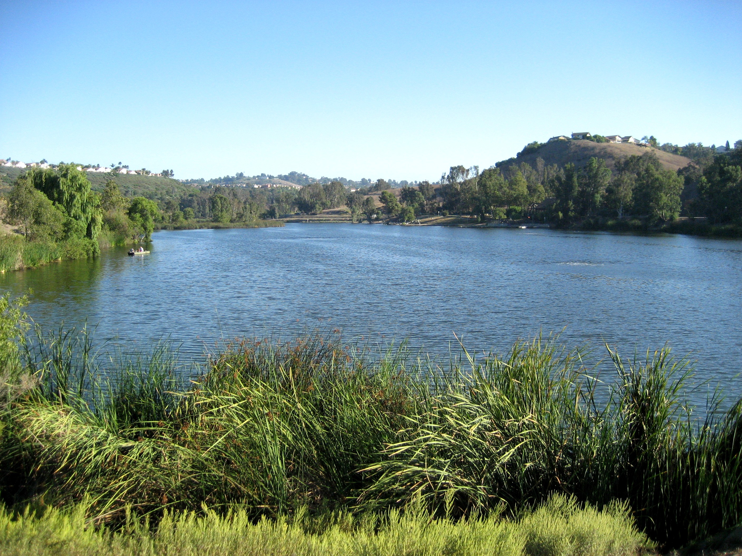
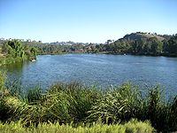 Laguna Niguel Lake (otherwise known as Sulphur Creek Reservoir), here seen near the dam, is a major recreation and flood-control feature on Sulphur Creek.
The Aliso Creek watershed includes portions of the Cleveland National Forest in the upper watershed, and two major regional parks—the 3,879-acre (1,570 ha) Aliso and Wood Canyons Regional Park and its adjoining Aliso Creek Beach, one of the county's most popular beaches with over one million annual visitors;[42] and the 236-acre (96 ha) Laguna Niguel Regional Park, which borders Sulphur Creek. Because of its shallowness and erratic flow, Aliso Creek is not navigable even in the winter and spring (rainy season); the only spot in the entire watershed where boating is possible is Sulphur Creek Reservoir. A mostly paved trail, the Aliso Creek Trail, follows the creek from Aliso Canyon to the Cleveland National Forest.[43]
The only major fishing spot in the Aliso Creek's watershed is the 44-acre (18 ha) Sulphur Creek Reservoir, formed by a large earthfill dam across Sulphur Creek inside Laguna Niguel Regional Park. The lake is regularly stocked with catfish, bass, bluegill, and trout during the winter months.[44] Any other location in the watershed will probably yield only the bottom-dweller carp.
Most of the trails in the watershed are biking and equestrian trails located in the lower portion of the watershed, in the immensely popular Aliso Canyon and its tributary, Wood Canyon. Aside from the main Aliso Creek Trail, the Wood Canyon Trail parallels a tributary of Aliso Creek (Wood Canyon Creek). There is also a bikeway along Sulphur Creek and along parts of English Canyon .[43]
Wildlife
Historic
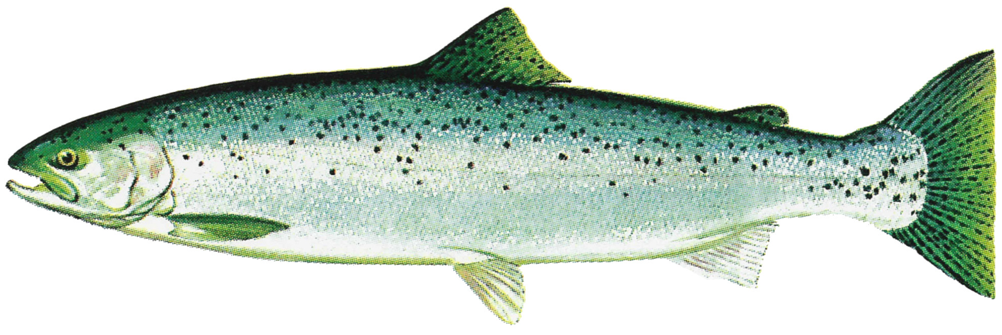
 Steelhead trout have been said to exist in Aliso Creek, but likely did not inhabit the creek within recorded history.
Aliso Creek's polluted water and degraded riparian areas now support few native animals and plants. But once, live oak, sycamore, and alder trees lined the banks of Aliso Creek and its major tributaries, specifically Wood Canyon, Sulphur and English Canyon creeks, in a rich riparian zone.[45] Coyotes, mountain lions, and other large mammals were found throughout the Aliso Creek watershed, especially in the mountainous areas in the San Joaquin Hills and Santa Ana Mountains. These animals can still be found in some number, but they are mostly confined to the wilderness areas that are surrounded by residential development. These "islands" of native vegetation and wildlife still support many native Southern California organisms. As the creek was perennial, the riparian zone surrounding the creek likely was similar to that of San Juan Creek to the south.[4]
Researchers and long-time residents of the lower Aliso Creek watershed have argued for many years over the presence of steelhead trout in Aliso Creek. However, the National Marine Fisheries Service states that Aliso Creek is a "[coastal basin] with no evidence of historical or extant of O. mykiss in anadromous waters."[46] Contradictorily, many anglers in the 1960s and 1970s reported taking tens or even hundreds of steelhead trout from the creek before suburban development began.[47][48][49][50][51] This indicates that there was a "possible run or population" of steelhead in Aliso Creek at some point.[52] The creek is also inhabited by bottom-dwellers such as carp, and historically shrimp and other benthic organisms were found throughout perennial pools in the Aliso Creek watershed. Historically, a large population of tidewater goby (10,000–15,000) was documented at the creek's mouth by Swift et al.. (1989), from a study period that ranged from March 1973 to January 1977. The tidewater goby, which depended on the transient lagoon at the mouth for survival, has declined in number because of modifications to its habitat.[53]
Human impact
Since urbanization began in the 1960s, sudden high and sediment-lacking flows of polluted water began to destroy the native riparian vegetation once found along much of the creek. Exotic plants, including tobacco tree, castor bean, pampas grass, periwinkle, and Artichoke thistle, but most notably the giant reed, then replaced the historic live oaks, sycamores and alders as riparian vegetation.[45] These plants have crowded out native vegetation, and in the case of giant reed, crowded out native animals—giant reed does not provide habitat for any native Southern California animals.[45] These invasive species are most prevalent along upper Sulphur Creek (Sulphur Creek Reservoir prevents these plants from spreading downstream), much of the Aliso Creek mainstem, and some parts of Wood Canyon Creek.
Many of the trees in Aliso Creek's riparian zone were cut down in the Spanish Mission period to construct buildings, ships, and other projects. According to the Flood Protection Corridor Program of the Costa Machado Water Act of 2000, "Aliso Creek was one of the few streams that contained water most of the year, even during the pre-development period. There are documents describing explorers mooring their ships outside the mouth of the river and harvesting large timbers from the river area. Such large timbers could only be available from a relatively lush environment in which water was somewhat plentiful."[4] Some trees survived into the early 20th century, then a second decline of unknown cause began—either erosion or floods in the creek were responsible for their destruction, or the water table has lowered out of reach of the trees' roots. The water table began a drastic decline in the 1960s, after the watershed began to become urbanized.[45]
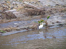 White Heron and ducklings in Aliso Creek
Although historically many fish species used Aliso Creek, the only remaining one is carp, which is known to survive in areas with high toxicity. Bird life was also abundant in the watershed—and 137 species remain in the less developed areas of the watershed. Some of these birds include California Least Tern, Least Bell's Vireo, Southwestern Willow Flycatcher, California Gnatcatcher, and Western Snowy Plover.[4] Remaining habitat for native wildlife is now primarily along Wood Canyon Creek, in the upper reaches of Aliso Creek, and along some parts of English Canyon.[25]
Aside from carp, several species of fish and amphibians still inhabited the creek up to the 1980s, when floods destroyed much of the remaining riparian habitat. These included the mosquito fish, bluegill, bass, and several species of native frogs. After the floods, most of these species were reported to have disappeared completely.[4]
History
First inhabitants
It is believed that in Native American times, Aliso Creek served as part of an important tribal boundary—between the Tongva in the north and the Acjachemen (or Juaneño) tribe in the south.[54] The Tongva's territory extended north, past the Santa Ana River and San Gabriel River, into present-day Los Angeles County, while the Acjachemen's smaller territory extended from Aliso Creek south, past San Juan Creek, and to the vicinity of San Mateo Creek in present-day San Diego County.[54] The creek's perennial flow[4] made it a likely spot for Indian settlement, although the Tongva's main settlements were near the San Gabriel River and the Acjachemen mostly lived at the confluence of San Juan Creek and Trabuco Creek. Even so, some 70 major archaeological sites have been discovered along the creek,[54] and it is believed that there was once an Acjachemen Indian village near the confluence of Aliso Creek and Sulphur Creek, named Niguili, which means "a large spring" in the native Luiseño dialect.[55]
The creek's use as a tribal boundary is disputed. As other southern California Native Americans have done, a tribe typically claimed both sides of a stream or river—and used drainage divides as boundaries instead. However, the presence of Aliso Canyon, a steep and difficult-to-traverse gorge, suggests the opposite.[54] Kroeber (1907) was the first to support this theory, and many other archaeologists have followed as well. The Juaneño disagree, arguing that their boundary stretches north to the northern drainage divide of the Aliso Creek watershed, which supports the practice of claiming both sides of a stream.[56]
Around the 1770s, Spanish explorers came to Southern California and took control over both of these Native American groups. They built Mission San Gabriel Arcángel and Mission San Juan Capistrano near the main population centers of both of these Indian groups, seeking to convert them to Christianity. Most of the Indian population was moved to these two missions—the Tongva were renamed the Gabrielino[57] and the Acjachemen, the Juaneño,[58] after these two missions. The Spanish began farming and ranching practices on many of the fertile floodplains surrounding the only perennial streams in the area—San Juan and Trabuco Creek, Aliso Creek, and the Santa Ana, San Gabriel and Los Angeles rivers to the north. Many of the trees in the riparian zones surrounding these creeks—specifically Aliso Creek—were cut down, and it was said that the trees near the "river['s]"[4] mouth were especially tall and there were written accounts of Spanish ships mooring in the large bay at the outlet of Aliso Canyon and men going ashore to chop down and take away these trees for constructing mission buildings, ships and other structures.[4][45]
In 1842, with California now a province of Mexico, Juan Avila received the 13,316-acre (53.89 km2) Rancho Niguel Mexican land grant. The name of the rancho was partially derived from a corruption of the original name of the village, Niguili. (This corruption was later to become part of the name of the city of Laguna Niguel.) Not too long after, from June to July 1846, during the Mexican–American War, California broke away from Mexico and formed the California Republic for less than a month. California was annexed by the United States soon after, becoming the 31st state. In 1871, the first white settler along Aliso Creek, Eugene Salter, claimed 152 acres (0.62 km2) along the lower creek, inside Aliso Canyon.[5] The following year the 152 acres (0.62 km2) were acquired by George and Sarah Thurston, homesteaders who converted the mouth of the creek into an orchard irrigated by its waters for roughly the next half century.[5]
Urbanization and development
 View of the proposed Aliso Reservoir site (below, in canyon) from the San Joaquin HillsSee also: Orange County, California#History
In 1895, Rancho Niguel was acquired by rancher Lewis Moulton (1854–1938) and his partner, Jean Pierre Daguerre (1856–1911). The rancho remained under their ownership for approximately thirty-eight years, and the rancho continued to be owned by the Moulton family until the 1960s. Rancho Niguel was eventually assimilated into Laguna Niguel, Aliso Viejo, Laguna Hills, and Aliso and Wood Canyons Regional Park.[4][59][60]
By the 1920s, Aliso Creek was already being experimented with as a municipal water source. In 1924, the City of Laguna Beach drilled wells into gravel deposits near the mouth of the creek, in order to provide drinking water. Just four years later, the unusually high and unexplained presence of chloride in the water prompted the city to abandon Aliso Creek as a water source.[2] Taking advantage of the creek's high winter surges, ranging from 0 to 404 acre feet (0 to 498,000 m3) monthly, local resident A. J. Stead proposed in 1934 to build a dam very near the mouth of the creek, forming a reservoir with a capacity of 2,650 acre feet (3,270,000 m3) and safe annual yield of 150 acre feet (190,000 m3). Although the proposal was accepted, the results are unknown—there is no remaining trace of these works today.[2]
By the late 1960s, increasing runoff in the creek from the growing cities in the watershed begun to spell ecological problems and severe erosion for the creek. Although a series of flood control channels upstream of Aliso Creek Road (near Aliso Canyon) had already begun to prevent erosion in those heavily developed areas, the creek eroded to depths of 20 feet (6.1 m) or more in any unlined areas.[61]
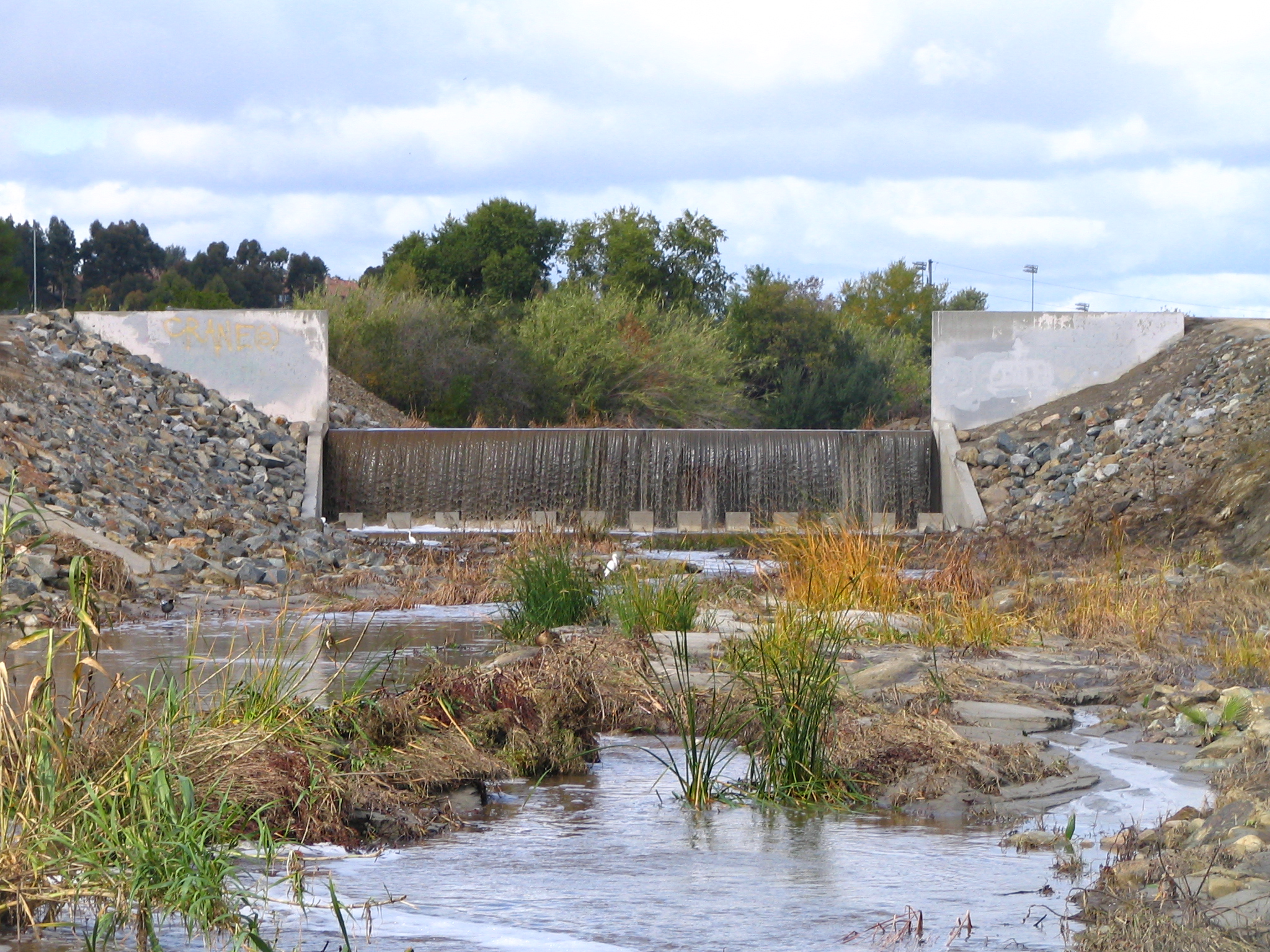
In 1969 a flow control and erosion mitigation project for Aliso Creek was begun, requiring the construction of two concrete drop structures on the creek.[61] These two vertical barriers, 11 feet (3.4 m) high and 30 feet (9.1 m) long, were built both upstream and downstream of Aliso Creek Road. Several grouted riprap structures were also constructed between and downstream of these drops.[4]
A small dam was built about 1.4 miles (2.3 km) downstream of Aliso Creek Road in the 1990s—inside Aliso Canyon—as part of a "mitigation bank project".[61] This project, known as ACWHEP (Aliso Creek Wildlife Habitat Enhancement Project) was intended to provide water to 70 acres (0.28 km2) of former riparian areas now several feet higher than the eroded channel of the creek. It was conceived and jointly funded by the county and the Mission Viejo Company.[62] The dam was also supposed to control further erosion downstream. Due to faulty design, however, the dam failed to prevent erosion, which has continued to undermine structures throughout the canyon.[45] The grouted riprap structure is about 15 feet (4.6 m) high and 100 feet (30 m) long, and aside from impounding water, captures debris and temporarily controls wet season flows. The building of these modifications, as well as dry weather runoff from seven municipal storm sewer systems, began to contribute to the infamous pollution of Aliso Creek.[61]
Cities and protected areas timeline
 Aliso Creek watershed map with city boundaries
In 1927 Laguna Beach became the first city to be incorporated in the Aliso Creek watershed and the second in Orange County. At this time, prior to the 1930s, aside from some farming and ranching practices, the watershed was largely unpopulated.[4] At the end of that decade, the watershed still remained less than 1 percent developed. Up to the 1960s and 1970s, barely 15 percent of the watershed was developed, but by 1990, after doubling its rate in the past two decades, the watershed was roughly 60 percent developed.[4] The cities of Mission Viejo and Laguna Niguel were incorporated in 1988 and 1989, respectively. By the end of the 20th century, more than 70 percent of the watershed was developed.[4] The newest city in the watershed, Aliso Viejo, was incorporated in 2001.
The Cleveland National Forest, the oldest protected area in the Aliso Creek watershed, was created in 1908, and the next major park to be created was Laguna Niguel Regional Park in 1973.[63] Land for Aliso and Wood Canyons Regional Park was first secured in April 1979 with 3,400 acres (14 km2), and small increments were added to the park until the early 1990s forming a total of 3,879 acres (15.70 km2).[64] Also in the 1990s, Aliso and Wood Canyons became part of the Laguna Coast Wilderness, which stretches north to Crystal Cove State Park.
Flooding and mitigation
Like most other coastal Orange County streams, the watershed of Aliso Creek is now heavily urbanized. With 70 percent of the original land surface now underneath impermeable surfaces such as pavement and buildings, far more runoff now enters the creek—not only inducing an increased year-round flow, but much larger rainy season flows. In the 1920s and 1930s, devastating floods wreaked havoc on much of southern California; the Los Angeles Flood of 1938 was the most famous flooding episode of this period.[4]
The Orange County Flood Control Act of 1927 was created in the wake of some of the earlier flooding events of this era. Dams and reservoirs, some of the largest of which include Irvine Lake and the Sulphur Creek Reservoir, were the first features to be constructed following the passage of this act.[65] Starting from the 1960s, most Orange County rivers, including Aliso Creek, were channelized. Some, like the Santa Ana River, were entirely lined with concrete, but Aliso Creek retains a natural riverbed in most parts despite being bound to a narrow channel.[4]
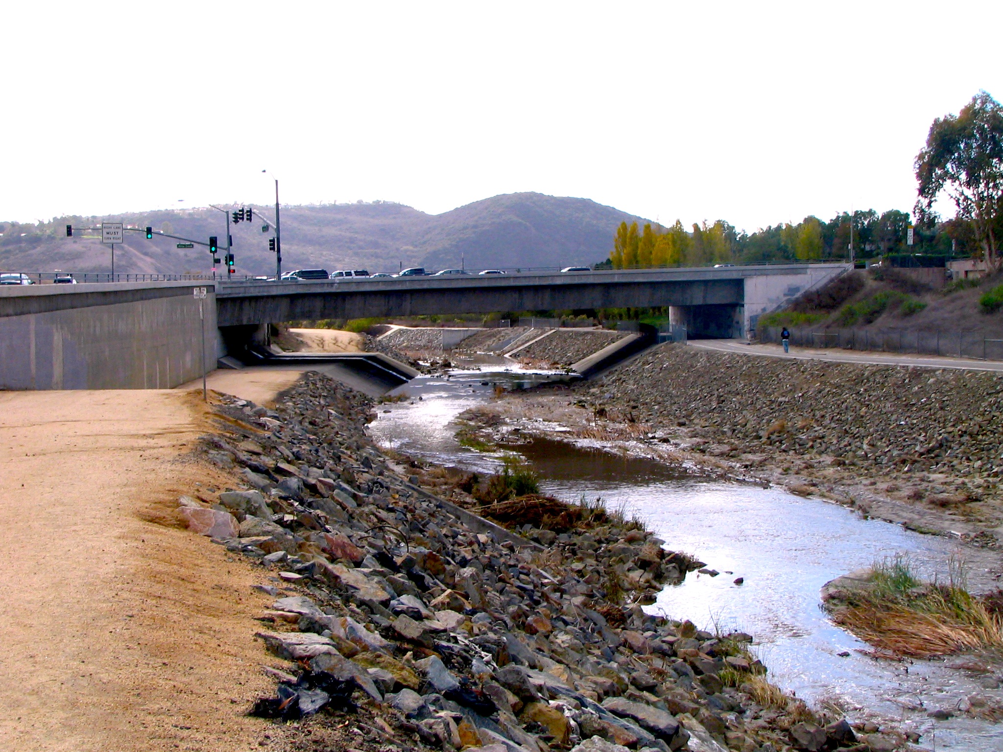
 Many drop structures exist in the Aliso Creek riverbed to prevent erosion.
Several tributaries of Aliso Creek—the Dairy Fork, Aliso Hills Channel, Munger Creek, and other smaller ones—have been replaced by storm drains.[66] Wood Canyon Creek remains much like its original condition, despite degradation due to polluted water. Sulphur Creek has been channelized and diverted into culverts in several stretches, and English Canyon Creek has received some riprap stabilization and bank protection.[45]
Although there are no major flood control dams on Aliso Creek itself, there are 19 drop structures, and while doing nothing to reduce the creek's rainy season surges, the drop structures were constructed to mitigate the catastrophic erosion that came with the creek's increased flow. Although the creek has a wide floodplain throughout most of Aliso Canyon, a major bottleneck lies at the south end of the canyon where a sharp bend in the creek is constricted between crowded development and steep cliffs. In flooding events, this area generally sustains heavy damage.[4]
Another major era of floods lasted from the 1980s until the early 21st century. The 1983 El Niño season brought unprecedented rainfall that produced a flow of 5,400 cubic feet per second (150 m3/s) from the creek, an all-time high. The creek overflowed its banks and flooded up to 10 feet (3.0 m) deep in places.[19] There were five large floods throughout the 1990s, including one in 1998 that reputedly destroyed six footbridges.[67] The years of 2004 and 2005 again saw heavy rainfall.[68]
Along the creek
Crossings
Crossings of the creek are listed from mouth to source (year built in parentheses).[13][69] The creek is crossed by roughly 30 major bridges.
 SR 1 / Pacific Coast Highway (1926)
- Multiple private roads in the Aliso Creek Golf Course
- Aliso Canyon Road
- Service Road for Aliso Canyon Dam
- AWMA Road—an acronym for the Aliso Water Management Agency
- Aliso Creek Road (1988)
- Pacific Park Drive
 SR 73 / California State Route 73 (1996)
- Trail [Pedestrian Bridge]
- Moulton Parkway (northbound 1969, southbound 1987)
- Laguna Hills Drive—twin bridges (1985)
- Avenida Sevilla
- Trails in Aliso Park
- Paseo de Valencia (1966)
- Aliso Creek Trail
 I-5 / Interstate 5 (1959)
- Aliso Creek Trail
- Los Alisos Boulevard (1973)
- Muirlands Boulevard (1973)
- Private road in Lake Forest Golf Center
- BNSF Railway
- Jeronimo Road (1974)
- 2nd Street [Pedestrian Bridge]
- Trabuco Road—twin bridges (1975)
- Creekside Drive (1980)
- El Toro Road (1975)
- Normandale Drive (1987)
- Portola Parkway
- Saddleback Parkway
 SR 241 / California State Route 241 (1995)
- Glen/Glenn Ranch Road
- Aliso Creek Trail
- Ridgeline Road
- Santiago Canyon Road
- Crystal Canyon Road
- Country Home Road
- Whiting Road
Tributaries
From mouth to source, Aliso Creek is joined by six major tributaries. All of these tributaries as well as several others are listed. Another 46 minor streams and drains flow into the creek.
Name Variant Name(s) Source Source coordinates Length Mouth Mouth coordinates Mouth N/A N/A N/A Aliso Creek Beach, Laguna Beach 33°30′38″N 117°45′12″W / 33.5105°N 117.7532°W Wood Canyon Creek Aliso Viejo 33°35′39″N 117°44′22″W / 33.5941°N 117.7394°W[70] 2.8 miles (4.5 km)[71] Aliso Canyon—right bank of Aliso Creek 33°32′28″N 117°44′13″W / 33.5411°N 117.7369°W[70] Sulphur Creek Arroyo Salada, Sulpher Creek, Salt Creek, Cañada Salada[72] North Laguna Niguel 33°33′33″N 117°41′04″W / 33.5591°N 117.6844°W[73] 4.5 miles (7.2 km)[72] Head of Aliso Canyon—left bank of Aliso Creek 33°32′32″N 117°42′16″W / 33.5422°N 117.7044°W[73] Aliso Hills Channel South Laguna Hills 4.5 miles (7.2 km)[12] Aliso Viejo—left bank of Aliso Creek Dairy Fork Dairy Fork Storm Drain South Laguna Woods 3 miles (4.8 km)[12] Aliso Viejo- right bank of Aliso Creek Munger Creek Munger Creek Storm Drain Lake Forest 1 mile (1.6 km)[12] Mission Viejo—right bank of Aliso Creek Unnamed northern fork Portola Hills 2.5 miles (4.0 km) Mission Viejo—right bank of Aliso Creek English Canyon English Canyon Creek, English Canyon Channel Mission Viejo 33°39′30″N 117°38′28″W / 33.6583°N 117.6411°W[74] 3.5 miles (5.6 km)[75] Mission Viejo—left bank of Aliso Creek 33°37′42″N 117°40′52″W / 33.6283°N 117.6811°W[74] Source Cleveland National Forest, Portola Hills 33°42′10″N 117°37′21″W / 33.7027°N 117.6225°W[3] N/A N/A N/A See also

San Diego Creek Santiago Creek Laguna Canyon 
San Juan Creek  Aliso Creek

Salt Creek Footnotes
- ^ Durham, p. 4
- ^ a b c d e f g h i j "California Division of Water Resources, Department of Public Works, Application #7901" (PDF). California Division of Water Rights. 1936-03-06. http://www.waterrights.ca.gov/hearings/decisions/WRD386.pdf. Retrieved 2009-02-04.
- ^ a b c d e f g "Aliso Creek". Geographic Names Information System, U.S. Geological Survey. January 19, 1981. http://geonames.usgs.gov/pls/gnispublic/f?p=gnispq:3:::NO::P3_FID:254336. Retrieved October 8, 2009.
- ^ a b c d e f g h i j k l m n o p q r s "Flood Protection Corridor Program Project Evaluation Criteria Competitive Grant Application Form" (PDF). California Department of Water Resources. http://www.water.ca.gov/floodmgmt/fpo/sgb/fpcp/prop13/proposals/4036_AlisoCreek/4036_AlisoCreek.pdf. Retrieved 2009-02-12.
- ^ a b c d e f O’Neil, Stephen; Christopher Corey and Nancy Sikes (October 2006). "Cultural Resources Inventory and Evaluation for the Proposed Aliso Creek Inn and Golf Course Project, City of Laguna Beach, Orange County, California". SWCA Cultural Resources Report Database No. 2005-115 (SWCA Environmental Consultants).
- ^ "Surface Water Ambient Monitoring Program (SWAMP) Report on the San Juan Hydrologic Unit". South California Coastal Water Recovery Project. ftp://ftp.sccwrp.org/pub/download/DOCUMENTS/TechnicalReports/527_SanJuanHU_Report.pdf. Retrieved 2009-05-16.
- ^ Diamond, Barbara (2006-09-01). "Cleaning up the creek". Coastline Pilot. http://www.coastlinepilot.com/articles/2006/09/01/news/cpt-alisocreek01.txt. Retrieved 2009-02-02.
- ^ Gudde and Bright, p. 8
- ^ "GNIS Feature Search with "California" and "Stream" parameters selected and "Aliso" search word". Geographic Names Information System. United States Geological Survey. http://geonames.usgs.gov/pls/gnispublic/f?p=105:2:4205694310145890::NO:::. Retrieved 2009-08-12.
- ^ a b c Google Maps (2009). Map of Aliso Creek (Map). Cartography by NAVTEQ. http://maps.google.com/. Retrieved 2009-08-10.
- ^ a b c d e f "Aliso Creek Watershed" (PDF). 303(d) Fact Sheet Region 9 Water Quality Control Board. State Water Resources Control Board. 1998. http://www.waterboards.ca.gov/water_issues/programs/tmdl/records/region_9/2006/ref287.pdf. Retrieved 2009-02-04.
- ^ a b c d e f g h i j k l "Aliso Creek Watershed and Elevation Ranges". Orange County Watershed and Coastal Resources Division. Watershed and Coastal Resources Division. Archived from the original on 2007-10-21. http://web.archive.org/web/20071021125734/www.ocwatersheds.com/watersheds/alisocreek_watercourses_elevation_image1.asp. Retrieved 2009-05-03.
- ^ a b c d e f g "South Orange Street Map- San Clemente/Mission Viejo". American Maps. Langenscheidt Publishing Group, 2001.
- ^ a b Mudry, Dwight (June 2008). "Aliso Creek Hydrologic Conditions, Project Plans, and Adaptive Management". Aliso Creek Urban Runoff Recovery, Reuse, and Conservation Project. Environmental & GIS Services, LLC. http://www.scwd.org/acproject/Hydrology_Report_Rev2.pdf. Retrieved 2009-05-03.[dead link]
- ^ a b Mudry, Dwight (July 2008). "Initial Study and Environmental Checklist for Aliso Creek Urban Runoff Recovery, Reuse, and Conservation Project Laguna Beach, California". Environmental & GIS Services, LLC. http://www.scwd.org/acproject/Aliso_Creek_Final_IS_Rev3.pdf. Retrieved 2009-05-03.
- ^ "What is to become of Aliso Creek?". Laguna Greenbelt, Inc.. 2009-06-02. http://www.lagunagreenbelt.org/Laguna_Greenbelt/City_Council_Meeting_June_2nd.html. Retrieved 2009-12-01.[dead link]
- ^ a b c "USGS Gage #11047700 on Aliso Creek at South Laguna, CA". National Water Information System. United States Geological Survey. 1983-03-01 to 1986-11-18. http://nwis.waterdata.usgs.gov/nwis/peak/?site_no=11047700&. Retrieved 2009-08-14.
- ^ a b c "USGS Gage #11047500 on Aliso Creek at El Toro". National Water Information System. United States Geological Survey. 1931 to 1980-02-16. http://nwis.waterdata.usgs.gov/nwis/peak?site_no=11047500&agency_cd=USGS&format=html. Retrieved 2009-02-05.
- ^ a b Martin Beck &, Steve Kresal (1998-06-15). "Aliso Creek Is Ready for This Surge". Los Angeles Times. http://articles.latimes.com/1998/jun/15/sports/sp-60206. Retrieved 2009-02-07.
- ^ Bardsley, Audra (2007-05). "Patterns of Fecal Indicator Bacteria in the Aliso Creek Watershed". Brown University. http://envstudies.brown.edu/theses/archive20062007/audrabardsleythesis.pdf. Retrieved 2009-12-12.
- ^ "Santa Ana River Watershed Geology". Santa Ana Watershed Project Authority. www.sawpa.org. http://www.sawpa.org/watershedinfo.html. Retrieved 2009-09-12.
- ^ Grant, Lisa B.; Mueller, Karl J.; Gath, Eldon M.; Cheng, Hai; Edweards, R. Lawrence; Munro, Rosalind; Kennedy, George L. (November 1999). "Late Quartenary uplift and earthquake potential of the San Joaquin Hills, southern Los Angeles basin, California". California Institute for Hazards Research. http://reuben.cse.ucdavis.edu/research/uc-irvine/lisa-grant-ludwig-1/research/uc-irvine/lisa-grant-ludwig-1/project-papers/grant_1999.pdf. Retrieved 2009-08-10.
- ^ a b Colburn, Ivan P.. "The Role of Antecedent Rivers in Shaping the Orange/Los Angeles Coastal Plain". California State University Los Angeles, Department of Geology. http://www.calstatela.edu/dept/geology/ColburnRivers.pdf. Retrieved 2009-08-18.
- ^ Stadum, Carol J. (2007). "The Geologic History of Orange County". Irvine Valley College. http://www.ivc.edu/geology/pages/ocgeo.aspx. Retrieved 2009-08-18.
- ^ a b c "Aliso and Wood Canyons Wilderness Park". Open House and Information Fair. County of Orange Resources & Development Management Department. http://www.ocparks.com/awresources/AWCWP_RMP_OpenHouse_Booklet.pdf. Retrieved 2009-05-03.
- ^ a b c "Orange County California Watershed: Aliso Creek Land Use". Watershed and Coastal Resources Division of Orange County. http://www.ocwatersheds.com/watersheds/alisocreek_land_use.asp. Retrieved 2009-05-03. The Orange County Watershed Website states that "Orange County, California is a rapid[ly] developing area. Land Use is constantly changing and this information may not reflect the current conditions of the land." so therefore, the information provided may only be an estimate.
- ^ a b "Aliso Creek Super Project Concept Plan Report". www.ocwatersheds.com. February 2007. http://www.ocwatersheds.com/documents/AlisoDraftReport_Feb07a.pdf. Retrieved 2009-08-17.
- ^ "Introduction to Aliso Creek Watershed". Watershed and Coastal Resources Division of Orange County. Archived from the original on 2007-10-09. http://web.archive.org/web/20071009195024/www.ocwatersheds.com/watersheds/alisocreek.asp. Retrieved 2010-02-13.
- ^ "Introduction to Watersheds of Orange County, California". Watershed and Coastal Resources Division of Orange County. http://www.ocwatersheds.com/Watersheds/introduction.asp. Retrieved 2009-08-10.
- ^ "Section 303(d) Maps (Impaired Water Bodies)". State Water Resources Control Board. http://www.swrcb.ca.gov/water_issues/programs/septic_tanks/docs/draft_eir/maps/appendix_e1_maps_index.pdf. Retrieved 2009-12-12.
- ^ Butow, Roger (2010-01-12). "How to Build an Environmental Activist". Salem News. http://www.salem-news.com/articles/january122010/enviro_ii_rb.php. Retrieved 2010-02-13.
- ^ a b c "San Juan Watershed". project clean water. http://www.projectcleanwater.org/html/ws_san_juan.html. Retrieved 2009-05-05.
- ^ Mariano, Willoughby (2000-05-11). "Aliso Creek Pollution Is Down, Report Says". Los Angeles Times. http://articles.latimes.com/2000/may/11/local/me-29065. Retrieved 2009-02-03.
- ^ Vardon, Susan Gill; Radcliffe, Jim (2001-08-01). "Checking up on the creek". Orange County Register. http://www.clearcreeksystems.com/oc1/. Retrieved 2009-02-12.
- ^ "Dangerous Pollution Levels Prompt 25 Percent More Beach Closings in California; Closings Hit Record High Nationwide". National Resources Defense Council. 2006-08-03. http://www.nrdc.org/media/pressReleases/060803_ca.asp. Retrieved 2009-05-03.
- ^ a b c d Granberry, Michael (1997-09-28). "A Cesspool Stew". Los Angeles Times. http://articles.latimes.com/1997/sep/28/local/me-37112. Retrieved 2009-02-17.
- ^ Walker, Cheryl (2007-09-21). "Parvo virus diagnosed in Woods canine, dog owners urged to get vaccine". OC Register. http://www.ocregister.com/articles/queenie-parvovirus-dogs-1850114-gloria-animal. Retrieved 2009-02-12.
- ^ Haldane, David (2001-03-23). "Pipe to Protect Creek Pollutes It Instead". Los Angeles Times. http://articles.latimes.com/2001/mar/23/local/me-41541. Retrieved 2009-02-02.
- ^ Mehta, Seema (2001-01-27). "Viruses Found in Water Running to Aliso Creek". Los Angeles Times. http://articles.latimes.com/2001/jan/27/local/me-17779. Retrieved 2009-02-02.
- ^ "Aliso Beach Annual Summary- 2004". California State Water Resources Control Board (SWRCB). http://www.swrcb.ca.gov/water_issues/programs/beaches/cbi_projects/docs/summaries/020_aliso.pdf. Retrieved 2009-02-19.
- ^ "Aliso Creek – Watershed Management Plan". Watershed and Coastal Resources Division of Orange County. http://www.ocwatersheds.com/watersheds/alisocreek_watershed_management_plan2.asp. Retrieved 2009-05-25.
- ^ "Aliso Beach". Orange County. 2008. http://www.ocparks.com/Alisobeach/. Retrieved 2009-02-14.
- ^ a b "Aliso & Wood Canyons Park Amenities". Orange County. 2008. http://www.ocparks.com/alisoandwoodcanyons/default.asp?Show=parkamenities. Retrieved 2009-08-29.
- ^ "Laguna Niguel Regional Park Activities". OC Parks. http://www.ocparks.com/lagunaniguelpark/default.asp?Show=Activities. Retrieved 2009-09-23.
- ^ a b c d e f g "Aliso Creek – Watershed Management Plan Chapter II". Watershed and Coastal Resources Division of Orange County. www.ocwatersheds.com. http://www.ocwatersheds.com/watersheds/alisocreek_watershed_management_plan2.asp. Retrieved 2009-02-12.
- ^ National Marine Fisheries Service. Technical Memorandum #394 Steelhead of the South-Central/Southern California Coast: Population Characterization for Recovery Planning (2006).
- ^ "Steelhead/rainbow trout resources of Orange County". Center for Ecosystem Management and Restoration. http://www.cemar.org/SSRP/pdfs/SSRP_Orange.pdf. Retrieved 2009-12-01.
- ^ Hagle, William (2008-06-27). "Steelhead Spawn a New Water War". Laguna Beach Independent. http://laguna.our-hometown.com/news/2008-06-27/Front_Page/Steelhead_Spawn_a_New_Water_War.html. Retrieved 2010-02-13.
- ^ Hagle, William. "At Every Turn, Aliso Creek Walk Surprises". Laguna Beach Independent. http://www.lagunabeachindependent.com/news/2008-05-16/Front_Page/At_Every_Turn_Aliso_Creek_Walk_Surprises.html. Retrieved 2010-02-13.
- ^ Adelson, Andrea (2009-03-20). "Storms Brew Over Water Protections". Laguna Beach Independent. http://www.lagunabeachindependent.com/news/2009-03-20/Front_Page/Storms_Brew_Over_Water_Protections.html. Retrieved 2010-02-13.
- ^ "Aliso Beach Deserves a Better Fix: Long-term plan needed to avert polluted runoff from ocean". Los Angeles Times. 1997-10-05. http://articles.latimes.com/1997/oct/05/local/me-39567. Retrieved 2010-02-13.
- ^ Center for Ecosystem Management and Restoration (2008). Current status of Oncorhynchus mykiss in coastal streams of Orange County, California (Map). Cartography by CEMAR. http://www.cemar.org/SSRP/Maps/Figure31_Orange_curr.pdf. Retrieved 2009-12-01.
- ^ "Rules and Regulations". Federal Register. publicresource.org. 2000-11-20. http://ftp.resource.org/gpo.gov/register/2000/2000_69707.pdf. Retrieved 2009-12-01.[dead link]
- ^ a b c d Cameron, Constance. "Determining Tribal Boundaries Through Potsherds – An Archaeological Perspective". Pacific Coast Archaeological Society. PCAS Quarterly, 35 (2 & 3), Spring and Summer 1999. http://www.pcas.org/Vol35N23/3523Cameron.pdf. Retrieved 2009-08-10.
- ^ "Niguel Shores – A History". niguelshores.org. http://niguelshores.org/Niguel%20Shores%20History.pdf. Retrieved 2009-08-10.
- ^ O'Neil, Stephen; Evans, Nancy H. (1980). "Notes on Historical Juaneno Villages and Geographical Features". Journal of California and Great Basin Anthropology (2).
- ^ McCawley, William (1996). The First Angelinos: The Gabrielino Indians of Los Angeles. Ballena Publishing. ISBN 0-9651016-0-6.
- ^ Granberry, Michael (1994-03-13). "Orange County Tribe Battles for Its Identity – The Juaneño Indians were stripped of a large part of Southern California. They seek U.S. recognition to validate their past and enrich their future.". Los Angeles Times. http://latimes.perfectmarket.com/1994-03-13/news/mn-33637_1_southern-california?pg=1. Retrieved 2009-08-10.
- ^ "Wood Canyon Trails". Biketrails. http://www.biketrails.com/alisowood.html. Retrieved 2009-02-10.
- ^ "Headline History: Orange County 1866 to 1888". Orange County Almanac. http://www.ocalmanac.com/History/hi01d.htm. Retrieved 2009-08-11.
- ^ a b c d "Executive Officer Summary Report: April 08, 2009". State of California, Regional Water Quality Control Board, San Diego Region. http://www.swrcb.ca.gov/rwqcb9/board_info/agendas/2009/apr/item14/Executive%20Officer%20Summary%20Report%20Item%2014.pdf. Retrieved 2009-05-03.
- ^ Mitigation banking: theory and practice, p. 251
- ^ OC Parks. "Laguna Niguel Regional Park History". www.ocparks.com. http://www.ocparks.com/lagunaniguelpark/default.asp?Show=History. Retrieved 2009-08-11.
- ^ Yi, Daniel (2005-01-17). "'Open Space' Doesn't Always Mean Forever". The Los Angeles Times (articles.latimes.com). http://articles.latimes.com/2005/jan/17/local/me-wilderness17?pg=1. Retrieved 2009-08-11.
- ^ "Neighborhood Flood Control Introduction". Orange County Flood Control District. http://www.ocflood.com/NFC.aspx. Retrieved 2009-02-02.
- ^ The County of Orange Watershed and Coastal Resources Division mentions several times in its reports "Dairy Fork Storm Drain" and "Munger Creek Storm Drain".
- ^ Seymour, Liz (1998-01-29). "Oft-Battered Laguna Storms Into Action". Los Angeles Times. http://articles.latimes.com/1998/jan/29/local/me-13217. Retrieved 2009-05-03.
- ^ Schofield, Kent; Earp, Suzie. "Historical Perspectives on flooding in Southern California". California State University San Bernardino. http://aftf.csusb.edu/documents/History%20of%20Flooding%20in%20Southern%20California.pdf. Retrieved 2009-08-10.
- ^ "2007 National Bridge Inventory". www.nationalbridges.com. http://www.nationalbridges.com/. Retrieved 2009-08-08.
- ^ a b "Wood Canyon". Geographic Names Information System, U.S. Geological Survey. http://geonames.usgs.gov/pls/gnispublic/f?p=gnispq:3:::NO::P3_FID:251764. Retrieved 2009-02-14. Note: The GNIS site details the beginning of the canyon, not the creek, which actually begins as a subterranean channel upstream of the head of the canyon.
- ^ "Wood Canyon Emergent Wetland Project". City of Aliso Viejo. http://www.cityofalisoviejo.com/environmental_care/Wood_Canyon_Wetlands.pdf. Retrieved 2009-02-17.
- ^ a b Durham, p. 176
- ^ a b "Sulphur Creek". Geographic Names Information System, U.S. Geological Survey. 1981-01-19. http://geonames.usgs.gov/pls/gnispublic/f?p=gnispq:3:::NO::P3_FID:250038. Retrieved 2009-02-15.
- ^ a b "English Canyon". Geographic Names Information System, U.S. Geological Survey. 1981-01-19. http://geonames.usgs.gov/pls/gnispublic/f?p=gnispq:3:::NO::P3_FID:271067. Retrieved 2009-10-18.
- ^ Durham, p. 59
References
- Durham, David L. (2001). Durham's Place Names of Greater Los Angeles. Clovis, Calif.: Word Dancer Press. ISBN 1-884995-28-4.
- Gudde, Erwin G.; Bright, William (2004). California Place Names: The Origin and Etymology of Current Geographical Names (4th ed.). Berkeley, Calif., and London: University of California Press. ISBN 0-520-24217-3.
- Marsh, Lindell L.; Porter, Douglas R.; Salvesen, David; Urban Land Institute (1996). Mitigation banking: theory and practice. Washington, D.C.: Island Press. ISBN 1-55963-371-9. Retrieved 2010-01-28.
External links
- Orange County Watersheds Introduction
- Aliso Creek Fecal Coliform Indicators
- Wood Canyon Emergent Wetland
Coyote Creek • Talbert Channel • Santa Ana River • San Diego Creek • Laguna Canyon • Aliso Creek • Salt Creek • San Juan Creek Coyote Creek tributaries Carbon Creek • Moody Creek • Fullerton Creek • North Fork Coyote Creek • Brea Creek • Imperial CreekSantiago Creek tributaries Handy Creek • Black Star Canyon • Silverado Canyon • Modjeska CreekSan Diego Creek tributaries Bonita Creek • Sand Canyon Wash • Peters Canyon Wash • Bee Canyon Creek • Agua Chinon Creek • Serrano Creek • La Cañada Creek • See also: San Diego Creek#TributariesAliso Creek tributaries Wood Canyon Creek • Sulphur Creek • Aliso Hills Channel • Dairy Fork • Munger Creek • English Canyon Creek • See also: Aliso Creek (Orange County)#TributariesSan Juan Creek tributaries Trabuco Creek • El Horno Creek • Cañada Gobernadora • Trampas Canyon • Bell Canyon • Lucas Canyon Creek • Cold Springs Creek • Hot Springs CreekTrabuco Creek tributaries Oso Creek • Tijeras Canyon Creek • Live Oak Canyon Creek • Falls Canyon Creek • Hickey Canyon Creek • Holy Jim CreekRivers partially in the county Minor streams Newport Coast Creek • Muddy Creek • Prima Deshecha Cañada • Segunda Deshecha CañadaCategories:- Rivers of Southern California
- Rivers of Orange County, California
- Santa Ana Mountains


Wikimedia Foundation. 2010.