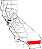
- Moreno Valley, California
-
City of Moreno Valley — City — 
Flag
SealNickname(s): "MoVal" Motto: "People, Pride, Progress" Location in Riverside County and the state of California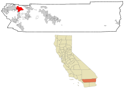
Coordinates: 33°56′35″N 117°13′42″W / 33.94306°N 117.22833°WCoordinates: 33°56′35″N 117°13′42″W / 33.94306°N 117.22833°W Country  United States
State  California
County Riverside Government - Type Council-Manager - City Council Mayor Richard Stewart
Jesse Molina
Richard Stewart
Robin Hastings
Marcelo Co
William H. Batey II- City Manager Henry Garcia Area[1] - Total 51.475 sq mi (133.319 km2) - Land 51.275 sq mi (132.800 km2) - Water 0.200 sq mi (0.519 km2) 0.39% Elevation 1,631 ft (497 m) Population (2010) - Total 186,365 - Rank 2nd in Riverside County
21st in California
119th in the United States- Density 3,620.5/sq mi (1,397.9/km2) Time zone PST (UTC-8) - Summer (DST) PDT (UTC-7) ZIP codes 92551-92557 Area code(s) 909/951 FIPS code 06-49270 GNIS feature ID 1668251 Website http://www.ci.moreno-valley.ca.us Moreno Valley is a city located in Riverside County, California.
A relatively young city, its rapid growth in the 1980s and the first decade of the 21st century made it second-largest city in Riverside County by population, and one of the Inland Empire's population centers. As of the 2010 census[2], the city's population was 193,365. Neighboring Riverside, California is the county seat and largest city in the county and the two cities are closely tied.
Located just north of Lake Perris, Moreno Valley shares March Joint Air Reserve Base with both Riverside, California and the city of Perris.
Contents
History
Prehistory to 1800s
Moreno Valley was originally inhabited by hunter-gatherer Native Americans of the Shoshone tribe. The first Europeans were Spanish scouts, sent from Mexico to explore the area. These Spanish scouts blazed a number of trails in the area, including the Anza Trail, which runs through the Edgemont area of present-day Moreno Valley. The relatively dry portion of the city was largely ignored by these earliest settlers.
U.S. settlement
When California entered the United States as a state in 1850, Americans began to move into the area. The Tucson-to-San Francisco route of John Butterfield's Overland Mail Company passed through Moreno Valley. Some farmers began to occupy the area. They relied upon Frank E. Brown's Bear Valley Land and Water Company to provide them water, which was collected and pumped from Bear Valley in the San Bernardino Mountains to the north. Brown began performing this service in 1883. In 1899, the city of Redlands won a lawsuit in which the city claimed eminent domain over the Bear Valley water; the resulting loss of service forced most of Moreno Valley's inhabitants to move. The valley first acquired its current name, "Moreno Valley," at this time; the name is derived from Frank Brown's name ("moreno" is Spanish for "dark").
March Field
The revival of Moreno Valley began in 1918, when the United States Air Force (then the United States Army Air Service) constructed March Field on the outskirts of Riverside as part of its World War I expansion. March Field was initially used to train fighter pilots. Although it was closed in 1922, it was reopened in 1927 and eventually became a full Air Force base. The presence of March caused the unincorporated communities of Sunnymead, Moreno, and Edgemont to develop and grow. In World War II, March again became a training ground for military pilots.
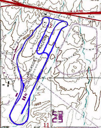
Riverside International Raceway
From 1957 to 1989, Riverside International Raceway occupied the current site of the Moreno Valley Mall. The Riverside International Raceway (Sometimes known as RIR or Riverside Raceway) race track was in operation from September 22, 1957, to July 3, 1989. Races held at the Riverside International Raceway included IMSA,NASCAR, Indycar, NHRA drag racing and AMA motorcycle racing.
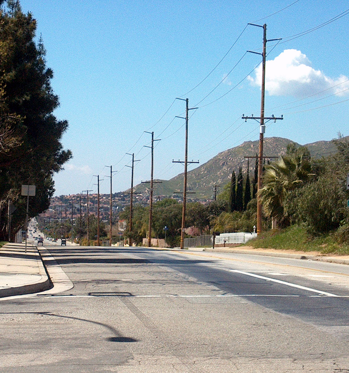
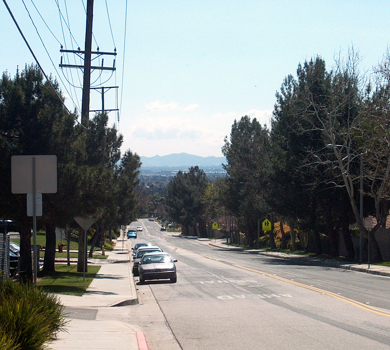
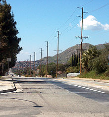 A view of Moreno Valley looking west down Ironwood Avenue. Box Springs Mountain is visible at right.
Incorporation
Moreno Valley experienced explosive growth in the 1980s; by 1984, the valley's population was 49,702 (contrasted with 18,871 residents in 1970). The state economic boom fueled the construction of new houses and businesses. This growth led to a push for incorporation. Although similar measures had failed in 1968 and 1983, a measure to form the city of Moreno Valley was approved by voters in 1984. The communities of Edgemont, Sunnymead, and Moreno were incorporated on December 3, 1984 to form the general law city of Moreno Valley. The first City Council was also elected in 1984, composed of Bob Lynn, Judith A. Nieburger, Steven Webb, J. David Horspool (first Mayor Pro Tem), and Marshall C. Scott (first Mayor). The City Seal and Motto were adopted the following year.
Bust and boom
By 1990, Moreno Valley had exploded in population growth to become the second largest city in Riverside County with a population of over 118,000. Growth continued until about 1992.
In the 1990s, the robust Moreno Valley economy deteriorated, largely due to the statewide economic downturn. Many people began to leave the city. March was also downsized to its present status as March Air Reserve Base. The surplus land was given to the March Joint Powers Authority, made up of representatives of Riverside County and the cities of Riverside, Moreno Valley, and Perris for development. The dismal economic trend began to reverse in the late part of the decade, however. Companies such as Aurora Modular, U-Haul, and Lowe's moved major operating facilities to the city or neighboring municipalities (although Aurora later filed for bankruptcy).
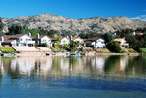
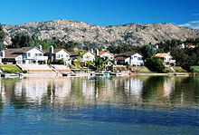 Man-made lake in the Sunnymead Ranch community of northern Moreno Valley.
By the early 21st century, the arrival of so many newcomers to Riverside County and the soaring cost of living in Los Angeles and Orange County combined to make the less-developed southern half of the Inland Empire a very attractive place for industry.
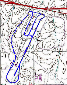 From 1957 to 1989 the Riverside international Raceway occupied the current site of the Moreno Valley Mall. The mall is located toward the northern end of the former raceway.
Nevertheless, Moreno Valley's coming of age can also be seen in the growth of the area around the Moreno Valley Mall (former location of the Riverside Raceway from 1957 to 1989) and nearby Day Street, which straddles the border between Moreno Valley and Riverside. The area has seen massive construction in recent years, attracting Lowe's, Starbucks, Outback Steakhouse, and other stores often seen as prestigious. A Pat & Oscar's and PFF Bank & Trust are being built, and rumors of Famous Dave's and Barnes & Noble coming to the area have emerged lately. These establishments are often seen as appealing to the upper-middle class; this appeal may help attract attention and money to the city.
On the east end of the city off Moreno Beach Drive, a new Wal-Mart was opened in early 2006 (233,000 sq ft (21,600 m2), huge for a traditional Wal-Mart) next to the Moreno Valley Auto Mall. This is also the site of the first Super Target in California and the first (and only) Best Buy store located within Moreno Valley city limits, which opened in July and October 2007, respectively. The exit off state route 60 is the main way to the Moreno Valley Ranch Golf Course, once included in Golf Magazine's Top 75 Golf Courses in the USA.
Recent proposals to turn March Joint Air Reserve Base to a major commercial airport has been debated in 2005, but the plan was rejected by the Riverside county board of supervisors, until further notice. However, the coming of quieter, more environmentally friendly aircraft and cheaper security procedures and utilities may signal a re-consideration of the plan.[citation needed] In May 2008 the March JPA approved opening the facility to general aircraft.
March Air Reserve base has a ball park facility, where the semi-pro baseball Inland Empire (now Rancho Belago) Rockets of the Southern California League play in the summer months season.
DHL controversy
While some may view DHL's selection of March Air Reserve Base as its new Southern California hub as a "bright spot", the March JPA and March Global Port operations that brought DHL have been a matter of considerable controversy. DHL selected the March airport over San Bernardino International Airport and LA/Ontario International Airport. The DHL facility commenced operations in October 2005 (previously expected to be running by March 2005). While initial claims were that the facility would employ 250 workers in its initial stage, over 300 employees went to work daily during normal operations.
Neighboring residents filed an unsuccessful lawsuit to block the zoning change necessary to allow DHL's operations.
In November 2008, due to escalating financial losses associated with deteriorating macroeconomic conditions, DHL announced it was leaving the U.S. market and would shut its operation associated with March Air Field in January 2009.[3]
Rancho Belago
On February 13, 2007, the City Council passed, by a vote of 4-1, a controversial resolution christening the eastern half of the city (roughly from Lasselle Street to Gilman Springs Road) "Rancho Belago", a pastiche of Spanish and Italian words.[4][5][6] The city council's resolution includes the 92555 zipcode within the boundaries of the area, as reported by the Press Enterprise newspaper.
Geography
Moreno Valley is located at 33°55'35" North, 117°13'42" West (33.926267, -117.228345).[7]
According to the United States Census Bureau, the city has a total area of 51.5 square miles (133 km2), of which, 51.3 square miles (133 km2) of it is land and 0.2 square miles (0.52 km2) of it is water.
 Southern Moreno Valley, viewed looking south down Kitching Street.
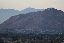 View of Box Spring Mountain from RCC: Moreno Valley.
Moreno Valley is located at a geographic crossroad. To the east lie the San Gorgonio Pass and Coachella Valley; to the south are Lake Perris, Perris, the San Jacinto Mountains, and the route to San Diego; to the north are the San Bernardino Valley and San Bernardino Mountains. To the west lies neighboring Riverside, as well as Los Angeles and Orange Counties. The heavily-traveled routes of State Route 60 (locally called the Moreno Valley Freeway) and Interstate 215 both pass through the city. It lies under approach paths for Los Angeles International Airport, John Wayne Airport in Orange County, LA/Ontario International Airport and San Bernardino International Airport.
One of the most visible geographical features in Moreno Valley, visible from almost anywhere in the city, is Box Springs Mountain. This mountain at the northwest end of the city towers over the city, providing a concrete landmark. The face of the mountain that faces the city has a large "M" constructed upon it. This was built privately at the encouragement of the City Council, which argued it would foster unity. The letter is located on public land and is maintained entirely by charity. The letter had lights installed on December 3, 2005 to celebrate Moreno Valley's 21st anniversary of its incorporation and the completion of the repairs of heavy damage to the M, due to excessive rain the year before. The mayor at that time, Bonnie Flickinger, has said that the citizens liked it that way and that the council would try to get it to light up regularly. Between December 2, 2009 and December 6, 2009, Moreno Valley, along with Edison lit up the "M" in celebration of the city's 25th anniversary. Several Eagle Scout projects have been dedicated to maintaining the letter.
Climate
Moreno Valley has a mild mediterranean climate (Köppen climate classification CSa). The summer temperatures average in the mid to high 90's, though many days can reach well above 100°.
- On average, the warmest month is August.
- The highest recorded temperature was 113 °F (45 °C) in 1960.
- On average, the coolest month is December.
- The lowest recorded temperature was 22 °F (−6 °C) in 1974.
- The maximum average precipitation occurs in December.[8]Climate data for Moreno Valley Month Jan Feb Mar Apr May Jun Jul Aug Sep Oct Nov Dec Year Record high °F (°C) 97
(36)92
(33)98
(37)104
(40)108
(42)112
(44)113
(45)112
(44)113
(45)108
(42)98
(37)93
(34)113
(45)Average high °F (°C) 68
(20)68
(20)71
(22)76
(24)81
(27)87
(31)94
(34)95
(35)91
(33)83
(28)74
(23)67
(19)79 Average low °F (°C) 43
(6)44
(7)46
(8)49
(9)54
(12)57
(14)62
(17)62
(17)59
(15)53
(12)46
(8)42
(6)51 Record low °F (°C) 24
(−4)27
(−3)29
(−2)33
(1)38
(3)44
(7)49
(9)49
(9)42
(6)32
(0)26
(−3)22
(−6)22
(−6)Precipitation inches (mm) 2.33
(59.2)2.50
(63.5).68
(17.3).45
(11.4).31
(7.9).01
(0.3).00
(0).00
(0).08
(2).32
(8.1).74
(18.8)5.24
(133.1)12.75
(323.9)Source no. 1: [9] Source no. 2: [10] Demographics
2010
The 2010 United States Census[11] reported that Moreno Valley had a population of 193,365. The population density was 3,756.5 people per square mile (1,450.4/km²). The racial makeup of Moreno Valley was 80,969 (41.9%) White, 34,889 (18.0%) African American, 1,721 (0.9%) Native American, 11,867 (6.1%) Asian, 1,117 (0.6%) Pacific Islander, 51,741 (26.8%) from other races, and 11,061 (5.7%) from two or more races. Hispanic or Latino of any race were 105,169 persons (54.4%).
The Census reported that 192,811 people (99.7% of the population) lived in households, 471 (0.2%) lived in non-institutionalized group quarters, and 83 (0%) were institutionalized.
There were 51,592 households, out of which 28,586 (55.4%) had children under the age of 18 living in them, 29,000 (56.2%) were opposite-sex married couples living together, 9,990 (19.4%) had a female householder with no husband present, 4,191 (8.1%) had a male householder with no wife present. There were 3,627 (7.0%) unmarried opposite-sex partnerships, and 375 (0.7%) same-sex married couples or partnerships. 6,094 households (11.8%) were made up of individuals and 1,611 (3.1%) had someone living alone who was 65 years of age or older. The average household size was 3.74. There were 43,181 families (83.7% of all households); the average family size was 3.99.
The population was spread out with 62,496 people (32.3%) under the age of 18, 23,563 people (12.2%) aged 18 to 24, 53,726 people (27.8%) aged 25 to 44, 41,446 people (21.4%) aged 45 to 64, and 12,134 people (6.3%) who were 65 years of age or older. The median age was 28.6 years. For every 100 females there were 95.1 males. For every 100 females age 18 and over, there were 91.3 males.
There were 55,559 housing units at an average density of 1,079.3 per square mile (416.7/km²), of which 33,393 (64.7%) were owner-occupied, and 18,199 (35.3%) were occupied by renters. The homeowner vacancy rate was 3.4%; the rental vacancy rate was 7.5%. 123,863 people (64.1% of the population) lived in owner-occupied housing units and 68,948 people (35.7%) lived in rental housing units.
2000
The city became a diverse ethnoburb of a variety of racial and ethnic groups, esp. Blacks, Latinos and Asians replaced the once majority White (non-Hispanic) population in the 1990's. Immigrants often come from Central America, Southeast Asia and the Philippines, the Middle East and Somalia, the Balkans, the Caribbean islands (esp. Cubans and Puerto Ricans) and Samoans to reestablish themselves in older post-WWII suburban tracts in Sunnymead.
Moreno Valley has increasingly become a destination for African-American families from Los Angeles County. Between 2006-2007 alone, Moreno Valley saw a 13% increase in its black population.[12]
Also in the same time period, Latinos became the majority of over half the MoVal's population, especially a large Mexican-American and Mexican population developed in Sunnymead. There are several business strips catering to Spanish-speaking clientele and Latin American cultures.
There were 43,381 households out of which 54.0% had children under the age of 18 living with them, 61.6% were married couples living together, 17.1% had a female householder with no husband present, and 14.9% were non-families. 11.0% of all households were made up of individuals and 3.1% had someone living alone who was 65 years of age or older. The average household size was 3.6 and the average family size was 3.9.
In the city the population was spread out with 36.8% under the age of 18, 10.5% from 18 to 24, 29.5% from 25 to 44, 17.7% from 45 to 64, and 5.5% who were 65 years of age or older. The median age was 27 years. For every 100 females there were 95.8 males. For every 100 females age 18 and over, there were 91.3 males.
The median income for a household in the city was $47,387, and the median income for a family was $48,965 (these figures had risen to $55,604 and $57,385 respectively as of a 2007 estimate[13]). Males had a median income of $38,620 versus $26,492 for females. The per capita income for the city was $14,983. 14.2% of the population and 11.6% of families were below the poverty line. 18.1% of those under the age of 18 and 9.7% of those 65 and older were living below the poverty line.
Government
Local
Moreno Valley is an incorporated common law city. It is governed by a council-manager government. The city is divided into five districts, each of which elect a representative. The council chooses two of its own members to serve as Mayor and Mayor Pro Tem. The council also selects the city manager. The current City Council consists of:
- District 1: Jesse Molina
- District 2: Richard Stewart
- District 3: Robin Hastings
- District 4: Marcelo Co
- District 5: William H. Batey II
Richard Stewart is the current Mayor. Jesse Molina is the current Mayor Pro Tem. The current City Manager is Henry Garcia.[14]
According to the city’s most recent Comprehensive Annual Financial Report, the city’s various funds had $243.3 million in Revenues, $132.8 million in expenditures, $1,076.3 million in total assets, $195.3 million in total liabilities, and $293.8 million in cash and investments.[15]
The structure of the management and coordination of city services is:[15]
City Department Director City Manager Henry Garcia Assistant City Manager Michelle Dawson City Attorney Bob Hansen City Clerk Jane Halstead Community & Economic Development Director Barry Foster Financial & Administrative Services Director Richard Teichert Fire Chief Steve Curley Human Resources Director Juris "Sonny" Morkus Parks and Community Services Director Michael McCarty Police Chief John Anderson Public Works Director / City Engineer Chris A. Vogt State and Federal
In the state legislature Moreno Valley is located in the 37th Senate District, represented by Republican Bill Emmerson, and in the 63rd, 64th, and 65th Assembly Districts, represented by Republicans Mike Morrell, Brian Nestande, and Paul Cook respectively. Federally, Moreno Valley is located in California's 45th congressional district, which has a Cook PVI of R +3[16] and is represented by Republican Mary Bono Mack.
Public Safety
Moreno Valley is serviced by its own regional station of the Riverside County Sheriff's Department for law enforcement. The sheriff's station is currently commanded by Captain John Anderson,[17] who also functions as Moreno Valley's Chief of Police.
Moreno Valley also contracts for fire services with the Riverside County Fire Department through a cooperative agreement with Cal Fire (California Department of Forestry and Fire Protection). Six paramedic engines and three truck companies provide both medical support and fire related services to the city.
American Medical Response is responsible for transports to emergency departments via paramedic ambulance.
Education
Moreno Valley's primary and secondary education needs are fulfilled by the Moreno Valley Unified School District and the Val Verde Unified School District. The former serves approximately 35,000 students, the bulk of the city's children, and has 35 schools, including five high schools: Moreno Valley High School, Canyon Springs High School, Valley View High School, March Mountain High School, and Vista del Lago High School. Val Verde District serves part of southern and eastern Moreno Valley, in addition to parts of Perris, Mead Valley, and unincorporated areas. It serves about 13,000 students and maintains 12 schools; one of its high schools, Rancho Verde High School, is located in Moreno Valley. Some private schools exist, including the local Valley Christian Academy, established in 1979, and Calvary Chapel Academy.
The Riverside Community College District, RCCD, serves 6,500 students at their Moreno Valley College campus. The city is also the location of one of the twenty-six Chapman University campuses. In Neighboring Riverside, students may opt to attend RCCD's main campus, Riverside Community College, the University of California, Riverside, La Sierra University or California Baptist University. California State University, San Bernardino is another popular school for city high school graduates.
Economy
According to the City's 2009 Comprehensive Annual Financial Report,[18] the top employers in the city are:
# Employer # of Employees 1 March Air Reserve Base 9,000 2 Moreno Valley Unified School District 3,752 3 Riverside County Regional Medical Center 2,215 4 Moreno Valley Mall 1,669 5 City of Moreno Valley 1,183 6 Riverside Community College 1,038 7 Val Verde Unified School District 734 8 Walgreens 650 9 Ross Stores 600 10 Wal-Mart 465 Hospitals
There are two hospitals in Moreno Valley:[19]
- Kaiser Permanente Community Hospital, formerly Moreno Valley Community Hospital, is a General Acute Care Hospital with Basic Emergency Services as of 2008.[20][21] Kaiser Permanente officially acquired the Moreno Valley Community Hospital and took complete control in July 2008. Current Kaiser Permanente members began receiving notification of the purchase in March 2008. Moreno Valley residents will not feel the effects of the acquisition immediately, as Kaiser Permanente members were asked to continue using the nearby Riverside facility and the Moreno Valley Clinic for hospital services while the transition process is completed. Kaiser Permanente is planning to increase the size and capacity of the new hospital by adding a new 80+ patient tower and expanding the main facility, as well as increasing the size of the emergency and operating rooms.[22][23][24]
- Riverside County Regional Medical Center is a General Acute Care Hospital with Basic Emergency Services and a Level II Trauma Center.
Notable residents
- Mike Cosgrove: Drummer for Alien Ant Farm
- Greg Dobbs: Thirdbaseman for Philadelphia Phillies graduated from Canyon Springs High School (1996)
- DeNique Ford: Professional Arena football player.
- Bobby Kielty: professional baseball player with the Boston Red Sox, graduated from Canyon Springs High School
- Ryan Madson: Philadelphia Phillies pitcher graduated from Valley View High School in 1998
- Andre McGee: College basketball player for the University of Louisville, (Jersey Number 33), graduated from Canyon Springs High School (2005)
- Dryden Mitchell: Singer for Alien Ant Farm
- Olivia O'Lovely: Pornographic actress
- Jasmine Byrne: Pornographic actress, graduated from Rancho Verde High School. (2003)
- Troy Percival: Former Anaheim Angels All-Star Pitcher, World Series Champion, attended Moreno Valley High School
- Terrelle Smith: Fullback for Arizona Cardinals graduated from Canyon Springs High School (1996)
- Kyle Turley: Kansas City Chiefs star graduated from Valley View High School
- Derrick Ward: New York Giants running back graduated from Valley View High School
- Charlotte Morgan, softball player. Played for the Alabama Crimson Tide and was drafted first overall in the 2010 National Pro Fastpitch Senior Draft
- Daniel Carroll: Outfielder in the Seattle Mariners organization, graduated Valley View High School in 2007, selected in the third round of the 2007 Major League Baseball Draft
- D'Aundre Reed: 2011 NFL Draftee to the Minnesota Vikings, graduated from Rancho Verde High School in 2006.
References
- ^ U.S. Census
- ^ "American FactFinder". United States Census Bureau. http://factfinder.census.gov. Retrieved 2008-01-31.
- ^ "Inland airports' dream of cargo hubs grounded," Press-Enterprise newspaper, Thursday, November 20, 2008
- ^ Resolution of "Rancho Belago"
- ^ http://www.pe.com/localnews/inland/stories/PE_News_Local_R_rname21.43a1895.html
- ^ http://www.pe.com/localnews/perris/stories/PE_News_Local_D_moreno22.3dbd6df.html
- ^ "US Gazetteer files: 2010, 2000, and 1990". United States Census Bureau. 2011-02-12. http://www.census.gov/geo/www/gazetteer/gazette.html. Retrieved 2011-04-23.
- ^ Moreno Valley, CA: Weather Facts Retrieved 2009-05-07
- ^ "Moreno Valley historic weather averages". Weather Channel. http://www.weather.com/outlook/health/fitness/wxclimatology/monthly/graph/USCA0730. Retrieved 06 June 2011.
- ^ "Average Weather for Moreno Valley, CA - Temperatures and Precipitation". weathercurrents.com. http://weathercurrents.com/morenovalley/Climate.do. Retrieved 06 June 2011.
- ^ All data are derived from the United States Census Bureau reports from the 2010 United States Census, and are accessible on-line here. The data on unmarried partnerships and same-sex married couples are from the Census report DEC_10_SF1_PCT15. All other housing and population data are from Census report DEC_10_DP_DPDP1. Both reports are viewable online or downloadable in a zip file containing a comma-delimited data file. The area data, from which densities are calculated, are available on-line here. Percentage totals may not add to 100% due to rounding. The Census Bureau defines families as a household containing one or more people related to the householder by birth, opposite-sex marriage, or adoption. People living in group quarters are tabulated by the Census Bureau as neither owners nor renters. For further details, see the text files accompanying the data files containing the Census reports mentioned above.
- ^ Levister, Chris (August 21, 2008). "Latinos Have Babies, Blacks Move South -- Population Shifts". Black Voice News. http://news.newamericamedia.org/news/view_article.html?article_id=e16651df35b51b30962cd017f31eec2c.
- ^ Moreno Valley 2005-2007 Census Estimate. Retrieved March 23, 2009.
- ^ http://www.moreno-valley.ca.us/city_hall/departments/city_manager.shtml moreno.valley.ca.us
- ^ a b City of Moreno Valley CAFR Retrieved 2009-08-13
- ^ "Will Gerrymandered Districts Stem the Wave of Voter Unrest?". Campaign Legal Center Blog. http://www.clcblog.org/blog_item-85.html. Retrieved 2008-02-10.
- ^ Riverside Sheriff's Department
- ^ City of Moreno Valley CAFR
- ^ California Department of Health Services
- ^ http://www.pe.com/elections/2007/nov/Riverside.html
- ^ http://www.pe.com/localnews/menifee/stories/PE_News_Local_H_forum18.3d2d468.html
- ^ http://www.pe.com/blcS.sc?search=Moreno+Valley+Community+Hospital&cat=all
- ^ http://www.pe.com/localnews/morenovalley/stories/PE_News_Local_H_union12.3e8b1c9.html
- ^ http://www.pe.com/localnews/inland/stories/PE_News_Local_H_kaiser02.41674bb.html
External links
Municipalities and communities of Riverside County, California County seat: Riverside Cities Banning | Beaumont | Blythe | Calimesa | Canyon Lake | Cathedral City | Coachella | Corona | Desert Hot Springs | Eastvale | Hemet | Indian Wells | Indio | Jurupa Valley | La Quinta | Lake Elsinore | Menifee | Moreno Valley | Murrieta | Norco | Palm Desert | Palm Springs | Perris | Rancho Mirage | Riverside | San Jacinto | Temecula | Wildomar
CDPs Aguanga | Anza | Bermuda Dunes | Cabazon | Cherry Valley | Coronita | Crestmore Heights | Desert Center | Desert Edge | Desert Palms | East Hemet | El Cerrito | El Sobrante | French Valley | Garnet | Glen Avon | Good Hope | Green Acres | Highgrove | Home Gardens | Homeland | Idyllwild-Pine Cove | Indio Hills | Lake Mathews | Lake Riverside | Lakeland Village | Lakeview | March ARB | Mead Valley | Meadowbrook | Mecca | Mesa Verde | Mira Loma | Mountain Center | North Shore | Nuevo | Oasis | Pedley | Ripley | Romoland | Rubidoux | Sky Valley | Sunnyslope | Temescal Valley | Thermal | Thousand Palms | Valle Vista | Vista Santa Rosa | Warm Springs | Whitewater | Winchester | Woodcrest
Unincorporated
communitiesAlberhill | Alessandro | Arcilla | Arnold Heights | Belltown | Biskra Palms | Bly | Bonnie Bell | Box Springs | Cactus City | Cahuilla | Cahuilla Hills | Chiriaco Summit | East Blythe | Edgemont | El Cariso | Gilman Hot Springs | La Cresta | Lost Lake | Mortmar | Murrieta Hot Springs | River Bend Lodge | Sun City Palm Desert
Indian
reservationsAgua Caliente Indian Reservation | Cabazon Indian Reservation | Cahuilla Reservation | Colorado River Indian Reservation | Los Coyotes Reservation | Morongo Reservation | Ramona Indian Reservation | Santa Rosa Indian Reservation | Soboba Reservation | Torres-Martinez Indian Reservation
Ghost towns Alamo Bonito | Auld | Bergman | Caleb | Eagle Mountain | Hell | La Placita | Midland | Pinacate | Saahatpa | Terra Cotta
Greater Los Angeles Area Central city Counties Satellite cities Cities
>200kCities and towns
100k–200kBurbank • Compton • Corona • Costa Mesa • Downey • East Los Angeles • El Monte • Fontana • Fullerton • Garden Grove • Inglewood • Lancaster • Mission Viejo • Moreno Valley • Murrieta • Norwalk • Ontario • Orange • Palmdale • Pasadena • Pomona • Rancho Cucamonga • Santa Clarita • Simi Valley • South Gate • Temecula • Thousand Oaks • Torrance • Ventura • Victorville • West CovinaArea regions Antelope Valley • Conejo Valley • Downtown Los Angeles • East Los Angeles • Gateway Cities • Greater Hollywood • Harbor Area • Inland Empire • Palos Verdes Hills • Pomona Valley • San Bernardino Valley • San Fernando Valley • San Gabriel Valley • Santa Ana Valley • Santa Clarita Valley • South Bay • South Los Angeles • Westside Los AngelesLandforms Los Angeles Basin • Baldwin Hills (range) • Calico Mountains • Catalina Island • Channel Islands • Coachella Valley • High Desert—Mojave Desert • Low Desert—Colorado Desert • San Fernando Valley • San Bernardino Mountains • San Gabriel Mountains • Santa Ana Mountains • Santa Monica Mountains • Santa Susana Mountains • Verdugo MountainsBodies of water Los Angeles River • Aliso Creek • Arroyo Seco • Ballona Creek • Bell Creek • Big Bear Lake • Coyote Creek • Lake Arrowhead • Lake Perris • Lake Piru • Malibu Creek • Pacific Ocean • Pyramid Lake • Rio Hondo • San Gabriel River • San Juan Creek • San Pedro Bay • Santa Ana River • Santa Clara River • Santa Margarita River • Santa Monica BayMayors of cities with populations exceeding 100,000 in California - Antonio Villaraigosa
(Los Angeles) - Jerry Sanders
(San Diego) - Chuck Reed
(San Jose) - Edwin M. Lee
(San Francisco) - Ashley Swearengin
(Fresno) - Kevin Johnson
(Sacramento) - Bob Foster
(Long Beach) - Jean Quan
(Oakland) - Harvey Hall
(Bakersfield) - Tom Tait
(Anaheim) - Miguel A. Pulido
(Santa Ana)
- Ronald O. Loveridge
(Riverside) - Ann Johnston
(Stockton) - Cheryl Cox
(Chula Vista) - Bob Wasserman
(Fremont) - Sukhee Kang
(Irvine) - Pat Morris
(San Bernardino) - Jim Ridenour
(Modesto) - Thomas E. Holden
(Oxnard) - Acquanetta Warren
(Fontana) - William H. Batey II
(Moreno Valley)^ - John Drayman
(Glendale)
- Cathy Green
(Huntington Beach)^ - Bob Kellar
(Santa Clarita)^ - William Dalton
(Garden Grove) - Susan Gorin
(Santa Rosa)^ - Jim Wood
(Oceanside) - Donald Kurth
(Rancho Cucamonga) - Paul S. Leon
(Ontario) - R. Rex Parris
(Lancaster) - Pat Hume
(Elk Grove) - James C. Ledford Jr.
(Palmdale) - Stan Skipworth
(Corona)^
- Dennis Donohue
(Salinas) - Elliot Rothman
(Pomona) - Frank Scotto
(Torrance) - Michael Sweeney
(Hayward) - Sam Abed
(Escondido) - Tony Spitaleri
(Sunnyvale) - Bill Bogaard
(Pasadena) - Carolyn Cavecche
(Orange) - F. Richard Jones
(Fullerton)^ - Jacqui Irwin
(Thousand Oaks)^ - Jesus Gamboa
(Visalia)
- Paul Miller
(Simi Valley) - William D. Shinn
(Concord)^ - Gina Garbolino
(Roseville) - Jamie L. Matthews
(Santa Clara) - Osby Davis
(Vallejo) - Rudy Cabriales
(Victorville) - Ernest Gutierrez
(El Monte) - Tom Bates
(Berkeley) - Rick Trejo
(Downey)^ - Eric R. Bever
(Costa Mesa)^ - James T. Butts, Jr.
(Inglewood)

^Mayor selected from city council
Other states: AL • AK • AZ • AR • CA • CO • CT • DE • FL • GA • HI • ID • IL • IN • IA • KS • KY • LA • ME • MD • MA • MI • MN • MS • MO • MT • NE • NV • NH • NJ • NM • NY • NC • ND • OH • OK • OR • PA • RI • SC • SD • TN • TX • UT • VT • VA • WA • WV • WI • WYCategories:- Moreno Valley, California
- Cities in Riverside County, California
- Incorporated cities and towns in California
- Populated places in California with Hispanic majority populations


Wikimedia Foundation. 2010.