- Oak Glen, San Bernardino County, California
-
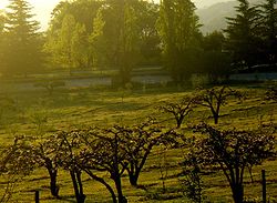
Oak Glen — census-designated place — One of Oak Glen's apple orchards Location within the state of California Coordinates: 34°02′44″N 116°56′59″W / 34.04556°N 116.94972°WCoordinates: 34°02′44″N 116°56′59″W / 34.04556°N 116.94972°W Country  United States
State  California
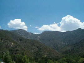
County San Bernardino Area[1] – Total 15.121 sq mi (39.164 km2) – Land 15.117 sq mi (39.153 km2) – Water 0.004 sq mi (0.011 km2) 0.03% Elevation[2] 4,734 ft (1,443 m) Population (2010) – Total 638 – Density 42.2/sq mi (16.3/km2) Time zone Pacific (PST) (UTC-8) – Summer (DST) PDT (UTC-7) ZIP codes FIPS code GNIS feature ID 2583099 Oak Glen is a census-designated place situated between the San Bernardino Mountains and the Little San Bernardino Mountains in San Bernardino County, California, United States. Oak Glen is located 15 miles east of San Bernardino, at an elevation of 4,734 feet (1,443 m). The population was 638 at the 2010 census.
The original settlers, the Cahuilla and the Serrano, harvested acorns; many metates can still be found in the streambeds where the acorns were leached. [3] According to Huell Howser's 2005 California's Gold profile, the potato was the original crop grown by the first Caucasians to settle in the area.
The apple orchards produce the Vasquez and King David varieties, which are grown only in Oak Glen [4], as well as antique varieties no longer commercially available such as Ben Davis, Gravenstein, and Pink Pearl.
Although Oak Glen grew apples mainly for export, in the 1940s several farms began to sell apples, apple pies, apple cider and apple butter at roadside stands. The export trade has virtually disappeared, and growers now earn much of their revenue from visitors who are allowed to pick apples directly off the trees at some of the orchards.
Contents
History
Enoch Parrish opened his apple orchard in 1876, followed by the Wilshire family. The Rivers brothers and their families came to Oak Glen in 1906. Their orchard, Los Rios Rancho (Spanish for "The Rivers Ranch"), is still in operation, as are many of the other original orchards in the area (though many have changed owners over the years). The Law family came into the area with its own apple orchard in the early 1930s and built the first roadside packinghouse and first restaurant and gift shop soon after. Various other shops, a Wildland Trust picnic area and hiking trails, and many special activities make Oak Glen appealing to virtually everyone. A large number of families make a visit to Oak Glen an annual event, with several generations participating.
Geography
According to the United States Census Bureau, the CDP covers an area of 15.1 square miles (39.2 km²), 99.97% of it land, and 0.03% of it water.
Demographics
The 2010 United States Census[5] reported that Oak Glen had a population of 638. The population density was 42.2 people per square mile (16.3/km²). The racial makeup of Oak Glen was 545 (85.4%) White, 50 (7.8%) African American, 13 (2.0%) Native American, 2 (0.3%) Asian, 1 (0.2%) Pacific Islander, 14 (2.2%) from other races, and 13 (2.0%) from two or more races. Hispanic or Latino of any race were 123 persons (19.3%).
The Census reported that 482 people (75.5% of the population) lived in households, 0 (0%) lived in non-institutionalized group quarters, and 156 (24.5%) were institutionalized.
There were 190 households, out of which 42 (22.1%) had children under the age of 18 living in them, 127 (66.8%) were opposite-sex married couples living together, 8 (4.2%) had a female householder with no husband present, 9 (4.7%) had a male householder with no wife present. There were 7 (3.7%) unmarried opposite-sex partnerships, and 2 (1.1%) same-sex married couples or partnerships. 40 households (21.1%) were made up of individuals and 16 (8.4%) had someone living alone who was 65 years of age or older. The average household size was 2.54. There were 144 families (75.8% of all households); the average family size was 2.88.
The population was spread out with 72 people (11.3%) under the age of 18, 76 people (11.9%) aged 18 to 24, 167 people (26.2%) aged 25 to 44, 236 people (37.0%) aged 45 to 64, and 87 people (13.6%) who were 65 years of age or older. The median age was 45.4 years. For every 100 females there were 171.5 males. For every 100 females age 18 and over, there were 180.2 males.
There were 214 housing units at an average density of 14.2 per square mile (5.5/km²), of which 142 (74.7%) were owner-occupied, and 48 (25.3%) were occupied by renters. The homeowner vacancy rate was 3.4%; the rental vacancy rate was 4.0%. 348 people (54.5% of the population) lived in owner-occupied housing units and 134 people (21.0%) lived in rental housing units.
References
- ^ U.S. Census
- ^ U.S. Geological Survey Geographic Names Information System: Oak Glen, San Bernardino County, California
- ^ San Bernardino County Oak Glen Community Plan
- ^ Parrish Pioneer Apple Ranch
- ^ All data are derived from the United States Census Bureau reports from the 2010 United States Census, and are accessible on-line here. The data on unmarried partnerships and same-sex married couples are from the Census report DEC_10_SF1_PCT15. All other housing and population data are from Census report DEC_10_DP_DPDP1. Both reports are viewable online or downloadable in a zip file containing a comma-delimited data file. The area data, from which densities are calculated, are available on-line here. Percentage totals may not add to 100% due to rounding. The Census Bureau defines families as a household containing one or more people related to the householder by birth, opposite-sex marriage, or adoption. People living in group quarters are tabulated by the Census Bureau as neither owners nor renters. For further details, see the text files accompanying the data files containing the Census reports mentioned above.
Further reading
Oak Glen and Los Rios Rancho by J.R. Sanders
External links
Inland Empire Counties Major cities Cities and towns
100k-200kCities and towns
25k-100kApple Valley • Cathedral City • Chino • Chino Hills • Colton • Eastvale • Hemet • Hesperia • Highland • Indio •
Jurupa Valley • Lake Elsinore • Menifee • Montclair • Palm Desert • Palm Springs • Perris • Redlands • Rialto • Rubidoux • San Jacinto • Upland • Valle Vista • Wildomar • YucaipaCities and towns
10k-25kAdelanto • Banning • Barstow • Beaumont • Big Bear Lake • Bloomington • Blythe • Cabazon • Canyon Lake • Coachella • Crestline • Desert Hot Springs • Glen Avon • Grand Terrace • La Quinta • Loma Linda • Mira Loma • Norco • Pedley • Rancho Mirage • Twentynine Palms • Yucca ValleyCities and towns
under 10kBig Bear City • Calimesa • Devore • El Cerrito • Oak Glen • Highgrove • Home Gardens • Indian Wells • Joshua Tree • Lake Arrowhead • Mentone • Muscoy • Needles • Romoland • San Antonio Heights • Sunnyslope • Wrightwood • WoodcrestRegions Coachella Valley • Cucamonga Valley • High Desert • Morongo Basin • San Bernardino Valley • San Jacinto Valley • Victor ValleyCategories:- Unincorporated communities in California
- Census-designated places in San Bernardino County, California
Wikimedia Foundation. 2010.


