- Norco, California
-
City of Norco — City — Location in Riverside County and the state of California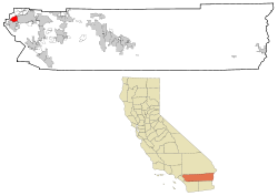
Coordinates: 33°55′38″N 117°33′41″W / 33.92722°N 117.56139°WCoordinates: 33°55′38″N 117°33′41″W / 33.92722°N 117.56139°W Country  United States
State  California
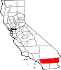
County Riverside Area[1] - Total 14.278 sq mi (36.980 km2) - Land 13.962 sq mi (36.161 km2) - Water 0.316 sq mi (0.819 km2) 2.22% Elevation 640 ft (195 m) Population (2010) - Total 27,063 - Density 1,895.4/sq mi (731.8/km2) Time zone PST (UTC-8) - Summer (DST) PDT (UTC-7) ZIP code 92860 Area code(s) 951 FIPS code 06-51560 GNIS feature ID 1652819 Website City of Norco Norco is a city in Riverside County, California, in the United States. As of the 2010 census, the city population was 27,063, up from 24,157 at the 2000 census. The city's name is an abbreviation of "North Corona."
Contents
Geography
Norco is located at 33°55′38″N 117°33′41″W / 33.92722°N 117.56139°W (33.927124, -117.561326).[2]
According to the United States Census Bureau, the city has a total area of 14.3 square miles (37 km2) of which 14.0 square miles (36 km2) is land and 0.3 square miles (0.78 km2), or 2.22%, is water.
Demographics
2010
The 2010 United States Census[3] reported that Norco had a population of 27,063. The population density was 1,895.4 people per square mile (731.8/km²). The racial makeup of Norco was 20,641 (76.3%) White, 1,893 (7.0%) African American, 248 (0.9%) Native American, 844 (3.1%) Asian, 59 (0.2%) Pacific Islander, 2,514 (9.3%) from other races, and 864 (3.2%) from two or more races. Hispanic or Latino of any race were 8,405 persons (31.1%).
The Census reported that 22,666 people (83.8% of the population) lived in households, 75 (0.3%) lived in non-institutionalized group quarters, and 4,322 (16.0%) were institutionalized.
There were 7,023 households, out of which 2,831 (40.3%) had children under the age of 18 living in them, 4,353 (62.0%) were opposite-sex married couples living together, 777 (11.1%) had a female householder with no husband present, 453 (6.5%) had a male householder with no wife present. There were 354 (5.0%) unmarried opposite-sex partnerships, and 61 (0.9%) same-sex married couples or partnerships. 1,030 households (14.7%) were made up of individuals and 458 (6.5%) had someone living alone who was 65 years of age or older. The average household size was 3.23. There were 5,583 families (79.5% of all households); the average family size was 3.53.
The population was spread out with 5,488 people (20.3%) under the age of 18, 2,798 people (10.3%) aged 18 to 24, 7,854 people (29.0%) aged 25 to 44, 8,303 people (30.7%) aged 45 to 64, and 2,620 people (9.7%) who were 65 years of age or older. The median age was 39.5 years. For every 100 females there were 136.8 males. For every 100 females age 18 and over, there were 146.7 males.
There were 7,322 housing units at an average density of 512.8 per square mile (198.0/km²), of which 5,702 (81.2%) were owner-occupied, and 1,321 (18.8%) were occupied by renters. The homeowner vacancy rate was 1.9%; the rental vacancy rate was 3.8%. 18,572 people (68.6% of the population) lived in owner-occupied housing units and 4,094 people (15.1%) lived in rental housing units.
2000
As of the census[4] of 2000, there were 24,157 people, 6,136 households, and 4,945 families residing in the city. The population density was 1,714.8 people per square mile (662.0/km²). There were 6,277 housing units at an average density of 445.6 per square mile (172.0/km²). The racial makeup of the city was 82.4% White, 6.1% African American, 0.8% Native American, 1.2% Asian, 0.1% Pacific Islander, 6.4% from other races, and 3.0% from two or more races. Hispanic or Latino of any race were 22.8% of the population.
There were 6,136 households out of which 37.7% had children under the age of 18 living with them, 64.7% were married couples living together, 10.4% had a female householder with no husband present, and 19.4% were non-families. 13.7% of all households were made up of individuals and 4.5% had someone living alone who was 65 years of age or older. The average household size was 3.2 and the average family size was 3.4.
In the city the population was spread out with 22.4% under the age of 18, 8.8% from 18 to 24, 37.7% from 25 to 44, 24.5% from 45 to 64, and 6.6% who were 65 years of age or older. The median age was 36 years. For every 100 females there were 128.4 males. For every 100 females age 18 and over, there were 137.6 males.
The median income for a household in the city was $62,652, and the median income for a family was $66,204. Males had a median income of $41,599 versus $30,652 for females. The per capita income for the city was $20,710. About 3.3% of families and 5.3% of the population were below the poverty line, including 3.9% of those under age 18 and 2.2% of those age 65 or over.
Politics
In the state legislature Norco is located in the 37th Senate District, represented by Republican Bill Emmerson, and in the 71st Assembly District, represented by Republican Jeff Miller. Federally, Norco is located in California's 44th congressional district, which has a Cook PVI of R +6[5] and is represented by Republican Ken Calvert.
City politics can be quite heated, with long time friends and allies becoming outspoken critics of one another in the biannual City Council Elections.[citation needed]
In 2003 Norco became a Charter City for the express purpose of protecting and preserving animal keeping rights. The Charter was not extensive, maintaining all aspects of California's General Law provisions except in three areas: horse trails, lot size, and animal keeping rights. To change any ordinances in Norco relating to those three topics requires a supermajority (4/5 ths) vote of the City Council.
Major employers
According to the City of Norco, the major area employers are Corona-Norco Unified School District with 5,215 employees, California Rehabilitation Center with 1,146 employees, and Naval Surface Warfare Center with 1,010 employees.[6]
Horse community
As a horse community, there are few sidewalks in the city of Norco; instead there are horse trails. Riders can ride to town and tie their horses at the many hitching rails and corrals placed close to businesses. There are many associations that are a part of the city, including the Norco Horsemen's Association and the Norco Junior Horsemen's Association. Politics in Norco also are dominated by concerns about horses and animal-keeping vs. suburbanization, a battle that has played out over development in the Norco Hills. In that area, which borders eastern Corona and Riverside, an influx of Orange County commuters are buying homes for $500,000 and up that have few provisions for animal-keeping—regarded by longtime residents[who?], who believe their town's character is in jeopardy, as an affront. The original spirit of the town's incorporation was to promote "City living in a rural atmosphere".
In 2006 Norco began promoting itself as "Horsetown U.S.A". A large cement mural with this logo and reliefs of horses can be seen on the freeway near the I-15 southbound onramp at 6th St. The nickname can also be found on stickers and other promotional items sold around town.
Norco is also the home of the Norco Animal Rescue Team (NART). NART was founded after the October 2003 wildfires that savaged San Bernardino County and San Diego County. During the fires, Norco citizens banded together to provide a place of refuge for horses and other animals being evacuated from the fire areas. In the aftermath of these fires, the community of Norco recognized a need for an organized group to assist in the evacuation of mainly large animals from floods, fires and other dangers. NART's main purpose is to rescue large animals, mainly horses, from dangerous situations such as being stranded in areas where they cannot remove themselves from, such as canyons or ravines, using the Anderson Sling and a helicopter. Such major rescues have been accomplished twice and NART has mobilized during every major fire that has hit southern California since 2004.
The largest event highlighting Norco's community and lifestyle is the annual Norco Valley Fair, sponsored by the Norco Chamber of Commerce. Tickets for the fair are in the form of colorful button pins. Each year a contest is held to design the button. Buttons are sold in the weeks before the Fair by teenage girls competing to be the next Miss Norco. Buttons must be worn at all time by patrons of the Fair or they risk being locked in 'jail' by the Fair's marshals.
The Norco Valley Fair begins on a Thursday evening with the Miss Norco Contest and continues until Sunday and is being held at Raahauge's Shooting Range. Events included at the Fair are the rodeo, rodeo dance, calf dressing competition, pageants, exhibitions, cowboy poker, wild cow milking, snail races, talent show, pet parade, and "Family Fun Day."
Norco's largest event center, George Ingall's Equestrian Event Center at 6th St. and Crestview is a popular location for weekend horse shows, community events, and is now home to the California Finals Rodeo and the 2010 Norco Fair. Construction is underway to expand the equestrian center to include a second covered horse arena and other amenities. The arena is open for free public riding to Norco residents several nights a week.
Public safety
Norco contracts out for law enforcement services with the Riverside County Sheriff's Department through a regional station off Hamner Street, but maintains its own fire department.
The Norco Fire Department operates out of two stations --- one located on Sixth Street and Hillside Avenue, where the Fire Chief's office is; and one located on Corydon Avenue adjacent to Wayne Makin little league fields and Shearer soccer fields. The Norco Fire Department staffs its fire engines with four professional firefighters: a captain, an engineer, and firefighter, and a firefighter/paramedic. By having four firefighters on an engine, the Norco Fire Department is compliant with the "2 in/2 out" safety standard accepted by both state and national professional firefighters organizations. "2 in / 2 out" allows for two firefighters to be inside a burning building while two are outside the fire to maintain water pressure and to respond to any emergencies that may threaten the lives of the firefighters inside the burning building.
Norco bank robbery shootout
See Norco shootout
References
- ^ U.S. Census
- ^ "US Gazetteer files: 2010, 2000, and 1990". United States Census Bureau. 2011-02-12. http://www.census.gov/geo/www/gazetteer/gazette.html. Retrieved 2011-04-23.
- ^ All data are derived from the United States Census Bureau reports from the 2010 United States Census, and are accessible on-line here. The data on unmarried partnerships and same-sex married couples are from the Census report DEC_10_SF1_PCT15. All other housing and population data are from Census report DEC_10_DP_DPDP1. Both reports are viewable online or downloadable in a zip file containing a comma-delimited data file. The area data, from which densities are calculated, are available on-line here. Percentage totals may not add to 100% due to rounding. The Census Bureau defines families as a household containing one or more people related to the householder by birth, opposite-sex marriage, or adoption. People living in group quarters are tabulated by the Census Bureau as neither owners nor renters. For further details, see the text files accompanying the data files containing the Census reports mentioned above.
- ^ "American FactFinder". United States Census Bureau. http://factfinder.census.gov. Retrieved 2008-01-31.
- ^ "Will Gerrymandered Districts Stem the Wave of Voter Unrest?". Campaign Legal Center Blog. http://www.clcblog.org/blog_item-85.html. Retrieved 2008-02-10.
- ^ City of Norco. Major Area Employers. Accessed 10 Dec 2007.
External links
- City of Norco Official Website
- Official Website of the Norco Fair
- Norco Hills Community Information Wiki
Municipalities and communities of Riverside County, California County seat: Riverside Cities Banning | Beaumont | Blythe | Calimesa | Canyon Lake | Cathedral City | Coachella | Corona | Desert Hot Springs | Eastvale | Hemet | Indian Wells | Indio | Jurupa Valley | La Quinta | Lake Elsinore | Menifee | Moreno Valley | Murrieta | Norco | Palm Desert | Palm Springs | Perris | Rancho Mirage | Riverside | San Jacinto | Temecula | Wildomar
CDPs Aguanga | Anza | Bermuda Dunes | Cabazon | Cherry Valley | Coronita | Crestmore Heights | Desert Center | Desert Edge | Desert Palms | East Hemet | El Cerrito | El Sobrante | French Valley | Garnet | Glen Avon | Good Hope | Green Acres | Highgrove | Home Gardens | Homeland | Idyllwild-Pine Cove | Indio Hills | Lake Mathews | Lake Riverside | Lakeland Village | Lakeview | March ARB | Mead Valley | Meadowbrook | Mecca | Mesa Verde | Mira Loma | Mountain Center | North Shore | Nuevo | Oasis | Pedley | Ripley | Romoland | Rubidoux | Sky Valley | Sunnyslope | Temescal Valley | Thermal | Thousand Palms | Valle Vista | Vista Santa Rosa | Warm Springs | Whitewater | Winchester | Woodcrest
Unincorporated
communitiesAlberhill | Alessandro | Arcilla | Arnold Heights | Belltown | Biskra Palms | Bly | Bonnie Bell | Box Springs | Cactus City | Cahuilla | Cahuilla Hills | Chiriaco Summit | East Blythe | Edgemont | El Cariso | Gilman Hot Springs | La Cresta | Lost Lake | Mortmar | Murrieta Hot Springs | River Bend Lodge | Sun City Palm Desert
Indian
reservationsAgua Caliente Indian Reservation | Cabazon Indian Reservation | Cahuilla Reservation | Colorado River Indian Reservation | Los Coyotes Reservation | Morongo Reservation | Ramona Indian Reservation | Santa Rosa Indian Reservation | Soboba Reservation | Torres-Martinez Indian Reservation
Ghost towns Alamo Bonito | Auld | Bergman | Caleb | Eagle Mountain | Hell | La Placita | Midland | Pinacate | Saahatpa | Terra Cotta
Categories:- Cities in Riverside County, California
- Populated places on the Santa Ana River
- Cities in Southern California
- Incorporated cities and towns in California


Wikimedia Foundation. 2010.