- Homeland, California
Infobox Settlement
official_name = Homeland, California
settlement_type = CDP
imagesize =
image_caption =
image_
imagesize =
image_caption =
image_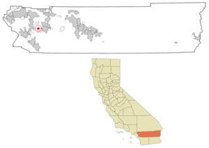
mapsize = 250x200px
map_caption = Location in Riverside County and the state ofCalifornia
mapsize1 =
map_caption1 =
subdivision_type = Country
subdivision_type1 = State
subdivision_type2 = County
subdivision_name =United States
subdivision_name1 =California
subdivision_name2 = Riverside
government_type =
leader_title =
leader_name =
established_date =
area_magnitude =
area_total_km2 = 8.5
area_total_sq_mi = 3.3
area_land_km2 = 8.5
area_land_sq_mi = 3.3
area_water_km2 = 0
area_water_sq_mi = 0
elevation_ft = 1604
elevation_m = 489
population_as_of = 2000
population_footnotes =
population_total = 3710
population_metro =
population_density_km2 = 436.5
population_density_sq_mi = 1124.2
timezone = PST
utc_offset = -8
latd = 33 |latm = 44 |lats = 31 |latNS = N
longd = 117 |longm = 6 |longs = 48 |longEW = W
timezone_DST = PDT
utc_offset_DST = -7
postal_code_type =ZIP code
postal_code = 92548
area_code = 951
blank_name = FIPS code
blank_info = 06-34316
blank1_name = GNIS feature ID
blank1_info = 1652723
footnotes =
website =Homeland is a
census-designated place (CDP) in Riverside County,California ,United States . The population was 3,710 at the 2000 census.Geography
Homeland is located at coor dms|33|44|31|N|117|6|48|W|city (33.741859, -117.113201)GR|1.
According to the
United States Census Bureau , the CDP has a total area of 3.3square mile s (8.5km² ), all of it land.Demographics
As of the
census GR|2 of 2000, there were 3,710 people, 1,572 households, and 985 families residing in the CDP. Thepopulation density was 1,125.9 people per square mile (434.1/km²). There were 1,812 housing units at an average density of 549.9/sq mi (212.0/km²). The racial makeup of the CDP was 79.95% White, 0.78% Black or African American, 1.08% Native American, 0.51% Asian, 0.11% Pacific Islander, 13.88% from other races, and 3.69% from two or more races. 29.70% of the population were Hispanic or Latino of any race.There were 1,572 households out of which 21.4% had children under the age of 18 living with them, 48.6% were married couples living together, 9.5% had a female householder with no husband present, and 37.3% were non-families. 33.1% of all households were made up of individuals and 22.0% had someone living alone who was 65 years of age or older. The average household size was 2.36 and the average family size was 2.99.
In the CDP the population was spread out with 23.0% under the age of 18, 6.7% from 18 to 24, 21.1% from 25 to 44, 18.0% from 45 to 64, and 31.1% who were 65 years of age or older. The median age was 44 years. For every 100 females there were 91.7 males. For every 100 females age 18 and over, there were 88.2 males.
The median income for a household in the CDP was $20,607, and the median income for a family was $22,631. Males had a median income of $25,481 versus $20,038 for females. The
per capita income for the CDP was $11,338. About 19.6% of families and 26.4% of the population were below thepoverty line , including 50.9% of those under age 18 and 6.0% of those age 65 or over.Politics
In the state legislature Homeland is located in the 37th Senate District, represented by Republican
Jim Battin , and in the 65th Assembly District, represented by RepublicanPaul Cook . Federally, Homeland is located inCalifornia's 45th congressional district , which has a Cook PVI of R +3 [cite web | title = Will Gerrymandered Districts Stem the Wave of Voter Unrest? | publisher = Campaign Legal Center Blog | url=http://www.clcblog.org/blog_item-85.html | accessdate = 2008-02-10] and is represented by RepublicanMary Bono Mack .External links
Wikimedia Foundation. 2010.