- Rancho Cucamonga, California
-
"Cucamonga" redirects here. For the historic Mexican rancho, see Rancho Cucamonga. For the California wine region, see Cucamonga Valley AVA. For the old district of Rancho Cucamonga, see Cucamonga, California. For the former Native American settlement, see Cucamonga (former settlement), California.
City of Rancho Cucamonga — City — 
SealMotto: A World Class Community Location of Rancho Cucamonga in San Bernardino County
Coordinates: 34°7′24″N 117°34′46″W / 34.12333°N 117.57944°WCoordinates: 34°7′24″N 117°34′46″W / 34.12333°N 117.57944°W Country  United States
State  California
County San Bernardino Incorporated (city) November 30, 1977[1] Government - Type Council-Manager - City Council Mayor L. Dennis Michael[2]
Sam Spagnolo
William J. Alexander
Chuck Buquet
Diane Williams- City Clerk Janice C. Reynolds - City Treasurer James C. Frost - City Manager Jack Lam Area[3] - Total 39.871 sq mi (103.263 km2) - Land 39.851 sq mi (103.212 km2) - Water 0.0200 sq mi (0.051 km2) 0.05% Elevation 1,207 ft (368 m) Population (2010) - Total 165,269 - Rank 3rd in San Bernardino County
28th in California
142nd in the United States- Density 4,145.1/sq mi (1,600.5/km2) Time zone PST (UTC-8) - Summer (DST) PDT (UTC-7) ZIP Code 91701, 91729, 91730, 91737, 91739[4] Area code(s) 909[5] FIPS code 06-59451 GNIS feature ID 1667908 Website http://www.ci.rancho-cucamonga.ca.us/ Rancho Cucamonga is a suburban city in San Bernardino County, California, United States. As of the 2010 census, the city had a population of 165,269, up from 127,743 at the 2000 census. L. Dennis Michael was elected as Mayor on November 2, 2010. Jack Lam is the City Manager. The city was incorporated in 1977, as a result of a vote among the residents of the unincorporated communities of Alta Loma, Cucamonga, and Etiwanda.[6]
Money's Best Places to Live 2006 ranked Rancho Cucamonga as #42 in America.[7] Remembered by fans of comedian and radio personality Jack Benny who would often hear a train announcement made by Mel Blanc calling out: "Train leaving on track five for Anaheim, Azusa and Cucamonga!". This running gag became so well known that it eventually led to a statue of Benny in Cucamonga.
Contents
Geography
Rancho Cucamonga is located at 34°7′24″N 117°34′46″W / 34.12333°N 117.57944°W (34.123345, -117.579404),[8] or about 39 miles (63 km) east of Los Angeles.
According to the United States Census Bureau, the city has a total area of 39.9 square miles (103 km2). 99.95% of it is land and 0.05% is water.
Rancho Cucamonga is the conjunction of the Mojave Trail, the Old Spanish Trail, the Santa Fe Trail, former U.S. Route 66 (now signed as Foothill Boulevard), and El Camino Real.
Demographics
2010
The 2010 United States Census[9] reported that Rancho Cucamonga had a population of 165,269. The population density was 4,145.2 people per square mile (1,600.5/km²). The racial makeup of Rancho Cucamonga was 102,401 (62.0%) White, 15,246 (9.2%) African American, 1,134 (0.7%) Native American, 17,208 (10.4%) Asian, 443 (0.3%) Pacific Islander, 19,878 (12.0%) from other races, and 8,959 (5.4%) from two or more races. Hispanic or Latino of any race were 57,688 persons (34.9%).
The Census reported that 162,145 people (98.1% of the population) lived in households, 136 (0.1%) lived in non-institutionalized group quarters, and 2,988 (1.8%) were institutionalized.
There were 54,383 households, out of which 23,055 (42.4%) had children under the age of 18 living in them, 30,533 (56.1%) were opposite-sex married couples living together, 7,514 (13.8%) had a female householder with no husband present, 3,257 (6.0%) had a male householder with no wife present. There were 2,995 (5.5%) unmarried opposite-sex partnerships, and 425 (0.8%) same-sex married couples or partnerships. 9,956 households (18.3%) were made up of individuals and 2,679 (4.9%) had someone living alone who was 65 years of age or older. The average household size was 2.98. There were 41,304 families (76.0% of all households); the average family size was 3.41.
The population was spread out with 42,550 people (25.7%) under the age of 18, 17,365 people (10.5%) aged 18 to 24, 48,600 people (29.4%) aged 25 to 44, 43,710 people (26.4%) aged 45 to 64, and 13,044 people (7.9%) who were 65 years of age or older. The median age was 34.5 years. For every 100 females there were 97.6 males. For every 100 females age 18 and over, there were 95.2 males.
There were 56,618 housing units at an average density of 1,420.1 per square mile (548.3/km²), of which 35,250 (64.8%) were owner-occupied, and 19,133 (35.2%) were occupied by renters. The homeowner vacancy rate was 1.6%; the rental vacancy rate was 5.2%. 110,570 people (66.9% of the population) lived in owner-occupied housing units and 51,575 people (31.2%) lived in rental housing units.
2000
As of the census[10] of 2000, there were 127,743 people, 40,863 households, and 31,832 families residing in the city. The population density was 1,317.0/km² (3,411.4/mi²). There were 42,134 housing units at an average density of 434.4/km² (1,125.2/mi²). The racial makeup of the city was 66.53% White, 9.00% Asian, 0.67% Native American, 5.99% African American, 0.27% Pacific Islander, 13.25% from other races, and 5.41% from a biracial or multiracial background. Hispanic or Latino of any race were 27.78% of the population.
There are 40,863 households, of which 44.7% have children under the age of 18. 60.2% of households consist of a married couple living together. 12.8% have a female householder with no husband present. 22.1% were non-families. 16.8% of all households are single-person and 4.1% have a person of 65 years of age or older. The average household size was 3.04 and the average family size was 3.44.
In the city, the population spread is as follows: 29.9% are under the age of 18, 9.9% are from 18 to 24, 33.2% are from 25 to 44, 21.0% are from 45 to 64, and 6.1% are 65 years of age or older. The median age is 32 years. For every 100 females there were 100.1 males. For every 100 females age 18 and over, there were 98.0 males.
The median income for a household in the city was $78,428 and the median income for a family was $91,240. Males had a median income of $50,288 versus $40,952 for females. The per capita income for the city was $23,702. About 4.9% of families and 7.1% of the population were below the poverty line, including 7.6% of those under age 18 and 7.3% of those age 65 or over.
Population history
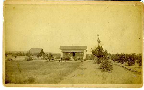
 Orchards and farms, such as this Cucamonga ranch photographed in 1884, had dominated the landscape of the area until the recent land development boom in the late 20th century.
- 1950 - 1,255*
- 1960 - N/A
- 1970 - 5,796*
- 1980 - 55,250
- 1990 - 101,409
- 2000 - 127,743
- 2010 - 165,269
(*): Population figures for 1950 and 1970 are for the Cucamonga portion of the city only and the figures were tabulated prior to incorporation in 1977. The 1960 census data was not available.
Source: U.S. Census Bureau
Economy
Commerce and culture
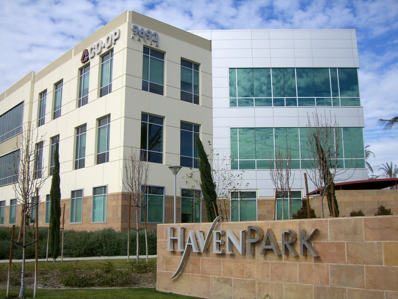
 An example of the office parks along Haven Avenue.
While most of the city's land area is devoted to residential areas, Rancho Cucamonga, like its neighbors Ontario and Fontana, is a major center for the Logistics industry in Southern California. This is due to its proximity to two Interstate Highways and Ontario International Airport, and the space afforded by the large tracts of former agricultural land in the southern section of the city.[11] In the area around Milliken Avenue, between Archibald and Etiwanda Avenues, Foothill Boulevard, and Fourth Street, about seven square miles of land are primarily occupied by numerous massive distribution centers, and even more, smaller manufacturing companies. This area is ringed by wealthy office parks, mostly along Haven Avenue, and shopping strips, such as the Terra Vista Town Center (part of a nearly two-square-mile master-planned community in the center of the city), and malls, such as the Ontario Mills, across Fourth Street in Ontario.[12] The city is also home to Tamco Steel, which runs the only steel mini-mill in California. This mill recycles ferrous scrap, such as junked cars and appliances, to produce rebar.[13]
The city is also the location of The Epicenter, a minor-league baseball stadium, home of the Rancho Cucamonga Quakes. The Quakes' mascot, Tremor, is a "Rallysaurus". A firework show is held after every Saturday game.
According to the City's 2009 Comprehensive Annual Financial Report,[14] the top employers in the city are:
# Employer # of employees 1 Chaffey Community College 1,300 2 Etiwanda School District 1,267 3 Alta Loma School District 923 4 City of Rancho Cucamonga 908 5 Amphastar Pharmaceuticals 880 6 Southern California Edison 800 7 Mercury Insurance Group 550 8 West Coast Liquidators 521 9 Frito-Lay, Inc. 572 10 CMC Steel Fabricators 517 Victoria Gardens and Foothills Crossing
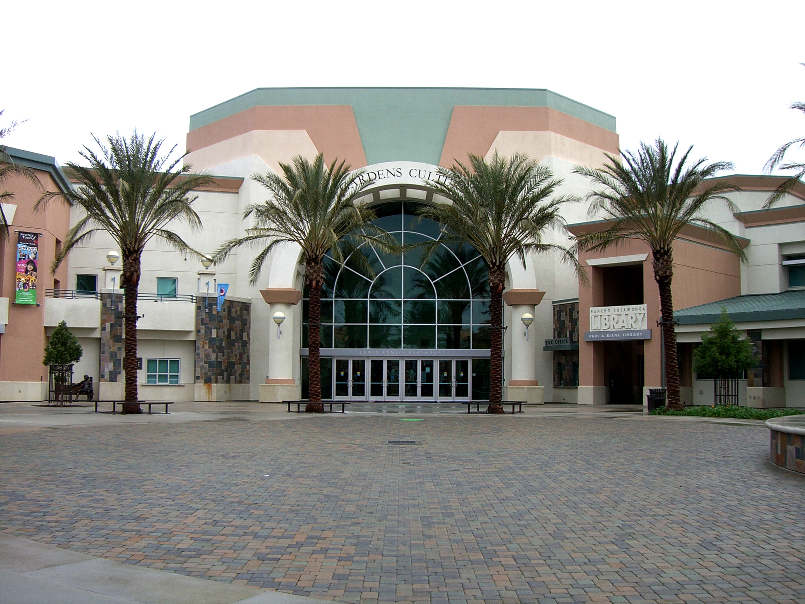
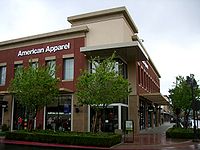 An example of the architecture and urban design of Victoria Gardens.
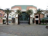 The Victoria Gardens Cultural Center.
The Victoria Gardens lifestyle center, built in the eastern end of the city, is located at the intersection of Foothill and Day Creek Boulevards. Since the city had never developed a traditional commercial downtown like neighboring cities Ontario and Upland had, special efforts were made in the design of Victoria Gardens in order to bring elements of more traditional and urban town design to what had historically been a decidedly suburban city. While retaining many characteristics of traditional shopping malls, such as large anchor stores, a food court, and sufficiently vast surrounding parking lots and garages, the smaller stores are arranged as city blocks in a grid of two-lane streets, featuring lush landscaping and metered "teaser parking" in front of the stores, which open right up to the sidewalk. There are two "Main Streets", which run from west to east across the center. Running from north to south between them is a pedestrian axis leading from one of the Macy's anchor stores, through a "town square" between a pair of mixed-use office buildings, to the Victoria Gardens Cultural Center, which contains a 570 seat theater and a city library. In addition to the food court, there are restaurants throughout the center, both well-known chains and unique eateries including California Pizza Kitchen, Fleming's, Gyu-Kaku Japanese BBQ Dining, Harry's Pacific Grill, Johnny Rockets, King's Fish House, Lucille's BBQ, P.F. Chang's China Bistro, Richie's Diner, T.G.I. Friday's, and Yard House. The center also features a 12 screen AMC Theatre. Foothills Crossing is a shopping center located at Foothill Blvd and is also seen of the Interstate 15.
Across the street from Victoria Gardens, Rancho Cucamonga also boasts Southern California's only Bass Pro Shops Outdoor World superstore. Both are highly visible from Interstate 15.
Government
Local government
Rancho Cucamonga is a General Law City, incorporated in 1977 under the "Council-Manager" form of local government. The four-member Council, plus the Mayor, City Clerk, and City Treasurer, are all elected at-large by the voters of the city. The Council then appoints the City Manager, who acts as the aministrative head of the city government, and is responsible for the day-to-day operations, code enforcement, and the fiscal soundness of the municipal government. The council itself serves as a local legislative body.
According to the city’s most recent Comprehensive Annual Financial Report, the city’s various funds had $278.3 million in Revenues, $243.6 million in expenditures, $1,400.7 million in total assets, $492.1 million in total liabilities, and $583.3 million in cash and investments.[14]
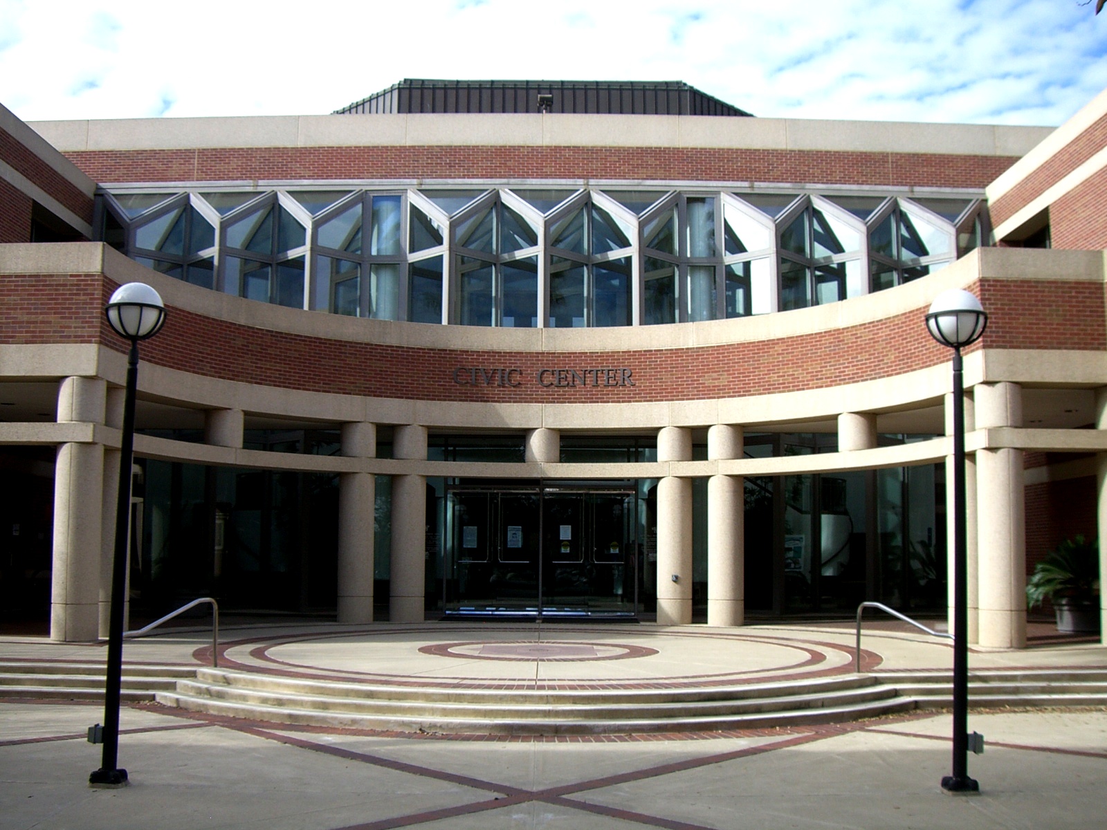
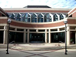 Main entrance to Rancho Cucamonga City Hall
The structure of the management and coordination of city services is:[14]
City department Director City Manager Jack Lam (retired 2011) Assistant City Manager John Gillison Deputy City Manager/Administrative Services Vacant Deputy City Manager/Economic & Community Development Linda Daniels City Attorney James L. Markman Animal Services Director Joe Pulcinella Building and Safety Official Trang Huynh Community Services Director Kevin McArdle City Engineer Mark Steuer Finance Director Tamara L. Layne Fire Chief Mike Bell Human Resources Director Chris Paxton Library Director Robert Karatsu Planning Director James Troyer Police Chief Joe Cusimano Public Works Services Director Bill Wittkopf Politics
In the state legislature Rancho Cucamonga is located in the 31st Senate District, represented by Republican Robert Dutton, and in the 63rd Assembly District, represented by Republican Mike Morrell. Federally, Rancho Cucamonga is located in California's 26th congressional district, which has a Cook PVI of R +3[15] and is represented by Republican David Dreier. In 2005, the non-partisan Bay Area Center for Voting Research ranked Rancho Cucamonga as the 28th most conservative city in the United States.[16]
Rancho Cucamonga is also home to the Foothill Communities San Bernardino County Courthouse.
Infrastructure
Rancho Cucamonga's particular situation at the base of the San Gabriel Mountains has necessitated the use of numerous control channels and basins across the city to reduce the seasonal flood danger from the several streams descending from the range. In past years, some of the city's roads were known for flooding repeatedly. Hermosa Avenue, in particular, now features many high stone curbs and extra-large storm drain grates in order to mitigate the floods.
Utilities
Rancho Cucamonga receives natural gas from the Southern California Gas Company. The city's water supply and sewage are managed by the Cucamonga Valley Water District. Garbage collection is by Burrtec Disposal, phone service is from Verizon, and cable TV is provided by Time Warner Cable and Charter Communications.[17]
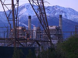
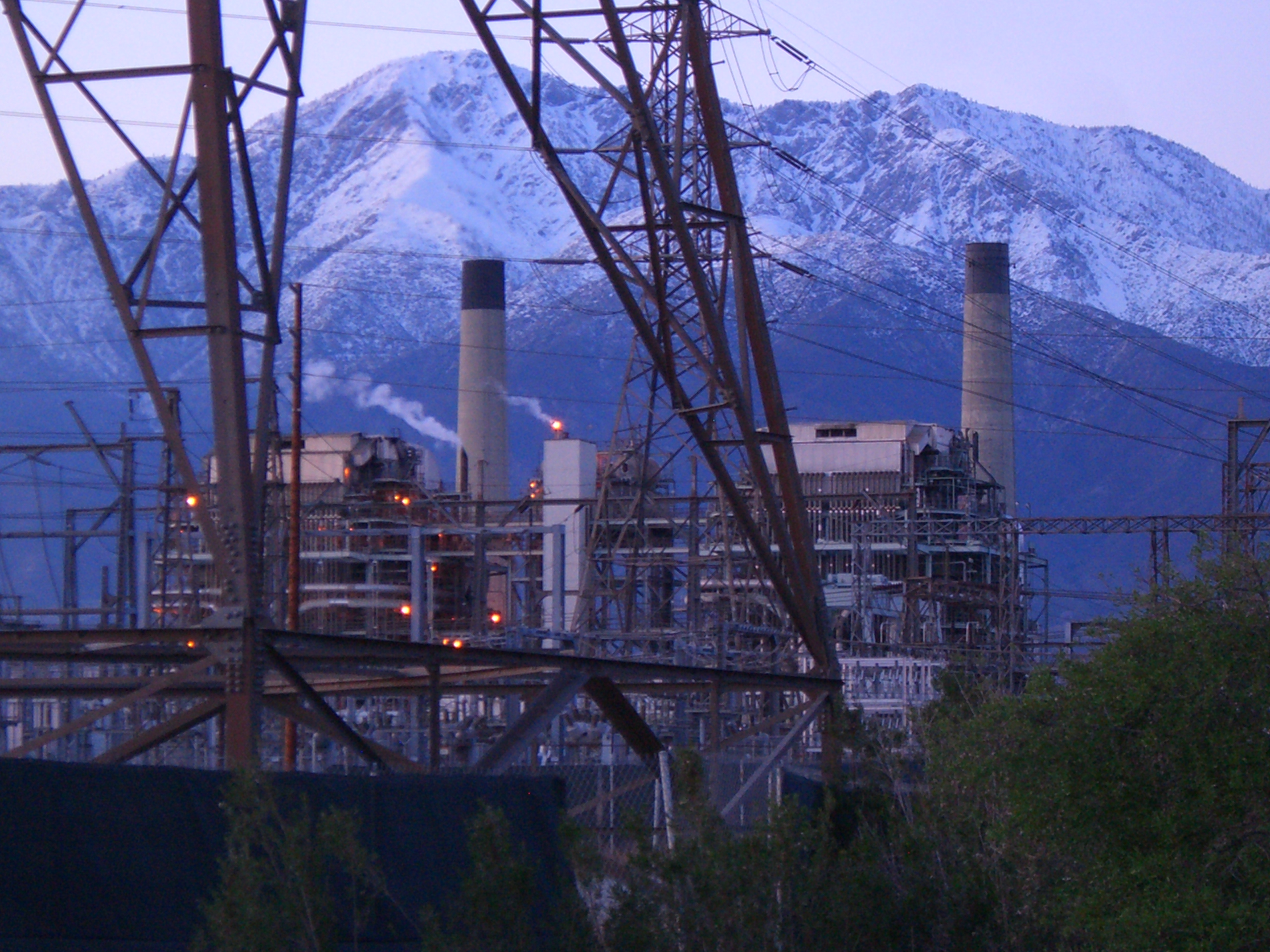
Electric power in Rancho Cucamonga is provided by Southern California Edison and the Rancho Cucamonga Municipal Utility, and the city is also home to the Reliant Energy Etiwanda Generating Station, on Etiwanda Avenue. This facility, one of five Reliant stations in California, is a natural gas-fired power plant, which began operation in 1963. At 640 MW net capacity, it is Reliant's second-highest capacity plant on the West Coast. It utilizes four steam turbine generators; of which units three and four are currently active. Steam turbines one and two, as well as a combustion turbine, were retired in 2003 and 2004, respectively. Several systems are in place to control gas emissions, and annually, over 900,000,000 gallons of recycled water are used for cooling.[18][19]
Transportation
Rancho Cucamonga is served by Omnitrans Bus Service, Metrolink Train Service, and nearby Ontario International Airport. Interstate 15 and the relatively new 210 freeway extension run through Rancho Cucamonga as well as the historic U.S. Route 66. I-15 sits atop an elevated berm, and cuts a curve through the southeastern part of the city, isolating a mostly industrial area, a small shopping center, and several housing tracts from the larger part of the city. It then levels out toward the north, and forms part of the northeastern border with neighboring Fontana, before entering the Cajon Pass through the San Gabriel Mountains. Route 210 runs nearly straight east-west through the northern part of the city, roughly bisecting the residential communities of Alta Loma and Etiwanda. The western section of the freeway, as it passes through the city, sits in a trench, but east of Day Creek Boulevard, the freeway levels out, then becomes elevated as it passes the San Sevaine creek flood control basins, before passing into Fontana at the angled interchange with I-15.
Education
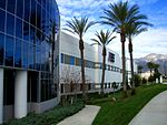
 Archibald Avenue Library
Schools
 UTI (Universal Technical Institute)
Rancho Cucamonga has multiple public K-12 schools, operating under several different school districts, within its borders: Alta Loma School District, Central School District, Cucamonga School District, Etiwanda School District, and Chaffey Joint Union High School District. In addition to these, Rancho Cucamonga is the home to Chaffey College and satellite campuses of the University of La Verne, University of Redlands, Everest College, and University of Phoenix, as well as the automotive trade school, Universal Technical Institute. Its newest addition is the private school Upland Christian Academy.
High Schools
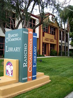
Libraries
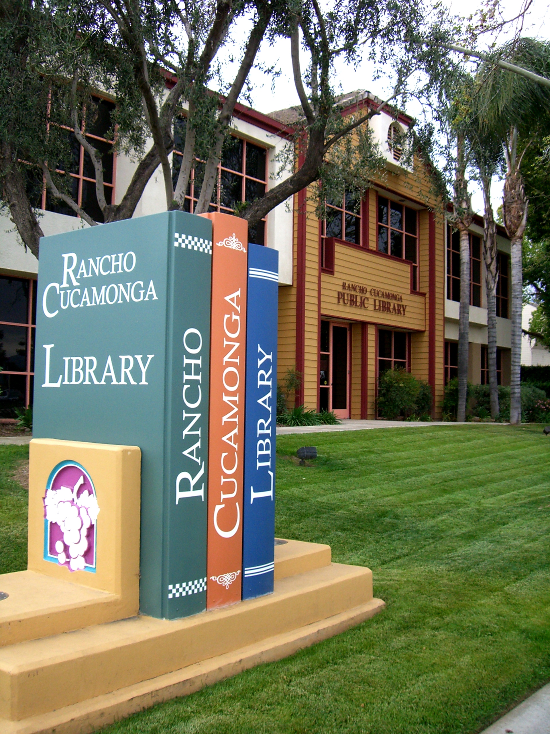
The city of Rancho Cucamonga has two public libraries, with a combined total of over 200,000 volumes. The library at 7368 Archibald Avenue opened in 1994 and was remodeled in the summer of 2008. The Paul A. Biane library at 12505 Cultural Center Drive at the Victoria Gardens Cultural Center opened in August 2006.[citation needed]
See also
- List of people from Rancho Cucamonga, California
References
- ^ "Incorporation Dates of California Cities". http://www.cacities.org/resource_files/20457.IncorpDateLO.doc. Retrieved 2007-02-20.
- ^ "Rancho Cucamonga - City Mayor". http://www.CityofRC.us/cityhall/council/michael.asp. Retrieved 2007-02-20.
- ^ U.S. Census
- ^ "USPS - ZIP Code Lookup - Find a ZIP+ 4 Code By City Results". http://zip4.usps.com/zip4/zcl_1_results.jsp?visited=1&pagenumber=0&state=ca&city=Rancho%20Cucamonga. Retrieved 2007-02-20.
- ^ "Number Administration System - NPA and City/Town Search Results". http://www.nanpa.com/nas/public/npa_city_query_step2.do?method=displayData&cityToNpaModel.stateAbbr=CA&cityToNpaModel.city=Rancho%20Cucamonga. Retrieved 2007-02-20.
- ^ Roger Vincent and Adrian G. Uribarri (November 25, 2006). "Getting the masses in the mood". Los Angeles Times. http://articles.latimes.com/2006/nov/25/business/fi-shop25/2. Retrieved 2011-10-29.
- ^ "MONEY Magazine: Best places to live 2006: Rancho Cucamonga, CA snapshot". CNN. http://money.cnn.com/magazines/moneymag/bplive/2006/snapshots/PL0659451.html.
- ^ "US Gazetteer files: 2010, 2000, and 1990". United States Census Bureau. 2011-02-12. http://www.census.gov/geo/www/gazetteer/gazette.html. Retrieved 2011-04-23.
- ^ All data are derived from the United States Census Bureau reports from the 2010 United States Census, and are accessible on-line here. The data on unmarried partnerships and same-sex married couples are from the Census report DEC_10_SF1_PCT15. All other housing and population data are from Census report DEC_10_DP_DPDP1. Both reports are viewable online or downloadable in a zip file containing a comma-delimited data file. The area data, from which densities are calculated, are available on-line here. Percentage totals may not add to 100% due to rounding. The Census Bureau defines families as a household containing one or more people related to the householder by birth, opposite-sex marriage, or adoption. People living in group quarters are tabulated by the Census Bureau as neither owners nor renters. For further details, see the text files accompanying the data files containing the Census reports mentioned above.
- ^ "American FactFinder". United States Census Bureau. http://factfinder.census.gov. Retrieved 2008-01-31.
- ^ http://www.citivu.com/rc/city/tlanes.html
- ^ http://www.cityofrc.us/govt/documents/Exhibit3-1LANDUSE.pdf
- ^ http://www.tamcosteel.com/compinfo.html
- ^ a b c "City of Rancho Cucamonga - Comprehensive Annual Financial Report". City of Rancho Cucamonga. 2009. http://www.CityofRC.us/cityhall/admin/finance/budgeting.asp.
- ^ "Will Gerrymandered Districts Stem the Wave of Voter Unrest?". Campaign Legal Center Blog. http://www.clcblog.org/blog_item-85.html. Retrieved 2007-10-18.
- ^ Modie, Neil (2005-08-12). "Where have Seattle's lefties gone?". Seattle Post-Intelligencer. http://www.seattlepi.com/local/236320_liberal12.html. Retrieved 2009-09-24.
- ^ http://www.cityofrc.us/index_res.htm
- ^ http://www.reliant.com/en_US/Page/Generic/Public/Wholesale_Plant_Listings.jsp#etiwanda
- ^ http://www.reliant.com/en_US/Page/Generic/Public/Wholesale_Plant_Listings.jsp
External links
- Rancho Cucamonga Redevelopment Agency
- History of Rancho Cucamonga on official city web site
- Rancho Cucamonga Library web site
- The History of Casa de Rancho Cucamonga
- Rancho Cucamonga Chamber of Commerce
- Cucamonga Valley Water District
- City of Rancho Cucamonga
Municipalities and communities of San Bernardino County, California County seat: San Bernardino Cities and towns Adelanto | Apple Valley | Barstow | Big Bear Lake | Chino | Chino Hills | Colton | Fontana | Grand Terrace | Hesperia | Highland | Loma Linda | Montclair | Needles | Ontario | Rancho Cucamonga | Redlands | Rialto | San Bernardino | Twentynine Palms | Upland | Victorville | Yucaipa | Yucca Valley
CDPs Baker | Big Bear City | Big River | Bloomington | Bluewater | Crestline | Fort Irwin | Homestead Valley | Joshua Tree | Lake Arrowhead | Lenwood | Lucerne Valley | Lytle Creek | Mentone | Morongo Valley | Mountain View Acres | Muscoy | Oak Glen | Oak Hills | Phelan | Piñon Hills | Running Springs | San Antonio Heights | Searles Valley | Silver Lakes | Spring Valley Lake | Wrightwood
Unincorporated
communitiesAmboy | Angelus Oaks | Argus | Arrowbear Lake | Baldy Mesa | Bell Mountain | Blue Jay | Bryn Mawr | Cadiz | Cedar Glen | Cedarpines Park | Cima | Crafton | Crest Park | Daggett | Declezville | Del Rosa | Devore | Earp | El Mirage | Essex | Fawnskin | Fenner | Forest Falls | Goffs | Green Valley Lake | Guasti | Halloran Springs | Havasu Lake | Helendale | Hinkley | Hodge | Ivanpah | Johnson Valley | Landers | Ludlow | Mojave Heights | Mount Baldy | Mountain Pass | Nebo Center | Newberry Springs | Nipton | Oro Grande | Patton | Parker Dam | Parker Junction | Pioneer Point | Pioneertown | Red Mountain | Rimforest | Skyforest | Sugarloaf | Sunfair | Sunfair Heights | Trona | Twentynine Palms Base | Twin Peaks | Vidal | Vidal Junction | Yermo | Zzyzx
Indian
reservationsGhost towns Greater Los Angeles Area Central city Counties Satellite cities Cities
>200kCities and towns
100k–200kBurbank • Compton • Corona • Costa Mesa • Downey • East Los Angeles • El Monte • Fontana • Fullerton • Garden Grove • Inglewood • Lancaster • Mission Viejo • Moreno Valley • Murrieta • Norwalk • Ontario • Orange • Palmdale • Pasadena • Pomona • Rancho Cucamonga • Santa Clarita • Simi Valley • South Gate • Temecula • Thousand Oaks • Torrance • Ventura • Victorville • West CovinaArea regions Antelope Valley • Conejo Valley • Downtown Los Angeles • East Los Angeles • Gateway Cities • Greater Hollywood • Harbor Area • Inland Empire • Palos Verdes Hills • Pomona Valley • San Bernardino Valley • San Fernando Valley • San Gabriel Valley • Santa Ana Valley • Santa Clarita Valley • South Bay • South Los Angeles • Westside Los AngelesLandforms Los Angeles Basin • Baldwin Hills (range) • Calico Mountains • Catalina Island • Channel Islands • Coachella Valley • High Desert—Mojave Desert • Low Desert—Colorado Desert • San Fernando Valley • San Bernardino Mountains • San Gabriel Mountains • Santa Ana Mountains • Santa Monica Mountains • Santa Susana Mountains • Verdugo MountainsBodies of water Los Angeles River • Aliso Creek • Arroyo Seco • Ballona Creek • Bell Creek • Big Bear Lake • Coyote Creek • Lake Arrowhead • Lake Perris • Lake Piru • Malibu Creek • Pacific Ocean • Pyramid Lake • Rio Hondo • San Gabriel River • San Juan Creek • San Pedro Bay • Santa Ana River • Santa Clara River • Santa Margarita River • Santa Monica BayMayors of cities with populations exceeding 100,000 in California - Antonio Villaraigosa
(Los Angeles) - Jerry Sanders
(San Diego) - Chuck Reed
(San Jose) - Edwin M. Lee
(San Francisco) - Ashley Swearengin
(Fresno) - Kevin Johnson
(Sacramento) - Bob Foster
(Long Beach) - Jean Quan
(Oakland) - Harvey Hall
(Bakersfield) - Tom Tait
(Anaheim) - Miguel A. Pulido
(Santa Ana)
- Ronald O. Loveridge
(Riverside) - Ann Johnston
(Stockton) - Cheryl Cox
(Chula Vista) - Bob Wasserman
(Fremont) - Sukhee Kang
(Irvine) - Pat Morris
(San Bernardino) - Jim Ridenour
(Modesto) - Thomas E. Holden
(Oxnard) - Acquanetta Warren
(Fontana) - William H. Batey II
(Moreno Valley)^ - John Drayman
(Glendale)
- Cathy Green
(Huntington Beach)^ - Bob Kellar
(Santa Clarita)^ - William Dalton
(Garden Grove) - Susan Gorin
(Santa Rosa)^ - Jim Wood
(Oceanside) - Donald Kurth
(Rancho Cucamonga) - Paul S. Leon
(Ontario) - R. Rex Parris
(Lancaster) - Pat Hume
(Elk Grove) - James C. Ledford Jr.
(Palmdale) - Stan Skipworth
(Corona)^
- Dennis Donohue
(Salinas) - Elliot Rothman
(Pomona) - Frank Scotto
(Torrance) - Michael Sweeney
(Hayward) - Sam Abed
(Escondido) - Tony Spitaleri
(Sunnyvale) - Bill Bogaard
(Pasadena) - Carolyn Cavecche
(Orange) - F. Richard Jones
(Fullerton)^ - Jacqui Irwin
(Thousand Oaks)^ - Jesus Gamboa
(Visalia)
- Paul Miller
(Simi Valley) - William D. Shinn
(Concord)^ - Gina Garbolino
(Roseville) - Jamie L. Matthews
(Santa Clara) - Osby Davis
(Vallejo) - Rudy Cabriales
(Victorville) - Ernest Gutierrez
(El Monte) - Tom Bates
(Berkeley) - Rick Trejo
(Downey)^ - Eric R. Bever
(Costa Mesa)^ - James T. Butts, Jr.
(Inglewood)

^Mayor selected from city council
Other states: AL • AK • AZ • AR • CA • CO • CT • DE • FL • GA • HI • ID • IL • IN • IA • KS • KY • LA • ME • MD • MA • MI • MN • MS • MO • MT • NE • NV • NH • NJ • NM • NY • NC • ND • OH • OK • OR • PA • RI • SC • SD • TN • TX • UT • VT • VA • WA • WV • WI • WYCategories:- 1977 establishments
- Cities in San Bernardino County, California
- Communities on U.S. Route 66
- Rancho Cucamonga, California
- Incorporated cities and towns in California


Wikimedia Foundation. 2010.