- Ventura County, California
-
County of Ventura — County — 
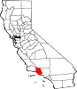
SealLocation in the state of California California's location in the United States
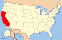
Country  United States
State  California
Region Southern California Incorporated 1873 County seat Ventura Largest city Oxnard Area – Total 5,719.2 km2 (2,208.20 sq mi) – Land 4,779.3 km2 (1,845.30 sq mi) – Water 939.9 km2 (362.90 sq mi) Population (2010) – Total 823,318 – Density 144/km2 (372.8/sq mi) Time zone Pacific Standard Time (UTC-8) – Summer (DST) Pacific Daylight Time (UTC-7) Area code(s) 805 Website www.countyofventura.org Ventura County is a county in the southern part of the U.S. state of California. It is located on California's Pacific coast. It is often referred to as the Gold Coast,[citation needed] and has a reputation of being one of the safest populated places and one of the most affluent places in the country.[citation needed] It is ranked as one of the 100 highest-income counties in the country and as the sixth wealthiest county in California by per capita income.[citation needed] This is partly because it is part of the Tech Coast Area,[citation needed] and has a large presence in technology corporations like telecommunications, healthcare, development, and especially biotech corporations, most of which are located in the Conejo Valley.[citation needed] As of December 2008, the median home price was $355,000.[1]
As of the 2010 census, the county had a population of 823,318. The county seat is the city of Ventura (formally known as San Buenaventura). Ventura County's largest city is Oxnard, with a population of about 200,000.
Contents
History
Prior to the arrival of Europeans in California, the area was home to the Chumash tribe of Native Americans.
Spanish period
In October 1542, the expedition led by Juan Rodríguez Cabrillo anchored in an inlet near Point Mugu; its members were the first Europeans to arrive in the area that would become Ventura County.[2]
Active occupation of California by Spain began in 1769. Gaspar de Portolà led a military expedition by land from San Diego to Monterey, passing through Ventura County in August of that year. A priest with the expedition, Father Juan Crespi, kept a journal of the trip and noted that the area was ideal for a mission to be established and it was a "good site to which nothing is lacking".[3] Also on this expedition was Father Junípero Serra, who later founded a mission on this site.
On March 31, 1782, the Mission San Buenaventura was founded by Father Serra.[4] It is named after Saint Bonaventure one of the early intellectual founders of the Franciscan Order. The town that grew up around the mission, originally and still officially named San Buenaventura, has been known as Ventura since 1891.[5]
In the 1790s, the Spanish Governor of California began granting land concessions to Spanish Californians, often retiring soldiers. These concessions were known as ranchos and consisted of thousands of acres of land that were used primarily as ranch land for livestock. In Ventura County, Rancho Simi was granted in 1795 and Rancho El Conejo in 1802.
Mexican period
In 1822, California was notified of Mexico's independence from Spain and the Governor of California, the Junta, the military in Monterey and the priests and neophytes at Mission San Buenaventura swore allegiance to Mexico on April 11, 1822. California land that had been vested in the King of Spain was now owned by the nation of Mexico.
By the 1830s, Mission San Buenaventura was in a decline with fewer neophytes joining the mission. The number of cattle owned by the mission dropped from first to fifteenth ranking in the California Missions.[6] The missions were secularized by the Mexican government in 1834. The Mexican governors began granting land rights to Mexican Californians, often retiring soldiers. By 1846, there were 19 rancho grants in Ventura County.[7] In 1836, Mission San Buenaventura was transferred from the Church to a secular administrator. The natives who had been working at the mission gradually left to work on the ranchos. By 1839, only 300 Indians were left at the Mission and it slipped into neglect.[8]
Several outhouses were discovered in July 2007 dating back to the 1800s. They have proved to be a treasure trove for archaeologists who braved the lingering smell in the dirt to uncover some 19th-century artifacts.
American period
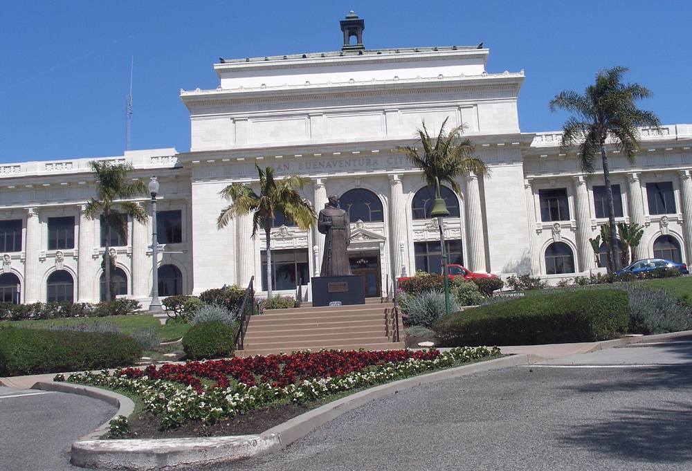
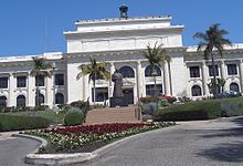 Ventura City Hall in Old Town Ventura
The Mexican–American War began in 1846 but its effect was not felt in Ventura County until 1847. In January of that year, Captain John C. Frémont led the California Battalion into San Buenaventura finding that the Europeans had fled leaving only the Indians in the Mission. Fremont and the Battalion continued south to sign the Treaty of Cahuenga with General Andrés Pico. The Treaty of Guadalupe Hidalgo formally transferred California to the United States in 1848.[9]
By 1849, a constitution had been adopted for the California territory. The new Legislature met and divided the pending state into 27 counties. At the time, the area that would become Ventura County was the southern part of Santa Barbara County.[10]
The 1860s brought many changes to the area. A drought caused many of the ranchos to experience financial difficulties and most were divided, sub-divided and sold. Large sections of land were bought by eastern capitalists based on favorable reports of petroleum deposits. A United States Post Office was opened at Mission San Buenaventura in 1861. On April 1, 1866, the town of San Buenaventura was incorporated becoming the first officially recognized town in Ventura County.[11]
On January 1, 1873, Ventura County was officially split from Santa Barbara County, bringing a flurry of change. That same year, a courthouse and wharf were built in San Buenaventura. A bank was opened and the first public library was created. The school system grew, with the first high school opening in 1890.[12]
Other towns were starting in the county. A plan for Port Hueneme was recorded in 1874, and Santa Paula's plan was recorded in 1875. The community of Nordhoff (later renamed Ojai) was started in 1874.[13] Piru, Fillmore and Montalvo were established in 1887.[14] 1892 saw Simi (later Simi Valley), Somis, Saticoy and Moorpark. Oxnard was a late-comer, not being established until 1898.[15]
The Southern Pacific Railroad laid tracks through San Buenaventura in 1887. For convenience in printing their timetables, Southern Pacific shortened San Buenaventura to Ventura. The Post Office soon followed suit. While the city remains officially known as San Buenaventura, it is more commonly referred to as Ventura.[16]
Oil has been known in Ventura County since before the arrival of the Europeans, as the native Chumash people used tar from natural seeps as a sealant and waterproofing for baskets and canoes. In the 1860s, several attempts were made to harvest the petroleum products under Ventura County but none were financially successful, and the oil speculators eventually changed from oil to land development. In 1913, oil exploration began in earnest, with Ralph Lloyd obtaining the financial support of veteran oil man Joseph B. Dabney. Their first well, named "Lloyd No. 1", was started on January 20, 1914. The well struck oil at 2558 feet (780 m) but was destroyed when it went wild. Other wells met a similar fate, until 1916, when a deal was struck with the Shell Oil Company. 1916 was the year the large South Mountain Oil Field was discovered, and other deals followed with General Petroleum in 1917 and Associated Oil Company in 1920. At its peak, the largest oil field in the county, the Ventura Avenue oilfield, discovered in 1919 in the hills north of Ventura, was producing 90,000 barrels (14,000 m3) of oil a day, with annual production of over a million and a half barrels. More oil fields came on-line in the 1920s and 1930s, with the Rincon field, the second-largest, in 1927, and the adjacent San Miguelito in 1931.[17][18]
In the early hours of the morning of March 13, 1928, the St. Francis Dam collapsed, sending billions of gallons of water rushing through the Santa Clarita Valley, killing 385 people, destroying 1,240 homes and flooding 7,900 acres (32 km²) of land, devastating farm fields and orchards.[19] This was the largest single disaster to strike Ventura County.
Modern period
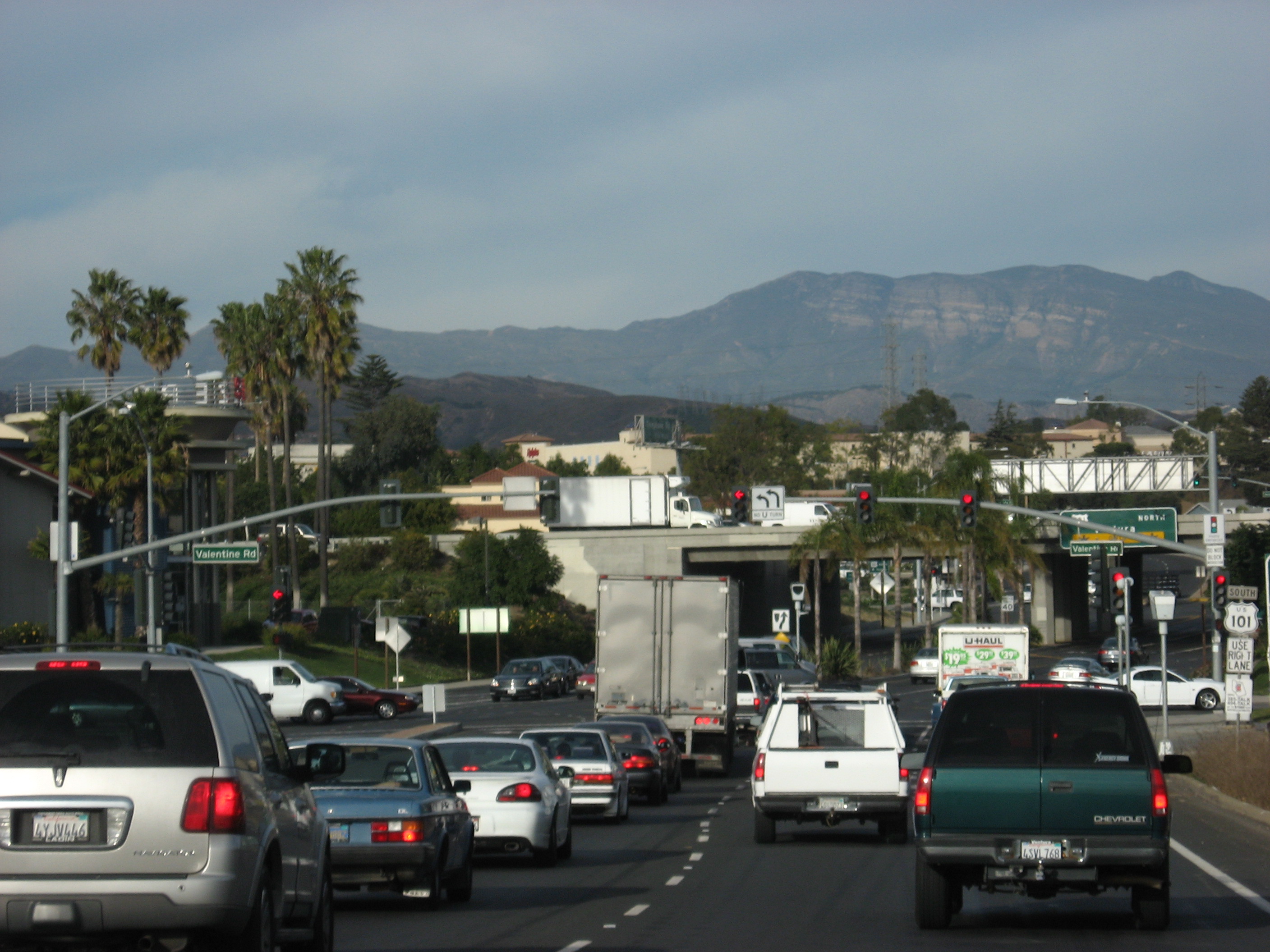
 Typical rush hour traffic in Ventura
Ventura County can be separated into two major parts, East County and West County.[citation needed] East County consists of all cities east of the Conejo Grade, known locally as "The Grade." Geographically East County is the end of the Santa Monica Mountains, in which the Conejo Valley is located, and where there is a considerable increase in elevation. Communities which are considered to be in the East County are Thousand Oaks, Newbury Park, Lake Sherwood, Hidden Valley, Santa Rosa Valley, Oak Park, Moorpark, and Simi Valley.[citation needed] A majority of these communities are in the Conejo Valley.
West County, which is everything west of the Conejo Grade, consists of communities such as Camarillo, Oxnard, Somis, Point Mugu, Port Hueneme, Ventura, Ojai, Santa Paula, and Fillmore. West County consists of some of the first developed cities in the county. The largest beach communities are located in West County on the coastline of the Channel Islands Harbor.
Starting in the mid-1900s, there was a large growth in population in the East County, moving from the San Fernando Valley in Los Angeles and out into the Conejo and Simi Valleys, which consists of Calabasas, Hidden Hills, Agoura Hills, Agoura, and parts of Westlake Village belonging to Los Angeles County. The other half of the Conejo Valley, which belongs to Ventura County, consists of Lake Sherwood, Hidden Valley, Oak Park, parts of Westlake Village, Thousand Oaks, and Newbury Park, which was formerly an unincorporated area that is now the most westerly part of Thousand Oaks. Many working-class white people migrated to this area during the 1960s and 1970s out of East and Central Los Angeles. As a result, there was a large growth in population into the Conejo Valley and into Ventura County through the US 101 corridor. Making the US 101 a full freeway in the 1960s, and the expansions that followed, helped make commuting to Los Angeles easier and opened the way for development westward. The communities that have seen the most substantial development are Calabasas, Hidden Hills, Agoura Hills, Westlake Village, Thousand Oaks, and Newbury Park.
Development moved farther down the US 101 corridor and sent population rising in West County cities as well. The largest population growth there has been in Camarillo, Oxnard, and Ventura. Development in the East County and along the US 101 corridor is becoming rare today, because most of these cities were master-planned cities, such as Thousand Oaks and Simi Valley, and are approaching build-out. Although the area still has plenty of open space and land, almost all of it was put aside and mandated never to be developed as part of the master plan of each city. Because of this, its private low-key location, its country feel, and its close proximity to Los Angeles, the Conejo Valley area has become a very attractive place to live. It once had relatively inexpensive real estate, but prices have risen sharply. For example, real estate in Newbury Park has increased in price by over 250% in the last 10 years. Median home prices in the Conejo Valley now range from $700,000 to $2.2 million. The Conejo Valley area is one of the most affluent areas in the United States.
Geography
According to the 2000 census, the county has a total area of 2,208.20 square miles (5,719.2 km2), of which 1,845.30 square miles (4,779.3 km2) (or 83.57%) is land and 362.90 square miles (939.9 km2) (or 16.43%) is water.[20] Anacapa Island of Channel Islands National Park and San Nicolas Island are located in the county. Begg Rock, 8 miles (13 km) north west of the western tip of San Nicolas Island, has claimed one boat.[21]
Most of the population of Ventura County lives in the southern (mainland) portion of the county. The major population centers are the Oxnard Plain and the Simi and Conejo Valleys. In local media, the county is usually split between the eastern portion, generally associated with the San Fernando Valley, and the western portion, often referred to as "Oxnard-Ventura."
North of Highway 126 the county is mountainous and mostly uninhabited, and contains some of the most unspoiled, rugged and inaccessible wilderness remaining in southern California. Most of this land is in the Los Padres National Forest, and includes the Chumash Wilderness in the northernmost portion, adjacent to Kern County, as well as the large Sespe Wilderness and portions of both the Dick Smith Wilderness and Matilija Wilderness (both of these protected areas straddle the line with Santa Barbara County). All of the wilderness areas are within the jurisdiction of Los Padres National Forest.
The highest peaks in the county include Mount Pinos (8831', 2697 m), Frazier Mountain (8017', 2444 m), and Reyes Peak (7525', 2294 m), all except Reyes Peak in the San Emigdio Mountains (Pinos and Frazier Mountain are sometimes assigned to the Tehachapis). The uplands are well-timbered with coniferous forests, and receive plentiful snow in the winter.
Mount Pinos is sacred to the Chumash Indians. It is known to them as Iwihinmu, and was considered to be the center of the universe; being the highest peak in the vicinity, it has a spectacular view, unimpeded in three directions.
The Santa Clara River is the principal waterway. Lake Casitas, an artificial reservoir, is the largest body of water.
Cities
- Incorporated cities
Census-designated places (CDPs)
- Bell Canyon
- Casa Conejo
- Channel Islands Beach
- El Rio
- Lake Sherwood
- Meiners Oaks
- Mira Monte
- Oak Park
- Oak View
- Piru
- Santa Rosa Valley
- Santa Susana
- Saticoy
Other unincorporated communities
- Bardsdale
- Buckhorn
- Casitas Springs
- Dulah
- Faria
- La Conchita
- Newbury Park
- Point Mugu
- Sea Cliff
- Somis
- Upper Ojai
Adjacent counties
- Santa Barbara County, California—west
- Kern County, California—north
- Los Angeles County, California—east / southeast
National protected areas
- Angeles National Forest (part)
- Channel Islands National Park (part)
- Hopper Mountain National Wildlife Refuge
- Los Padres National Forest (part)
- Santa Monica Mountains National Recreation Area (part)
- Dick Smith Wilderness (part)
Transportation infrastructure
Major highways
 U.S. Route 101
 State Route 1
 State Route 23
 State Route 33
 State Route 34
 State Route 118
 State Route 126
 State Route 150
 State Route 232
Unconstructed
 State Route 257
Public transportation
Ventura County is served by Amtrak and Metrolink trains, as well as Greyhound Lines, Gold Coast Transit (formerly South Coast Area Transit), and VISTA buses. The cities of Camarillo, Simi Valley and Thousand Oaks have their own small bus systems.
Island Packers ferries connect Ventura with the five islands of Channel Islands National Park.
Airports
- Oxnard Airport, just west of Downtown Oxnard, is a general aviation airport.
- Camarillo Airport, formerly a US Air Force Base, is a general aviation airport located south of the City of Camarillo. It is the current base of operations of the Ventura County Sheriff's Department Aviation Unit and the home of the VCSD's Training Facility and Academy, the Ventura County Criminal Justice Training Center. The Camarillo Airport also serves as the base of operations for the Ventura County Fire Department and facilitates the Oxnard College Regional Fire Academy and the Ventura County Reserve Officers Training Center.
- Santa Paula Airport is a privately owned airport; however, it is open to the public for general aviation.
Libraries
Public Libraries: Ventura County Library - 14 locations, Oxnard Public Library, Thousand Oaks Library, Moorpark City Library, and Blanchard Community Library (in Santa Paula).
Academic Libraries: California State University Channel Islands, California Lutheran University, St. Thomas Aquinas College, Moorpark College, Oxnard College, and Ventura College.
Other: Ronald Reagan Presidential Library, Ventura County Law Library.
Politics
Ventura County vote
by party in presidential electionsYear GOP DEM Others 2008 43.0% 145,853 55.3% 187,601 2.2% 7,587 2004 51.2% 160,314 47.3% 148,859 1.3% 4,020 2000 48.2% 136,173 47.1% 133,258 4.7% 13,261 1996 43.5% 109,202 44.1% 110,772 12.4% 31,220 1992 35.5% 94,911 37.0% 99,011 27.5% 73,725 1988 61.6% 147,604 37.2% 89,065 1.2% 2,804 1984 68.7% 151,383 30.2% 66,550 1.2% 2,529 1980 60.3% 114,930 29.5% 56,311 10.2% 19,409 1976 53.2% 82,670 44.1% 68,529 2.7% 4,201 1972 63.2% 95,310 32.7% 49,307 4.1% 6,188 1968 51.4% 59,705 41.1% 47,794 7.5% 8,762 1964 41.0% 40,264 58.8% 57,805 0.2% 169 1960 49.6% 35,074 50.0% 35,334 0.5% 315 1956 49.9% 26,342 49.8% 26,276 0.3% 149 1952 52.5% 24,534 47.0% 21,967 0.6% 256 1948 42.2% 13,930 54.8% 18,100 3.1% 1,019 1944 40.2% 11,071 59.3% 16,342 0.5% 131 1940 42.2% 11,225 57.0% 15,182 0.9% 227 1936 35.8% 7,579 63.1% 13,384 1.1% 235 1932 37.3% 6,908 58.8% 10,903 3.9% 724 1928 70.2% 9,017 28.9% 3,717 0.9% 117 1924 65.2% 5,705 10.4% 911 24.4% 2,139 1920 76.0% 5,231 19.0% 1,305 5.0% 347 Unlike most other areas of Coastal California, Ventura County tends to support the Republican Party in local and national elections. While Republicans used to win a large majority of votes throughout the 1970s and 1980s, no party has received more than 55% of the county's vote since 1992. Prior to Barack Obama's victory in the county in 2008, the last Democrat to win a majority was Lyndon Johnson in 1964, though Democrat Bill Clinton carried the county by a plurality in 1992 and 1996.
Most of the county's area, including inland areas and the cities of Thousand Oaks and Moorpark, lies in the 24th district, which has a PVI of R +5 (meaning that based on the presidential election results of 2000 and 2004, the district is 5% more Republican than the nation) and is represented by Republican Elton Gallegly. Coastal regions of Ventura County along with the cities of Oxnard and Ventura, the 23rd district, which includes has a Cook Partisan Index (CPI) rating of D +9 and is currently represented by Democrat Lois Capps. In the State Senate, Ventura is part of the 17th, 19th, and 23rd Senate districts, which are held by Republicans Sharon Runner and Tony Strickland and Democrat Fran Pavley, respectively. In the State Assembly, Ventura is in the 35th, 37th, 38th, and 41st districts. The 35th and 41st districts are held by Democrats Das Williams and Julia Brownley, respectively; the 37th and 38th districts are held by Republicans Jeff Gorell and Cameron Smyth, respectively.
Current county supervisors are Steve Bennett, Linda Parks, Kathy Long (Chair), Peter Foy, and John C. Zaragoza. Bob Brooks is the sheriff. Geoff Dean is the sheriff-elect of the Ventura County Sheriff's Department. Bob Roper is the chief of the Ventura County Fire Department.
Republicans have historically held the registration advantage, but on March 3, 2008, Democratic registration surpassed Republican registration.[22] The cities of Camarillo, Moorpark, Simi Valley, and Thousand Oaks all have voter rolls with Republican pluralities. The remaining cities and towns in the county have a Democratic plurality or majority on the voter rolls, while the unincorporated areas are split almost evenly between the parties.
Demographics
Historical populations Census Pop. %± 1900 14,367 — 1910 18,347 27.7% 1920 28,724 56.6% 1930 54,976 91.4% 1940 69,685 26.8% 1950 114,647 64.5% 1960 199,138 73.7% 1970 376,430 89.0% 1980 529,174 40.6% 1990 669,016 26.4% 2000 753,197 12.6% 2010 823,318 9.3% 2010
The 2010 United States Census reported that Ventura County had a population of 823,318. The racial makeup of Ventura County was 565,804 (68.7%) White, 15,163 (1.8%) African American, 8,068 (1.0%) Native American, 55,446 (6.7%) Asian, 1,643 (0.2%) Pacific Islander, 140,253 (17.0%) from other races, and 36,941 (4.5%) from two or more races. Hispanic or Latino of any race were 331,567 persons (40.3%).[23]
Population reported at 2010 United States Census The County Total
PopulationWhite African
AmericanNative
AmericanAsian Pacific
Islanderother
racestwo or
more racesHispanic
or Latino
(of any race)Ventura County 823,318 565,804 15,163 8,068 55,446 1,643 140,253 36,941 331,567 Incorporated
cities and townsTotal
PopulationWhite African
AmericanNative
AmericanAsian Pacific
Islanderother
racestwo or
more racesHispanic
or Latino
(of any race)Camarillo 65,201 48,947 1,216 397 6,633 116 4,774 3,118 14,958 Fillmore 15,002 8,581 75 180 155 12 5,204 795 11,212 Moorpark 34,421 25,860 533 248 2,352 50 3,727 1,651 10,813 Ojai 7,461 6,555 42 47 158 1 440 218 1,339 Oxnard 197,899 95,346 5,771 2,953 14,550 658 69,527 9,094 145,551 Port Hueneme 21,723 12,357 1,111 295 1,299 119 5,224 1,318 11,360 Santa Paula 29,321 18,458 152 460 216 24 8,924 1,087 23,299 Simi Valley 124,237 93,597 1,739 761 11,555 178 10,685 5,722 28,938 Thousand Oaks 126,683 101,702 1,674 497 11,043 146 6,869 4,752 21,341 Ventura 106,433 81,553 1,724 1,287 3,663 206 12,486 5,514 33,874 Census-designated
placesTotal
PopulationWhite African
AmericanNative
AmericanAsian Pacific
Islanderother
racestwo or
more racesHispanic
or Latino
(of any race)Bell Canyon 2,049 1,724 58 4 179 0 10 74 103 Casa Conejo 3,249 2,560 27 20 160 4 327 151 851 Channel Islands Beach 3,103 2,712 27 16 108 6 103 131 402 El Rio 7,198 3,495 58 201 73 24 3,027 320 6,188 Lake Sherwood 1,527 1,368 5 1 101 0 9 43 52 Meiners Oaks 3,571 2,789 14 58 51 1 549 109 1,068 Mira Monte 6,854 5,989 43 61 129 3 406 223 1,254 Oak Park 13,811 11,473 141 32 1,556 9 162 438 826 Oak View 4,066 3,227 11 63 34 3 575 153 1,217 Piru 2,063 1,063 16 43 11 0 830 100 1,748 Santa Rosa Valley 3,334 2,904 23 13 187 4 102 101 353 Santa Susana 1,037 904 17 2 23 0 33 58 156 Saticoy 1,029 413 9 29 2 0 508 68 895 Unincorporated
communitiesTotal
PopulationWhite African
AmericanNative
AmericanAsian Pacific
Islanderother
racestwo or
more racesHispanic
or Latino
(of any race)All others not CDPs (combined) 42,046 32,227 677 400 1,208 79 5,752 1,703 13,769 2000
As of the census[24] of 2000, there were 753,197 people, 243,234 households, and 182,911 families living in the county. The population density was 408 people per square mile (158/km²). There were 251,712 housing units at an average density of 136 per square mile (53/km²). The racial makeup of the county was 69.93% White, 5.35% Asian, 1.95% Black or African American, 0.94% Native American, 0.22% Pacific Islander, 17.68% from other races, and 3.93% from two or more races. About one third (33.42%) of the population is Hispanic or Latino of any race. 9.8% were of German, 7.7% English and 7.1% Irish ancestry according to Census 2000. 67.1% spoke English, 26.2% Spanish and 1.5% Tagalog as their first language.
There were 243,234 households, of which 39.7% had children under the age of 18 living with them, 59.5% were married couples living together, 10.9% had a female householder with no husband present, and 24.8% were non-families. 18.9% of all households were made up of individuals, and 7.4% had someone living alone who was 65 years of age or older. The average household size was 3.04 and the average family size was 3.46.
In the county the population was spread out, with 28.4% under the age of 18, 9.0% from 18 to 24, 30.7% from 25 to 44, 21.7% from 45 to 64, and 10.2% who were 65 or older. The median age was 34 years. For every 100 females there were 99.7 males. For every 100 females age 18 and over, there were 97.5 males.
The median income for a household in the county was $59,666, and the median income for a family was $65,285. Males had a median income of $45,310, versus $32,216 for females. The per capita income for the county was $24,600. About 6.4% of families and 9.2% of the population were below the poverty line, including 11.6% of those under age 18 and 6.3% of those aged 65 or over.
According to an updated 2005 US Census, median household income was $66,859, while the mean was $85,032. Per capita income was up to $29,634, making it the 6th wealthiest county in California.
Environment
In 2010, the County of Ventura completed a solar energy system 492 kilowatts DC in size, on several County buildings. The systems were financed using a solar Power Purchase Agreement, which required no upfront cash from the County. The systems are owned, maintained, and operated by Solar Power Partners and its investors, and were designed and constructed by Solar Power, Inc. The County pays for the solar-generated electricity generated by the system, offsetting a portion of its utility costs.
Entertainment
Lake Sherwood is so called due to its use as the location for Sherwood Forest in the 1922 film, Robin Hood, starring Douglas Fairbanks.[25][26] The 1938 film, The Adventures of Robin Hood, starring Errol Flynn, also had a major scene shot on location at "Sherwood Forest".[27]
On July 23, 1982 actor Vic Morrow and two children actors (My-Ca Dinh Le and Renee Shin-Ye Chen) were filming a helicopter scene for Twilight Zone: The Movie in the area of Indian Dunes in Ventura County when the helicopter lost control and crashed on top of them. Morrow and Le were decapitated and Chen was fatally crushed.
In 2009, the popular VH1 television show Tool Academy was filmed in Ventura County. In 1963, the touching Korean War story The Young and The Brave, featuring a brave and resourceful young boy, was filmed in rural areas of Ventura County.
Also, in 2000 the movie Swordfish filmed the final bank scene on East Main Street in Ventura. The building they used is the white building on the corner.34°16′51″N 119°17′41″W / 34.280823°N 119.294599°W
The movie Back to the Future Part III filmed the scene where Marty returns to the year 1985 in the time-traveling DeLorean at the railroad crossing at S Ventura Rd & Shoreview Dr in Port Hueneme
Many films including Swordfish, Little Miss Sunshine, Chinatown, Erin Brockovich, The Aviator, and The Rock were partly filmed in Ventura.
Downtown Ventura also hosts the Majestic Ventura Theater, a beautiful early century theatre, which is situated about two blocks away from city hall. It serves as a venue for concerts. The theater has seen many bands such as Gregg Allman, John Prine, The Doors, Devo, Van Halen, X, Paramore, She Wants Revenge, Pennywise, Red Hot Chili Peppers, Lamb of God, Social Distortion, Bad Religion, Thrice, Avenged Sevenfold, Fugazi, Incubus, Tom Petty, America, They Might Be Giants, and Modest Mouse, as well as successful local artists such as Army of Freshmen, Big Bad Voodoo Daddy, Gregory Hillman, Bruce Kimmell, Shim Come Quick
See also
- Burro Flats Painted Cave
- List of schools in the Roman Catholic Archdiocese of Los Angeles
- Los Angeles Times suburban sections
- National Register of Historic Places listings in Ventura County, California
- Ventura County Air Pollution Control District
Notes
- ^ "Southern California’s median home price drops below $300,000". Los Angeles Times. 2008-12-17. http://www.latimes.com/business/la-fi-homes17-2008dec17,0,2443063.story. Retrieved 2009-02-27.
- ^ Murphy, p 3-4.
- ^ A Comprehensive Story of Ventura County, California, 6.
- ^ A Comprehensive Story of Ventura County, California, 8.
- ^ Erwin G. Gudde, California Place Names: The Origin and Etymology of Current Geographical Names, 4th ed., rev. and enlarged by William Bright (University of California Press, 1998), p. 410.
- ^ A Comprehensive Story of Ventura County, California, 11.
- ^ Ventura County Spanish and Mexican Land Grants
- ^ A Comprehensive Story of Ventura County, California, 12.
- ^ A Comprehensive Story of Ventura County, California, 12–3.
- ^ A Comprehensive Story of Ventura County, California, 15.
- ^ A Comprehensive Story of Ventura County, California, 16–7.
- ^ A Comprehensive Story of Ventura County, California, 22–3.
- ^ A Comprehensive Story of Ventura County, California, 23–4.
- ^ A Comprehensive Story of Ventura County, California, 25–7.
- ^ A Comprehensive Story of Ventura County, California, 27.
- ^ A Comprehensive Story of Ventura County, California, 25.
- ^ A Comprehensive Story of Ventura County, California, 27–29.
- ^ California Oil and Gas Fields, Volumes I, II and III. Vol. I (1998), Vol. II (1992), Vol. III (1982). California Department of Conservation, Division of Oil, Gas, and Geothermal Resources (DOGGR), p. 573.
- ^ A Comprehensive Story of Ventura County, California, 31.
- ^ "Census 2000 U.S. Gazetteer Files: Counties". United States Census. http://www.census.gov/tiger/tms/gazetteer/county2k.txt. Retrieved 2011-02-13.
- ^ Erwin G. Gudde, William Bright (2004). California Place Names: The Origin and Etymology of Current Geographical Names.
- ^ Democrats take lead in county registration : Local News : Ventura County Star
- ^ "2010 Census P.L. 94-171 Summary File Data". United States Census Bureau. http://www2.census.gov/census_2010/01-Redistricting_File--PL_94-171/California/.
- ^ "American FactFinder". United States Census Bureau. http://factfinder.census.gov. Retrieved 2008-01-31.
- ^ Behlmer, Rudy (1979). The Adventures of Robin Hood. Madison, Wisconsin: Univ of Wisconsin Press. p. 32. ISBN 0-299-07940-6.
- ^ http://www.imdb.com/title/tt0013556/locations
- ^ http://www.imdb.com/title/tt0029843/locations
References
- Murphy, Arnold L. (1979). A Comprehensive Story of Ventura County, California. Oxnard, California: M & N.
External links
- Official county website
- Oxnard Transportation Center A Major Transportation Hub of Southern California
- Ventura County Star, largest Ventura County daily news organization, Scripps chain newspaper
- The Ojai and Ventura VIEW, only true locally owned alternative press, a monthly newspaper
- VC Reporter, a weekly chain newsmagazine with a pro-urban developer bias, owned by southland publications corp. based in Pasadena.
- Ventura County Crime Blog, Crime, trials, and reports in Ventura County
- News from Ventura County, from the Los Angeles Times website
- Ventura County Air Pollution Control District
- Ventura County Law Library - open to the public
- Ventura County on the National Association Of Counties

Kern County Santa Barbara County 
Los Angeles County  Ventura County, California

Pacific Ocean Los Angeles County Municipalities and communities of Ventura County, California Cities Camarillo | Fillmore | Moorpark | Ojai | Oxnard | Port Hueneme | Santa Paula | Simi Valley | Thousand Oaks | Ventura
CDPs Bell Canyon | Casa Conejo | Channel Islands Beach | El Rio | Lake Sherwood | Meiners Oaks | Mira Monte | Oak Park | Oak View | Piru | Santa Rosa Valley | Santa Susana | Saticoy
Unincorporated
communitiesBardsdale | Buckhorn | Casitas Springs | Dulah | Faria | La Conchita | Newbury Park | Point Mugu | Sea Cliff | Somis | Upper Ojai
 State of California
Topics - Climate
- Delegations
- Deserts
- Districts
- Ecology
- Elections
- Environment
- Geography
- Government
- History
- Protected areas
- Sports
- Symbols
- Transportation
- Visitor attractions
- Index of California-related articles
Society Regions - Antelope Valley
- Big Sur
- Cascade Range
- Central California
- Central Coast
- Central Valley
- Channel Islands
- Coachella Valley
- Conejo Valley
- Cucamonga Valley
- Death Valley
- East Bay (SF)
- East County (SD)
- Eastern California
- Emerald Triangle
- Gold Country
- Great Basin
- Greater Los Angeles
- Greater Sacramento
- Inland Empire
- Lake Tahoe
- Los Angeles Basin
- Lost Coast
- Metropolitan Fresno
- Mojave
- Mountain Empire
- North Bay (SF)
- North Coast
- North County (SD)
- Northern California
- Owens Valley
- Oxnard Plain
- San Francisco Peninsula
- Pomona Valley
- Sacramento Valley
- San Bernardino Valley
- San Diego–Tijuana
- San Fernando Valley
- San Francisco Bay Area
- San Gabriel Valley
- San Joaquin Valley
- Santa Clara Valley
- Santa Clara River Valley
- Santa Clarita Valley
- Shasta Cascade
- Sierra Nevada
- Silicon Valley
- South Bay (LA)
- South Bay (SF)
- South Bay (SD)
- South Coast
- Southern California
- Southern Border Region
- Tri-Valley
- Upstate California
- Victor Valley
- Wine Country
- Yosemite
Metro areas - Bakersfield
- Chico
- El Centro
- Fresno
- Hanford–Corcoran
- Los Angeles–Long Beach–Glendale
- Madera
- Modesto
- Merced
- Napa
- Oakland–Fremont–Hayward
- Oxnard–Thousand Oaks–Ventura
- Redding
- Riverside–San Bernardino–Ontario
- Sacramento–Arden Arcade–Roseville
- Salinas
- San Diego–Carlsbad–San Marcos
- San Francisco–San Mateo–Redwood City
- San Jose–Sunnyvale–Santa Clara
- San Luis Obispo–Paso Robles
- Santa Ana–Anaheim–Irvine
- Santa Barbara–Santa Maria–Goleta
- Santa Cruz–Watsonville
- Santa Rosa–Petaluma
- Stockton
- Vallejo–Fairfield
- Visalia–Porterville
- Yuba City
Micro areas Counties - Alameda
- Alpine
- Amador
- Butte
- Calaveras
- Colusa
- Contra Costa
- Del Norte
- El Dorado
- Fresno
- Glenn
- Humboldt
- Imperial
- Inyo
- Kern
- Kings
- Lake
- Lassen
- Los Angeles
- Madera
- Marin
- Mariposa
- Mendocino
- Merced
- Modoc
- Mono
- Monterey
- Napa
- Nevada
- Orange
- Placer
- Plumas
- Riverside
- Sacramento
- San Benito
- San Bernardino
- San Diego
- San Francisco
- San Joaquin
- San Luis Obispo
- San Mateo
- Santa Barbara
- Santa Clara
- Santa Cruz
- Shasta
- Sierra
- Siskiyou
- Solano
- Sonoma
- Stanislaus
- Sutter
- Tehama
- Trinity
- Tulare
- Tuolumne
- Ventura
- Yolo
- Yuba
Categories:- California counties
- Ventura County, California


Wikimedia Foundation. 2010.