- Calaveras County, California
-
County of Calaveras — County — Calaveras County view
SealLocation in the state of California California's location in the United States
Country  United States
State  California
Region Sierra Nevada/Gold Country Incorporated 1850 County seat San Andreas Largest settlement Rancho Calaveras Area – Total 1,036.84 sq mi (2,685.4 km2) – Land 1,020.04 sq mi (2,641.9 km2) – Water 16.81 sq mi (43.5 km2) Population (2010) – Total 45,578 – Density 44/sq mi (17/km2) Time zone Pacific Standard Time (UTC-8) – Summer (DST) Pacific Daylight Time (UTC-7) Website www.co.calaveras.ca.us Calaveras County is a county located in the Gold Country of the U.S. state of California. Calaveras is named for the Spanish word for skulls; the county was reportedly named for the remains of Native Americans discovered by the Spanish explorer Captain Gabriel Moraga. As of the 2010 census, the county had a population of 45,578. The county seat is San Andreas. Angels Camp is the only incorporated city.
Calaveras Big Trees State Park, a preserve of Giant Sequoia trees, is located in the county several miles east of the town of Arnold on state highway 4. The uncommon gold telluride mineral calaverite was discovered in the county in 1861, and is named for it.
Mark Twain set his story, "The Celebrated Jumping Frog of Calaveras County", in the county. Each year, the county hosts a County Fair and Jumping Frog Jubilee, featuring a frog-jumping contest, to celebrate the association with Twain's story. The California Red-legged Frog, feared extinct in the county by 1969, was rediscovered in 2003.
Contents
History
Calaveras County was one of the original counties of the state of California, created in 1850 at the time of admission to the Union. Parts of the county's territory were reassigned to Amador County in 1854 and to Alpine County in 1864.
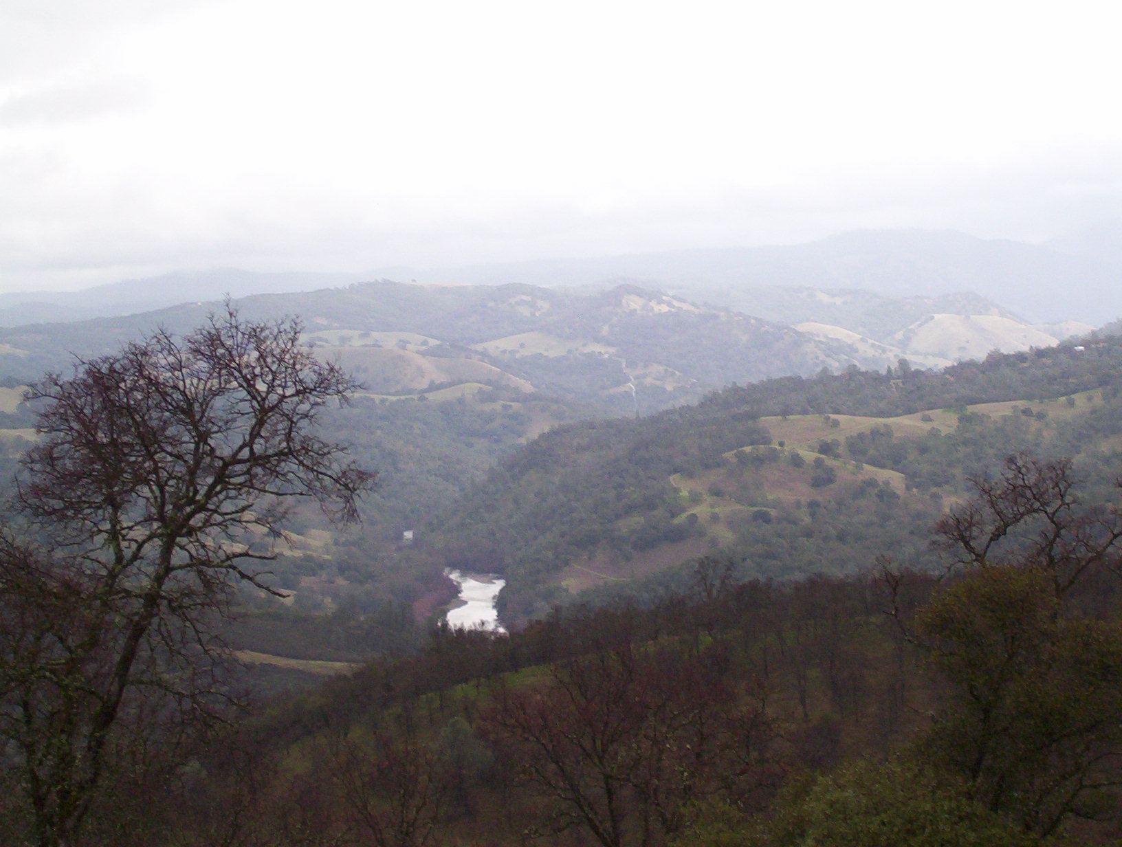
The Spanish word calaveras means "skulls." The county takes its name from the Calaveras River; it was said to have been named by Spanish explorer Gabriel Moraga when he found many skulls of Native Americans along the banks of the stream. He believed they had either died of famine or been killed in tribal conflicts over hunting and fishing grounds. In fact, the human remains were of the native Miwuk people killed by Spanish soldiers after they banded together to rise against Spanish missionaries. The Stanislaus river is named for Estanislau a coastal Miwuk who escaped from Mission San Jose in the late 1830s. He is reported to have raised a small group of men with crude weapons, hiding in the foothills when the Spanish attacked. The Miwuk were quickly decimated by Spanish gunfire. The writer Mark Twain spent many of his writing years in the county. Its geography includes beautiful landmarks, rolling hills, and giant valleys. It is also known for its friendly communities, and businesses such as agriculture management and construction engineering. It has numerous caverns, such as Mercer Caverns, that are national destinations for tourists from across the country.
Geography
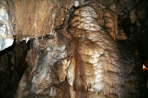
According to the 2000 census, the county has a total area of 1,036.84 square miles (2,685.4 km2), of which 1,020.04 square miles (2,641.9 km2) (or 98.38%) is land and 16.81 square miles (43.5 km2) (or 1.62%) is water.[1] A California Department of Forestry report lists the county's area in acres as 663,000, although the exact figure would be 663,477.949 acres (2,685.00000 km2). There are a number of caverns located in Calaveras County.
 California Caverns - Calaveras County
Cities and towns
Former Settlements
- Camanche
- Cat Camp
- Poverty Bar
- Sand Hill
Special Districts
Special districts in Calaveras County include:
- Altaville Cemetery District
- Altaville-Melones Fire District
- Angels Camp Fire District
- Bret Harte Union High School District
- Calaveras County Air Pollution Control District
- Calaveras Unified School District
- Central Calaveras Fire and Rescue Protection District
- Copperopolis Fire Protection District
- Ebbetts Pass Fire Protection District
- Foothill Fire District
- Jenny Lind Fire District
- Mark Twain Union Elementary School District
- Mokelumne Hill Fire District
- Murphys Fire District
- San Andreas Fire District
- Vallecito Union Elementary School District
- Valley Springs Public Utilities District
- West Point Fire District.[2]
Adjacent counties
- Stanislaus County, California - southwest
- San Joaquin County, California - west
- Amador County, California - north
- Alpine County, California - northeast
- Tuolumne County, California - south, southeast
National protected areas
- Stanislaus National Forest (part)
Transportation Infrastructure
Major highways
Public transportation
Calaveras Transit provides service in Angels Camp, San Andreas, and other communities in the county. Intercounty connections are available to Columbia (Tuolumne County), Jackson (Amador County) and Lodi (San Joaquin County)
Airports
Calaveras County Airport is a general aviation airport located just southeast of San Andreas.
Demographics
Historical populations Census Pop. %± 1850 16,884 — 1860 16,299 −3.5% 1870 8,895 −45.4% 1880 9,094 2.2% 1890 8,882 −2.3% 1900 11,200 26.1% 1910 9,171 −18.1% 1920 6,183 −32.6% 1930 6,008 −2.8% 1940 8,221 36.8% 1950 9,902 20.4% 1960 10,289 3.9% 1970 13,585 32.0% 1980 20,710 52.4% 1990 31,998 54.5% 2000 40,554 26.7% 2010 45,578 12.4% [3][4][5] 2010
The 2010 United States Census reported that Calaveras County had a population of 45,578. The racial makeup of Calaveras County was 40,522 (88.9%) White, 383 (0.8%) African American, 689 (1.5%) Native American, 571 (1.3%) Asian, 79 (0.2%) Pacific Islander, 1,534 (3.4%) from other races, and 1,800 (3.9%) from two or more races. Hispanic or Latino of any race were 4,703 persons (10.3%).[6]
Population reported at 2010 United States Census The County Total
PopulationWhite African
AmericanNative
AmericanAsian Pacific
Islanderother
racestwo or
more racesHispanic
or Latino
(of any race)Calaveras County 45,578 40,522 383 689 571 79 1,534 1,800 4,703 Incorporated
cityTotal
PopulationWhite African
AmericanNative
AmericanAsian Pacific
Islanderother
racestwo or
more racesHispanic
or Latino
(of any race)Angels Camp 3,836 3,329 12 48 49 5 270 123 498 Census-designated
placesTotal
PopulationWhite African
AmericanNative
AmericanAsian Pacific
Islanderother
racestwo or
more racesHispanic
or Latino
(of any race)Arnold 3,843 3,590 20 28 46 3 60 96 259 Avery 646 604 5 7 3 1 2 24 38 Copperopolis 3,671 3,318 31 43 36 12 83 148 454 Dorrington 609 576 0 2 11 1 1 18 33 Forest Meadows 1,249 1,198 0 4 14 0 7 26 60 Mokelumne Hill 646 571 3 12 4 0 26 30 66 Mountain Ranch 1,628 1,472 15 33 18 2 15 73 123 Murphys 2,213 2,045 9 17 7 10 82 43 223 Rail Road Flat 475 411 0 15 4 2 9 34 41 Rancho Calaveras 5,325 4,645 48 102 87 13 195 235 670 San Andreas 2,783 2,453 23 48 28 1 83 147 255 Vallecito 442 398 0 6 11 1 5 21 33 Valley Springs 3,553 3,047 35 39 70 6 179 177 454 Wallace 403 347 3 4 10 2 22 15 32 West Point 674 563 0 43 2 7 29 30 67 Unincorporated
communitiesTotal
PopulationWhite African
AmericanNative
AmericanAsian Pacific
Islanderother
racestwo or
more racesHispanic
or Latino
(of any race)All others not CDPs (combined) 13,582 11,955 179 238 171 13 466 560 1,397 2000
As of the census[7] of 2000, there were 40,554 people, 16,469 households, and 11,742 families residing in the county. The population density was 40 people per square mile (15/km²). There were 22,946 housing units at an average density of 22 per square mile (9/km²). The racial makeup of the county was 91.19% White, 0.75% Black or African American, 1.74% Native American, 0.85% Asian, 0.09% Pacific Islander, 2.07% from other races, and 3.31% from two or more races. 6.82% of the population were Hispanic or Latino of any race. 15.7% were of German, 13.0% English, 10.7% Irish, 7.4% Italian and 7.0% American ancestry according to Census 2000. 94.5% spoke English and 4.0% Spanish as their first language.
There were 16,469 households out of which 26.7% had children under the age of 18 living with them, 58.9% were married couples living together, 8.6% had a female householder with no husband present, and 28.7% were non-families. 23.3% of all households were made up of individuals and 10.1% had someone living alone who was 65 years of age or older. The average household size was 2.44 and the average family size was 2.85.
In the county the population was spread out with 22.8% under the age of 18, 5.5% from 18 to 24, 22.4% from 25 to 44, 31.1% from 45 to 64, and 18.2% who were 65 years of age or older. The median age was 45 years. For every 100 females there were 98.5 males. For every 100 females age 18 and over, there were 95.7 males.
The median income for a household in the county was $41,022, and the median income for a family was $47,379. Males had a median income of $41,827 versus $28,108 for females. The per capita income for the county was $21,420. About 8.7% of families and 11.80% of the population were below the poverty line, including 15.6% of those under age 18 and 6.2% of those age 65 or over.
Major Employers
The major Calaveras County employers include:
250-499 employees:
- Bear Valley Ski Area[8]
- Forestry & Fire Protection
- Mark Twain St. Joseph's Hospital
100-249 employees:
- Bret Harte High School
- Ironstone Vineyards
- Calaveras High School
- Mark Twain Convalescent Hospital
- Mountain Machinery[9]
Government and politics
Calaveras County vote
by party in presidential electionsYear GOP DEM Others 2008 55.1% 12,835 42.2% 9,813 3.3% 773 2004 60.9% 13,601 37.1% 8,286 2.0% 456 2000 56.2% 10,599 37.6% 7,093 6.3% 1,184 1996 48.1% 8,279 38.6% 6,646 13.3% 2,281 1992 35.4% 6,006 35.3% 5,989 29.4% 4,996 1988 56.3% 7,640 41.8% 5,674 1.9% 260 1984 64.3% 7,632 34.4% 4,081 1.4% 164 1980 58.9% 6,054 29.9% 3,076 11.1% 1,145 1976 49.1% 3,695 47.9% 3,607 3.0% 226 1972 60.8% 4,119 33.5% 2,268 5.8% 392 1968 52.2% 3,042 36.6% 2,134 11.3% 656 1964 41.6% 2,244 58.3% 3,145 0.2% 8 1960 52.6% 2,820 46.8% 2,509 0.6% 32 1956 57.9% 2,843 41.7% 2,049 0.4% 17 1952 61.7% 3,112 37.4% 1,890 0.9% 46 1948 46.8% 1,888 49.4% 1,995 3.8% 154 1944 43.2% 1,455 56.2% 1,893 0.6% 21 1940 40.4% 1,649 58.9% 2,405 0.7% 29 1936 27.2% 960 71.3% 2,520 1.5% 54 1932 29.0% 754 67.1% 1,744 3.9% 101 1928 53.8% 1,262 45.4% 1,066 0.8% 18 1924 39.4% 872 15.06% 333 45.5% 1,006 1920 64.0% 1,480 27.7% 641 8.3% 193 Calaveras is part of California's 3rd congressional district, which is held by Dan Lungren.
In the State Assembly, Calaveras is part of the 25th district, which is held by Kristin Olsen. In the State Senate, Calaveras is part of the 1st district, which is held by Ted Gaines.
Past presidential elections in Calaveras County have displayed preferences for Republican candidates; the last Democrat to win a majority in the county was Lyndon Johnson in 1964, although Democrat Bill Clinton lost the county by only 17 votes in 1992. By contrast, recent elections have seen a sharp upswing in Democratic voter registrations.
Calaveras County is governed by a five member Board of Supervisors.[1]
See also
- USS Calaveras County (LST-516)
- List of school districts in Calaveras County, California
- Calaveras Big Trees State Park
- Mercer Caverns
- Moaning Cavern
- National Register of Historic Places listings in Calaveras County, California
References
- ^ "Census 2000 U.S. Gazetteer Files: Counties". United States Census. http://www.census.gov/tiger/tms/gazetteer/county2k.txt. Retrieved 2011-02-13.
- ^ "Largest Calaveras County Employers". infoUSA. January 2008. http://www.calmis.cahwnet.gov/file/majorer/countymajorer.cfm?CountyCode=000009. Retrieved 2008-03-10.
- ^ http://www.census.gov/population/www/censusdata/cencounts/files/ca190090.txt
- ^ http://factfinder2.census.gov
- ^ http://mapserver.lib.virginia.edu/
- ^ "2010 Census P.L. 94-171 Summary File Data". United States Census Bureau. http://www2.census.gov/census_2010/01-Redistricting_File--PL_94-171/California/.
- ^ "American FactFinder". United States Census Bureau. http://factfinder.census.gov. Retrieved 2008-01-31.
- ^ "Bear Valley Ski Resort Home Page". Bear Valley Ski Resort. January 2008. http://www.bearvalley.com. Retrieved 2008-03-12.
- ^ "Calaveras County Largest Employers". usaINFO. January 2008. http://www.calmis.cahwnet.gov/file/majorer/countymajorer.cfm?CountyCode=000009. Retrieved 2008-03-10.
Sources
- "Tuolumne-Calaveras Unit: 2005 Pre-Fire Management Plan September 28, 2005 Edition," California Department of Forestry and Fire Protection, 09-28-2005, pp. 16, 17
- US Department of Education, National Center for Education Statistics.
External links
- MyCalaveras: Search Calaveras County businesses, services, organizations and communities
- Calaveras County government services
- Angels Camp, Calaveras County, weather
- Arnold, Calaveras County, weather
- Calaveras County Visitors Bureau

Amador County Alpine County San Joaquin County 
 Calaveras County, California

Stanislaus County Tuolumne County Tuolumne County Municipalities and communities of Calaveras County, California City 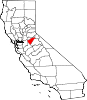
CDPs Arnold | Avery | Copperopolis | Dorrington | Forest Meadows | Mokelumne Hill | Mountain Ranch | Murphys | Rail Road Flat | Rancho Calaveras | San Andreas | Vallecito | Valley Springs | Wallace | West Point
Unincorporated
communitiesAlabama Hill | Big Bar | Big Meadow | Big Trees | Big Trees Village | Big Valley | Blue Lake Junction | Blue Lake Springs | Bummerville | Burson | Calaveritas | Camp Connell | Camp Pardee | Campo Seco | Canyon View | Carmen City | Cave City | Cedar Vista | Copper Cove Subdivision | Copper Cove Village | Cottage Springs | Douds Landing | Douglas Flat | Ebbetts Pass Highlands | Felix | Fisher Place | Fly-In Acres | Fort Jones | Fourth Crossing | Fuchs | Ganns | Glencoe | Goodmans Corner | Grizzly Ridge | Hams | Hanford Hill | Happy Valley | Hathaway Pines | Hathaways Mountain Pines | Independence | Indian Creek | Indian Hills | Jenny Lind | Jesus Maria | La Honda Park | Lake Camanche Ranches | Lakemont Pines | Lakeside Terrace | Lilac Park | Lombardi | Lost City | Lynn Park Acres | Manuel Mill | McKay | Meadowmont | Milton | Mother Lode Acres | Mountain Ranch Subdivision | Mountain Retreat | Mumbert Acres | Oak Grove | Oak Park Estates | Paloma | Pinebrook | Ponderosa Park | Porter | Quail Oaks | Red Apple | Rich Gulch | Rocky Hill | Sandoz | Sandy Gulch | Scenic Valley Ranchos | Sheep Ranch | Sherman Acres | Skyhigh | Snowshoe Springs | South Camanche Shore | Sunset Point | Tamarack | Tamarack Springs | Telegraph City | The Shores of Poker Flat | Timber Trails | Toyanza Subdivision | Toyon | White Pines | Wilseyville | Wyldewood
Former
settlementsAltaville | Antelope House | Balaklava Hill | Blue Mountain | Brownsville | Buckeye Hill | Camanche | Camp Spirito | Carson Hill | Chichi | El Dorado Bar | Fremont Valley | Greasertown | Hodson | Independence Flat | Lower Calaveritas | Mammoth Cave | McLeans Bar | McLeans Ferry | Melones | Mill Valley | North American House | Norval | Oregon Bar | Pattees Ranch | Poverty Bar | Sandy Bar | Spanish Bar | Stony Bar | Stoutenburg | Taylors Bar | Tremont House | Yaqui Camp
Categories:- Calaveras County, California
- California counties


Wikimedia Foundation. 2010.