- Camanche, California
-
Camanche — Former settlement — Location in California
 Camanche
Coordinates: 38°12′48″N 120°56′07″W / 38.21333°N 120.93528°W Country United States State California County Calaveras County Elevation[1] 220 ft (67 m) Reference #: 254 Camanche (originally, Limerick; also, Clay's Bar)[2] is a former settlement in Calaveras County, California. It lay at an elevation of 220 feet (67 m). Once called Limerick, the town became Camanche (after Camanche, Iowa) in 1849. Gold mining at nearby Cat Camp, Poverty Bar, and Sand Hill brought its population to a peak of 1,500. Mokelumne River water was brought in by Lancha Plana and Poverty Bar Ditch. A fire on June 21, 1873, destroyed Camanche's large Chinatown. Buhach, an insect powder made from a plant, was manufactured on the nearby Hill Ranch. Camanche is now inundated by Camanche Reservoir.
The settlement is registered as California Historical Landmark #254.
Its location is at 38°12′48″N 120°56′07″W / 38.21333°N 120.93528°WCoordinates: 38°12′48″N 120°56′07″W / 38.21333°N 120.93528°W[3]
A post office was opened in Clay's Bar in 1861 and renamed Camanche in 1864 before closing in 1886; it was re-established in 1887 and closed for good in 1962.[2]
References
- ^ U.S. Geological Survey Geographic Names Information System: Camanche, California
- ^ a b Durham, David L. (1998). California's Geographic Names: A Gazetteer of Historic and Modern Names of the State. Quill Driver Books. p. 753. ISBN 9781884995149.
- ^ U.S. Geological Survey Geographic Names Information System: Camanche
Municipalities and communities of Calaveras County, California City 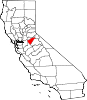
CDPs Arnold | Avery | Copperopolis | Dorrington | Forest Meadows | Mokelumne Hill | Mountain Ranch | Murphys | Rail Road Flat | Rancho Calaveras | San Andreas | Vallecito | Valley Springs | Wallace | West Point
Unincorporated
communitiesAlabama Hill | Big Bar | Big Meadow | Big Trees | Big Trees Village | Big Valley | Blue Lake Junction | Blue Lake Springs | Bummerville | Burson | Calaveritas | Camp Connell | Camp Pardee | Campo Seco | Canyon View | Carmen City | Cave City | Cedar Vista | Copper Cove Subdivision | Copper Cove Village | Cottage Springs | Douds Landing | Douglas Flat | Ebbetts Pass Highlands | Felix | Fisher Place | Fly-In Acres | Fort Jones | Fourth Crossing | Fuchs | Ganns | Glencoe | Goodmans Corner | Grizzly Ridge | Hams | Hanford Hill | Happy Valley | Hathaway Pines | Hathaways Mountain Pines | Independence | Indian Creek | Indian Hills | Jenny Lind | Jesus Maria | La Honda Park | Lake Camanche Ranches | Lakemont Pines | Lakeside Terrace | Lilac Park | Lombardi | Lost City | Lynn Park Acres | Manuel Mill | McKay | Meadowmont | Milton | Mother Lode Acres | Mountain Ranch Subdivision | Mountain Retreat | Mumbert Acres | Oak Grove | Oak Park Estates | Paloma | Pinebrook | Ponderosa Park | Porter | Quail Oaks | Red Apple | Rich Gulch | Rocky Hill | Sandoz | Sandy Gulch | Scenic Valley Ranchos | Sheep Ranch | Sherman Acres | Skyhigh | Snowshoe Springs | South Camanche Shore | Sunset Point | Tamarack | Tamarack Springs | Telegraph City | The Shores of Poker Flat | Timber Trails | Toyanza Subdivision | Toyon | White Pines | Wilseyville | Wyldewood
Former
settlementsAltaville | Antelope House | Balaklava Hill | Blue Mountain | Brownsville | Buckeye Hill | Camanche | Camp Spirito | Carson Hill | Chichi | El Dorado Bar | Fremont Valley | Greasertown | Hodson | Independence Flat | Lower Calaveritas | Mammoth Cave | McLeans Bar | McLeans Ferry | Melones | Mill Valley | North American House | Norval | Oregon Bar | Pattees Ranch | Poverty Bar | Sandy Bar | Spanish Bar | Stony Bar | Stoutenburg | Taylors Bar | Tremont House | Yaqui Camp
Categories:- Former settlements in Calaveras County, California
- Former populated places in California
- California Historical Landmarks
- Sunken cities
- Destroyed towns
- Calaveras County, California geography stubs


Wikimedia Foundation. 2010.