- Mokelumne River
-
For the California wine region, see Mokelumne River AVA.
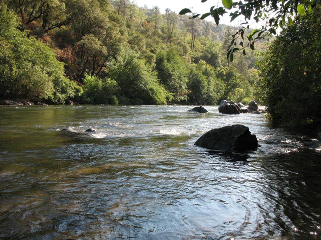
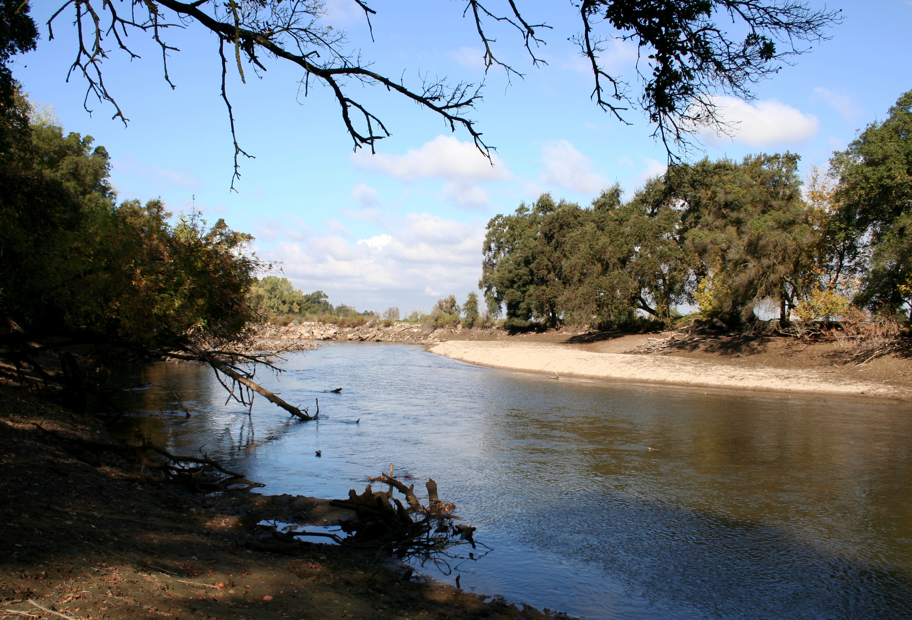
Mokelumne River River  The upper Mokelumne River, September, 2007.
Country United States State California Source Sierra Nevada Mountains, California, USA. Mouth San Joaquin River - location California, United States - elevation 0 ft (0 m) - coordinates 38°5′46″N 121°34′12″W / 38.09611°N 121.57°W Length 80 mi (129 km) [1] Basin 1,701 sq mi (4,406 km2) Discharge - average 1,026 cu ft/s (29 m3/s) - max 27,000 cu ft/s (765 m3/s) [2] - min 2.4 cu ft/s (0 m3/s) [2] 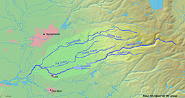 Map of the Mokelumne River watershed
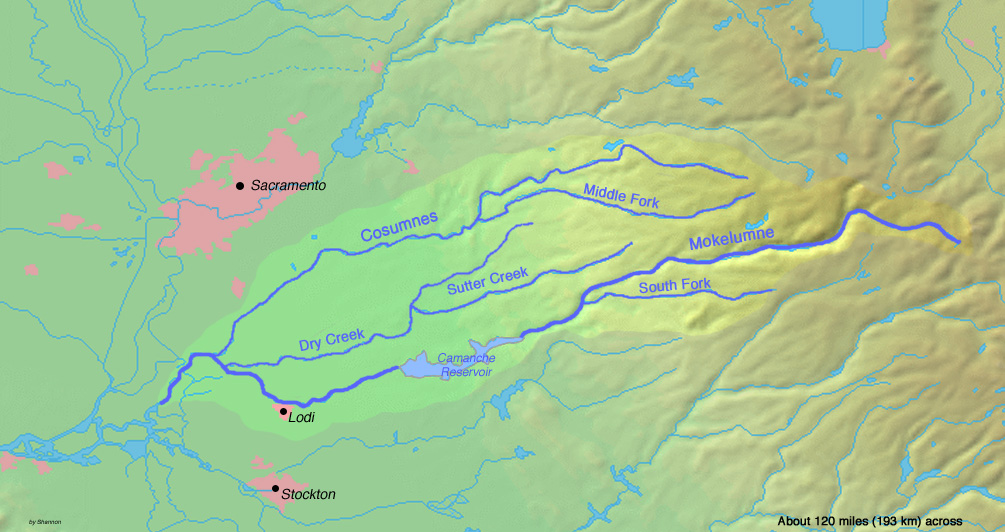
The Mokelumne River is a river in Northern California. The Upper Mokelumne River originates in the Sierra Nevada mountain range and flows into Pardee Reservoir and then Camanche Reservoir in the Sierra foothills. The Lower Mokelumne River refers to the portion of the river below Camanche Dam. It crosses California's Central Valley, flowing westward through Lodi, California, and ultimately meeting its confluence with the San Joaquin River in the Sacramento-San Joaquin River Delta. The river crosses or forms the border of five California counties: Alpine, Amador, Calaveras, San Joaquin, and Sacramento.
The name, pronounced /məˈkʌləmni/, is Plains Miwok and is constructed from moke, meaning fishnet, and -umne, a suffix meaning "people of".[3] The town of Mokelumne Hill was named for the river in about 1850.
Contents
Recreational uses
The Mokelumne River is home to five notable Whitewater Kayak runs: Fantasy Falls, Devil's Nose, Tiger Creek Dam, Ponderosa and Electra-Middle Bar. Fantasy Falls, a Class V+, 26-mile wilderness reach, runs from below Highway 4 in Alpine County to the backwaters of Salt Springs Reservoir. Devil's Nose, Class IV-V, runs 17 miles from Salt Springs Dams to Tiger Creek Powerhouse. Below Tiger Creek Dam is the Tiger Creek Dam Whitewater run, a scenic, 3 mile Class IV run. The Ponderosa run goes from Ponderosa Way to Electra Powerhouse. The westernmost run is Electra-Middle Bar, a 5+-mile Class II-III run. It begins just below the Electra Powerhouse and ends at the Middle Bar Bridge.
The Mokelumne is also a popular site for fishing, camping, water play, birding, picnics, gold panning, spring wildflower watching, and other activities. Electra Road, just east of Highway 49, is a popular place to run, walk, and enjoy the river. The large granite domes, Calaveras Dome and Hammer Dome, near Salt Springs Reservoir, are popular for technical rock climbing. Three campgrounds are also located near Salt Springs: Mokelumne River, White Azalea, and Moore Creek.
Above Salt Springs Reservoir, the Mokelumne Wilderness challenges those who seek a true wilderness experience. Backpacking in this federally designated wilderness area requires good back-country skills.
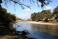 The lower Mokelumne River passing through Lodi, California.
Threats
The East Bay Municipal Utility District has included an optional expansion of Pardee Reservoir in its [1] 2040 water plan. The expansion could drown more than a mile of the river as well as unique cultural and historic sites. Some local governments, conservation, recreation and fishery activists oppose the reservoir expansion.
Tributaries
- Dry Creek
- Cosumnes River
- Bear River
- Blue Creek
- Beaver Creek
- Green Creek
- Camp Creek
- Ashland Creek
See also
- Mokelumne River AVA
- Foothill Conservancy
- East Bay Municipal Utility District (EBMUD)
- Pardee Dam, Pardee Reservoir
- Camanche Dam, Camanche Reservoir, Mokelumne River Fish Hatchery
References
- ^ "Geographic Names Information System Feature Detail Report: Mokelumne River". United States Geological Survey Geoegraphic Names Information System. Retrieved Oct. 2, 2007.
- ^ a b "Water-Data Report 2006: 11325500 Mokelumne River at Woodbridge, CA". United States Geological Survey. Retrieved Oct. 2, 2007.
- ^ Bright, William (1998). 1500 California Place Names: their origin and meaning. University of California Press; Berkeley, California, 1998. ISBN: 0-520-21271-1.
External links
- Lodi News-Sentinel: Searching for the Mokelumne Part II
- EPA: Lower Mokelumne watershed
- EBMUD's Mokelumne history
- Fantasy Falls kayaking video
- Amador Ledger-Dispatch: Mokelumne Frustrations Flow Toward EBMUD
- Indymedia: Chris Shutes of CSPA Slams Pardee Reservoir Expansion Project
- East Bay Express: Sierra Water Grab
- Mokelumne River Wild and Scenic video by Mikey Wier
- East Bay MUD 2040 Water Program
Sacramento River Valley Pit River • McCloud River • Mill Creek • Deer Creek • Battle Creek •Stony Creek •Butte Creek • Feather River • Yuba River • Bear River • American River • Cache Creek • Putah CreekSan Joaquin River Valley Mokelumne River • Cosumnes River • Calaveras River • Stanislaus River • Tuolumne River • Clavey River • Merced River • Mariposa Creek • Chowchilla River • Fresno RiverTulare Basin Categories:- Tributaries of the San Joaquin River
- Rivers of Amador County, California
- Rivers of Calaveras County, California
- Rivers of San Joaquin County, California
- Rivers of Sacramento County, California
Wikimedia Foundation. 2010.