- Sacramento County, California
-
County of Sacramento — County — 
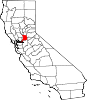
SealLocation in the state of California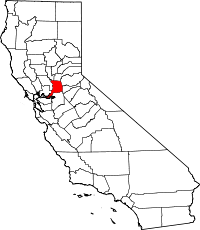 California's location in the US
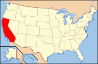
Country  United States
State  California
Region Sacramento Valley Metro area Greater Sacramento Incorporated 1850 County seat Sacramento Largest city Sacramento Area – Total 2,578.3 km2 (995.48 sq mi) – Land 2,501 km2 (965.65 sq mi) – Water 77.3 km2 (29.83 sq mi) Population (2010) – Total 1,418,788 – Density 550.3/km2 (1,425.2/sq mi) Time zone Pacific Standard Time (UTC−8) – Summer (DST) Pacific Daylight Time (UTC−7) Website www.saccounty.net Sacramento County is a county in the U.S. state of California. Its county seat is Sacramento, which is also the state capital. As of 2010 the county had a population of 1,418,788.
The Greater Sacramento metropolitan area consists of eight counties with Sacramento County being the largest. The County covers about 994 square miles (2,570 km2) in the middle of the California Central Valley, on into Gold Country. Sacramento County extends from the low delta lands between the Sacramento River and San Joaquin River north to about ten miles (16 km) beyond the State Capitol and east into the foothills of the Sierra Nevada Mountains. The southmost portion of Sacramento County has direct access to San Francisco Bay.
Contents
History
Sacramento County was one of the original counties of California, which were created in 1850 at the time of statehood.
The county was named after the Sacramento River, which forms its western border. The river was named by Spanish cavalry officer Gabriel Moraga for the Santisimo Sacramento (Most Holy Sacrament), referring to the Catholic Eucharist.
Alexander Hamilton Willard, a member of the Lewis and Clark Expedition, is buried in the old Franklin Cemetery.
Geography
According to the 2000 census, the county has a total area of 995.48 square miles (2,578.3 km2), of which 965.65 square miles (2,501.0 km2) (or 97.00%) is land and 29.83 square miles (77.3 km2) (or 3.00%) is water.[1] Most of the county is at an elevation close to sea level, with some areas below sea level. Hills along the eastern boundary rise to several hundred feet. Major watercourses in the county include the American River, Sacramento River and Dry Creek, a tributary of the Sacramento River.
Cities and towns
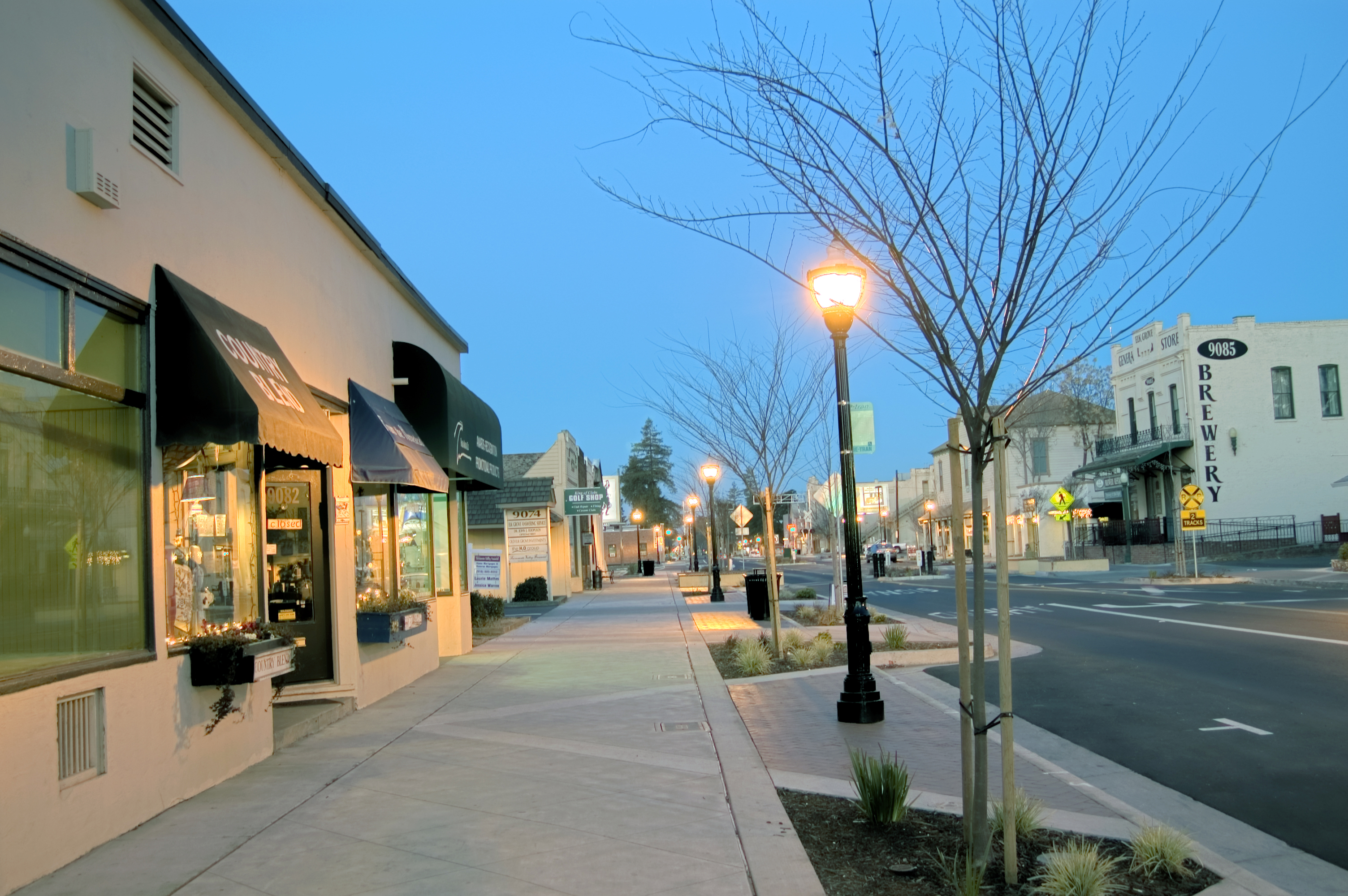
 Sacramento
 Pocket-Greenhaven
 Elk Grove
Incorporated places
- Citrus Heights (incorporated 1997)
- Elk Grove (incorporated 2000)
- Folsom (incorporated 1946)
- Galt (incorporated 1946)
- Isleton (incorporated 1923)
- Rancho Cordova (incorporated 2003)
- Sacramento (incorporated 1850)
Unincorporated census-designated places
- Antelope
- Arden Arcade
- Carmichael
- Del Paso Heights
- Elverta
- Fair Oaks
- Florin
- Foothill Farms
- Gold River
- Hagginwood
- Herald
- La Riviera
- Laguna
- Locke
- Natomas
- North Highlands
- Orangevale
- Parkway-South Sacramento
- Rancho Murieta
- Rio Linda
- Rosemont
- Vineyard
- Walnut Grove
- Wilton
Adjacent counties
- San Joaquin County, California – south
- Contra Costa County, California – southwest
- Solano County, California – west
- Yolo County, California – west
- Sutter County, California – northwest
- Placer County, California – north
- El Dorado County, California – east
- Amador County, California – east
See also: List of counties bordering eight or more countiesNational protected area
- Stone Lakes National Wildlife Refuge
Government and politics
Sacramento County vote
by party in presidential electionsYear GOP DEM Others 2008 39.5% 213,583 58.5% 316,506 2.4% 12,770 2004 49.3% 235,539 49.5% 236,657 1.2% 5,670 2000 45.3% 195,619 49.3% 212,792 5.4% 23,139 1996 40.8% 166,049 49.8% 203,019 9.4% 38,346 1992 35.4% 160,366 43.6% 197,540 21.1% 95,606 1988 51.0% 201,832 47.7% 188,557 1.3% 5,301 1984 55.6% 204,922 43.1% 159,128 1.3% 4,791 1980 47.7% 153,721 40.4% 130,031 11.9% 38,368 1976 44.6% 123,110 52.3% 144,203 3.1% 8,563 1972 49.0% 141,218 47.6% 137,287 3.4% 9,716 1968 41.7% 97,177 50.9% 118,769 7.4% 17,300 1964 34.2% 77,871 65.7% 149,668 0.2% 332 1960 43.3% 84,252 56.3% 109,695 0.4% 809 1956 45.1% 67,686 54.7% 82,134 0.2% 260 1952 49.0% 67,207 50.4% 69,066 0.6% 837 1948 37.8% 35,074 58.4% 54,197 3.9% 3,571 1944 33.2% 24,611 66.3% 49,204 0.5% 403 1940 30.8% 23,201 68.1% 51,351 1.2% 864 1936 20.1% 12,119 78.5% 47,265 1.3% 800 1932 27.7% 14,553 69.3% 36,370 2.9% 1,542 1928 50.8% 20,762 48.2% 19,684 1.0% 403 1924 41.1% 13,400 7.0% 2,285 51.9% 16,932 1920 64.9% 15,634 29.7% 7,150 5.5% 1,316 Sacramento County is governed by an elected five-member Sacramento County Board of Supervisors[2] according to the Sacramento County Charter and the Sacramento County Code. The county is administered by the County Executive[3] appointed by the Board, and an elected Assessor, District Attorney, Sheriff, and Board of Education.[4][5]
Sacramento County is politically competitive in presidential elections, though marginally Democratic. Candidates from the Democratic Party have carried the county in the past five presidential elections, but have won a majority of the county's votes only once during that time (in 2008). The city of Sacramento is strongly Democratic, while rural areas are strongly Republican; suburban areas are more divided. This pattern is also present in congressional and state legislative elections. The last Republican presidential candidate to win a majority in the county was George H.W. Bush in 1988.
In the House of Representatives, all of California's 5th congressional district, part of the 3rd district, as well as small portions of the 4th and 10th districts, are in the county. The 3rd and 4th districts are represented by Republicans Dan Lungren and Tom McClintock, respectively, while the 5th and 10th are represented by Democrats Doris Matsui and John Garamendi, respectively.
In the State Assembly, all of the 9th district and parts of the 4th, 5th, 10th, and 15th districts are in the county. The 5th, represented by Richard Pan, the 9th, represented by Roger Dickinson, the 10th by Alyson Huber, and the 15th by Joan Buchanan are represented by Democrats, while the 4th is represented by Republican Beth Gaines.
In the State Senate, all of the 6th district and parts of the 1st and 5th districts are in the county. The 1st district is represented by Republican Ted Gaines and the 5th and 6th districts are represented by Democrats, Lois Wolk and Darrell Steinberg, respectively.
As of 2008, approximately 45% of registered voters were Democratic and 31% were registered Republicans; the remaining 23% declined to state their affiliation.[6]
Transportation infrastructure
Major highways
 Interstate 5
 Interstate 80
 Interstate 80 Business
 U.S. Route 50
 State Route 12
 State Route 16
 State Route 70
 State Route 99
 State Route 104
 State Route 160
 State Route 220
 State Route 244
Public transportation
Sacramento Regional Transit (RT) provides bus and light rail service in Sacramento and nearby communities like Rancho Cordova, Citrus Heights, and Rosemont. Sacramento hosts 37.4 miles (60.2 km) of light rail. The cities of Elk Grove, Folsom and Galt also operate their own bus lines. In addition, the transit agencies of the adjacent counties have routes operating into downtown Sacramento, or connecting with the light rail system.
Greyhound and Amtrak both serve Sacramento. The port of Sacramento ships 870,000 short tons (790,000 metric tons) of cargo annually.
Airports
Sacramento International Airport is a major, full-service airport with passenger flights. It is owned by the County of Sacramento. The County also owns Sacramento Mather Airport in Rancho Cordova and Sacramento Executive Airport, both of which are general aviation airports. There are also privately owned public use airports located in Elk Grove and Rio Linda.
Demographics
Historical populations Census Pop. %± 1900 45,915 — 1910 67,806 47.7% 1920 91,029 34.2% 1930 141,999 56.0% 1940 170,333 20.0% 1950 277,140 62.7% 1960 502,778 81.4% 1970 631,498 25.6% 1980 783,381 24.1% 1990 1,041,219 32.9% 2000 1,223,499 17.5% 2010 1,418,788 16.0% 2010
The 2010 United States Census reported that Sacramento County had a population of 1,418,788. The racial makeup of Sacramento County was 815,151 (57.5%) White, 147,058 (10.4%) African American, 14,308 (1.0%) Native American, 203,211 (14.3%) Asian, 13,858 (1.0%) Pacific Islander, 131,691 (9.3%) from other races, and 93,511 (6.6%) from two or more races. Hispanic or Latino of any race were 306,196 persons (21.6%).[7]
Population reported at 2010 United States Census The County Total
PopulationWhite African
AmericanNative
AmericanAsian Pacific
Islanderother
racestwo or
more racesHispanic
or Latino
(of any race)Sacramento County 1,418,788 815,151 147,058 14,308 203,211 13,858 131,691 93,511 306,196 Incorporated
citiesTotal
PopulationWhite African
AmericanNative
AmericanAsian Pacific
Islanderother
racestwo or
more racesHispanic
or Latino
(of any race)Citrus Heights 83,301 66,856 2,751 753 2,714 363 5,348 4,516 13,734 Elk Grove 153,015 70,478 17,172 965 40,261 1,807 10,231 12,101 27,581 Folsom 72,203 53,627 4,140 427 9,000 173 1,818 3,018 8,064 Galt 23,647 15,639 430 361 815 108 4,834 1,460 10,113 Isleton 804 542 10 10 41 4 139 58 316 Rancho Cordova 64,776 39,123 6,561 668 7,831 556 5,517 4,520 12,740 Sacramento 466,488 210,006 68,335 5,291 85,503 6,655 57,573 33,125 125,276 Census-designated
placesTotal
PopulationWhite African
AmericanNative
AmericanAsian Pacific
Islanderother
racestwo or
more racesHispanic
or Latino
(of any race)Antelope 45,770 29,200 4,039 402 6,090 407 2,284 3,348 6,635 Arden-Arcade 92,186 64,688 7,977 948 5,152 531 7,420 5,470 17,147 Carmichael 61,762 49,776 2,972 546 2,653 287 2,035 3,493 7,218 Clay 1,195 981 6 24 8 0 108 68 242 Courtland 355 247 0 6 4 0 75 23 200 Elverta 5,492 4,453 117 77 208 48 302 287 859 Fair Oaks 30,912 26,479 729 255 1,289 57 738 1,365 2,954 Florin 47,513 15,034 7,521 543 13,605 815 6,756 3,239 13,048 Foothill Farms 33,121 21,249 3,628 357 1,731 208 3,362 2,586 7,579 Franklin 155 119 0 0 5 0 20 11 42 Freeport 38 34 0 0 2 0 1 1 6 Fruitridge Pocket 5,800 1,704 1,047 105 1,113 67 1,317 447 2,345 Gold River 7,912 5,837 195 20 1,426 28 97 309 515 Herald 1,184 934 20 13 64 7 105 41 254 Hood 271 135 0 15 15 1 70 35 137 La Riviera 10,802 7,315 1,084 76 766 87 671 803 1,756 Lemon Hill 13,729 5,091 1,493 246 2,394 196 3,487 822 6,790 Mather 743 467 99 13 27 21 31 85 110 McClellan Park 4,451 2,477 393 42 850 84 267 338 704 North Highlands 42,694 27,000 4,883 603 2,067 300 4,709 3,132 10,077 Orangevale 33,960 29,679 463 316 1,040 75 879 1,508 3,448 Parkway 14,670 5,225 2,696 182 1,997 300 3,161 1,109 6,185 Rancho Murieta 5,488 4,874 130 33 158 6 81 206 425 Rio Linda 15,106 11,654 365 235 665 62 1,304 821 3,033 Rosemont 22,681 13,496 2,720 310 2,419 134 1,754 1,848 4,587 Vineyard 24,836 11,306 2,426 163 7,293 256 1,682 1,710 4,414 Walnut Grove 1,542 943 15 24 110 0 402 48 673 Wilton 5,363 4,234 169 45 289 13 343 270 683 Unincorporated
communitiesTotal
PopulationWhite African
AmericanNative
AmericanAsian Pacific
Islanderother
racestwo or
more racesHispanic
or Latino
(of any race)All others not CDPs (combined) 24,823 14,249 2,472 234 3,606 202 2,770 1,290 6,306 2000
As of the census[8] of 2000, there were 1,223,499 people, 453,602 households, and 297,562 families residing in the county. The population density was 1,267 people per square mile (489/km²). There were 474,814 housing units at an average density of 492/sq mi (190/km²). The racial makeup of the county was 64.02% White, 10.56% Black or African American, 1.09% Native American, 13.53% Asian, 0.59% Pacific Islander, 7.48% from other races, and 5.84% from two or more races. 19.31% of the population were Hispanic or Latino of any race. 10.2% were of German, 7.0% English, 6.7% Irish and 5.1% American ancestry according to Census 2000. 75.7% spoke only English at home; 10.0% spoke Spanish, 1.5% Hmong, 1.4% Chinese or Mandarin, 1.3% Vietnamese, 1.2% Tagalog and 1.2% Russian.
There were 453,602 households out of which 33.70% had children under the age of 18 living with them, 46.40% were married couples living together, 14.10% had a female householder with no husband present, and 34.40% were non-families. 26.70% of all households were made up of individuals and 8.00% had someone living alone who was 65 years of age or older. The average household size was 2.64 and the average family size was 3.24.
In the county the population was spread out with 27.60% under the age of 18, 9.50% from 18 to 24, 31.00% from 25 to 44, 20.90% from 45 to 64, and 11.10% who were 65 years of age or older. The median age was 34 years. For every 100 females there were 95.90 males. For every 100 females age 18 and over, there were 92.50 males.
The median income for a household in the county was $43,816, and the median income for a family was $50,717. Males had a median income of $39,482 versus $31,569 for females. The per capita income for the county was $21,142. About 10.3% of families and 14.1% of the population were below the poverty line, including 20.2% of those under age 18 and 6.6% of those age 65 or over.
See also
- Hiking trails in Sacramento County
- History of Sacramento, California
- List of California Historical Landmarks in Sacramento County
- List of California public officials charged with crimes, Sacramento County
- List of school districts in Sacramento County, California
- National Register of Historic Places listings in Sacramento County, California
- Elwood Bruner, district attorney in 1893
References
- ^ "Census 2000 U.S. Gazetteer Files: Counties". United States Census. http://www.census.gov/tiger/tms/gazetteer/county2k.txt. Retrieved 2011-02-13.
- ^ California Government Code §25000(a)
- ^ Sacramento County Charter §20
- ^ Sacramento County Charter §23(e)
- ^ Sacramento County Charter §24
- ^ SOS.ca.gov
- ^ "2010 Census P.L. 94-171 Summary File Data". United States Census Bureau. http://www2.census.gov/census_2010/01-Redistricting_File--PL_94-171/California/.
- ^ "American FactFinder". United States Census Bureau. http://factfinder.census.gov. Retrieved 2008-01-31.
External links
- Official Sacramento County website
- Sacramento County transit website
- Sacramento Metro Chamber – representing Sacramento County and surrounding counties

Sutter County Placer County Solano County and Yolo County 
El Dorado County and Amador County  Sacramento County, California

Contra Costa County San Joaquin County Municipalities and communities of Sacramento County, California Cities Citrus Heights | Elk Grove | Folsom | Galt | Isleton | Rancho Cordova | Sacramento
CDPs Antelope | Arden-Arcade | Carmichael | Clay | Courtland | Elverta | Fair Oaks | Florin | Foothill Farms | Franklin | Freeport | Fruitridge Pocket | Gold River | Herald | Hood | La Riviera | Lemon Hill | Mather | McClellan Park | North Highlands | Orangevale | Parkway | Rancho Murieta | Rio Linda | Rosemont | Vineyard | Walnut Grove | Wilton
Unincorporated
communitiesLocke | Paintersville | Parkway-South Sacramento | Ryde | Sloughhouse
Ghost towns Mormon Island | Sutterville
Greater Sacramento Counties Major City Cities
and
towns100k–200k25k–100kArden Arcade · Auburn · Carmichael · Citrus Heights · Davis · Folsom · Florin · Laguna · Lincoln · North Highlands · Orangevale · Parkway-South Sacramento · Rancho Cordova · Rocklin · West Sacramento · Woodland · Yuba City
10k–25kCameron Park · El Dorado Hills · Fair Oaks · Foothill Farms · Galt · Gardnerville Ranchos (NV) · Granite Bay · Grass Valley · La Riviera · Linda · Marysville · North Auburn · Olivehurst · Placerville · Rosemont · Rio Linda · South Lake Tahoe · South Yuba City · Truckee · Vineyard
Sub-regions Gold Country · Lake Tahoe · Sacramento Valley · Sierra Nevada · Yuba-Sutter Area
Categories:- Sacramento County, California
- California counties
- Sacramento metropolitan area


Wikimedia Foundation. 2010.