- Tehama County, California
-
County of Tehama — County — 
SealLocation in the state of California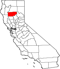 California's location in the United States
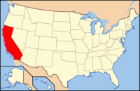
Country  United States
State  California
Region Shasta Cascade Incorporated 1856 County seat Red Bluff Area - Total 7,672.2 km2 (2,962.27 sq mi) - Land 7,643 km2 (2,950.99 sq mi) - Water 29.2 km2 (11.28 sq mi) Population (2010) - Total 63,463 - Density 8.3/km2 (21.4/sq mi) Time zone Pacific Standard Time (UTC-8) - Summer (DST) Pacific Daylight Time (UTC-7) Website www.co.tehama.ca.us Tehama County (pronounced teh-HAY-muh) is a county located in the northern part of the U.S. state of California. It is bisected by the Sacramento River. As of 2010 its population was 63,463, up from 56,039 as of 2000. The county seat is Red Bluff.
Contents
History
Tehama County was formed from parts of Butte, Colusa, and Shasta Counties in 1856.
The county is named for the City of Tehama. The origin of the name is not known. Suggested possible roots are the Arabic word tehama ("hot low-lands"), the Spanish word tejamanil (shingle), or "high water" in the dialect of local Native Americans.
The first permanent settlers in the area that is now Tehama County, were Robert Hasty Thomes, Albert Gallatin Toomes, William George Chard, and Job Francis Dye. The four men were each given land grants by the government of Mexico in 1844. Thomes received Rancho Saucos, Toomes received Rancho Rio de los Molinos, Chard received Rancho Las Flores, and Dye received Rancho Primer Cañon o Rio de Los Berrendos. Later in the same year Josiah Belden received Rancho Barranca Colorado.[1]
Famous early figures include Kit Carson, who took part in a fight that gave name to Bloody Island and Battle Creek, Jedediah Smith, John Fremont, and William B. Ide, the first and only president of the California Republic.
Geography
According to the 2000 census, the county has a total area of 2,962.27 square miles (7,672.2 km2), of which 2,950.99 square miles (7,643.0 km2) (or 99.62%) is land and 11.28 square miles (29.2 km2) (or 0.38%) is water.[2] Watercourses in Tehama County include Dye Creek and Payne's Creek. A small part of Lassen Volcanic National Park extends into the northeast corner of the county.
Cities and towns
- Capay
- Corning
- portions of Cottonwood
- Flournoy
- Gerber-Las Flores
- Kirkwood
- Lake California
- Los Molinos
- Manton
- Mill Creek
- Mineral
- Paskenta
- Rancho Tehama Reserve
- Red Bluff
- Tehama
- Vina
Adjacent counties
- Butte County, California - south
- Glenn County, California - south
- Mendocino County, California - southwest
- Trinity County, California - west
- Shasta County, California - north
- Plumas County, California - east
National protected areas
- Lassen National Forest (part)
- Lassen Volcanic National Park (part)
- Mendocino National Forest (part)
- Sacramento River National Wildlife Refuge (part)
- Shasta-Trinity National Forest (part)
Transportation Infrastructure
Major highways
Public Transportation
Tehama Rural Area Express (TRAX) operates local service in Red Bluff and service to Los Molinos and Corning. Greyhound buses stop in Red Bluff.
Airports
Red Bluff Municipal Airport and Corning Municipal Airport are two general aviation airports.
Politics
Tehama County vote
by party in presidential electionsYear GOP DEM Others 2008 60.8% 14,843 36.7% 8,945 3.1% 772 2004 66.4% 15,572 32.0% 7,504 1.6% 368 2000 63.6% 13,270 31.2% 6,507 5.2% 1,077 1996 50.3% 10,292 35.7% 7,290 14.0% 2,861 1992 35.4% 7,419 35.8% 7,508 28.9% 6,052 1988 56.5% 9,854 41.4% 7,213 2.1% 367 1984 62.8% 11,586 35.4% 6,527 1.9% 342 1980 59.1% 9,140 31.3% 4,832 9.6% 1,485 1976 44.8% 6,110 51.3% 6,990 3.9% 535 1972 48.7% 6,054 41.7% 5,175 9.6% 1,195 1968 47.3% 5,198 41.5% 4,565 11.2% 1,236 1964 39.0% 4,529 60.4% 6,928 0.1% 10 1960 50.0% 5,522 49.6% 5,483 0.4% 47 1956 53.8% 4,866 45.8% 4,143 0.4% 33 1952 64.3% 5,742 34.8% 3,110 0.9% 77 1948 51.3% 3,348 44.7% 2,920 4.0% 262 1944 47.8% 2,903 51.5% 3,130 0.7% 41 1940 44.0% 2,913 54.6% 3,618 1.5% 97 1936 38.5% 2,376 59.7% 3,687 1.9% 115 1932 34.2% 2,001 60.4% 3,534 5.4% 316 1928 65.6% 3,393 31.9% 1,650 2.5% 131 1924 46.0% 1,943 11.5% 486 42.5% 1,798 1920 61.8% 2,462 27.1% 1,079 11.1% 442 Tehama is a strongly Republican county in Presidential and congressional elections. The last Democrat to win a majority in the county was Jimmy Carter in 1976. Bill Clinton won a plurality in 1992. Tehama is part of California's 2nd congressional district, which is held by Republican Wally Herger. In the state legislature Tehama is in the 2nd Assembly district, which is held by Republican Jim Nielsen, and the 4th Senate district, which is held by Republican Doug LaMalfa.
On November 4, 2008, Tehama County voted 72.7% for Proposition 8, which amended the California Constitution to ban same-sex marriages.[3]
Demographics
2010
The 2010 United States Census reported that Tehama County had a population of 63,463. The racial makeup of Tehama County was 51,721 (81.5%) White, 406 (0.6%) African American, 1,644 (2.6%) Native American, 656 (1.0%) Asian, 76 (0.1%) Pacific Islander, 6,258 (9.9%) from other races, and 2,702 (4.3%) from two or more races. Hispanic or Latino of any race were 13,906 persons (21.9%).[4]
Population reported at 2010 United States Census The County Total
PopulationWhite African
AmericanNative
AmericanAsian Pacific
Islanderother
racestwo or
more racesHispanic
or Latino
(of any race)Tehama County 63,463 51,721 406 1,644 656 76 6,258 2,702 13,906 Incorporated
cities and townsTotal
PopulationWhite African
AmericanNative
AmericanAsian Pacific
Islanderother
racestwo or
more racesHispanic
or Latino
(of any race)Corning 7,663 5,510 44 201 82 11 1,496 319 3,271 Red Bluff 14,076 11,366 128 438 187 16 1,168 773 3,037 Tehama 418 346 6 23 1 0 27 15 57 Census-designated
placesTotal
PopulationWhite African
AmericanNative
AmericanAsian Pacific
Islanderother
racestwo or
more racesHispanic
or Latino
(of any race)Bend 619 570 4 15 3 0 14 13 48 Flournoy 101 90 0 1 3 2 4 1 9 Gerber 1,060 575 6 55 8 0 371 45 526 Lake California 3,054 2,751 11 81 31 6 55 119 251 Las Flores 187 127 0 5 0 0 41 14 72 Los Molinos 2,037 1,581 0 39 7 2 321 87 537 Manton 347 312 0 20 1 0 7 7 35 Mineral 123 115 0 1 1 0 1 5 4 Paskenta 112 95 0 0 0 0 8 9 19 Paynes Creek 57 51 0 2 0 0 1 3 7 Proberta 267 174 0 7 1 1 76 8 91 Rancho Tehama Reserve 1,485 1,181 21 52 21 5 102 103 214 Richfield 306 264 0 4 0 0 35 3 65 Vina 237 195 1 7 2 0 20 12 42 Unincorporated
communitiesTotal
PopulationWhite African
AmericanNative
AmericanAsian Pacific
Islanderother
racestwo or
more racesHispanic
or Latino
(of any race)All others not CDPs (combined) 31,314 26,418 185 693 308 33 2,511 1,166 5,621 2000
As of the census[5] of 2000, there were 56,039 people, 21,013 households, and 14,898 families residing in the county. The population density was 19 people per square mile (7/km²). There were 23,547 housing units at an average density of 8 per square mile (3/km²). The racial makeup of the county was 84.79% White, 0.57% Black or African American, 2.10% Native American, 0.79% Asian, 0.10% Pacific Islander, 8.26% from other races, and 3.39% from two or more races. 15.83% of the population were Hispanic or Latino of any race. 14.4% were of German, 11.0% English, 9.6% Irish and 9.5% American ancestry according to Census 2000. 86.0% spoke English and 13.0% Spanish as their first language.
There were 21,013 households out of which 32.9% had children under the age of 18 living with them, 54.6% were married couples living together, 11.6% had a female householder with no husband present, and 29.1% were non-families. 24.0% of all households were made up of individuals and 11.5% had someone living alone who was 65 years of age or older. The average household size was 2.62 and the average family size was 3.08.
In the county the population was spread out with 27.4% under the age of 18, 7.8% from 18 to 24, 25.7% from 25 to 44, 23.2% from 45 to 64, and 15.9% who were 65 years of age or older. The median age was 38 years. For every 100 females there were 97.7 males. For every 100 females age 18 and over, there were 95.0 males.
The median income for a household in the county was $31,206, and the median income for a family was $37,277. Males had a median income of $30,872 versus $22,864 for females. The per capita income for the county was $15,793. About 13.0% of families and 17.3% of the population were below the poverty line, including 24.0% of those under age 18 and 9.2% of those age 65 or over.
See also
- Hiking trails in Tehama County
- National Register of Historic Places listings in Tehama County, California
References
- ^ E. J. Lewis ,1891,Tehama County History:A Memorial and Biographical History of Northern California, Lewis Publishing Co., Chicago
- ^ "Census 2000 U.S. Gazetteer Files: Counties". United States Census. http://www.census.gov/tiger/tms/gazetteer/county2k.txt. Retrieved 2011-02-13.
- ^ County Results - Election Center 2008 - Elections & Politics from CNN.com
- ^ "2010 Census P.L. 94-171 Summary File Data". United States Census Bureau. http://www2.census.gov/census_2010/01-Redistricting_File--PL_94-171/California/.
- ^ "American FactFinder". United States Census Bureau. http://factfinder.census.gov. Retrieved 2008-01-31.
External links
- Tehama County official website
- TehamaPulse.com is an online events calendar for Tehama County.

Shasta County Trinity County 
Plumas County  Tehama County, California

Mendocino County Glenn County and Butte County Municipalities and communities of Tehama County, California Cities 
CDPs Bend | Flournoy | Gerber | Lake California | Las Flores | Los Molinos | Manton | Mineral | Paskenta | Paynes Creek | Proberta | Rancho Tehama Reserve | Richfield | Vina
Unincorporated
communitiesDairyville | Dales | El Camino | Gerber-Las Flores | Henleyville | Lyonsville | Kirkwood | Mill Creek | Red Bank | Reeds Creek
Categories:- California counties
- Tehama County, California
- Metropolitan areas of California


Wikimedia Foundation. 2010.