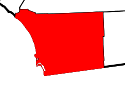
- San Diego County, California
-
County of San Diego — County — 
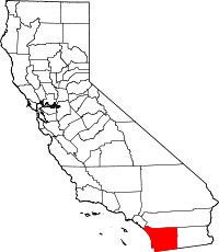
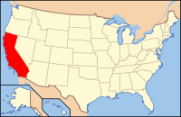
SealLocation in the state of California California's location in the United States Country USA State  California
metropolitan area San Diego metropolitan area municipal corporation 1850 county seat San Diego largest city San Diego Area – Total 4,525.52 sq mi (11,721 km2) – Land 4,199.89 sq mi (10,877.7 km2) – Water 325.62 sq mi (843.4 km2) Population (2010 Census) – Total 3,095,313 – Density 684/sq mi (264.1/km2) Time zone Pacific Standard Time (UTC-8) – Summer (DST) Pacific Daylight Time (UTC-7) Website sdcounty.ca.gov San Diego County is a large county located in the southwestern corner of the US state of California. Hence, San Diego County is also located in the southwestern corner of the 48 contiguous United States. Its county seat and largest city is San Diego. Its population was about 2,813,835 in the 2000 U.S. Census. According to the 2010 U.S. Census, San Diego County had a population of 3,095,313 people, making it the second-most-populous county in California, just behind its northern neighbor Los Angeles County.[1] Its population in 2009 was estimated at 3,208,466,[2] making it the fifth most-populous county in the United States and giving it a population greater than 20 of the 50 U.S. states.
San Diego County has 70 miles (110 km) of coastline. It has a mild Mediterranean to semi-arid climate.[3] Also in this county are 16 significant naval and military locations of the United States Navy, U.S. Marine Corps and the U.S. Coast Guard, including Naval Base San Diego, Marine Corps Base Camp Pendleton, Marine Corps Air Station Miramar, and Naval Air Station North Island.
San Diego County defines the metropolitan statistical area of San Diego-Carlsbad-San Marcos, and in its metropolitan capacity is also known as Greater San Diego. In addition, San Diego County is part of the San Diego–Tijuana metropolitan area, an area with above five million people and the largest bi-national metropolitan area shared between the United States and Mexico. Arising from an effort by the state government to identify regional economies, San Diego County and Imperial County are part of the Southern Border Region, one of nine such regions. As a regional economy, the Southern Border Region is the smallest but most economically diverse region in the state, though the two counties maintain weak relations and have little in common, aside from their border proximity.[4]
San Diego County extends south all the way to the Mexican border, which is also the northern border of the State of Baja California and the northern municipal limits of Tijuana Municipality and Tecate Municipality. San Diego County is bordered by Orange County and Riverside County on its north, by Imperial County on its east, and the Pacific Ocean on its west and southwest.
Contents
History
The area which is now San Diego County has been inhabited for more than 10,000 years by Kumeyaay (also called Diegueño), Luiseño, Cupeño and Cahuilla Indians.[5]
European settlement in what is now San Diego County began with the founding of the Mission San Diego de Alcalá, by Spanish pioneers, in 1769. This county was part of Alta California under the Viceroyalty of New Spain until the Mexican revolution. From 1821 through 1848 this area was part of Mexico.
San Diego County became part of the United States as a result of the Treaty of Guadalupe Hidalgo in 1848, ending the U.S.-Mexican War. This treaty designated the new border as terminating at a point on the Pacific Ocean coast which would result in the border passing one Spanish league south of the southernmost portion of San Diego Bay, thus ensuring that the United States received all of this natural harbor.
San Diego County was one of the original counties of California, and it was created at the time of California statehood in 1850.[6] San Diego County was named for San Diego Bay, which had been renamed in 1602 by Sebastián Vizcaíno in honor of the Franciscan St. Didacus of Alcalá, known in Spanish as San Diego de Alcalá de Henares, and whose name was borne by Vizcaíno's flagship.
At the time of its establishment in 1850, San Diego County was relatively large, and included all of southernmost California which was south and east of Los Angeles County. As such it included areas of what are now Inyo County and San Bernardino County, as well as all of what is now Riverside County and Imperial County.[6]
During the later part of the 19th century, there were numerous changes in the boundaries of San Diego County, when various areas became separated for the counties mentioned above. The most recent changes were the establishments of Riverside County in 1893[7] and Imperial County in 1907.[8] Imperial County was also the last county to be established in California, and after this division, San Diego no longer extended from the Pacific Ocean to the Colorado River, and it no longer covered the entire border between California and Mexico.
Geography
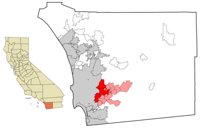
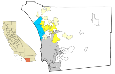 North County communities. Coastal cities are in dark blue, unincorporated coastal communities are in light blue. Inland cities are in dark yellow, unincorporated inland communities are in light yellow.
*This map does not show neighborhoods of the city of San Diego that are considered to be part of North County, such as Del Mar Heights, Rancho Peñasquitos, and Rancho Bernardo)
*Some areas in white in this general region that are in white would be also considered part of North County, but only cities and unincorporated communities are colored on this map.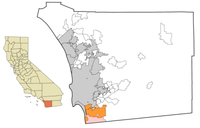 South Bay communities of San Diego County. The cities and towns of National City, Chula Vista, and Imperial Beach are in dark orange. The unincorporated community of Bonita is in light orange. San Ysidro and Otay Mesa, neighborhoods of the city of San Diego, are in pink.
According to the 2000 census, the county has a total area of 4,525.52 square miles (11,721.0 km2), of which 4,199.89 square miles (10,877.7 km2) (or 92.80%) is land and 325.62 square miles (843.4 km2) (or 7.20%) is water.[9]
The county is larger in area than the combined states of Rhode Island and Delaware.[10]
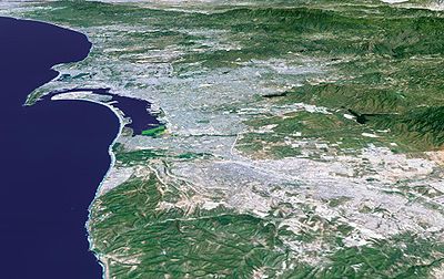
San Diego County has a varied topography. On its western side is 70 miles (110 km) of coastline.[11] Most of San Diego between the coast and the Laguna Mountains consists of hills, mesas, and small canyons. Snow-capped (in winter) mountains rise to the northeast, with the Sonoran Desert to the far east. Cleveland National Forest is spread across the central portion of the county, while the Anza-Borrego Desert State Park occupies most of the northeast. Although the western third of the county is primarily urban, the mountains and deserts in the eastern two-thirds of the county consist primarily of undeveloped backcountry. Most of these backcountry areas are home to a native plant community known as chaparral. San Diego County contains more than a million acres (4,000 km²) of chaparral, twice as much as any other California county.[12]
North San Diego County is known as North County; the exact geographic definitions of "North County" vary, but it includes the northern suburbs and sometimes certain northern neighborhoods of the City of San Diego.
The eastern suburbs are collectively known as East County, though most still lie in the western third of the county. The southern suburbs and southern detached portion of the city of San Diego, extending to the Mexican border, are collectively referred to as South Bay.
Largest cities in San Diego County by population
Largest cities (2010 census population):
Largest towns, 2010 Census City Population San Diego 1,387,000Chula Vista 244,000Oceanside 182,000Escondido 151,000Carlsbad 109,000Vista 99,000El Cajon 97,000San Marcos 89,000Encinitas 62,000Cities and towns in San Diego County
Incorporated cities and towns
- Carlsbad
- Chula Vista
- Coronado
- Del Mar
- El Cajon
- Encinitas (Cardiff-by-the-Sea, Leucadia, Olivenhain)
- Escondido
- Imperial Beach
- La Mesa
- Lemon Grove
- National City
- Oceanside
- Poway
- San Diego
- San Marcos
- Santee
- Solana Beach
- Vista
Unincorporated communities
- Eucalyptus Hills
- Fairbanks Ranch
- Fallbrook
- Fernbrook
- Flinn Springs
- Four Corners
- Granite Hills
- Guatay
- Harbison Canyon
- Harmony Grove
- Hidden Meadows
- Jacumba
- Jamul
- Julian
- La Presa
- Lake Morena Village
- Lake San Marcos
- Lakeside
- Lincoln Acres
- Live Oak Springs
- Mount Laguna
- Oak Grove
- Ocotillo Wells
- Pala, California
- Pine Hills
- Pine Valley
- Potrero
- Pueblo Siding
- Rainbow
- Ramona
- Ranchita
- Rancho San Diego
- Rancho Santa Fe
- Rincon
- San Diego Country Estates
- Santa Ysabel
- Shelter Valley
- Spring Valley
- Tecate
- Tierra del Sol
- Valley Center
- Vallecitos
- Warner Springs
- Winter Gardens
- Wynola
Indian reservations
San Diego County has 18 federally recognized Indian reservations, more than any other county in the United States.[13] Although they are typical in size to other Indian reservations in California (many of which are termed "Rancherías"), they are relatively tiny by national standards,[citation needed] and all together total 200.2 square miles (518.5 km²) of area.
- Barona Indian Reservation
- Campo Indian Reservation
- Capitan Grande Indian Reservation
- Cuyapaipe Indian Reservation
- Inaja and Cosmit Indian Reservation
- Jamul Indian Village
- La Jolla Indian Reservation
- La Posta Indian Reservation
- Los Coyotes Indian Reservation
- Manzanita Indian Reservation
- Mesa Grande Indian Reservation
- Pala Indian Reservation
- Pauma and Yuima Indian Reservation
- Rincon Indian Reservation
- San Pasqual Indian Reservation
- Santa Ysabel Indian Reservation
- Sycuan Indian Reservation
- Viejas Indian Reservation
Boundaries (counties and municipalities)
San DiegoCounties adjacent to San Diego County, California National protected areas
- Cabrillo National Monument
- Cleveland National Forest (part)
- San Diego National Wildlife Refuge Complex, which includes several individual wildlife refuge areas:[14]
- San Diego Bay South Bay
- San Diego Bay Sweetwater Marsh
- Tijuana Slough National Wildlife Refuge
- Seal Beach National Wildlife Refuge (located in Orange County)
- San Diego National Wildlife Refuge
- Vernal Pools
State parks and protected areas
- Anza-Borrego Desert State Park (portions are also in Imperial and Riverside counties)
- Torrey Pines State Reserve
- Cuyamaca Rancho State Park
- Palomar Mountain State Park
- San Pasqual Battlefield State Historic Park
- Old Town San Diego State Historic Park
- Border Field State Park
- Tijuana River Natural Estuarine Research Reserve
- San Onofre State Beach
- Moonlight State Beach
- Carlsbad State Beach
- South Carlsbad State Beach
- Leucadia State Beach
- San Elijo State Beach
- Cardiff State Beach
- Torrey Pines State Beach
- Silver Strand State Beach
Mountains
- Cuyamaca Mountains
- In-Ko-Pah Mountains
- Jacumba Mountains
- Laguna Mountains
- Palomar Mountain
- Peninsular Ranges
- San Ysidro Mountains
- Santa Ana Mountains
- Volcan Mountains
There are 236 mountain summits and peaks in San Diego County[15] including:
- Black Mountain
- Cuyamaca Peak (second highest point in San Diego County)
- Cowles Mountain (highest point in the city of San Diego)
- Mount Helix
- Hot Springs Mountain (highest point in San Diego County)
- Mount Soledad
- Stonewall Mountain
Bays and Lagoons
- Buena Vista Lagoon
- Agua Hedionda Lagoon
- Batiquitos Lagoon
- San Elijo Lagoon
- Mission Bay
- San Diego Bay
Lakes
- Lake Cuyamaca
- Lake Hodges
- Santee Lakes
- Sweetwater Reservoir
- Otay Lakes
- Lake Wolford
- El Capitan Reservoir
- Sutherland Reservoir
- Lake Henshaw
- Lake Murray
- San Vicente Reservoir
- Lake Jennings
- Barrett Reservoir
- Natural Rock Tanks
- Little Laguna Lake
- Big Laguna Lake
- Big Lake
- Twin Lakes
- Jean, Lake
- Lost Lake
- Swan Lake
Rivers
- San Diego River
- San Luis Rey River
- San Dieguito River
- Sweetwater River (California)
- Otay River
- Tijuana River
Transportation in San Diego County
Main article: Transportation in San Diego CountyMajor Highways
Border crossings to Mexico
San Ysidro Border Crossing
Otay Mesa Border Crossing
Tecate Border CrossingRailroads
AMTRAK (Pacific Surfliner)
Metrolink
The Coaster
San Diego and Arizona Eastern Railway
San Diego and Imperial Valley Railroad Sprinter (North County)Light rail and local transit
San Diego Trolley
San Diego Metropolitan Transit System
Sprinter
North County Transit DistrictThe Port of San Diego
Primary Civilian Airports
- Lindbergh Field (San Diego International Airport) (SAN)
- Montgomery Field, (MYF)
- McClellan-Palomar Airport, (CLD or CRQ) a.k.a. Palomar Airport or Carlsbad Airport
- Gillespie Field, (SEE) in El Cajon
- Agua Caliente Airport
- Borrego Valley Airport
- Fallbrook Airport
- Oceanside Municipal Airport
- Ocotillo Airport
- Ramona Airport, (RNM)
- Brown Field Municipal Airport, (SDM) (formerly East Field, NAAS Otay Mesa, and NAAS Brown Field)
Education
San Diego County contains three public state universities: University of California, San Diego; San Diego State University; and California State University, San Marcos. Major private universities in the county include University of San Diego (USD), Point Loma Nazarene University (PLNU), Alliant International University (AIU), and National University.
Within the county there are 24 public elementary school districts, 6 high school districts, and 12 unified school districts. There are also 5 community college districts.[16]
There are two separate public library systems in San Diego County: the San Diego Public Library serving the city of San Diego, and the San Diego County Library serving all other areas of the county. In 2010 the county library had 33 branches and two bookmobiles; circulated over 10.7 million books, CDs, DVDs, and other material formats; recorded 5.7 million visits to library branches; and hosted 21,132 free programs and events. The San Diego County Library is one of the 25 busiest libraries in the nation as measured by materials circulated.[17][18]
- Naval Base San Diego, also known as "32nd Street Naval Station"
- Naval Amphibious Base Coronado
- Naval Air Station North Island
- Naval Base Point Loma, which includes the Submarine Base and the Fleet Antisubmarine Warfare Training Center
- Space and Naval Warfare Systems Center San Diego (SPAWAR)
- Bob Wilson Naval Hospital, formerly the Naval Medical Center San Diego, also known as Balboa Naval Hospital
U.S. Marine Corps
- Marine Corps Base Camp Pendleton
- Marine Corps Air Station Miramar
- Marine Corps Recruit Depot San Diego
U.S. Coast Guard
Sites of interest
- Anza-Borrego State Park, the largest state park in California with high levels of both plant and animal biodiversity
- Mount Laguna Observatory, owned and primarily operated by San Diego State University
- Palomar Observatory, owned and primarily operated by the California Institute of Technology
- The Ramona Valley wine-producing region, located 28 miles (45 km) northeast of the City of San Diego
- San Diego Zoo Safari Park, formerly known as the San Diego Wild Animal Park, 35 miles (56 km) north of the San Diego Zoo and east of Escondido
- Sea World of San Diego, on Mission Bay.
- Mission Bay Recreation Area, including Fiesta Island, a sheltered bay popular for water sports, also known for the annual Over the line tournament.
- Mission San Diego de Alcala, the first of California's 21 Spanish missions. It is an operating Roman Catholic parish and also is open for historical interest tours during the week. It is located near the interchange of Interstates 8 and 15.
- Balboa Park, with numerous museums and other cultural locations, located just north of Downtown San Diego.
- San Diego Zoo, located in Balboa Park
- Old Town San Diego State Historic Park, located at the western end of Mission Valley, north of Downtown San Diego. It preserves and recreates the original settlement of San Diego during its pueblo, Alta California, and early American periods, through 1872.
- Presidio Park, located on a bluff directly above Old Town, a city historic park on the site of the San Diego Presidio, the first European settlement in California.
- Cabrillo National Monument, located at the southern tip of the Point Loma Peninsula. It has historical exhibits about Juan Rodriguez Cabrillo and World War II as well as the Old Point Loma Lighthouse which is open to the public. It offers striking views of the harbor and ocean, natural areas for hiking and bird watching, and tide pools.
- San Diego Bay contains the aircraft carrier USS Midway now used as a memorial ship and as a floating museum, and the eight floating museum ships of the San Diego Maritime Museum. Harbor cruises, sailing, and sport fishing are also available.
- Legoland California is a "Lego" theme park in Carlsbad.
- Alta Vista Gardens is a Botanical Garden in Vista dedicated to bringing together 'People, Nature & Art'.
Politics
San Diego County vote
by party in presidential electionsYear GOP DEM Others 2008 44.1% 539,939 54.3% 664,685 1.7% 19,270 2004 52.5% 596,033 46.4% 526,437 1.1% 12,378 2000 49.6% 475,736 45.7% 437,666 4.7% 45,232 1996 45.8% 402,876 44.1% 389,964 10.3% 91,311 1992 35.7% 352,125 37.2% 367,397 27.1% 267,124 1988 60.2% 523,143 38.3% 333,264 1.5% 12,788 1984 65.3% 502,344 33.4% 257,029 1.3% 9,894 1980 60.8% 435,910 27.3% 195,410 11.9% 85,546 1976 55.7% 353,302 41.6% 263,654 2.7% 16,839 1972 61.8% 371,627 34.3% 206,455 3.8% 23,055 1968 56.3% 261,540 36.1% 167,669 7.7% 35,654 1964 50.3% 214,445 49.7% 211,808 0.0% 33 1960 56.4% 233,045 43.3% 171,259 0.3% 1,106 1956 64.5% 195,742 35.2% 106,716 0.4% 1,147 1952 63.5% 186,091 35.9% 105,255 0.6% 1,688 1948 49.4% 101,552 47.8% 98,217 2.8% 5,690 1944 45.4% 75,746 53.9% 89,959 0.6% 1,059 1940 43.3% 55,434 55.6% 71,188 1.2% 1,488 1936 35.0% 35,686 63.5% 64,628 1.5% 1,540 1932 41.5% 35,305 53.6% 45,622 5.0% 4,223 1928 67.1% 47,769 32.0% 22,749 0.9% 633 1924 49.0% 22,726 6.4% 2,944 44.7% 20,721 1920 63.8% 19,826 27.3% 8,478 9.0% 2,783 San Diego County has historically been a Republican stronghold: 2008 was the first time in decades that a Democratic presidential nominee won a majority of the county's votes (though in 1992 Bill Clinton won a plurality). The city of San Diego itself is more Democratic than the county's average (though fairly moderate for a large city) and has voted for Democrats Clinton, Gore, Kerry, and Obama in the last five presidential elections respectively. The city of San Diego, as well as Coronado and Imperial Beach, is part of the 53rd congressional district which has a Cook Partisan Voting Index (CPVI) of D +12. San Diego's northern and eastern suburbs tend to be very conservative. Northern suburbs including Carlsbad are part of the 50th district with a CPVI of R +5. In the 2004 presidential election, San Diego, Encinitas, National City, Del Mar, and some other areas voted for John Kerry; San Marcos, Escondido, Carlsbad, Oceanside, Coronado, Santee, Poway, El Cajon, and Vista overwhelmingly backed George W. Bush. Chula Vista, La Mesa, Lemon Grove, Solana Beach, and Imperial Beach are considered swing areas of the county – Chula Vista and Imperial Beach narrowly backed Al Gore in 2000 but narrowly voted for Bush in 2004, while Solana Beach switched from Bush in 2000 to Kerry in 2004. La Mesa narrowly voted for Bush both times, and Lemon Grove narrowly went Democratic both times. In 2008, Barack Obama became the first Democrat to win a majority of votes in San Diego County since World War II. Obama captured Chula Vista, Oceanside, and Carlsbad.
One unique feature of the political scene is the use of Golden Hall, a convention facility next to City Hall, as a central elections center. The County Registrar of Voters rents the hall to distribute election results. Supporters and political observers are invited to watch the results come in, candidates give their victory and concession speeches and host parties for campaign volunteers and donors at the site, and television stations broadcast from the floor of the convention center. Golden Hall was scheduled to be closed in 2004, but was reused again for the November 2005 special election. The atmosphere on the evening of election day is often comparable to the voting portion of a political party national convention.[19]
In the House of Representatives, all of California's 50th, 52nd, and 53rd districts and parts of the 49th and 51st districts are in the county. By district, the seats are held by Republican Darrell Issa, Republican Brian Bilbray, Democrat Bob Filner, Republican Duncan D. Hunter, and Democrat Susan Davis.
On Nov. 4, 2008 San Diego County voted 53.8 % for Proposition 8 which amended the California Constitution to ban same-sex marriages, thus restoring Proposition 22 which was overturned by a ruling from the California Supreme Court. However the city of San Diego, along with Del Mar, Encinitas, and Solana Beach, voted against Proposition 8.[20]
In the State Assembly, parts of the 66th and 73rd districts, and all of the 74th–79th districts are in the county. Assemblymembers are: District 66, Kevin Jeffries (R); District 73, Diane Harkey (R); District 74, Martin Garrick (R); District 75, Nathan Fletcher (R); District 76, Toni Atkins (D); District 77, Brian W. Jones (R); District 78, Marty Block (D); and District 79, Ben Hueso (D).[21]
In the State Senate, all of the 38th and 39th district and parts of the 36th and 40th districts are in the county. Senators are: District 36, Joel Anderson (R); District 38, Mark Wyland (R); District 39, Christine Kehoe (D); and District 40 Juan Vargas (D).[22]
District Location Cook PVI % for Bush, 2004 Median household income[23] Per capita income[23] 49th district Northern San Diego and southwestern Riverside County R +10 63% $46,445 $19,659 50th district Northern San Diego County, including costal communities such as Carlsbad, California but excluding La Jolla R +5 55% $59,813 $29,877 51st district Southern San Diego County, including Chula Vista and National City. Also includes all of Imperial County D +7 46% $39,243 $14,923 52nd district Eastern San Diego County, including La Mesa, El Cajon and Lakeside. R +9 61% $52,940 $24,544 53rd district San Diego including La Jolla, Coronado and Imperial Beach D +12 39% $36,637 $21,715 Mean Districts: 49th, 50th, 51st, 52nd, 53rd R +5 52.8% $47,016 $22,144 Government and infrastructure
County Board of Supervisors
As of December 2010 the members of the San Diego County Board of Supervisors are:
- Greg Cox, District 1
- Dianne Jacob, District 2
- Pam Slater-Price, District 3, Chairwoman
- Ron Roberts, District 4
- Bill Horn, District 5, Vice-Chairman
State representation
The Richard J. Donovan Correctional Facility of the California Department of Corrections and Rehabilitation is in an unincorporated area in the county.[24]
Demographics
Historical populations Census Pop. %± 1850 798 — 1860 4,324 441.9% 1870 4,951 14.5% 1880 8,018 61.9% 1890 34,987 336.4% 1900 35,090 0.3% 1910 61,665 75.7% 1920 112,248 82.0% 1930 209,659 86.8% 1940 289,348 38.0% 1950 556,808 92.4% 1960 1,033,011 85.5% 1970 1,357,854 31.4% 1980 1,861,846 37.1% 1990 2,498,016 34.2% 2000 2,813,833 12.6% 2010 3,095,313 10.0% 2010
The 2010 United States Census reported that San Diego County had a population of 3,095,313. The racial makeup of San Diego County was 1,981,442 (64.0%) White, 158,213 (5.1%) African American, 26,340 (0.9%) Native American, 336,091 (10.9%) Asian (4.7% Filipino, 1.6% Chinese, 1.4% Vietnamese, 0.8% Indian, 0.7% Korean, 0.6% Japanese, 0.2% Laotian, 0.2% Cambodian), 15,337 (0.5%) Pacific Islander, 419,465 (13.6%) from other races, and 158,425 (5.0%) from two or more races. Hispanic or Latino of any race were 991,348 persons (32.0%).[25]
Population reported at 2010 United States Census The County Total
PopulationWhite African
AmericanNative
AmericanAsian Pacific
Islanderother
racestwo or
more racesHispanic
or Latino
(of any race)San Diego County 3,095,313 1,981,442 158,213 26,340 336,091 15,337 419,465 158,425 991,348 Incorporated
citiesTotal
PopulationWhite African
AmericanNative
AmericanAsian Pacific
Islanderother
racestwo or
more racesHispanic
or Latino
(of any race)Carlsbad 105,328 87,205 1,379 514 7,460 198 4,189 4,383 13,988 Chula Vista 243,916 130,991 11,219 1,880 35,042 1,351 49,171 14,262 142,066 Coronado 18,912 16,668 399 103 572 55 457 658 2,302 Del Mar 4,161 3,912 10 8 118 3 25 85 175 El Cajon 99,478 68,897 6,306 835 3,561 495 12,552 6,832 28,036 Encinitas 59,518 51,067 361 301 2,323 91 3,339 2,036 8,138 Escondido 143,911 86,876 3,585 1,472 8,740 350 36,507 6,381 70,326 Imperial Beach 26,324 16,467 1,170 266 1,731 188 4,764 1,738 12,893 La Mesa 57,065 40,964 4,399 431 3,289 318 4,326 3,338 11,696 Lemon Grove 25,320 13,072 3,495 225 1,624 275 4,828 1,801 10,435 National City 58,582 24,725 3,054 618 10,699 482 16,175 2,829 36,911 Oceanside 167,086 109,020 7,873 1,385 11,081 2,144 25,886 9,697 59,947 Poway 47,811 36,781 783 265 4,853 106 2,944 2,079 7,508 San Diego 1,307,402 769,971 87,949 7,696 207,944 5,908 161,246 66,688 376,020 San Marcos 83,781 53,235 1,967 591 7,518 322 15,853 4,295 30,697 Santee 53,413 44,083 1,057 409 2,044 253 2,677 2,890 8,699 Solana Beach 12,867 11,039 60 62 513 19 738 436 2,048 Vista 93,834 59,551 3,137 1,103 3,979 677 20,423 4,964 45,380 Census-designated
placesTotal
PopulationWhite African
AmericanNative
AmericanAsian Pacific
Islanderother
racestwo or
more racesHispanic
or Latino
(of any race)Alpine 14,236 12,424 167 222 319 39 576 489 2,081 Bonita 12,538 8,382 466 109 1,200 80 1,681 620 5,106 Bonsall 3,982 3,194 67 28 138 10 376 169 893 Borrego Springs 3,429 2,766 20 34 22 5 500 82 1,218 Bostonia 15,379 10,891 1,011 102 375 89 1,781 1,130 3,941 Boulevard 315 272 2 7 3 0 14 17 44 Campo 5,200 3,730 501 83 151 80 305 350 1,157 Camp Pendleton North 10,616 7,530 992 146 299 41 725 883 2,586 Camp Pendleton South 2,684 2,083 114 90 31 6 248 112 794 Casa de Oro-Mount Helix 18,762 14,881 1,108 89 593 96 996 999 3,235 Crest 2,593 2,329 23 21 38 7 90 85 319 Descanso 1,423 1,290 5 29 16 9 46 28 150 Eucalyptus Hills 5,313 4,566 195 58 87 6 187 214 782 Fairbanks Ranch 3,148 2,780 24 7 209 4 34 90 224 Fallbrook 30,534 20,454 489 233 592 71 7,372 1,323 13,800 Granite Hills 3,035 2,617 43 26 45 9 158 137 401 Harbison Canyon 3,841 3,404 12 74 71 6 145 129 623 Hidden Meadows 3,485 2,865 66 11 318 6 93 126 329 Jacumba 561 389 4 15 6 0 114 33 207 Jamul 6,163 5,300 127 28 146 10 294 258 1,188 Julian 1,502 1,341 5 27 12 0 81 36 195 La Presa 34,169 15,064 4,428 282 3,212 410 8,238 2,535 16,150 Lake San Marcos 4,437 3,978 37 20 133 3 186 80 464 Lakeside 20,648 17,545 235 181 351 53 1,327 956 3,627 Mount Laguna 57 55 0 0 1 0 1 0 1 Pine Valley 1,510 1,408 6 6 16 1 20 53 154 Potrero 656 338 0 8 0 3 281 26 499 Rainbow 1,832 1,324 19 12 43 12 371 51 665 Ramona 20,292 15,887 139 224 279 71 2,965 727 6,334 Rancho San Diego 21,208 17,535 817 105 940 56 739 1,016 3,117 Rancho Santa Fe 3,117 2,910 10 1 87 4 45 60 176 San Diego Country Estates 10,109 9,107 91 90 147 34 276 364 1,126 Spring Valley 28,205 16,781 3,131 237 1,660 236 4,332 1,828 9,196 Valley Center 9,277 6,785 84 188 295 16 1,484 425 2,581 Winter Gardens 20,631 16,845 409 234 345 95 1,616 1,087 4,289 Unincorporated
communitiesTotal
PopulationWhite African
AmericanNative
AmericanAsian Pacific
Islanderother
racestwo or
more racesHispanic
or Latino
(of any race)All others not CDPs (combined) 161,717 117,868 5,163 5,149 10,820 534 15,668 6,515 36,431 2009
As of 2009 Census Bureau estimates, there were 3,053,793 people, 1,067,846 households, and 663,449 families residing in the county. The population density was 670 people per square mile (259/km²). There were 1,142,245 housing units at an average density of 248 per square mile (96/km²). The racial makeup of the county was 79.4% White American, 5.6% Black or African American, 1% Native American, 10.4% Asian, 0.5% Pacific Islander, 10.3% from other races, and 3.6% from two or more races. 31.3% of the population were Hispanic or Latino of any race. 67.0% spoke only English at home; 21.9% spoke Spanish, 3.1% Tagalog and 1.2% Vietnamese.
2000
In 2000 there were 994,677 households out of which 33.9% had children under the age of 18 living with them, 50.7% were married couples living together, 11.6% had a female householder with no husband present, and 33.3% were non-families. 24.2% of all households were made up of individuals and 7.9% had someone living alone who was 65 years of age or older. The average household size was 2.73 and the average family size was 3.29.
In the county the population was spread out with 25.7% under the age of 18, 11.30% from 18 to 24, 32.0% from 25 to 44, 19.8% from 45 to 64, and 11.2% who were 65 years of age or older. The median age was 33 years. For every 100 females there were 101.2 males. For every 100 females age 18 and over, there were 99.7 males.
The median income for a household in the county was $47,067, and the median income for a family was $53,438. Males had a median income of $36,952 versus $30,356 for females. The per capita income for the county was $22,926. About 8.9% of families and 12.4% of the population were below the poverty line, including 16.5% of those under age 18 and 6.8% of those age 65 or over.
Current estimates
According to estimates by the San Diego Association of Governments, the median household income of San Diego County in 2005 was $64,273 (not adjusted for inflation). When adjusted for inflation (1999 dollars; comparable to Census data above), the median household income was $52,192.
Crime statistics
Crime statistics for 2005 (Reported by the sheriff's office or police)[26]
- Murders: 105
- Rapes: 86
- Robberies: 270
- Assaults: 1220
- Burglaries: 2469
- Thefts: 4626
- Auto thefts: 2084
See also
- List of school districts in San Diego County, California
- List of high schools in San Diego County, California
- National Register of Historic Places listings in San Diego County, California
- List of California public officials charged with crimes, San Diego County
- Southern Border region of California
References
- ^ U.S. Census Quickfacts
- ^ Showley, Roger (December 18, 2009). "S.D. County’s population tops 3.2 million". San Diego Union Tribune. http://www.signonsandiego.com/news/2009/dec/18/sd-countys-population-tops-32-million/.
- ^ climate map
- ^ [1] Economics
- ^ kumeyaay website
- ^ a b Coy, Owen C.; PhD (1923). California County Boundaries. Berkeley: California Historical Commission. pp. 221. ASIN B000GRBCXG.
- ^ Ibid. 207
- ^ Ibid. 113
- ^ "Census 2000 U.S. Gazetteer Files: Counties". United States Census. http://www.census.gov/tiger/tms/gazetteer/county2k.txt. Retrieved February 13, 2011.
- ^ [2]
- ^ Gerber, James ed. Economic Profile of the San Diego-Tijuana Region: Characteristics for Investment and Governance Decisions. Institute for Regional Studies of the Californias. 1995. p.11
- ^ The California Chaparral Field Institute
- ^ University of San Diego
- ^ San Diego National Wildlife Refuge Complex website
- ^ MountainZone.com
- ^ San Diego County Board of Education
- ^ http://www.sdcl.org/aboutus.html
- ^ http://dbpcosdcsgt.co.san-diego.ca.us/screens/AR2010/index.html
- ^ Amid the celebrations, farewell | The San Diego Union-Tribune
- ^ San Diego County Proposition 8 Results by Community
- ^ State Assembly Member Roster
- ^ State Senate Districts
- ^ a b "US Census Bureau, 2000 Census income data by congressional district". http://factfinder.census.gov/servlet/DTTable?_bm=y&-context=dt&-ds_name=DEC_2000_110S&-_geoSkip=20&-CONTEXT=dt&-mt_name=DEC_2000_110S_P052&-mt_name=DEC_2000_110S_P053&-mt_name=DEC_2000_110S_P082&-mt_name=DEC_2000_110S_P148A&-mt_name=DEC_2000_110S_H085&-tree_id=609&-_skip=0&-redoLog=false&-geo_id=500$50000US0601&-geo_id=500$50000US0606&-geo_id=500$50000US0608&-geo_id=500$50000US0609&-geo_id=500$50000US0612&-geo_id=500$50000US0613&-geo_id=500$50000US0614&-geo_id=500$50000US0615&-geo_id=500$50000US0616&-geo_id=500$50000US0617&-geo_id=500$50000US0623&-geo_id=500$50000US0624&-geo_id=500$50000US0630&-geo_id=500$50000US0633&-geo_id=500$50000US0634&-geo_id=500$50000US0635&-geo_id=500$50000US0636&-geo_id=500$50000US0637&-geo_id=500$50000US0638&-geo_id=500$50000US0639&-geo_id=500$50000US0640&-geo_id=500$50000US0644&-geo_id=500$50000US0646&-geo_id=500$50000US0647&-geo_id=500$50000US0648&-geo_id=500$50000US0649&-geo_id=500$50000US0650&-geo_id=500$50000US0651&-geo_id=500$50000US0652&-geo_id=500$50000US0653&-_showChild=Y&-format=&-_lang=en&-_toggle=. Retrieved May 31, 2007.
- ^ "Richard J. Donovan Correctional Facility (RJD)." California Department of Corrections and Rehabilitation. Retrieved on September 24, 2011. "480 Alta Road San Diego, CA 92179"
- ^ "2010 Census P.L. 94-171 Summary File Data". United States Census Bureau. http://www2.census.gov/census_2010/01-Redistricting_File--PL_94-171/California/.
- ^ "city-data – San_Diego_County-CA". analyzed data from numerous sources. http://www.city-data.com/county/San_Diego_County-CA.html. Retrieved April 18, 2009.
External links
- Official Travel Resource for the San Diego Region
- County of San Diego Official Website
- San Diego Geographic Information Source Website
- San Diego County Water Authority Map
- California State Association of Counties (CSAC)
- The San Diego Union-Tribune Website
- San Diego Lifestyle Website
San Diego metropolitan area Counties San Diego
Global city
1.2 millionLarge cities
100k - 250kCities and towns
20k - 99kEl Cajon • Vista • San Marcos • Encinitas • La Mesa • Santee • National City • Poway • La Presa • Imperial Beach • Spring Valley • Lemon Grove • Coronado • Fallbrook • Rancho San DiegoBodies of water Regions San Diego–Tijuana History • Geography • Geology • Populace • Economy • Transportation • Education • Communication • Other Infrastructure • CultureCounties and
MunicipalitiesRosarito Beach • San Diego • Tecate • Tijuana
Global cities Large cities
100k - 250kCities and towns
20k - 99kCoronado • El Cajon • El Refugio • Encinitas • Fallbrook • Imperial Beach • La Joya • La Mesa • La Presa • Lemon Grove • National City • Pórticos de San Antonio • Poway • Rancho San Diego • Rosarito Beach • San Marcos • Santee • Spring Valley • Tecate • Terrazas del Valle • VistaCities and towns
10k-19kAlpine • Bonita • Bostonia • Casa de Oro-Mount Helix • Las Delicias • Ramona • Rancho San Diego • San Diego Country Esates • Solana Beach • Villa del Campo • Villa del Prado • Winter GardensBodies of water Agua Hedionda Lagoon • Batiquitos Lagoon • El Capitan Lake • Abelardo L. Rodriguez • Lake Hodges • Lake Sutherland • Lower Otay Reservoir • Loveland Reservoir • Mission Bay • Pacific Ocean • San Elijo Lagoon • San Diego Bay • San Vicente Reservoir • Sweetwater Reservoir • Tijuana River EstuarySub-regions Anza Borrego • Coronado Peninsula • Cuyamaca • East County • Mountain Empire • North County • Palm Valley • Rosarito • San Diego • South Bay • Tecate • TijuanaSouthern Border Region Counties San Diego • Imperial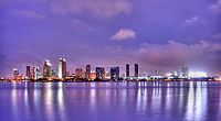
Global City
1.2 millionMajor Cities
100k-200kCities and towns
25k-100kEl Cajon • El Centro • Encinitas • Calexico • Fallbrook • Imperial Beach • La Mesa • La Presa • National City • Poway • San Marcos • Santee • Spring Valley • VistaCities and towns
under 25kAlpine • Bombay Beach • Bonita • Bostonia • Brawley • Casa de Oro-Mount Helix • Calipatria • Coronado • Desert Shores • Heber • Holtville • Imperial • Lakeside • Lemon Grove • Niland • Ocotillo • Palo Verde • Ramona • Rancho San Diego • Salton City • Salton Sea Beach • Seeley • Solana Beach • Westmorland • Winter Gardens • WinterhavenBodies of water Alamo River • Colorado River • Mission Bay • New River • Salton Sea • San Diego Bay • San Diego River • San Luis Rey River • Santa Margarita River • Sweetwater River • Tijuana RiverLandforms Regions North County • Borrego • South Bay • East County • San Diego • Imperial Valley • Southern Border Region State of California
Topics - Climate
- Delegations
- Deserts
- Districts
- Ecology
- Elections
- Environment
- Geography
- Government
- History
- Protected areas
- Sports
- Symbols
- Transportation
- Visitor attractions
- Index of California-related articles
Society Regions - Antelope Valley
- Big Sur
- Cascade Range
- Central California
- Central Coast
- Central Valley
- Channel Islands
- Coachella Valley
- Conejo Valley
- Cucamonga Valley
- Death Valley
- East Bay (SF)
- East County (SD)
- Eastern California
- Emerald Triangle
- Gold Country
- Great Basin
- Greater Los Angeles
- Greater Sacramento
- Inland Empire
- Lake Tahoe
- Los Angeles Basin
- Lost Coast
- Metropolitan Fresno
- Mojave
- Mountain Empire
- North Bay (SF)
- North Coast
- North County (SD)
- Northern California
- Owens Valley
- Oxnard Plain
- San Francisco Peninsula
- Pomona Valley
- Sacramento Valley
- San Bernardino Valley
- San Diego–Tijuana
- San Fernando Valley
- San Francisco Bay Area
- San Gabriel Valley
- San Joaquin Valley
- Santa Clara Valley
- Santa Clara River Valley
- Santa Clarita Valley
- Shasta Cascade
- Sierra Nevada
- Silicon Valley
- South Bay (LA)
- South Bay (SF)
- South Bay (SD)
- South Coast
- Southern California
- Southern Border Region
- Tri-Valley
- Upstate California
- Victor Valley
- Wine Country
- Yosemite
Metro areas - Bakersfield
- Chico
- El Centro
- Fresno
- Hanford–Corcoran
- Los Angeles–Long Beach–Glendale
- Madera
- Modesto
- Merced
- Napa
- Oakland–Fremont–Hayward
- Oxnard–Thousand Oaks–Ventura
- Redding
- Riverside–San Bernardino–Ontario
- Sacramento–Arden Arcade–Roseville
- Salinas
- San Diego–Carlsbad–San Marcos
- San Francisco–San Mateo–Redwood City
- San Jose–Sunnyvale–Santa Clara
- San Luis Obispo–Paso Robles
- Santa Ana–Anaheim–Irvine
- Santa Barbara–Santa Maria–Goleta
- Santa Cruz–Watsonville
- Santa Rosa–Petaluma
- Stockton
- Vallejo–Fairfield
- Visalia–Porterville
- Yuba City
Micro areas Counties - Alameda
- Alpine
- Amador
- Butte
- Calaveras
- Colusa
- Contra Costa
- Del Norte
- El Dorado
- Fresno
- Glenn
- Humboldt
- Imperial
- Inyo
- Kern
- Kings
- Lake
- Lassen
- Los Angeles
- Madera
- Marin
- Mariposa
- Mendocino
- Merced
- Modoc
- Mono
- Monterey
- Napa
- Nevada
- Orange
- Placer
- Plumas
- Riverside
- Sacramento
- San Benito
- San Bernardino
- San Diego
- San Francisco
- San Joaquin
- San Luis Obispo
- San Mateo
- Santa Barbara
- Santa Clara
- Santa Cruz
- Shasta
- Sierra
- Siskiyou
- Solano
- Sonoma
- Stanislaus
- Sutter
- Tehama
- Trinity
- Tulare
- Tuolumne
- Ventura
- Yolo
- Yuba
50 largest metropolitan statistical areas in the United States by population - New York
- Los Angeles
- Chicago
- Dallas–Fort Worth
- Philadelphia
- Houston
- Washington
- Miami
- Atlanta
- Boston
- San Francisco–Oakland
- Detroit
- Riverside–San Bernardino
- Phoenix
- Seattle
- Minneapolis–St. Paul
- San Diego
- St. Louis
- Tampa–St. Petersburg
- Baltimore
- Memphis
- Louisville
- Richmond
- Oklahoma City
- Hartford
- New Orleans
- Buffalo
- Raleigh
- Birmingham
- Salt Lake City
Categories:- California counties
- San Diego County, California
- San Diego metropolitan area
Wikimedia Foundation. 2010.

