- McClellan-Palomar Airport
-
McClellan-Palomar Airport 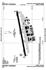
FAA airport diagram IATA: CLD – ICAO: KCRQ – FAA LID: CRQ Summary Airport type Public Owner County of San Diego Serves Oceanside/Carlsbad, California Elevation AMSL 331 ft / 101 m Coordinates 33°07′42″N 117°16′48″W / 33.12833°N 117.28°WCoordinates: 33°07′42″N 117°16′48″W / 33.12833°N 117.28°W Website Runways Direction Length Surface ft m 6/24 4,897 1,493 Asphalt Statistics (2006) Aircraft operations 202,236 Based aircraft 354 Sources: FAA,[1] airport website[2] McClellan-Palomar Airport (IATA: CLD, ICAO: KCRQ, FAA LID: CRQ), known to locals as Palomar Airport, is a public airport located three miles (5 km) southeast of the central business district of Carlsbad, a city in San Diego County, California, United States. It is owned by the County of San Diego[1] and serves the northern part of the county. The airport is mostly used for general aviation, and as of September 2009[3] United Express is the only commercial airline with regularly scheduled service to Los Angeles International Airport (LAX) from Carlsbad McClellan-Palomar Airport. Previously American Eagle served McClellan-Palomar Airport to LAX, and US Airways Express had service to Phoenix Sky Harbor International Airport (PHX), but those routes have been discontinued. It has basic amenities, including internet access, and has received major upgrades to the terminal over the past several years.
Although most U.S. airports use the same three-letter location identifier for the FAA and IATA, McClellan-Palomar Airport is assigned CRQ by the FAA and CLD by the IATA (which assigned CRQ to Caravelas, Brazil). The airport's ICAO identifier is KCRQ.[4][5]
The airport is named for Gerald McClellan, an aviator and civic leader in San Diego's North County area.[6]
Contents
Facilities and aircraft
McClellan-Palomar Airport covers an area of 466 acres (189 ha) which contains one asphalt paved runway (6/24) measuring 4,897 × 150 ft (1,493 × 46 m).[1]
For the 12-month period ending December 31, 2008, the airport had 192,960 aircraft operations, an average of 529 per day: 89% general aviation, 7% air taxi, 3% scheduled commercial and 1% military. There are 325 aircraft based at this airport: 61% single-engine, 24% jet, 11% multi-engine and 4% helicopter.[1]
It opened a new $24 million airline terminal on January 29, 2009.[7] As of October 26, 2010 Palomar Airport’s long term parking rates (30 day max) increased to $5 a day (from $3 per day).[8]
Airlines and destinations
Airlines Destinations United Express operated by SkyWest Airlines Los Angeles The airport is planned to be the main base for California Pacific Airlines, which intends to begin flights on six routes from the airport in early 2012. The planned destinations are Sacramento, California, San Jose, California, Oakland, California, Las Vegas, Nevada, Phoenix, Arizona, and Cabo San Lucas using 70-seat Embraer 170 aircraft.[9]
Accidents and incidents
- On January 24, 2006, a Cessna Citation V departed runway 24 on landing upon completion of its flight from Friedman Memorial Airport in Hailey, Idaho and burst into flames after crashing into a self-storage facility adjacent to the airport. All four people on board (two passengers and two crew) were killed; no one on the ground was hurt.[6]
- On April 29, 2007, a Cessna 182 Skylane carrying three people crashed approximately 1-mile (1.6 km) off the shore shortly after takeoff at 9:30 am.[10]
- On July 3, 2007, a Beechcraft 90 King Air carrying two people crashed after taking off shortly after 6 am in dense fog. The aircraft hit power lines, which caused power outages for local residents and businesses. The two people on board the aircraft were confirmed dead.[11][12]
- On April 19, 2008, a Cessna Citation Mustang skidded off the end of runway 24 and collapsed the main landing gear. The aircraft had four passengers on board, who were uninjured. The Mustang had flown from Lincoln Regional Airport, northeast of Sacramento, California.[citation needed]
- On September 22, 2008, a Cessna 152 crashed just west of College Boulevard on the extended centerline after departing runway 24. The aircraft had two passengers on board, who were both injured and subsequently evacuated by air.[13]
- On September 28, 2008, a Beechcraft Bonanza crashed southeast of the airport after the pilot aborted a landing attempt under foggy conditions. The pilot was the only person on board and was killed.[14]
References
- ^ a b c d FAA Airport Master Record for CRQ (Form 5010 PDF), effective 2007-10-25
- ^ McClellan-Palomar Airport at County of San Diego website
- ^ Search on Orbitz.com for CLD-SFO trips, September 2009
- ^ Great Circle Mapper: CLD / KCRQ - Carlsbad, California (McClellan-Palomar Airport)
- ^ Great Circle Mapper: CRQ / SBCV - Caravelas, Bahia, Brazil
- ^ a b Debbi Farr Baker, Greg Gross, Karen Kucher, Angelica Martinez (2006-01-24). "Four die in jet crash at Palomar Airport". The San Diego Union-Tribune. http://www.signonsandiego.com/news/northcounty/20060124-1205-bn24plane6.html. Retrieved 2006-12-14.
- ^ Palomar Airport Grand Opening Set For January 29th
- ^ San Diego County Airport Details webpage
- ^ "Carlsbad Palomar Airport to be the home of California Pacific Airlines". Seattle Post-Intelligencer. 6 April 2010. http://blog.seattlepi.com/worldairlinenews/archives/200776.asp. Retrieved 15 May 2010.
- ^ [1]
- ^ Chabner, Shayna (2007-07-03). "2 killed in San Diego County plane crash". North County Times. http://www.nctimes.com/articles/2007/07/03/news/top_stories/1_01_277_2_07.prt. Retrieved 2007-07-03.
- ^ Kristina Davis, Angelica Martinez (2007-07-03). "Two killed when private plane crashes on takeoff". The San Diego Union-Tribune. http://www.signonsandiego.com/news/northcounty/20070703-1012-bn03plane3.html. Retrieved 2007-07-03.
- ^ [2]
- ^ Pilot dies in crash of plane near airport
External links
- Airport website
- Palomar-McClellan Airport renovations
- FAA Airport Diagram (PDF), effective 20 October 2011
- Resources for this airport:
- AirNav airport information for KCRQ
- ASN accident history for CLD
- FlightAware airport information and live flight tracker
- NOAA/NWS latest weather observations
- SkyVector aeronautical chart, Terminal Procedures for KCRQ
Transportation in San Diego County Air: McClellan-Palomar Airport • Oceanside Municipal Airport • San Diego International AirportBus: Rail: Categories:- Airports in San Diego County, California

Wikimedia Foundation. 2010.