- Hidden Meadows, California
Infobox Settlement
official_name = Hidden Meadows, California
settlement_type = CDP
imagesize =
image_caption =
image_
imagesize =
image_caption =
image_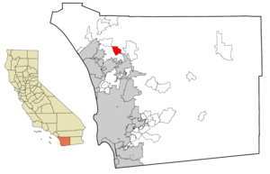
mapsize = 250x200px
map_caption = Location in San Diego County and the state ofCalifornia
mapsize1 =
map_caption1 =
subdivision_type = Country
subdivision_type1 = State
subdivision_type2 = County
subdivision_name =United States
subdivision_name1 =California
subdivision_name2 = San Diego
government_type =
leader_title =
leader_name =
established_date =
area_magnitude =
area_total_km2 = 21.9
area_total_sq_mi = 8.5
area_land_km2 = 21.9
area_land_sq_mi = 8.5
area_water_km2 = 0
area_water_sq_mi = 0
elevation_ft = 1493
elevation_m = 455
population_as_of = 2000
population_footnotes =
population_total = 3463
population_metro =
population_density_km2 = 158.1
population_density_sq_mi = 407.4
timezone = PST
utc_offset = -8
latd = 33 |latm = 13 |lats = 46 |latNS = N
longd = 117 |longm = 7 |longs = 29 |longEW = W
timezone_DST = PDT
utc_offset_DST = -7
postal_code_type =ZIP code
postal_code = 92026
area_code = 760
blank_name = FIPS code
blank_info = 06-33532
blank1_name = GNIS feature ID
blank1_info = 1867027
footnotes =
website =Hidden Meadows is an
unincorporated community in San Diego County,California ,United States . The population was 3,463 at the 2000 census.Geography
According to the
United States Census Bureau Hidden Meadows is located at coor dms|33|13|46|N|117|7|29|W|city (33.229571, -117.124754)GR|1.According to the United States Census Bureau, the Hidden Meadows
census-designated place (CDP) has a total area of 21.9km² (8.4 mi²), all land.Demographics
As of the
census GR|2 of 2000, there were 3,463 people, 1,549 households, and 1,149 families residing in the CDP. Thepopulation density was 158.2/km² (409.6/mi²). There were 1,649 housing units at an average density of 75.3/km² (195.0/mi²). The racial makeup of the CDP was 93.59% White, 0.90% African American, 0.35% Native American, 1.70% Asian, 0.12% Pacific Islander, 1.18% from other races, and 2.17% from two or more races. Hispanic or Latino of any race were 5.86% of the population.There were 1,549 households out of which 13.7% had children under the age of 18 living with them, 70.7% were married couples living together, 2.3% had a female householder with no husband present, and 25.8% were non-families. 21.6% of all households were made up of individuals and 16.0% had someone living alone who was 65 years of age or older. The average household size was 2.23 and the average family size was 2.55.
In the CDP the population was spread out with 12.5% under the age of 18, 3.6% from 18 to 24, 15.1% from 25 to 44, 33.7% from 45 to 64, and 35.1% who were 65 years of age or older. The median age was 56 years. For every 100 females there were 92.6 males. For every 100 females age 18 and over, there were 92.2 males.
The median income for a household in the CDP was $57,545, and the median income for a family was $72,878. Males had a median income of $50,341 versus $32,188 for females. The
per capita income for the CDP was $33,274. About 0.6% of families and 1.5% of the population were below thepoverty line , including none of those under age 18 and 0.6% of those age 65 or over.Politics
In the state legislature Hidden Meadows is located in the 38th Senate District, represented by Republican
Mark Wyland , and in the 66th Assembly District, represented by RepublicanKevin Jeffries . Federally, Hidden Meadows is located inCalifornia's 49th congressional district , which has a Cook PVI of R +10 [cite web | title = Will Gerrymandered Districts Stem the Wave of Voter Unrest? | publisher = Campaign Legal Center Blog | url=http://www.clcblog.org/blog_item-85.html | accessdate = 2008-02-10] and is represented by RepublicanDarrell Issa .External links
Wikimedia Foundation. 2010.