- Imperial Beach, California
Infobox Settlement
official_name = City of Imperial Beach
native_name =
settlement_type =City
nickname = I.B.
motto = "America's Most South-Westernly City"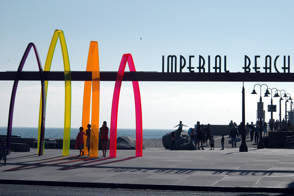
imagesize =
image_caption = "Surfhenge" in Imperial Beach
image_
image_shield =
image_
image_shield =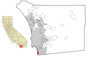
mapsize = 250x200px
map_caption =
mapsize1 =
map_caption1 =
subdivision_type = Country
subdivision_name =United States
subdivision_type1 = State
subdivision_name1 =California
subdivision_type2 = County
subdivision_name2 = San Diego
government_type =Council-Manager
leader_title =Mayor
leader_name = Jim Janney
leader_title1 =City Council
leader_name1 = Fred McLean
Mayda Winter
Patricia McCoy
Lorie Braggleader_title2 =
leader_name2 =
leader_title3
leader_name3 =
leader_title4 =
leader_name4 =
established_title = Founded
established_date = June 1, 1887
established_title2 = Incorporated
established_date2 = September 17, 1956
established_title3 =
established_date3 =
area_magnitude =
area_total_km2 = 11.7
area_total_sq_mi = 4.5
area_land_km2 = 4
area_land_sq_mi = 4.3
area_water_km2 = 0.7
area_water_sq_mi = 0.3
area_water_percent =
area_urban_km2 =
area_urban_sq_mi =
area_metro_km2 =
area_metro_sq_mi =
population_as_of = 2003 - 2007 incl. Tijuana
population_footnotes = [http://world-gazetteer.com/wg.php?x=&men=gpro&lng=en&dat=32&geo=-223&srt=pnan&col=aohdq&pt=a&va=&geo=-1049427 World Gazetteer – San Diego-Tijuana] ]
population_total = 27,151
population_density_km2 = 6324.2
population_density_sq_mi = 6324.2
population_metro = Incl. Tijuana: 4922723
population_density_metro_km2 =
population_density_metro_sq_mi =
population_urban =
timezone = PST
utc_offset = -8
timezone_DST = PDT
utc_offset_DST = -7
latd = 32 |latm = 34 |lats = 42 |latNS = N
longd = 117 |longm = 7 |longs = 2 |longEW = W
elevation_m = 21
elevation_ft = 69
postal_code_type =ZIP code
postal_code = 91932
website = www.ci.imperial-beach.ca.us
area_code = 619
blank_name = FIPS code
blank_info = 06-36294
blank1_name = GNIS feature ID
blank1_info = 1660788
footnotes =Imperial Beach is a city in San Diego County,
California ,United States . The population was 26,992 at the 2000 census.Every year the city holds the annual Sand Castles event, which draws about 400,000 people over three days.
Geography
Imperial Beach is located at coor dms|32|34|42|N|117|7|2|W|city (32.578255, -117.117111)GR|1.
According to the
United States Census Bureau , the city has a total area of 11.7 km² (4.5 mi²). 11.1 km² (4.3 mi²) of it is land and 0.6 km² (0.2 mi²) of it (5.53%) is water.The city occupies the extreme southwest corner of the continental
United States : bordered by thePacific Ocean on the west andMexico on the south.Known as a biker town for its rough atmosphere and seedy beachfront area throughout the 70s, Imperial Beach has undergone a significant makeover in the last ten years and the city has done much to become more visitor-friendly, commercially viable and overall more aesthetically pleasing. However, the city is still a low-key beach community. For years the city was controlled by pro-growth elected officials, but over the years environmentalists and other activists helped elect a group of smart-growth and no-growth officials. The City of Imperial Beach is now implementing an ambitious community redevelopment plan to improve the badly developed commercial corridor along Palm Avenue and Seacoast Drive.
Imperial Beach was the location of fierce environmental battles in the 1970s and 1980s over plans to develop the Tijuana Estuary and build a breakwater to control beach erosion. Former Mayor
Brian Bilbray , who later became a U.S. Congressman, lost both battles. The Tijuana Estuary is now aNational Estuarine Research Reserve and State Park. The cessation of plans to build the breakwater was officially the first major victory of the then fledgling Surfrider Foundation, now an international organization with 45,000-members. While the International Boundary and Water Commission wastewater plant completed in 1999 has greatly improved water quality during dry weather, the biggest obstacle to the renewal of Imperial Beach is the continued pollution of theTijuana River and beach closures just south of the city during wet weather.Surfing is popular in Imperial Beach with activities concentrated north and south of the Imperial Beach Pier and in front of the Tijuana Estuary at the famed Boca Rio beachbreak. The Tijuana Sloughs, a fabled big-wave surf spot is now almost unrideable due to raw toxic sewage that flows into the break from the Tijuana River. WiLDCOAST, a coastal conservation organization based in Imperial Beach, launched a grassroots "Clean Water Now" campaign to support a comprehensive plan to clean up the Tijuana River and reduce beach closures along the U.S.-Mexico border.References in popular culture
Kem Nunn's novel, "Tijuana Straits", provides insight into the culture of the border and surfing in Imperial Beach and the Tijuana River Valley, and the environmental problems that impact both the poorest and wealthiest residents of Tijuana, Imperial Beach and Coronado.
The HBO television series "
John from Cincinnati " was about a dysfunctional surfing family in Imperial Beach set against the backdrop of the U.S.-Mexico border. The series (from famed "Deadwood" and "NYPD Blue " Executive ProducerDavid Milch , writer Kem Nunn, and Emmy award-winning directorMark Tinker ) was filmed at a variety of locations in Imperial Beach and in the Tijuana River Valley.Demographics (2000 census)
As of the
census GR|2 of 2000, there were 26,992 people, 9,272 households, and 6,453 families residing in the city. Thepopulation density was 2,440.7/km² (6,324.2/mi²). There were 9,739 housing units at an average density of 880.6/km² (2,281.8/mi²). The racial makeup of the city was 62.26% White, 5.26% African American, 1.10% Native American, 6.55% Asian, 0.60% Pacific Islander, 17.77% from other races, and 6.45% from two or more races. Hispanic or Latino of any race were 40.08% of the population.There were 9,272 households out of which 40.2% had children under the age of 18 living with them, 45.2% were married couples living together, 18.1% had a female householder with no husband present, and 30.4% were non-families. 21.4% of all households were made up of individuals and 5.5% had someone living alone who was 65 years of age or older. The average household size was 2.84 and the average family size was 3.30.
In the city the population was spread out with 29.4% under the age of 18, 13.9% from 18 to 24, 32.3% from 25 to 44, 16.8% from 45 to 64, and 7.5% who were 65 years of age or older. The median age was 29 years. For every 100 females there were 99.7 males. For every 100 females age 18 and over, there were 98.4 males.
The median income for a household in the city was $35,882, and the median income for a family was $37,352. Males had a median income of $29,692 versus $24,201 for females. The
per capita income for the city was $16,003. About 14.1% of families and 18.8% of the population were below thepoverty line , including 23.7% of those under age 18 and 9.2% of those age 65 or over.Current estimates
According to estimates by the
San Diego Association of Governments , themedian household income of Imperial Beach in 2005 was $49,104 (not adjusted forinflation ). When adjusted forinflation (1999 dollars; comparable toCensus data above), the median household income was $39,874.Politics
In the state legislature Imperial Beach is located in the 40th Senate District, represented by Democrat
Denise Moreno Ducheny , and in the 79th Assembly District, represented by DemocratMary Salas . Federally, Imperial Beach is located inCalifornia's 53rd congressional district , which has a Cook PVI of D +12 [cite web | title = Will Gerrymandered Districts Stem the Wave of Voter Unrest? | publisher = Campaign Legal Center Blog | url=http://www.clcblog.org/blog_item-85.html | accessdate = 2008-02-10] and is represented by DemocratSusan Davis .Famous residents
* Republican Congressman
Brian Bilbray grew up in Imperial Beach and was mayor - Mar Vista High Graduate, 1970
* AuthorRobert Clark Young grew up in Imperial Beach.
* Software entrepreneur Charlie Jackson grew up in Imperial Beach - graduated Mar Vista High in 1967.
* Film actorMatthew Modine attended High School in Imperial Beach.
* Connie Mariano, retired USN Rear Admiral and physician to the President of the United States at the White House for 9 years. (http://edition.cnn.com/2004/HEALTH/09/23/cnna.mariano/) Dr. Mariano graduated Mar Vista High School, 1973 (http://www.mvalumni.com/)City History
The "modern" history of Imperial Beach started about June 1887 when R. R. Morrison, a real estate developer, filed a subdivision map with the
San Diego County Clerk. The map referred to the area asSouth San Diego Beach. The area It encompassed was 5th Street to 13th Street north of Palm Avenue and from about 9th Street to 17th Street between Palm Avenue and (what today is) Imperial Beach Blvd. This included areas that have since been annexed bySan Diego and which were formerly called Palm City. Mr. George Chaffey purchased several plots of land for subdivision. His intent was to create a summer retreat for the people of Imperial Valley. It's considered that the name 'Imperial Beach" was coined as part of a marketing strategy. Mr. Frank J. Cullen, another sub-divider, did some building on 1st street. Some of his structures lasted until 1963 when they were razed to provide space for the Municipal Pier parking lot.The 1880s came to be known as the land boom era, Promoters followed the same general pattern. First came acquisition and subdivision which was followed by a hotel or other attraction. Then came the land auction and finally the hardest part, the building of the community by its residents. In the years preceding and following, this same general pattern held true for many of the developments in the surrounding area, such as Coronado Heights, Oneonta, Monument City,
South San Diego , International City, Barbers Station, South Coronado, Tia Juana City andSan Ysidro .Imperial Beach got its first sidewalks in 1909-1910. The Disinger's operated a general store, post office and a branch of the county library on First Street for nearly fifty years. Down the street a few blocks, Mrs. Harmon built a dance pavilion with an adjoining cafe. It reached its peak of popularity during
World War I and operated until it burned down on Christmas Day, 1943, when its cooking tanks exploded. The roof on the home of Harold and Genevieve Ord caught fire from drifting cinders. Ord was away from home, fighting the Cafe-Pavilion fire.A pier was constructed about 1909. Its original purpose was to generate electricity for the town using wave action which activated massive machinery on the end of the pier. It worked inadequately for its intended purpose and the "Edwards Wave Motor," as it was named, was disassembled and removed. For many years the pier attracted large crowds as did the nearby boardwalk and bathhouse. The wooden pier finally deteriorated and it washed to sea in a severe 1948 storm. The boardwalk lasted until 1953.
Also in 1910, the builder of the
Hotel del Coronado , E. S. Babcock, who reportedly kept a mistress in Imperial Beach, dredged a channel to where the north end of 10th Street is today. Boats carrying up to fifty passengers landed at what was called theSouth San Diego Landing. The boats were operated by Oakley Hall and Ralph Chandler. Captain A. J. Larsen piloted the Grant, which had been purchased from the USS Grant hotel by Chandler. The Grant traveled between Market Street inSan Diego to the South Bay Landing three times a day. Sometimes a night trip was added. A battery powered trolley car operated by theMexico and San Diego Railway Company met the people at theSouth Bay Landing. The trolley took them up 10th Street to Palm Ave. and then west on Palm to First Street where it turned left and proceeded to the end of the street before returning to the landing. The motor cars' batteries were the newest invention of Thomas A. Edison who had experimented with a way to do away with the overhead trolley car wires. The cruises were very popular for about six years.In January 1916, after very heavy rains, the Sweetwater Dam suffered severe erosion, and the Lower Otay Dam was totally destroyed. A large wall of water rushed down the Otay Valley washing away nearly everything in its path. A total of convert|44|in|mm of rain was reported within 26 days. The flood caused the 10th Street channel to fill with silt. It was never dredged again.
South San Diego 's first school was constructed in 1888 at Tenth Street and Elm Avenue. It was a two story, wooden frame building with the auditorium upstairs and a large bell tower. There were no buildings close to it for years and made a beautiful picture.In 1920 the Highland,South San Diego and Oneonta School Districts united to form theSouth Bay Union School District . The Monument School District joined the South Bay District in 1940. The South Bay Union School District's enrollment for 1925 was 110. In 1928, district residents were asked to vote for bonds in the amount of $32,000 to purchase a ten acre site near 19th Street and Coronado Avenue. In May 1930, the new school was dedicated and named Emory, in honor of Brigadier General William R. Emory. He had used the site as his headquarters many years before, and was responsible for a large part of San Diego being in the United States. General Emory played a leading role in the conflicts that resulted in the selection of the International Boundary Line.Imperial Beach Elementary School was built In 1943 by the federal government. Mrs. Lillian Oliver, who had been district superintendent, gave up that position to take the job as principal. Godfrey G. Berry became superintendent for the next twenty years. By 1945, enrollment in the district reached 800 pupils. Westview was built in 1949. For a short period, classes met in the San Diego Children's Association Home on the beach and also in the Methodist Church on Evergreen Avenue near 2nd Street and the South Bay Community Center. One of the earliest churches within the boundaries of Imperial Beach was the Community Methodist Church whose congregation met during the 1940s in a small building at 213 Evergreen Avenue which was then called 5th Street. A retired Navy Chaplain, Adam P. Zedekar helped start the church. Dr. R. N. Merrill served the congregation in the late 1940s and was the first minister in the new church building at 455 Palm Avenue which began services in December, 1950. The church was geared to community service and was used by various organizations. Before the Imperial Beach congregation of Methodists organized, Methodists in the area had to travel to the Nestor United Methodist Church at 1120 22nd Street. This Is the oldest church In the area and dates back to 1888 when a congregation was formed and it was called the Tia Juana Methodist church.
The military made its presence known at various locations in the area. The Coronado Heights section, which was subdivided in the 1880's (North of Imperial Beach) but never developed, was used by the Army after the turn of the Century. Troop "A" of the 10th U.S. Cavalry was based at Camp Herne in this elevated spot to provide security to the region due to the conflicts along the border. After the outbreak of World War 1, Colonel Cominsky, then Commanding Officer of the 10th Cavalry, turned over his parade grounds and several buildings for the Imperial Beach Acrobatic Camp. East Field (Otay Mesa), Ream Field and the Imperial Beach Acrobatic Field became an important area for the national defense. North Island became a permanent air station in 1918. The following Year, the first civilians were hired at North Island as laborers and to do clerical work. Camp Herne soldiers used to put on a show on Sunday afternoons which was open to the public. It was a real thrill, especially to youngsters, to watch the mounted saber drill as the troop of horsemen galloped with horses head to tail, long sabers flashing in the sun. The cavalry sabers were much longer then the officer's swords of today. They had a "monkey" drill team too. This was trick riding. They used surcingles rather than saddles. This was a belly-band around the horse with hand grips on it. The soldiers would vault from one side to the other and always wound up with a pyramid routine using three horses and six men. The soldiers sometimes had relay races too, which allowed the spectators to cheer for their favorites.
In the latter part of the 1930s, war in
Europe caused the U.S. War Department to give consideration to reinforcing coastal defenses through the installation of a long range battery similar to those at Fort Rosecrans. This was accomplished at the elevated area north of Imperial Beach now occupied by the Navy. It was called Fort Emory. A 400 bed Army Psychiatric hospital was located on the hill overlooking the beach. From 1945 to 1950, the Army family of 1st Sgt. Frank W. Grissom were caretakers of the Army buildings and the guns at Fort Emory. The Army vacated Fort Emory in 1950. The Navy took over and established a communications school. The Naval Communications School operated for several years and brought a large payroll into Imperial Beach which supported many businesses. When the Navy moved the school to Florida, the financial impact was significant and many businesses suffered. The history of the U.S. Navy property which is South and Southeast of Imperial Beach started around 1917 when it was used by the Army and called Aviation Field. A year later it was re-named Ream Field in honor of Army Major William Roy Ream, the first flying surgeon to be killed in an aircraft accident. Ream Field was used for air gunnery practice by the Army during World War I. After the war, Ream Field was decommissioned. The Navy began using the field during the 1920's. Just prior to World War II, practice aircraft carrier landings were conducted. In 1943, runways were built and Ream Field was re-commissioned on July 17th. After the War, Ream Field was again de-commissioned and put under the control of Naval Air Station North Island. In July, 1951, Ream Field was commissioned again as a Naval Auxiliary Landing Field, and in 1955 designated Navy Auxiliary Air Station. January 1, 1968, the name game continued and it was designated a full Naval Air Station. August 1, 1974 the status again changed to Naval Auxiliary Landing Field. To Most Imperial Beach'ers, it is simply "Ream Field." With pride to some and pain (in the ears) to others, it was known as the "Helicopter Capitol of The World."From subdivision in the 1880's though the end of World War II, the area grew in population. Various organizations were formed for socializing and for the betterment of the communities. The Midway Civic Group, PTA, Palm City Women's Club, Palm City District Chamber of commerce, Imperial Beach Business Men's Group were some of the early ones. A Coordinating Council was formed of the heads of all the clubs and civic groups. All control and regulation of the area was by the County Board of supervisors. It was through our representative on the board that we were able to procure various items needed for the community. David Bird was our elected representative for many years. The civic organizations were able to make a number of improvements in the area by working with Mr. Bird. The Palm City Chamber of Commerce had been organized for several years and the sentiment at the beach was that it did not adequately represent the interests of the beach. The Imperial Beach Civic Group was formed in 1945 to resolve that problem. They set out in earnest to take care of their most pressing problems. Namely, the formation of a Fire Protection District and acquiring a fire truck. They also set about naming streets. A volunteer fire department and auxiliary were started that evolved into what was perhaps the finest civic organization that Imperial Beach ever had. Early Imperial Beach resident and civic leader Paul Smith was very instrumental during this period. in 1949, a sanitary district was formed, which was vital to the growth.
It was also a necessary precursor to securing county funds for development and attracting private developers. Among these builders was Clem E. (Pinky) Norcross, who with his parents Andrew and Mary Norcross, his brother-in-law and sister, Mr. and Mrs. John Frier, built the Miracle Shopping Center on the South side of Palm Avenue, between 9th Street and Delaware Avenue. It was considered the first of its type in the
County of San Diego . In 1956 surveys were made and petitions circulated proposing incorporation which included the Nestor area. This proposal initiated endless and often heated debate. Nestor objected strongly, so the boundaries were redrawn. Petitions were passed around again and on June 5, 1956 Imperial Beach voted to become its own independent city. The act of incorporation was recorded in the California State Secretary's office on July 18th, 1956. This became the official birthday of Imperial Beach which became the tenth city in San Diego County and the 327th city in California. Cecil H. Gunthrop was the first mayor, Miles Bowler vice-mayor and Paul N. Sexton, a reporter for the Imperial Beach News, was appointed as acting City Clerk. Gordon Grant, the Chula Vista finance officer was employed as a consultant to help set up the accounting system for the new city. A planning commission was appointed, composed of Dr. E. Morris Hayes as chairman, Paul Smith, Clarence Kempff Jr., Jane McLaughlin and Ernest H. Lashles. Mr. Al Carnesciali was the first city manager. other early employees were Fred Wagner of National City as engineering consultant and Mrs. Lois Link as Secretary's. In January 1957, Harold Reama was retained as chief of Police and agreed to serve at $88.00 per month because she was drawing Social Security benefits. The first Imperial Beach patrolman the new police department was Alfred George Ramos who became city clerk in 1966. The city budget for its first year provided a total revenue of $102,864 which included expenses of $52,984 and a surplus of $49,980.Many milestones have occurred during the city's history. The volunteer fire department gave way slowly to a fully paid department. In 1999, the Imperial Beach Police Department gave way to a contract with the
San Diego County Sheriff's Department during a period when the city almost went bankrupt. An extremely popular fishing pier was built In the early 60's after a bond issue was passed by the voters. The pier was destroyed by storms earlier in the early 80's, and was completely rebuilt by December 1988.Growth and redevelopment are key issues for the city's future, as they are in other areas of the country. Imperial Beach can't expand on any side with the possible exception of annexation on the east side, up to the freeway, an action city consultants have recommended against taking. The city can go "up,' but building height and density and related quality of life issues are of critical interest to many. The city has identified several possible redevelopment zones including the Palm Avenue/SR-75, Seacoast Drive, Old Palm Avenue and 13th Street/Imperial Beach Avenue areas. Beautification projects such as the landscaping and the installation of public art along the Palm Avenue median and the development of Portwood Pier Plaza, a multi-use oceanfront park and retail center along Seacoast Drive, are some of the first notable changes within these areas. Further changes are in the pipeline with the planned redevelopment of the Seacoast Inn, an older three-story hotel at 800 Seacoast Drive. The existing structure will be demolished to make way for a new four-story, 78-room hotel on the same location.
External links
* [http://www.ib-chamber.org Imperial Beach Chamber of Commerce]
* [http://sdcoos.ucsd.edu/data/webcam.cfm WebCam] from [http://sdcoos.ucsd.edu/ The San Diego Coastal Ocean Observing System]
* [http://www.cityofib.com/ The City of Imperial Beach]
* [http://www.imperialbeach.net/ Imperial Beach Online Community]References
Wikimedia Foundation. 2010.