- Cuyamaca Rancho State Park
-
Further information: Rancho Cuyamaca
Cuyamaca Rancho State Park 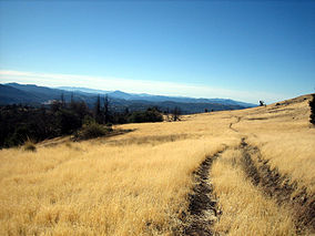
West Mesa Trail in the Laguna Mountains, Cuyamaca Rancho State Park.Location San Diego County, California Nearest city San Diego Coordinates 32°56′N 116°34′W / 32.933°N 116.567°WCoordinates: 32°56′N 116°34′W / 32.933°N 116.567°W Area 26,000 acres (105 km²) Governing body California Department of Parks and Recreation Cuyamaca Rancho State Park is a state park located forty miles east of San Diego, California in the Laguna Mountains of the Peninsular Ranges. The park's 26,000 acres[1] (105 km²) feature pine, fir, and oak forests, with meadows and streams that exist due to the relatively high elevation of the area compared to its surroundings. The park includes 6,512-foot (1,985 m) Cuyamaca Peak, the second highest point in San Diego County
Contents
Introduction
Park services include trails for hiking, horseback riding, and mountain biking, as well as campgrounds for family, group, equestrian, and primitive trail camping; as well as an exhibit at a former gold mine, the Stonewall Mine.
Wildlife in the area includes mountain lions, which have been known to attack humans, and park literature emphasizes avoiding encounters with them. Numerous other species of mammals, birds, reptiles, and amphibians are known to reside within the park.
The park was closed for several months due to massive damage incurred in the 2003 Cedar Fire. Although much of the forest was burned, the park has since been reopened and the fire ecology regenerating native plants are re-growing and returning.
Geology
Cuyamaca Rancho State Park is located in the mountains called the Peninsular Range, which extends from the San Jacinto Mountains north of the park, southward to the tip of Baja California. At the western edge of the most seismically active area in North America, the range is a great uplifted plateau, cut off from the Colorado Desert to the east by the Elsinore Fault Zone, where vertical movement over the last two million years has amounted to thousands of feet of tectonic uplift.
Quartz and granite
Metamorphosed sediments such as schist, gneiss, and quartzite are abundant in the Cuyamacas, particularly in the Stonewall Mine area. Most of the rocks now seen in the Park are plutonic: Either the granodiorite comprising Stonewall Peak, or the gabbro comprising Cuyamaca Peak. As these bedrocks weather, they become the parent material of the coarse, acidic, red soil found throughout the area. Gabbro weathers to a darker red soil than granodiorite or other quartz-rich rock.
Gold
Gold is a natural element that appears around granite formations because gold forms during cooling and solidification of igneous rock. Gold commonly occurs in association with quartz, either as pure gold or as an ore. In the Cuyamaca area, gold is associated with the metasediment called Julian schist. At mines in this area, including the Stonewall Mine in the Park, veins of gold were followed into the bedrock and the surrounding ore excavated. Most streams in the Park have small amounts of gold, since it is constantly being removed from the quartz exposures by weathering.
Flora - plants
Further information: California chaparral and woodlands and California montane chaparral and woodlandsTrees
Further information: California oak woodlandCuyamaca's average elevation of nearly 5,000 feet (1,500 m) enables many conifers and broadleaf trees to exist; a rarity in xeric Southern California. The conifers include the White fir, Incense cedar, Coulter pine, Jeffrey pine, Sugar pine and Ponderosa pine. The broadleaves include the White alder, Arizona ash, California sycamore, Fremont cottonwood, Coast live oak, Canyon live oak, Engelmann oak, California black oak, Interior live oak,[2] Oracle oak, and Red Willow. Detailed information about Cuyamaca area oak and pine trees is available at the park headquarters, in the "Summary of the Natural and Cultural History of Cuyamaca Rancho State Park."
Shrubs
Further information: ChaparralThe shrubs in Cuyamaca include both large (4–15 ft) and small (1–4 ft). On the large size, are the chamise, Eastwood manzanita, Cuyamaca manzanita, Mexican manzanita, cupleaf mountain lilac, whitebark mountain lilac, Pamer mountain lilac, mountain mahogany, creek dogwood, Parish goldenbush, yerba santa, Parish burning bush, toyon, California barberry, laurel sumac, hollyleaf cherry, western choke cherry, scrub oak, coffeeberry, western azalea, white sage, and elderberry.
The small shrubs in the Park include California buckwheat, Wright buckwheat, chaparral honeysuckle, basketbush, California rose, creeping sage, snowberry, and poison oak.
About poison oak: Usually found in moist, shady areas below 5,000 feet (1,500 m)(Though it sometimes occurs elsewhere). Many people develop severe dermatitis from coming into contact with its leaves or stems. Young leaves are usually reddish, turning glossy green, then red again in the fall. Flowers are tiny and white and the fruit is a small whitish berry.
See "Conspicuous Plants of Cuyamaca Rancho State Park," by Michael Curto-1987, for a list of 30 of the Park's shrubs, with their common and botanical names.
Wildflowers
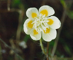
Early Season Middle Season Late Season Milkmaids - Cardamine californica Purple Nightshade Penstemon Peony Monkey Flower Locoweed Goldfields - Lasthenia sp. Mule's Ears - Wyethia sp. Southern Pink Dogwood Creamcups Milkweed - Asclepias sp. Cudweed Aster Checkerbloom - Sidalcea sp. Wallflower Red Indian Paintbrush - Castilleja sp. Splendid Mariposa Lily - Calochortus splendens Golden Bowl Mariposa Lily - Calochortus concolor California Fuchsia Tidy tips Virgin's Bower Goldenrod Golden Yarrow - Eriophyllum sp. Yarrow - Achillea sp. native Thistle Columbine - Aquilegia sp. Baby Blue Eyes Purple Lupine - Lupinus polyphyllus Goldenstars - Bloomeria crocea Fauna
Birds
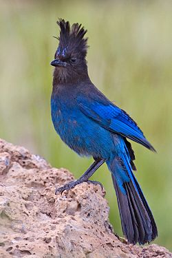
The Cuyamaca bird list, available at the park museum, contains about 200 different species. Several of the most commonly seen bird residents and migrants are the wild turkey, acorn woodpecker, Nuttall's Woodpecker, northern flicker, Steller's jay, western bluebird, white-breasted nuthatch, mountain chickadee, plain titmouse, American robin, red-tailed hawk and red-shouldered hawk. Migrants and summer residents include the black-headed grosbeak, northern oriole, ash-throated Flycatcher, western wood pewee, house wren, several warblers, and the Lesser Goldfinch.
Amphibians and reptiles
There are many varieties of amphibians and reptiles that call CRSP home. A few of them are the Canyon Tree Frog, Pacific Tree Frog, red-legged frog, western toad, common king snake, gopher snake, mountain kingsnake, racer, striped racer and western garter snake.
Insects
California has over 25,000 identified insect species with several thousand calling Cuyamaca their home. A good place to look for insects is among the plants along fire roads and wide trails. Due to the large number of insect species in the parks, it is not currently possible to provide a list of commonly seen insects. However, the results of a one-day insect walk in Cuyamaca on July 23, 1993 are an indication of the variety of insects in the Park. This survey is included in the "Summary of the Natural and Cultural History of Cuyamaca Rancho State Park, August 1993."
Mammals
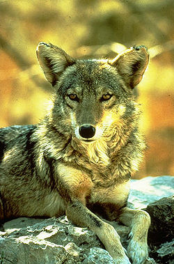
Frequently seen mammals in Cuyamaca Rancho State Park include the Southern mule deer, Coyote, California ground squirrel, Merriam's chipmunk, Black-tailed jackrabbit, Brush rabbit, and Audubon's cottontail rabbit.
Mountain lions
The native Mountain Lion, also known as the Cougar, the Panther, and the Puma, is tawny-colored with black tipped ears and tail. Adult males may be up to eight feet long from nose to end of tail, and generally weigh between 130 and 150 pounds, but can get to as much as 228 pounds. Adult females can be seven feet long and weigh between 65 and 90 pounds.
Mountain lions live in many different types of habitat in California, from deserts to humid coast range forest, and from sea level to 10,000-foot (3,000 m) elevations. They are generally most abundant in areas with plentiful deer and adequate cover. Mountain lions are important members of the natural community and may be found in the park. Normally, lions are very elusive and people rarely get more than a brief glimpse of a mountain lion in the wild. They are, however, unpredictable and have been known to attack people. The predatory behavior of a mountain lion is very similar to the domestic cat. The lion will attempt to conceal itself for a surprise attack while stalking its prey. A crouched position is assumed with the tail twitching and the ears upright. An agitated lion may snarl and lay its ears back.
Park History
Historical features date from prehistoric humans through the Southern California Gold Rush.[3]
Native Americans
indigenous peoples in the area date back a minimum of 7000 years. Traces of their ancient and pre-contact civilizations are within the park, which is a Cuyamaca complex archeological site.[4] Early bedrock mortars mark the sites of summer camps and villages. Even the name "Cuyamaca" is a Spanish version of the name the native Kumeyaay peoples used for this place. In water-short Southern California, the Indians called the area Ah-Ha Kwe-Ah Mac, meaning "the place where it rains."
Kumeyaay peoples' traditional lands range from San Diego east through the Cuyamaca and the Laguna Mountains through present day Anza Borrego Desert State Park to beyond the Salton Sea in the east, and south beyond present day Ensenada, Baja California on the Baja California Peninsula in Mexico. A typical band's typical range was a 20-mile (30 km) radius from their winter home. Today thirteen federally recognized Kumeyaay tribes are in San Diego County.
19th century
The park is located on the 1845 Rancho Cuyamaca Mexican land grant. With the discovery of gold in Julian in 1869, the Spanish, Mexican, and American governments and settlers changed the Kumeyaay's way of life forever. Disease spread through the Kumeyaay, traditional ways of life were destroyed, and promises broken as the Indians were expelled in 1875 from ancestral lands and taxed without representation. Currently there are about 20,000 Kumeyaay descendants in San Diego County, 10% of whom live on the 18 reservations which range from 6.3 to over 122,000 acres (494 km2).
The Stonewall Mine opened in 1870 and started the boomtown of Cuyamaca City. Peak production at the mine occurred between 1886 and 1891 while employing over 200 workers. In 1889, Cuyamaca Dam was completed and in 1892, Stonewall Mine was permanently sealed after large losses.
20th century
In 1923, Ralph Dyar bought the Cuyamaca Rancho and built a summer home. In 1933, he sold his property to the State, thereby creating Cuyamaca Rancho State Park. Now the park is over 26,000 acres (105 km2) of protected wildlife habitat, watershed, archeological sites, botanical reserve, and recreational land with roughly half of the Park classified as Wilderness area.
State park volunteers
The beauty and uniqueness of Cuyamaca has the ability to deeply affect visitors. For this reason many people choose to volunteer a portion of their time and energy to the Park or to support the Cuyamaca Rancho State Park Interpretive Association (CRSPIA) with donations and memberships. The CRSPIA is an educational/interpretive organization that helps to support the park and its volunteer programs. There are five volunteer units in Cuyamaca:
- The Interpreters Assistance Unit
- The Trails maintenance Unit
- The Mounted Assistance Unit
- The Mountain Bike Assistance Unit
- Camp Hosts
Wi-fi service
Cuyamaca Rancho State Park offers Wi-Fi service. This service enables park visitors with wireless enabled laptop computers or personal digital assistants (PDAs) to access the Internet. Visitors can access this service if within a 150-foot (46 m) range base of the Administrative Headquarters.[5]
See also
- California native plants
- Category: Parks in San Diego County, California
Park links
- Official Cuyamaca Rancho State Park website
- official Cuyamaca Rancho State Park Interpretive Association website
Visitor safety
Mountain lion encounters
- 1993 - Park officials closed Cuyamaca Rancho State Park for two weeks in September after a cougar chased two horseback riders, behavior that was considered unacceptable. The cougar subsequently attacked a girl and her dog.[6] Three bicyclists were menaced by a mountain lion at Cuyamaca Rancho State Park. The lion was killed on a ranch north of Descanso 11 days later. It was a young 65-pound male.[7][8]
- 1994 - A couple visiting in May with a 3-year-old boy saw a lion approaching. State park officials said the lion rushed within five feet of the youngster on the Azalea Glen Trail at the Paso Picacho campground. The lion bared its teeth and crouched to spring, but the boy's father said he drove the animal away by waving a stick and shouting. The Pine Valley Patrol went to the area the next day. "The lion was lying right where the park people said they saw it, We walked up to it with five adults and two dogs, and it made no attempt to move. That lion had no fear of people whatsoever." He fired one shot and killed the animal from about 20 yards (20 m) away. He found the 83-pound male had been feeding on a fresh deer kill nearby.[9]
- 1994 - A Hiker was killed by a cougar, near the bench dedicated to her, while hiking to Cuyamaca Peak alone an early December morning. The Kenna Bench is at the intersection of the Lookout Fire Road and Azalea Springs Fire Road - Fern Flat Fire Road.
- 1995 - A mountain lion, estimated to weigh at least 100 pounds, charged a 17-year-old as she bent down to get books out of her car parked in the driveway of her house. Her mother said: "She saw it coming at her, thought fast and closed the door before it reached her. It was running straight at her. It's not afraid of us at all. It just snarls and hisses at us. Then when it goes away, it doesn't run. It just saunters off as if to say, OK, not this time." The family first saw this lion in about December, and the encounters with it escalated. It became increasingly aggressive towards children at the 4.5 acre (18,000 m²) home near Julian on Volcan Mountains in San Diego County, about 10 miles (16 km) north of Cuyamaca Rancho State Park. They called the state Department of Fish and Game when the lion charged her daughter.[10]
- 1996 - Two lions chased a couple in June, with a small son in the Green Valley Campground area of the park. They reported one large lion with a smaller one. The game warden found both together, and neither moved when he approached. He shot the bigger one—an 80-pound male—first, and the smaller one didn't move. He then shot that one, a 63-pound male.[11]
- 1996 - A woman on horseback in January reported an aggressive lion. She likely saved herself by baring her teeth, growling and staring the lion down as it approached her. Two Game Wardens and an Animal Damage Control specialist went to that spot the next day, and the lion charged them, getting to within 15 feet (5 m) before the 62-pound male was shot twice. "What bothered me about this one is the veterinarian said it was a cub," the Game Warden said. "It was a 1½ - to 2-year-old that probably was just booted out by its mother and was trying to make it on its own." He said he'd never had a lion charge like this one.[12]
- 1998 - The park was closed for about a week in August after a woman encountered a cougar near Stonewall Peak. In that incident, a woman used pepper spray on an aggressive cougar and finally repelled it from attacking her and a friend after a 15-minute ordeal.
- 1998 - An early October Thursday morning, and a lion threatened a Banning, California member of the Yucaipa Valley Riding Club, as she went to check on her stock at the Los Vaqueros horse camp in the park. A horse, whirling around in its camp stall in reaction to a lion on some hay bales, alerted her, who then saw it. She yelled at it and grabbed a rake to defend herself. The lion left when other members of the group came to her aid.
- 1998. - A Lt. Game Warden of the state Department of Fish and Game returned to the Los Vaqueros horse camp in the park an October afternoon and learned that a camper had kicked a lion out of the way earlier in the day for attempting to attack his pet dog. The Warden hiked into the woods, spotted a 90-pound male sitting near the campground, and he shot it. Then suddenly the campers yelled that another one was running toward him. Turner said another 90-pound male stopped and glared at him, and he fired. Recently, more such encounters with multiple lions had been reported.[13]
References
- ^ "Cuyamaca Rancho State Park Interpretive Association". http://www.cuyamaca.us. Retrieved 2007-10-20.
- ^ C.Michael Hogan (2008) quercus kelloggii, Globaltwitcher.com, Ed. N. Stromberg [1]
- ^ Sampson, Michael, Recent Archaeological Investigations at the Stonewall Mine Site
- ^ "A Glossary of Proper Names in California Prehistory." Society for California Archaeology. (retrieved 12 Aug 2011)
- ^ "Cuyamaca Rancho State Park". California Department of Parks and Recreation. http://www.parks.ca.gov/?page_id=667. Retrieved 2007-10-20.
- ^ (report HERE?). Source: (Mountain Lions and California State Parks; 01/19/94) January 1994
- ^ Cougar Attacks from 1991–2000
- ^ Source: (San Diego Union-Tribune; 12/11/94, A-1)
- ^ Source: (Ed Zieralski, San Diego Union-Tribune; 05/10/94, A-1)
- ^ Source: (San Diego Union-Tribune; 01/28/95, B-3)
- ^ Source; (San Diego Union-Tribune; 02/11/96, C-14)
- ^ Source: (San Diego Union-Tribune; 02/11/96; C-14)
- ^ Source: (Ed Zieralski, San Diego Union-Tribune; 10/10/98, B-1)
Protected areas of California National Park System National Parks National Preserves National Monuments Cabrillo · Devils Postpile · Lava Beds · Muir Woods · Pinnacles · World War II Valor in the Pacific National MonumentNational Seashores National Historical Parks National Historic Sites National Memorials Port Chicago Naval MagazineNational Recreation Areas National Forests National Forests Angeles · Cleveland · Eldorado · Inyo · Klamath · Lassen · Los Padres · Mendocino · Modoc · Plumas · San Bernardino · Sequoia · Shasta-Trinity · Sierra · Six Rivers · Stanislaus · TahoeNational Wilderness
Preservation SystemAgua Tibia · Ansel Adams · Bucks Lake · Caribou · Carson-Iceberg · Castle Crags · Cucamonga · Desolation · Dick Smith · Dinkey Lakes · Emigrant · Golden Trout · Hoover · Inyo Mountains · Ishi · Jennie Lakes · John Muir · Kaiser · Marble Mountain · Mokelumne · Mount Shasta Wilderness · North Fork · San Gabriel · Sanhedrin · San Jacinto · San Rafael · Sespe · Siskiyou · Snow Mountain · South Fork Eel River · South Sierra · South Warner · Thousand Lakes · Trinity Alps · Ventana · Yolla Bolly-Middle Eel · YukiOther State Forests Boggs Mountain Demonstration · Ellen Pickett · Jackson Demonstration · Las Posadas · LaTour Demonstration · Mount Zion · Mountain Home Demonstration · Soquel Demonstration
National Wildlife Refuges Antioch Dunes · Bitter Creek · Blue Ridge · Butte Sink · Castle Rock · Clear Lake · Coachella Valley · Colusa · Delevan · Don Edwards San Francisco Bay · Ellicott Slough · Farallon · Guadalupe-Nipomo Dunes · Hopper Mountain · Humboldt Bay · Kern · Lower Klamath · Marin Islands · Merced · Modoc · Pixley · Sacramento · Sacramento River · Salinas River · San Diego Bay · San Diego · San Joaquin River · San Luis · San Pablo Bay · Seal Beach · Sonny Bono Salton Sea · Stone Lakes · Sutter · Tijuana Slough · Tule LakeState Wildlife Areas Wildlife Areas Antelope Valley · Ash Creek · Bass Hill · Battle Creek · Big Lagoon · Big Sandy · Biscar · Butte Valley · Buttermilk Country · Cache Creek · Camp Cady · Cantara/Ney Springs · Cedar Roughs · Cinder Flats · Collins Eddy · Colusa Bypass · Coon Hollow · Cottonwood Creek · Crescent City Marsh · Crocker Meadows · Daugherty Hill · Decker Island · Doyle · Dutch Flat · Eastlker River · Eel River · Elk Creek Wetlands · Elk River · Fay Slough · Feather River · Fitzhugh Creek · Fremont Weir · Grass Lake · Gray Lodge · Green Creek · Grizzly Island · Hallelujah Junction · Heenan Lake · Hill Slough · Hollenbeck Canyon · Honey Lake · Hope Valley · Horseshoe Ranch · Imperial · Indian Valley · Kelso Peak and Old Dad Mountains · Kinsman Flat · Knoxville · Laguna · Lake Berryessa · Lake Earl · Lake Sonoma · Little Panoche Reservoir · Los Banos · Lower Sherman Island · Mad River Slough · Marble Mountains · Mendota · Merrill's Landing · Miner Slough · Monache Meadows · Morro Bay · Moss Landing · Mouth of Cottonwood Creek · Napa-Sonoma Marshes · North Grasslands · O'Neill Forebay · Oroville · Petaluma Marsh · Pickel Meadow · Pine Creek · Point Edith · Putah Creek · Rector Reservoir · Red Lake · Rhode Island · Sacramento River · San Felipe Valley · San Jacinto · San Luis Obispo · San Luis Reservoir · San Pablo Bay · Santa Rosa · Shasta Valley · Silver Creek · Slinkard/Little Antelope · Smithneck Creek · South Fork · Spenceville · Surprise Valley · Sutter Bypass · Tehama · Truckee River · Upper Butte Basin · Volta · Warner Valley · Waukell Creek · West Hilmar · Westlker River · White Slough · Willow Creek · Yolo BypassEcological Reserves Albany Mudflats · Alkali Sink · Allensworth · Atascadero Creek Marsh · Bair Island · Baldwin Lake · Batiquitos Lagoon · Blue Sky · Boden Canyon · Boggs Lake · Bolsa Chica · Bonny Doon · Buena Vista Lagoon · Butler Slough · Butte Creek Canyon · Butte Creek House · Buttonwillow · By Day Creek · Calhoun Cut · Canebrake · Carlsbad Highlands · Carmel Bay · Carrizo Canyon · Carrizo Plains · China Point · Clover Creek · Coachella Valley · Coal Canyon · Corte Madera Marsh · Crestridge · Dairy Mart Ponds · Dales Lake · Del Mar Landing · Eden Landing · Elkhorn Slough · Estelle Mountain · Fall River Mills · Fish Slough · Fremont Valley · Goleta Slough · Indian Joe Spring · Kaweah · Kerman · King Clone · Laguna Laurel · Loch Lomond Vernal Pool · Lokern · Magnesia Spring · Marin Islands · Mattole River · McGinty Mountain · Morro Dunes · Morro Rock · Napa River · North Table Mountain · Oasis Spring · Panoche Hills · Peytonia Slough · Pine Hill · Piute Creek · Pleasant Valley · Point Lobos · Rancho Jamul · Redwood Shores · River Springs Lakes · Saline Valley · San Dieguito Lagoon · San Elijo Lagoon · San Felipe Creek · San Joaquin River · Santa Rosa Plateau · Springville · Stone Corral · Sycamore Canyon · Sycuan Peak · Thomes Creek · Tomales Bay · Upper Newport Bay · Watsonville Slough · West Mojave Desert · Woodbridge · YaudanchiMarine Protected Areas Abalone Cove · Agua Hedionda Lagoon · Albany Mudflats · Anacapa · Anacapa · Año Nuevo · Asilomar · Atascadero Beach · Bair Island · Batiquitos Lagoon · Big Creek · Big Creek · Big Sycamore Canyon · Bodega · Bolsa Chica · Buena Vista Lagoon · Cambria · Cardiff and San Elijo · Carmel Bay · Carmel Pinnacles · Carrington Point · Catalina Marine Science Center · Corte Madera Marsh · Crystal Cove · Dana Point · Del Mar Landing · Doheny · Doheny · Duxbury Reef · Edward F. Ricketts · Elkhorn Slough · Elkhorn Slough · Encinitas · Estero de Limantour · Fagan Marsh · Farallon Islands · Farnsworth Bank · Fort Ross · Gerstle Cove · Goleta Slough · Greyhound Rock · Gull Island · Harris Point · Heisler Park · Hopkins · Irvine Coast · James V. Fitzgerald · Judith Rock · Julia Pfeiffer Burns · La Jolla · Laguna Beach · Lovers Cove (Catalina Island) · Lovers Point · MacKerricher · Manchester and Arena Rock · Marin Islands · Mia J. Tegner · Moro Cojo Slough · Morro Bay · Morro Bay · Morro Beach · Natural Bridges · Niguel · Pacific Grove Marine Gardens · Painted Cave · Peytonia Slough · Piedras Blancas · Piedras Blancas · Pismo · Pismo-Oceano Beach · Point Buchon · Point Buchon · Point Cabrillo · Point Fermin · Point Lobos · Point Reyes Headlands · Point Sur · Point Sur · Portuguese Ledge · Punta Gorda · Redwood Shores · Refugio · Richardson Rock · Robert E. Badham · Robert W. Crown · Russian Gulch · Russian River · Salt Point · San Diego-Scripps · San Dieguito Lagoon · San Elijo Lagoon · Santa Barbara Island · Scorpion · Skunk Point · Sonoma Coast · Soquel Canyon · South Laguna Beach · South Point · Tomales Bay · Upper Newport Bay · Van Damme · Vandenberg · White Rock (Cambria)National Landscape Conservation System National Monuments National Conservation Areas California Desert · King RangeWilderness Areas Argus Range · Big Maria Mountains · Bigelow Cholla Garden · Bighorn Mountain · Black Mountain · Bright Star · Bristol Mountains · Cadiz Dunes · Carrizo Gorge · Chemehuevi Mountains · Chimney Peak · Chuckwalla Mountains · Chumash · Cleghorn Lakes · Clipper Mountain · Coso Range · Coyote Mountains · Darwin Falls · Dead Mountains · Dick Smith · El Paso Mountains · Fish Creek Mountains · Funeral Mountains · Golden Valley · Grass Valley · Headwaters Forest Reserve · Hollow Hills · Ibex · Indian Pass · Inyo Mountains · Jacumba · Kelso Dunes · Kiavah · Kingston Range · Little Chuckwalla Mountains · Little Picacho · Machesna Mountain · Matilija · Malpais Mesa · Manly Peak · Mecca Hills · Mesquite · Newberry Mountains · Nopah Range · North Algodones Dunes · North Mesquite Mountains · Old Woman Mountains · Orocopia Mountains · Otay Mountain · Owens Peak · Pahrump Valley · Palen/McCoy · Palo Verde Mountains · Picacho Peak · Piper Mountain · Piute Mountains · Red Buttes · Resting Spring Range · Rice Valley · Riverside Mountains · Rodman Mountains · Sacatar Trail · Saddle Peak Hills · San Gorgonio · Santa Lucia · Santa Rosa · Sawtooth Mountains · Sespe · Sheephole Valley · South Nopah Range · Stateline · Stepladder Mountains · Surprise Canyon · Sylvania Mountains · Trilobite · Turtle Mountains · Whipple Mountains ·National Marine Sanctuaries National Estuarine Research Reserves Elkhorn Slough · San Francisco Bay · Tijuana River Estuary
University of California Natural Reserve System Año Nuevo Island · Bodega Marine · Box Springs · Boyd Deep Canyon Desert Research Center · Burns Piñon Ridge · Carpinteria Salt Marsh · Chickering American River · Coal Oil Point · Dawson Los Monos Canyon · Eagle Lake Field Station · Elliott Chaparral · Emerson Oaks · Fort Ord · Hastings · James San Jacinto Mountains · Jenny Pygmy Forest · Jepson Prairie · Kendall-Frost Mission Bay Marsh · Kenneth S. Norris Rancho Marino · Landels-Hill Big Creek · McLaughlin · Motte Rimrock · Quail Ridge · Sagehen Creek Field Station · San Joaquin Freshwater Marsh · Santa Cruz Island · Scripps Coastal · Sedgwick · Stebbins Cold Canyon · Steele Burnand Anza-Borrego · Stunt Ranch Santa Monica Mountains · Sweeney Granite Mountains Desert Research Center · Valentine Eastern Sierra · Younger LagoonHeritage registers: World Heritage Sites · World Network of Biosphere Reserves · National Register of Historic Places · National Historic Landmarks · National Natural Landmarks · California Historical Landmarks · California Points of Historical Interest · California Register of Historical Resources
Categories:- Parks in San Diego County, California
- California state parks
- History of San Diego County, California
- Civilian Conservation Corps in California
- Campgrounds in California
- Protected areas established in 1933
- Kumeyaay
Wikimedia Foundation. 2010.

